Total miles: 11.9
Elevation gain: 1,092 ft
Time walking: 12pm – 5:15pm
Miles to date: 842.2
Today was definitely a day of two halves. As it was a short day and the bothy was so lovely I spent the morning relaxing there, which was beautiful. Sadly, the afternoon’s walk was rather forgettable!
I woke up fairly early to the sounds of Sean getting the fire going and soon enough the room was toasty and I could hear water boiling in the kettle. I lay there for a while just watching the flames and enjoying the warmth and the quiet. It was so peaceful. I was in no hurry to move! Eventually I moved, just to make a cup of tea and to sit in front of the stove contentedly eating my granola. The weather looked good outside although the grass was wet from the drizzle that set in last night. I had to go out to use nature’s bathroom and in trying to find a suitable spot my trousers got soaked from the long grass. While I was out I collected an armful of wood for the fire, a very therapeutic and satisfying task. Next task was to go and collect more water, and I spent a while just enjoying the peaceful and fresh morning while I was there. The simplicity of the morning was beautiful. Wake up, make fire, collect wood, collect water, drink tea, eat food, relax and contemplate life while gazing at the flames. I felt incredibly content.
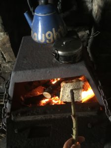
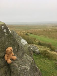
Back at the bothy I hung my trousers to dry by the fire and gradually packed up my bag, not in any great hurry. I decided I’d make some lunch while I was there and suddenly struck on the amazing idea of making toast! I remembered I had some bread in my bag, so out it came, on a stick, and I toasted it in the fire. Peanut butter on toast. Heaven! Quite possibly the most delicious peanut butter on toast I have ever eaten 🙂
Making toast
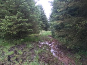
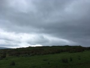
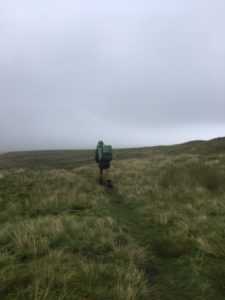
Eventually I really did need to think about leaving so I said farewell to Michael (Sean had left much earlier) and headed back out into the woods, which were silent except for chattering birds and the breeze in the fir trees. The woods were fairly boggy – mainly just over-the-toe boggy but occasionally ankle-deep boggy – but the paths were easy to follow and I enjoyed the woods. After a mile of walking along tracks through the trees the path emerged onto Haughton Common, a large empty moor with vast forests on one side and small hills on the other, golden brown with reeds and grass and the occasional sheep dotted about. Right in the middle there was a tiny stone-walled grassy enclosure with a few birch trees. I thought it looked like it would be a lovely place to wild camp!
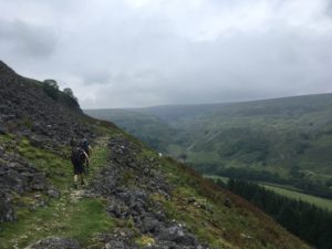
A bit of a boggy bit
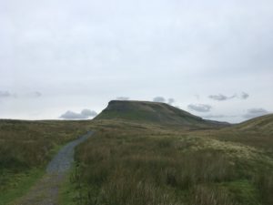
The path went back into and through another couple of sections of forest and then came out into a little more moorland (with a very faint path) and then farmland for a few miles. There were some nice bits, like a drop down into a mini gorge to cross a river and back up the other side (where I slipped on some wooden stepping stones and nearly face planted in the mud!) but mainly it was a bit fiddly, muddy and not much to see. There was also a long section on a tarmac track then little road which was a bit tedious. Slight confusion on arriving at Houxty Burn to find the river too wide and deep to ford, it turned out that the PW had forked off slightly earlier to meet a bridge just upstream. Bridge found, problem solved. Then an uphill climb (first real climb of the day, bit of a shock!) to Shitlington Hall and Shitlington Crags where I stopped for a break on the rocks. Another short section across some moorland and I can see Bellingham in the valley, whoop! Unfortunately the national trail’s description of the last mile or so being “contender for ‘worst finish to a PW day’ ” seemed true as it was 2/3rds mile along a busy B-road with no pavement or verge. Yuck!
Still, the final quarter mile was along the big, serene North Tyne river which was very pleasant and then up into town, where there were shops, cafes, a cash machine and a Co-op! What civilisation! I had also arrived only just after 5pm – a relatively early finish – which was a real treat for me. I’m staying in the lovely little youth hostel here, for two nights, and I have stocked up on lots of food! The plan for tomorrow is to eat, rest, catch up on blogs and plan the next few days.
The next leg of my walk will take me on the final three days of the Pennine Way, the most isolated days of them all! I’m praying for some clear nights as the sky is celebrated for its darkness out here and I’d love to do some good stargazing. I’ll stay in Byrness the first night, which is barely a village, then cross the Cheviots over two days. No shops, no nothing, for three days. I’m excited! And I have LOTS of food!
Yuuuum
I may not have signal though, in which case there may be a delay in posting blogs, but they’ll come at some point…
Total miles: 13.5
Elevation gain: 2,080 ft
Time walking: 11:30am to 6:30pm
Miles to date: 830.3
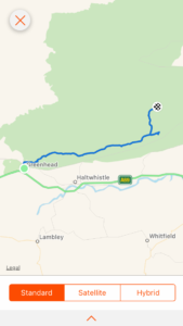
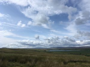
Oh my goodness what a stunning day! They say that yesterday is worth it because it brings you to today and I have to say I completely agree! Today was Hadrian’s Wall, a real milestone in my journey. I can now say I have walked the length of Britannia – Roman Britain! It was a brilliant walk today but not an easy one, lots of ups and downs equal only to the coast path. I was thankful that I was splitting the journey from Greenhead to Bellingham (officially one section) into two by staying at the bothy overnight. A lot of people do it in one go (there are limited accommodation options en route unless you stay somewhere along the wall) and that would make it a very long day!
I decided to set off a bit later today as I was really feeling the last few days of long tough walking and I knew it wasn’t the longest day. The pub did breakfast so I made the most of that and as I wandered back to the hostel I spotted Sean sat in the cafe. I popped in to say hello and we swapped stories from the last couple of days. I was reassured to find that he had found yesterday pretty arduous too! He didn’t know about the bothy that I was planning to stay at so I pointed it out on his map and he circled it excitedly, saying he’d take a look.
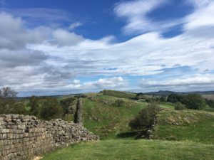
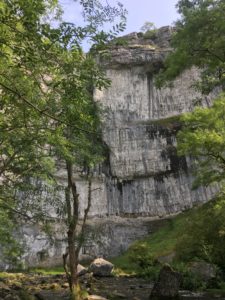
Eventually I set off and after a short riverside footpath I reached the ruined Thirlwall Castle and joined the Hadrian’s Wall Path. The path climbed steeply up onto my first section of wall, only an earth bank at this point, with fine views, a strong wind and a hot sun. Wow, summer’s back! It was beautiful walking. The wall often curves slightly so you can see it stretching away to the east for miles, up and down over the whin sill escarpment, with expansive sweeps of wilderness on either side. It is a stunning sight! It is also challenging walking. The first few ups and downs were exciting and satisfying, soon I realised that they didn’t lie when they said Hadrian’s Wall Path is a constant series of ups and downs! Sometimes I’d look ahead and half gasp in admiration at the beautiful crags, half sigh in exasperation at the prospect of yet another set of steep climbs. On the flatter sections I power-walked to make up some time so I could take my time along the prettier, harder sections.
Hadrian’s Wall
It was certainly the busiest section of my walk for a long time, being a sunny bank holiday there were lots of people out walking the wall, albeit mostly confined to 100m either side of the car parks! I met a couple of people actually walking the Hadrian’s Wall Path. The long distance walkers are easy to spot – and it’s not just the big rucksack which sets them apart – they have a slightly weatherbeaten and tired but usually happy expression, muddy boots and various bits of gear or clothes hanging off their packs to air or dry (socks or towels are the favourite). This point marks roughly the halfway point for them and apparently it is one of the best bits. It’s a path I’ve always wanted to do and at ‘only’ 84 miles it now seems very doable. I’m not sure about all those ups and downs though…!
At Winshields Crags, the highest point along the whole of Hadrian’s Wall, there is the option of detouring down to Twice Brewed to the pub (and hostel and campsite where people who break the long section usually stay). I’d debated popping to the pub for some lunch or a drink but it looked a long way down, and what goes down must come back up. Also it felt like I wasn’t making as good time as I’d hoped, even though I wasn’t walking particularly slowly. I guess it’s down to the distance covered on the map being very different from the distance you actually walk if you were to flatten out all the hills. It certainly felt like I had walked a lot further than the 7 or 8 miles Strava told me I had covered! Still, it was only a couple of miles to the point where the Pennine Way leaves the wall and the bothy was only a mile or two beyond that, so it looked like the day would end up being shorter in mileage than I’d first calculated.
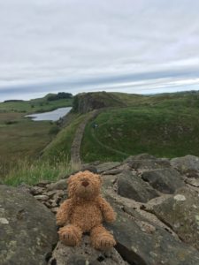
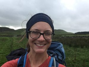
King Jennifer playing roman soldier
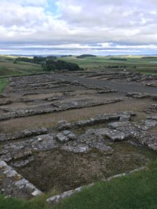
I pushed on and after a few more stiff climbs I made it to Rapishaw Gap, where the path leaves the safety of the wall and heads off into the wilderness beyond. It was still reasonably early so I decided I’d continue on for another half a mile and check out Housesteads Fort, supposedly one of the best preserved roman forts of them all. I first went to the little museum and treated myself to an ice cream and coffee (I couldn’t decide between hot or cold so went for both…!), as I couldn’t face walking down the hill to the visitors centre where there was a proper cafe. Excitingly the museum and fort are English Heritage (and National Trust) so my new membership (purchased at Launceston Castle all the way back in Cornwall) finally came in handy again and I enjoyed spending an hour wandering around the tiny museum and watching the short film, learning a bit more about the fort and the Romans in general. They were a pretty impressive bunch! It’s incredible how refined and ‘modern’ they were, nearly 2000 years ago, and I wondered what on earth happened to progress in the thousand or so years in the middle! The museum had some amazing pieces of pottery, tools and weapons and it was fascinating to think about how old they were. After the museum I wandered around the fort itself, which is basically a series of impressive stone walls and building foundations which give a clear indication of the layout of the buildings – barracks, granary, hospital, administration centre and commanding officer’s house. I still can’t get my head around the fact that those walls were nearly 2000 years old, and over 800 roman soldiers and their families lived here. The wall certainly must have some stories to tell!
Housesteads Fort
After the welcome refreshment and history stop it was time to retrace my steps the short distance to Rapishaw Gap and head out beyond the wall. It felt quite strange, to head over the wall and out into the lands beyond! I wondered what it must have felt like all those years ago, leaving the relative safety of the wall to venture into the lands of the barbarians. It certainly felt like crossing a frontier, even today, after the busyness of the wall the sparse lands to the north felt lonely and adventurous. The path crossed a series of ridges running parallel to the wall, gradually bringing me down to lower altitude so that the wall disappeared from view fairly quickly.
Leaving the wall behind…
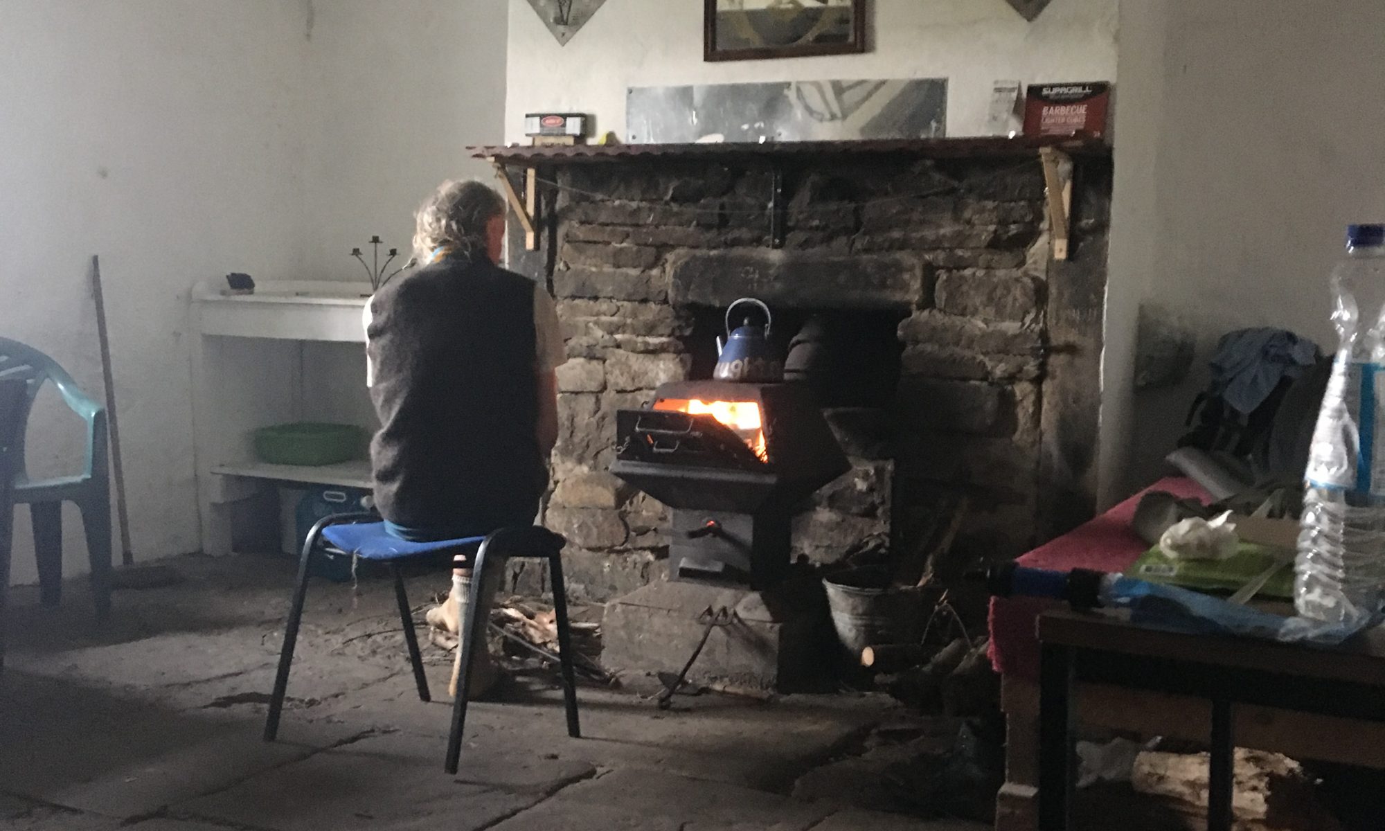
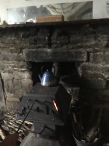
A bit of fiddly route finding across some fields (clearly there is at least a little bit of civilisation nearby) and then the path heads up into the huge Wark Forest and shortly after this the footpath to the bothy branches off from the Pennine Way. The bothy is only about half a mile off the path but as usual remains hidden until the last few metres. As I rounded the last corner and spotted the little building, on the edge of the forest overlooking a shallow valley and craggy hills beyond, I was excited to see smoke coming from the chimney – someone had the fire going already! Crossing my fingers that it was a friendly fellow hiker and not a group of drunken rowdy lads (rare but not unheard of), I headed around to the front door and stuck my head in. Friendly fellow hiker, phew! And, not too surprisingly but very welcome, was the sight of Sean’s rucksack on another of the chairs. Reassured that I would be sharing the bothy with two people who clearly knew what they were doing, I plonked my bag down and introduced myself. Michael is a regular user of the bothy and was just out here for a few days for a quiet break. He told me of the best place to get water, a small spring about 100m away in the middle of a field which I would never have known to look for, let alone find, without his directions. He offered me some of his water but me being Miss Independent wanted to go and fetch water herself, so off I trotted. His directions were very good. If you ever happen to stay there, turn left out of the door, over the stile and head diagonally down through the field not quite to the other side, and the spring is by a small stake about 2 metres in front of a taller stake. It’s nothing more than a trickle out of a small pipe, and if Michael hadn’t have cleared it of weeds it would have been easy to miss (unless you stepped into the boggy pool it flows into!). It was crystal clear and cool and although I still filtered it first, it made a change to not be drinking slightly peat and tannin-stained water!
I triumphantly returned to the bothy with my full water bottle and found Sean had returned from wherever he had been. He said he had originally only popped in to see what the place was liked but he liked it so much he decided to stay the night. It certainly is a lovely hut. There are four single bunks and one double, with two small tables, several chairs and a wood burning stove that made the room very cosy. The guys had the kettle going on top of the stove so there was plenty of hot water for a cup of tea. Oh I was in my happy place! We all made our respective dinners, I had a rehydrated vegetable hotpot and the guys used the super hot stove top to cook packets of pasta and rice. It was the perfect evening of conversation, happy munching, fire gazing, reading and just quiet appreciation of the company of likeminded individuals. As it got darker Michael brought out some tea lights and surrounded the room in a lovely warm glow. This is just heaven!
Kettle’s on!
I’m half tempted to take my rest day here, a day early, but with limited proper food and the need to take a bit of time to restock etc in civilisation I’ll need to head on tomorrow. Thankfully it is a much shorter day, only 11 miles, which means I can spend a leisurely morning here. I have a feeling I’ll leave rather reluctantly though!
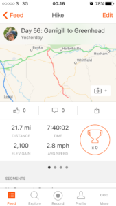
Total miles: 21.7
Elevation gain: 2,100 ft
Time walking: 8:30am – 8:15pm
Miles to date: 816.8
Today’s section of the Pennine Way suffers somewhat from comparison with the rest of the route. Standing alone, it wouldn’t be a bad walk. Standing next to the countless other stunning days, it’s a bit of a forgettable one. It really wasn’t that bad, but it was long and tiring, not helped by the fact I’d added 4 miles by deciding to stop at Garrigill yesterday.
I’d managed to make an early start, munching on granola and packing up my bag while still in my tent – I feared the midges would still be rife. I emerged from tent to do the last crucial bit of packing to find the midges were indeed still rife, they buzzed around my face as I took the tent down as quickly as I could, not even taking too much time to shake the dew off as they were driving me to distraction! I honestly don’t know how people live in midge-infested areas! As fast as I could I retreated to the village hall to pack the final few bits and made a quick getaway, on the road by 8:30am.
My plan was to walk the 4 miles to Alston to find somewhere for breakfast and to pick up some food and some cash. The walk was nice enough, more or less following the river through fields. I bumped into a lovely couple coming the other way who were headed up over Cross Fell. They said they’d bumped into a woman a day or two ago who was walking LEJOG too – I wonder if it is the same woman I’ve heard about before, if so it sounds like I’m catching her up! They also warned me that it was very wet along today’s route, something the national trail description also mentions. Glad I put my waterproof socks on then!
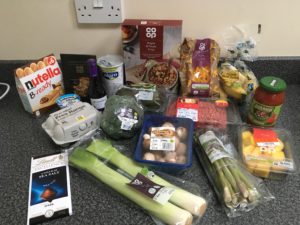
Arriving into Alston I tried to remember where the best cafes were. I’d been here last year but had a feeling most of the life of the small town (England’s highest market town, incidentally!) was up the hill. I saw an open cafe closer to my route, opposite the Information Centre, and decided to try my luck in there. It wasn’t the nicest cafe, more of a greasy spoon really, but the owner was friendly and at my request for “the biggest breakfast you do” he produced a full English with (I think) extra bacon and toast. I demolished the lot, except the black pudding (still not a fan…although I managed half…). Thankfully I had £10 in cash still as he didn’t take cards and it turned out that the only cash point in town had broken and there was no cash machine on my route for another 3 days, uh oh! I was down to about £2.50 and wondered what I’d do about paying for a campsite tonight. I figured I’d figure something out! Heading back down towards the route I popped into the well stocked Spar at the petrol station to restock on food, realising I’d made the rookie error of eating a massive breakfast before going food shopping…consequently I didn’t really feel like buying any food! I did the best I could, stocking up on nuts, biscuits and cereal bars in particular. I really should have picked up some lunch-type items as there are no lunch stops for the next 3 days, but my full English-full belly couldn’t face the idea of buying bread and ham!
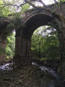
I finally left Alston at 11:30, later than I’d have liked but at least well fed and with food for the journey. The route crisscrossed through fields, crossing the main road several times in a rather random zigzagging fashion. I think the path tries to take in higher ground where possible and there were some sections just on the edge of the open moorland where there were lovely views up to heather-clad higher ground on either side, along with the main view up the valley. Part of me had been tempted to take a slightly easier option of following the South Tyne Trail which follows the former railway line in a straight, flat line, but I couldn’t bring myself to abandon the Pennine Way. It was probably the right idea regardless of whether one is a purist or not, as those cycle routes tend to be rather boring affairs to walk along. Furthermore, there were definitely some nice spots along the way. The first highlight was the Epiacum roman fort which the trail passes (with the option of a detour through the fort itself). The ridges of the fort were incredibly well defined and once at the other side, from below, it looked impressive silhouetted against the sky.
Epiacum silhouetted against the sky
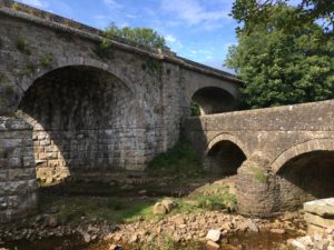
Other highlights included several beautiful tall arched bridges carrying the old railway line over little river-cut gorges, and the sight of the steam train that runs from Alston, puffing and tooting its way along the restored section of the line. I also saw a fair bit of wildlife today, a couple of Curlews (I think), lots of bunnies and some mice scuttling away out of my path. A less good moment was slipping badly on some sloping steps coming down towards Knarsdale Hall (a pretty spot). I went flying and would have landed hard on my backside had it not been for my pack landing first and cushioning my fall. Thankful that I only had a little jarring to my back and not a badly bruised coccyx (and, as I discovered later, that the only thing in my pack to explode was my pack of baby wipes), I picked myself up and made my way a little more steadily down the rest of the hill.
One of a few pretty bridges along today’s routeI loved this double bridge by Knarsdale Hall
The next section of the path went up onto the edge of the moor again and there was a nice spell of sunshine so I had a lovely lunch break overlooking the valley. Following my shopping fail earlier I didn’t have proper lunch as such, instead eating a rather strange combination of a bag of mixed nuts, a packet of crisps, some flapjack, apricots and oat cakes. While I was stopped I looked up camping options in Greenhead only to find that it seemed the campsite marked on the map had closed down. There were a couple of hostels though and suddenly that idea seemed very tempting…not only could I pay by card but I could have a hot shower and escape the potential midges. Decision made! I gave them a call and they had plenty of beds so I booked in and told the pub (who run the hostel) that I’d see them for dinner! (Incidentally it turns out that the other hostel (which is closer to the path but further from ‘town’) offers camping too…but I’d already been tempted..!). Satisfied at my decision I headed off strongly, looking forward to my shower, only for my stomach to wake up and decide I hadn’t fed it enough. I couldn’t believe how suddenly it can hit, having just eaten! I quickly had to stop again and devour another cereal bar, some juice, some pic n mix and some Kendal mint cake. I’m not the biggest fan of Kendal mint cake but it does seem to do the trick!
A scenic spot for lunch
The few miles along the edge of Lambley Common were pretty and occasionally squelchy but none of the really wet stuff I’d been expecting all day. I began to wonder whether everyone just had a different definition of ‘wet’ to me… I was starting to get almost disappointed that I hadn’t found this infamous wet stuff! As I came down from the common one of my feet did feel suspiciously damp though, despite my waterproof socks. On checking, it turned out there was a small hole in the toe. Nooo! Bye bye waterproof sock! I dug out my spare pair and replaced the offending sock, and headed on with my journey, this time over a series of fields and some slightly squelchier ground. A couple of short but stiff climbs reminded me that despite the lack of any one big climb, today was a long day, especially after yesterday’s tough day. Still, I only had a few miles left now, just the small matter of Blekinsopp Common and a shortcut into Greenhead.
Blekinsopp Common is pretty big! The path is very faint too, I lost it in one place so reverted to the good old compass and map reading. There is a pretty good fence though that the path heads towards then follows, so once I found this I soon came across the path again. It’s obvious when you see it – lots of mud and flattened reeds! There’s a section at the bottom of a couple of very shallow valleys where, after several metres of nearly ankle-deep sinking, I can confirm that Blekinsopp Common is indeed very wet! It still wasn’t quite the calf-deep wading I’d pictured based on some people’s accounts, but I was now beginning to agree it was pretty soggy! Then came the what-felt-long-but-wasn’t-really-all-that-bad climb up Black Hill, across the top (compass again!), squelching all the way but no sinking, and down the other side. The end was in sight! Well, it wasn’t actually, the village of Greenhead is tiny and hidden in a little valley, but on the map it was close.
The route still had a few more challenges just to test me though, at gone 7pm, when the tiredness and damp feet were starting to really make themselves felt. The first was a field of cows, and another massive bull right on the path. Thankfully he seemed more interested in the lady cow than me, but I gave him a wide berth just to be sure. Unfortunately for him, the lady cow did seem to be more interested in me than in him… just in case he was suddenly inspired by a fit of jealous rage I quickly hurried out of the field! The Pennine Way takes a roundabout route to get into Greenhead and given the time and the location of the pub I decided to follow the Wainwright “Pennine Journey” route into town which was much more direct, saving well over half a mile. The path started off clearly but headed over a couple of fields full of reeds and I managed to lose it, so it was back to the compass and pushing through a few thicker patches to find the stile at the other end. The steps at the other side were steep and didn’t look particularly well used, and feeling wary after my fall earlier I took them very carefully. The path comes out onto the busy A69 – biggest road I’ve seen by far for a while – and I have to wait a while to cross. I wonder what the passing cars thought of the travel weary, lone hiker emerging from the woods, muddy and windswept and two days without a shower! I probably looked like some sort of hermit or wild woman from the woods, hehe.
The path on the other side of the road was worse, through long slippery grass sideways down a hill and several times I slipped and nearly twisted my ankle. I really should learn my lesson about shortcuts…! But finally, I squelched down a boggy track to find tarmac and houses. I’d made it! My pub, the Greenhead Hotel, was just across the road and I gratefully walked out of the growing gloom of the evening into a lovely warm and welcoming bar, nearly 12 hours after I set out this morning. And gosh I was lucky – they were 10 minutes away from stopping serving food! That would have been devastating, to come so far and miss out on my long overdue pub dinner! As it was I was in luck and ordered a delicious rib eye steak with sweet potato fries (yuuum). That steak tasted so good! It didn’t last long!!
I’m so grateful to be in a bed tonight. My feet aren’t looking too worse for wear but they are aching, along with my legs. A couple of the midge bites on my leg have become irritated by my socks and blistered which is not nice. And how ironic, that I can walk 800 miles without blisters on my feet then I get blisters on my legs…?! Darn midges. Still, my hot shower was amazing, even with my funny dry soap sheets and not-terribly-absorbent microfibre towel, and I pretty much just collapsed into bed. Everything else can wait til morning…!
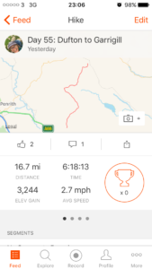
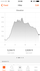
Total miles: 16.7
Elevation gain: 3,244 ft
Time walking: 10am – 8pm
Miles to date: 795.1
Wow, pretty epic day! It’s described as the hardest day on the Pennine Way and the first half definitely fits that description, with the unrelenting climb up to Great Dun Fell, the cruel up then down Little Dun Fell and up again to Cross Fell itself. Being the tallest peak in England outside of the Lake District I suppose I couldn’t really expect anything else, but gosh, it was a toughie!
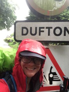
I did my best to start early as I knew it would be a tough long day, and with the plan being to get to Alston I knew it was going to be a push. I struggled to get going very quickly though after yesterday’s long day, and feeding myself a good breakfast slowed me down too, so I didn’t actually start walking til 10am. I tried not to be annoyed with myself and focused on trying to feel strong and energised, which wasn’t particularly easy! The sun was half shining though and the weather looked promising despite clouds hugging the top of the hills when I set out. After a few twists and turns through fields and tracks leaving Dufton the path settled on a route and then sneakily, so that I didn’t realise it at first, started to turn uphill. At first the climb was gradual and pretty, flanked by a narrow strip of trees, before a “no no no we can’t go downhill!” descent to a stream and back up the other side along a farm track into fields of cows, mud and steeper ascent.
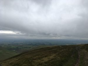
The path climbed up, up and still further up, leaving the mud behind and heading towards an attractive rocky cleft in the hill. The climb hadn’t felt too bad up until now, steady and achievable with a regular plod. Suddenly it became a lot steeper, with rocky or grassy steps in the hillside which required pauses to catch breath every few metres. Thankfully the view behind, out across the lowlands and to the edge of the Lake District, was well worthy of regular stops to admire. Today was the Dufton show and I could see the marquees standing proudly in a field outside the village and countless shiny cars lined up neatly in the parking area. I could make out the announcements on the tannoy perfectly, even this far away and this high up!
I paused on top of the rocky false summit of the first hill, actually nowhere near the top at all but I was determined to take on plenty of calories today so made the most of a handy seat-shaped rock to eat my peanut butter and jam sandwich. Even with that rest the climb to the first true summit was long and hard. At points I was trying to remember whether I’d ever found a climb this tough before. I’m sure I would have (Mount Kinabalu in Borneo is the obvious one – boy that is tough!) but right now it felt like the hardest thing I’d ever done! This was going to be a veeery long day at this rate!
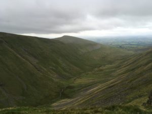
Eventually I reached the top of Green Fell, a fairly flat summit, and got a good view of the next target – Great Dun Fell with its radio masts and big white ball thing on top. It was a squelchy descent to meet the road which winds down from the top (lots of cyclists – looks like a popular hillclimb!) and then a climb back up reach the top. It was windy up there and after worrying at the warmer lower levels that I’d made a mistake wearing my thicker long-sleeved base layer I was now glad of it! The views North over the moors were incredible. I spotted a large body of water over to the east and checked the map to find out which one it was. Turned out it was Cow Green – the reservoir I’d walked past the dam of yesterday! Wow, talk about taking the long way around! What I also didn’t realise until later in the day was that I’d also be circling back into some of the moor in front of me, later this afternoon…
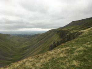
Little Dun Fell with Cross Fell behind, from the flanks of Great Dun Fell
Cross Fell was looking tantalising up ahead and looked like it had just about decided to keep its head out of the cloud, but first I had to tackle Little Dun Fell. Smaller than Great Dun but stiff enough, when legs are tired from hours of constant climbing! And then, the biggy, Cross Fell itself. It actually wasn’t all that bad, once the initial climb up to Great Dun was made. It was tough, with thighs already wobbly and the knowledge that I was less than halfway on the walk, but it was doable. It was also wet, with multiple streams running down off the top, and the path often followed them (or do the streams follow the path?!), but it did mean I could make a handy water top up thanks to my now-working-again water filter! The last bit of the climb (at least the worst of it – it’s another flattish top with a false summit) involved picking my way up lots of loose rocks and moss. At the top, an elegant cairn but not the hoped-for trig point. Suddenly it was clear to see that the top was a fair distance away but thankfully over a fairly gradual climb. There wasn’t much path up here and I was glad of the visibility – today it was easy to see and aim for the circular stone shelter and trig point but in fog it would be compass all the way. The views from the top were 360 degrees and although the flatness of the summit meant the views to the north were slightly limited, the vista out west and south was stunning. The peaks of the Lake District were clear and I could even see a lake (no idea which one…right on the edge). The weather was variable over there, some hills were clear and the sharp ridges stood out clearly in the sun, others had wisps of cloud softening their edges and hiding their heads. They looked very tempting though. I wondered how long it would take me to walk from here. It didn’t look too far, maybe three or four days, although the air looked quite clear so it was probably deceptively far! And don’t worry, I have no intention of actually doing it…on this trip at least! 😉
On top of Cross Fell, with views to the Lake District beyond
It was both quite surreal and satisfying to know I was standing on the highest point of my entire walk so far, and most likely the highest point of the walk in total unless (until) I climb Ben Nevis when I get to Fort William (weather, time and energy permitting). Either way, I feel like I’m racking up quite a few ‘highest’, ‘biggest’ etc this trip which is pretty cool.
I can see why they caution against climbing Cross Fell in bad weather – even with good visibility compass navigation was required to find the correct route off the summit. There were some useful cairns leading the way but I didn’t want to trust them 100% as you never quite know whether they are actual path markers or random piles of stones…these ones did seem to follow the Pennine Way though, helpfully. Again the path was invisible or faint at best – it was grassy and rocky at the top and the descent was wet so people had spread out to pick various routes among the boggiest bits. Sticking to the compass will get you down though – the route down meets (perpendicularly) a stony track so even if you are slightly off course you shouldn’t miss it. It was a soggy descent though with a few heart-in-mouth skids where I nearly ended up with a very wet and muddy bottom! The lower hills of the moor stretched out in front with one distinctive, gently curving, river-cut valley. It took me a while of looking at the view and comparing it against the map to work out the rough route. I was searching for Greg’s Hut and knew it was only a mile away but was confused that I couldn’t see it. Eventually I realised that the path doubled back on itself slightly down the hill which meant the hut was probably hidden beneath the incline. Even when I reached the track which led straight past the hut it took me a while to spot it, but suddenly I did. The roof at least! It was nestled behind an old spoil heap so was incredibly well hidden from view and as I lost height it disappeared completely. If I hadn’t known it was there it would have been a complete surprise to round the corner of the spoil heaps and suddenly see it there!
Can you spot Greg’s Hut?
Greg’s Hut is a bit of a legend on the trail. It’s an old miners’ hut which was taken over by the Mountain Bothies Association in the 70s and is permanently open as a shelter/overnight stop. It has an incredible view! I was pleased to reach it as I had promised myself lunch and a cup of tea here. There’s running water just outside so I filtered enough for a cup of tea and got the stove going. It felt like a treat to sit on a chair inside out of the wind and I imagined how cosy it would feel with the fire going when it was windy and rainy outside (you’d have to have lugged your own wood up though!). It would be a real haven in bad weather! As I dried my feet off (for some reason I’d thought it would be a good idea to not wear my waterproof socks today…!) I read the visitors book and was pleasantly surprised at how many people stopped off or stayed here. Mostly Pennine Way-ers but also some day hikers and also a few End to Enders, including a couple whose journey I’d followed on Instagram! I saw that Sean had stopped off earlier too.
I looked at my route and could tell from the current time that I wouldn’t make Alston before the pubs stopped serving food so I decided to shorten my route. I was tempted to stay the night in the hut but it was still reasonably early and it would have put me behind by about 10 miles, so I decided to continue. I daresay I’ll be back though! The visitors book mentioned that Garrigill had camping behind the village hall (but that sadly the pub had closed down), so I decided to make that my destination, 4 miles short of Alston.
The rest of the walk was beautiful. I was incredibly lucky with the weather – I had a gorgeous mixture of golden sun and cloud – and the hills looked so picturesque, I really was getting to see the Pennine Way at its very best! It was also straightforward and fairly easy – mostly flat or downhill along a stony or gravel track, with just a few turnings to double check on the map. With the memories of the tough climbs of the morning getting softened by the gentler afternoon it didn’t seem like such a tough day after all. Mind you, it only took the odd small uphill or the steeper downhill sections to remind my legs of what I’d put them through!
A beautiful evening to be walking in the hills!
A mile or so after leaving Greg’s Hut I suddenly saw another of the big white ball radio tower things on top of a hill. How strange, to have two so close, I thought! I looked more closely at the hill, and the two other peaks next to it. They looked familiar… I had a moment of panic – had I gone the wrong way? How was I just beneath Great Dun and Little Dun and Cross Fell after hours of walking?! I looked more closely at the map (this is where my “strips” of maps aren’t so useful…hard to see the bigger picture!) and realised that path does in fact loop around and almost double back on itself…and once again I wasn’t too far away from Cow Green reservoir either!
Reassured that I hadn’t made some disastrous map reading error I relaxed back into the beautiful walking and enjoyed hearing the numerous grouse with their familiar calls. I didn’t see a soul! On the northern horizon I could see some high ground with a big round hill and I have a feeling it may have been the Cheviots. It looked a long way away, but then it is about 5 days away…if it was the Cheviots then those hills marked the end of the Pennine Way. It will be strange once it’s finished, it’s such a long trail!
Beauty everywhere
With a few miles to go, the sun shining and some delightful views back towards Cross Fell I debated finding a spot to wild camp up there on the hills. It would have been a glorious evening for it! I even found the near-perfect spot, some grassy patches next to some low rocky hummocks and with a stunning view. The only issue was there didn’t seem to be any water anywhere near, and I was still a bit further from Garrigill than I’d have liked. I decided to keep going and if I found water I would then find another good spot to pitch up for the night. Typically, now I had the idea of wild camping in my head, I didn’t find any water anywhere! In complete contrast to the countless streams tumbling down off the hills around Cross Fell, on this stretch of moor the water just seemed to be non-existent! Ah well, it wasn’t to be! Next time I’ll know to stock up on water along the way…!
As if to ease my disappointment at not getting to camp up on the moor the universe provided me with another treat, this time in the form of a barn owl. It was out hunting, gracefully soaring along and occasionally swooping down towards potential prey. Serene and beautiful! I also found some raspberries just as I came into Garrigill, a pretty little village nestled in the valley, which was another treat. As I walked the last few hundred metres I saw a crowd outside a building which turned out to be a very open-looking pub! How exciting! I decided I would go and sort my tent out first then come back and see if they were doing food. The village hall was just around the corner and my heart sank slightly as I heard loud disco music coming from the hall. Ah, Saturday night… I headed around the back and there were a couple of kids and a man who had something to do with the village, who told me it was the annual village BBQ and disco. Oh dear! But he pointed me to the field and said I could camp, offering me some insect repellent which I gladly used as the midges were flying about in clouds. The tent went up quickly and I threw myself inside out of the midge storm, already feeling itchy, to think about what to do. I decided I’d check out the pub, if they did food at least I’d be away from the horrible biting creatures! I dive out of the tent, closing it quickly behind me and run to the hall, swiping midges from my face as I go. Urrrrgh they are horrible!!!! Some slightly bemused looks from teenage girls dressed up to the nines in the toilets as I appear in my hiking gear, and similar looks from the crowds in the pub. Sadly, pub not doing food as it only reopened today! Still, good news that it’s back open at least!
Coming down the hill into Garrigill
So, back to the tent and the midges, to cook one of my camping meals. A case of me putting water onto boil (which thankfully only takes a couple of minutes with my MSR Windburner, amazing piece of kit!), hiding in my tent all zipped up then doing as much as I can as quickly as I can in brief un-zipped spells. I’m just waiting the 8 minutes for the hot water to work its magic on my dinner when I hear the children running over. They are very cute and curious about my presence. “Are you camping?” “What are you doing!” “Are you making dinner?” Etc etc. I patiently explain that I’m waiting for my special chicken curry to ‘cook’ whilst being painfully aware that each second the tent door is open another ten midges make it into my bedroom… the children soon lose interest, as kids do, and ran off to play football, while I gratefully zip up the tent and tuck into my delicious dinner. Ten minutes later they are back, this time with whooping ghost noises. Sigh. “Are you in there?” they call. I stay silent for a few moments, wondering if they’ll leave. Nope. They come and start bashing on the tent. Argh! I open the door and smile and ask them (as pleasantly as I can when my beloved tent is under attack!) to please not touch the tent. They blame the youngest and run away again. Thankfully, they left me alone after that. I wish I did have a bit more patience, but after a long, tiring day all I want to do is curl up in peace and quiet and not get eaten alive by midges or small children! I keep thinking longingly back to that lovely spot on the moors…ahh the benefit of hindsight! Well, it’s all memories I suppose. And now at least I am getting an early night. Tomorrow is a big 22 miles to Greenhead, so I’m planning to be up early and walk the 4 miles to Alston for breakfast and to stock up on some supplies. It’s Sunday tomorrow, but I’m hoping something will be open! But for now, to the sounds of owls hooting, it’s time for a well earned sleep!
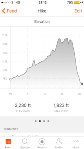
Total miles: 20.8
Elevation gain: 2,230 ft
Time walking: 9:45am to 7:30pm
Miles to date: 778.4
A long but thoroughly enjoyable day! Not as flat as the national trails website would have you believe (“it’s an unusually flat day, in fact there is more descent than ascent…”) but the climb was so gradual that I barely noticed it and there were plenty of stunning sights along the way, nicely spaced throughout the day. I was incredibly lucky with the weather – today’s walk could be quite miserable in poor weather as there’s a large section of remote moorland and pea-soup fog would make navigation a little harder and hide the incredible climax of the day – High Cup Nick. As it was I was dry until coming down off the last hill, thank you weather gods!
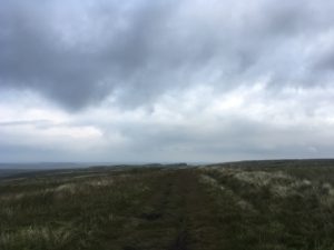
Not sure I’d call that a “flat” day..!
The day started out with a slight shock as we weighed my bag out of interest. It turns out it isn’t 18kg or even 20kg as I’ve been telling people. It’s 23kg! Yikes! No wonder it feels a bit heavy swinging it up onto my back…to put it in perspective that’s an overweight check in suitcase! That was with 3 litres of water though, so I promptly dumped a litre and vowed to make use of my water purification tablets! After that slight amazement I headed out onto the trail feeling well rested and strong after my rest day, looking forward to what lay ahead.
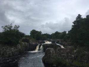
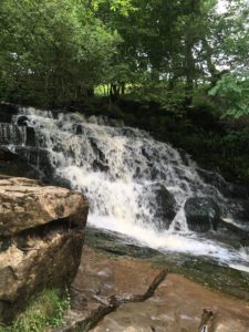
The first few miles went through farm fields and a series of stone stiles (thankfully none as tall as the other day), not the most interesting of walking but fairly easy going which made for a quick start to the day. After a while the path joined the banks of the wide but shallow River Tees which was a pleasant, gently chattering companion, with the path picking its way over a few rocks and tree roots here and there. Three and a half miles in and things start to get interesting….the banks become mini limestone cliffs and the river narrows slightly and becomes more vocal. A couple of small waterfalls provide the warm up act to the first major waterfall of the day – Low Force. I presume it is called Low Force because of its downstream position on the river relative to its rival, High Force, as although it certainly isn’t as high, I think it is more splendid than the latter. It’s certainly easier to view well – a (very bouncy) bridge leads over to a grassy and rocky area which looks over the multiple falls that make up Low Force. I sat there for a while munching on the first half of my picnic (scotch egg, yum! Have never eaten so many scotch eggs in my life!) and just taking in the vibrant energy of the falls.
A bouncy bridgeA peek at Low Force
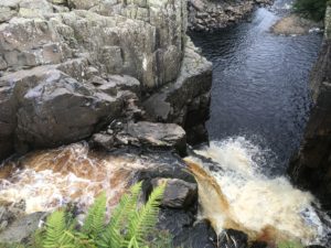
On the way to High Force, only about a mile and a half upstream along an easy path, I saw a little stoat run along ahead of me and dive into a bush. I haven’t seen a stoat in years! I could hear High Force before I could see it, in fact at first I wasn’t sure I was going to be able to get a good view at all! The main viewing point is on the other side of the river, from below, and I remember seeing it from here when we made an overnight stop nearby on our way up to Durham. As it turned out, the path on my current side of the river came out on top of the falls and heading cautiously to the edge (having deposited my bag a safe distance away) I could get a great view down the series of falls from above, a view you can’t get from the main viewpoint. It’s a powerful waterfall! Unlike at Low Force, where the river splits and tumbles over the rock face in different places, at High Force it all pours down the same chasm and is spectacular in its power.
High Force from above
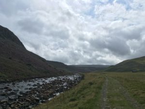
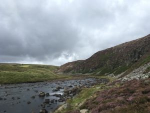
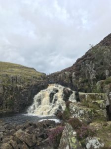
From High Force the path quickly leaves people behind and heads off up the valley, past a busy little quarry and up into a wide dale overlooked by tall but gentle hills and waterfalls on one side and steep limestone crags and purple heather on the other. It is quiet and peaceful, once the industry of the quarry is left behind, and the path is pleasant and grassy with some rabbits for company. After a near miss encounter with a little civilisation (a farm, a bridge, two men fishing and a YHA hostel a quarter of a mile up the road) at Langdon Beck it’s back to wild country again and a riverside path for the few miles to the next highlight – Cauldron Snout, another waterfall to add to the collection. The river flows through a wide, shallow valley here and the wind coming down through the hills was unexpectedly intense. Walking for several miles against a chilly headwind took away some of the pleasure of the otherwise-serene valley, and several rocky scrambles along the river where it ran close to limestone outcrops above also served to slow me down. It was very pretty though and had it not been so windy and had I not planned to stop at Cauldron Snout it might have been a nice place for a lunch stop! Whilst picking my way over the rocks I met a couple coming the other direction. They’d had a disappointing morning, with pea-soup fog up at the top and a tricky scramble down Cauldron Snout. I hoped I’d be more lucky!
A wide, shallow valley – less peaceful than it looks with a fierce, cold headwind blowing!Getting scrambly…
A little further on and I was rounding each bend excitedly expecting to see the waterfall. But Cauldron Snout kept itself well hidden until the last minute! I wasn’t sure what exactly to expect but I had been warned of a scramble up the side of it, which I was a little nervous of but I was glad at least that it had not been raining. When I finally rounded the final bend the waterfall did not disappoint. Tumbling water cascaded down over limestone slabs from about 20-30m up, the white of the foam contrasting with the black of the wet rock and the purple heather growing in cracks at the side. The scramble wasn’t so bad – a few bits where I had to pull myself up on my knee using rocks and heather but not as scary as I’d feared. It helped that I could see Eunice waiting at the top for me. Talk about amazing friends – she was staying with a friend in Yorkshire and drove nearly 3 hours (and walked over a mile) to meet me for a picnic lunch and give me a hug! I was thrilled to see her, not just for the hug but also because I hadn’t had phone signal for 3 hours and had no idea if she would actually make it and be able to find me!
Cauldron Snout waterfall, and the scramble up the left hand side (with my friends waiting at top!)Cauldron Snout – it’s a day of stunning waterfalls!
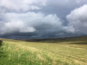
It was a welcome stop, sheltering out of the wind behind the bridge with the massive dam of Cow Green reservoir as a view. I was glad of my proper lunch following yesterday’s food shop as I was starving! The last couple of weeks my need for calories has really kicked in and I’m struggling to eat enough. It was as much as I could do not to eat tomorrow’s lunch too but I knew I’d regret it if I did! All too soon I had to head off as I still had another 10 miles to go and some even more remote terrain to cross. Thankfully our pleas to the sky seemed to send the dark clouds the way I had come rather than the way I was going, and I was hoping for a dry end to the afternoon.
Praying the dark clouds head the other way…
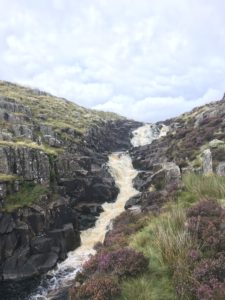
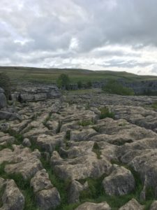
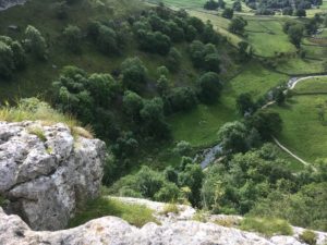
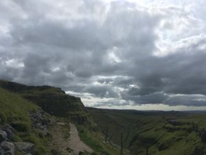
The first few miles after leaving Cauldron Snout were along a tiresome gravel track, up over a lovely moor, one side of which was an MoD danger area, warning signs dotted every few metres at the side of the track. The Pennine Way eventually leaves the track and heads down over squelchy ground (cue my first calf-deep sinking of the day) to the banks of Maize Beck which it then follows for a couple more miles. The beck was fairly low and it would have been easy to cross at several points, even when I spotted the footbridge I was tempted just to try to make my way across on the stones, before deciding it would be far more sensible to use the bridge, as it was there. The moor was fairly exposed and I found myself once again being thankful that the weather was clear! It felt like a long way, across that moor, knowing that at the other end was High Cup Nick, a sight that some describe as the best sight along the whole Pennine Way. There is no hint of it though, as you approach. It looks as though you are in a very shallow, wide valley up high, with moorland for miles, but as you start getting closer you start to feel there might be something more up ahead. It looks almost like the route just ends, or disappears over the edge, and suddenly you see what the edge is. The moor ends abruptly, with sheer limestone cliff edges dropping tens of metres to a steeply sloping valley, shallow at this end but deepening dramatically – 100m or more – as it curves away at either side into a slightly pointed U-shape. My first reaction is ohhh, wow, that’s awesome! But as I head around one side, where the path hugs the edge quite closely, the geological beauty just gets more impressive and I can’t help but keep stopping to gawp at it! It’s deeper than I first thought and the steep sides are gouged with scar-like crevices running down the side, presumably full of cascading water during wet periods. A winding stream ribbons at the base of the valley far below and apart from a few sheep dotted here and there it’s completely deserted! No car parks up here..!
Barely a hint at what’s to come…Finally High Cup Nick reveals itselfJust. Stunning.
The path follows the edge of the valley for a while, fording streams below mini cascades and the occasional small scramble. There were a couple of points where I was glad I don’t suffer from vertigo but on the whole it felt safe, yet thrilling. Sadly the path does eventually veer away from the valley to take a slightly more gentle descent down into Dufton, but as there were some black clouds headed my way it seemed like it was probably a good time to be coming down off the hills! And it really was coming down – for the first time in what seems like forever the land that stretched out in front of me was the patchwork fields of lowlands rather than moorland. I knew I’d be back in the hills tomorrow but it felt strange to be leaving them, however briefly. Out there was ‘normal’ life…up here was peace and freedom!
After days of upland walking, it’s strange to see lowlands ahead!
But descend I must, and the first bit wasn’t too bad, I even had some blue sheep to entertain me. Ok, they weren’t actually blue, but they were so covered in blue paint that for a moment they really did look blue! I also saw some beautiful black horses (Fell ponies, I think) which presumably are owned by someone but were free to roam the moor. The last bit of the descent was along more gravel track and it finally started to drizzle with rain so the waterproofs came out. Gravel track, tough on tired feet, eventually gave way to tarmac (possibly even harder on tired feet) and the rain got heavier until I finally came into the little village of Dufton. The woman in charge of the campsite spotted me coming and took me to a quieter section of the site (apparently they had some groups in for the bank holiday), where I spot a familiar looking tent. Sure enough about 10 minutes later I hear a cheerful welcome in a strong New Zealand accent – it’s Sean, my old-skool tough-as-old-boots Gandalf lookalike! The rain stopped for me to put up my tent and seems to be staying away now. I can cope with that! Sean offers me a cup of tea as he’s making a brew, very welcome as it’s getting late and I need to get my dinner on! So somewhat in reverse, I have cookies with my tea then eat my main course. Exhausted after my long day, I fall asleep whilst writing this blog…! Tomorrow is the toughest day of the route – 20 miles and up over Cross Fell, the tallest point in England outside of the Lake District. Two long days in a row isn’t ideal, but that’s the way it goes!
Lovely stay with the Barnett family. Feels strange to not be walking but the rest is welcome. Lie in, breakfast, planning session and blog updating, washing, stroll into town for lunch and to pick up some food items, bag-repacking, dinner, hot tub, early night. Over too quickly!
Total miles: 17.2
Elevation gain: 1,594 ft
Time walking: 9:15am – 6:30pm
Miles to date: 757.6
I can’t quite make up my mind about today. It was a fairly tough, remote day, probably one of the remotest so far, and lots of bog-squelching. I did have company though, and I reached County Durham, the penultimate county on my route through England!
The day started very promisingly, waking early to a windy but mostly-dry tent and the calls of the grouse all around. (As a slight aside, I’m sure the grouse up here have a slightly different accent to those I heard in the Peak District – rather than sounding like they are saying “go back go back go back”, the Dales grouse seem to say “alert alert alert”!) I’m getting rather fond of their calls, I’ll miss them when I’m back down south!
A misty start to the day
As it was dry I managed to pack the tent up quickly and was in the pub by 8am for breakfast. It looked like I’d be able to join Dan and Gareth today after all – they had an even longer day than me and wanted to get an early start. Sean the kiwi guy joined us for breakfast too – his first Full English! Just as we were about to leave it started to drizzle outside so we donned the waterproofs (except Sean, who wore shorts, a light mac and worn leather boots that were loose around the ankle and didn’t even have laces…talk about old-skool hardcore – he must think we are completely soft!) and headed out onto the moor.
The first few miles took us across mostly featureless, boggy moor with a fairly faint path that split and zigzagged about as previous walkers had chosen different routes over the boggiest sections. Thankfully there was an occasional post to mark the route, but I imagine in thick fog you’d have to rely entirely on a compass – both an exhilarating and terrifying thought! Sean took the lead and set a fair pace, probably a good thing as it meant we just got on with it and splashed our way through rather than trying to pick the driest route (nigh on impossible as it was wet everywhere). Sean’s pack was an ancient canvas and metal frame contraption with leather straps – even the shoulder straps were unpadded leather. His pack was barely heavier than the boys’ packs though, and he was camping the whole time. This is a guy who knows how to survive in the wild! Mind you, he lives in the middle of nowhere in New Zealand and his business is as a guide taking people out into the wild, so I guess it makes sense. He was a fascinating guy, able to live more or less completely cut off from the world but also able to integrate into it – he ran a tourism business in Tibet, travels the world and made a lot of money buying and selling land in New Zealand, now running a horse trekking business when he isn’t travelling. He must be in his late 60s too! I have his details for the next time I go to New Zealand, definitely going to look him up!
Sean setting a good pace up in front
The drizzle eased up fairly shortly but was replaced by midges. Urrgggh I hate midges! I dread to imagine what the Scottish midges must be like. Praying I miss the worst of them… We got warm very quickly once the drizzle stopped but kept our waterproofs on to provide a bit of protection from the nasty little critters. They kept flying all around my face and I feel itchy now just remembering them. They did ease off slightly at one point and I was so warm I decided to risk taking the waterproofs off. Soon after this we reached a tiny bit of civilisation in the form of a bridge and a gravel track which we followed for about half a mile to a farm in the middle of nowhere. At this point the midges got really bad again and we were all constantly swiping our arms, faces and necks (except Sean, cool as a cucumber and seemingly oblivious to the biting *insert unsavoury word of choice here* creatures), but couldn’t keep up. In the end I resorted to digging out my deet and we sprayed ourselves copiously. It did seem to help a little, thankfully, but I could already feel a few of their successful bites beginning to itch.
Protecting ourselves as best we can from the drizzle and midges
A short respite from the moor for a mile took us through farmland and across a pretty beck (stream) and up to another shorter stretch of moorland cut through by the busy A66 – the busiest road I’ve crossed since the M62 a week ago! Just before the road there was an interesting rock formation/bridge over a nearly-dry beck called God’s Bridge, where we met a big group of ramblers out for the day, the first people we’d come across out walking since yesterday morning. They told us of a hunters’ hut about a mile and a half further on, one end of which was left open for hikers to use as shelter. Another mile and a half of uphill then downhill moorland walking, marginally less boggy and easier navigationally, and we spotted the hut at the bottom of a shallow grassy valley, with a few hikers sitting outside on chairs in the sun. This looked like a very promising spot for some lunch! The hut was empty except for lots of plastic chairs and a wall where people could write messages. We left a group message (wishing I’d also written my own now!) and joined the other hikers out in the sun. As we sat down we realised there was also a portaloo – what civilisation!
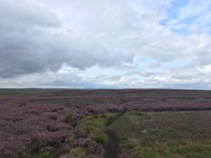
Back in the heather
Our feet got a good air in the sun but it was a struggle to get going again. My feet had stiffened up as we sat and whilst my body was glad of the break I was in a bit of discomfort for the next mile as my feet and ankles warmed up again. Not a great sign, and I have a niggly spot on my big toe which feels like a small but deep blister, but thankfully everything started to feel better after a while. The rest of the day felt tough though, yesterday’s elevation gain and the morning’s squelchy bogs had taken their toll and the afternoon was constant ups and downs as we crossed a series of ridges and reservoirs, the undulation almost reminiscent of the coast path, just slightly more gentle. It was beautiful though, with the heather and grass shining in the golden afternoon sun, and there were intriguing limestone(?) outcrops in the distance to add interest. On top of the highest ridges we could see right the way back to Tan Hill and it looked a long way away! As the day progressed we could even see Great Shunner Fell rising up on the skyline behind Tan Hill, and it was satisfying to know we’d walked all that way.
Golden sun and shiny reservoirs – much less bleak than this morning’s walk!
My least favourite part of the afternoon, other than feeling generally tired and all the ups and downs, was tackling the tall stone stiles between the fields in this section. We’re talking 5-6ft walls with stones jutting out as steps. Going up is hard enough with a big rucksack – getting down the other side verges on terrifying! Thankfully the guys were very helpful and held my poles for me and watched my back as I climbed over – and if there was an option of using the gate they’d open and close it for me! I’m proud of my independence but I’m not daft – at this stage I’m more than happy to accept help in whatever form it comes!
One of the highlights of the early evening, about 2 miles from Middleton-in-Teesdale (and just before the final climb), was finding a little tuck shop by a farmhouse, selling flapjack, sweets, chocolate and cans of drink with an honesty box. I was already carrying a ridiculous amount of food so I resisted (although Dan kindly gave me a swig of his Pepsi) but the boys, who had another 8 miles to go, were delighted. Dan gulped down his Pepsi, glad of the extra energy boost to get up the hill, before realising he’d chosen a Pepsi max which is both sugar free and caffeine free. We all wet ourselves laughing (Dan included) as he realised his rookie error – he was now full of fizz but little else!
Still, we all made it up the hill and over countless more stiles before finally seeing the little (but possibly second-biggest town on the route (don’t quote me on that!)) Middleton-in-Teesdale down below. Whoop! I’m feeling pretty tired by this point and very glad I’d decided to walk a little further today so I could squeeze in a rest day tomorrow. The one sad thing about getting Middleton-in-Teesdale (gee these names are so long to write!) was that it was time to say goodbye to Sean (who was camping here (and excited to try out English fish and chips for the first time)) and the boys, who were continuing on. If I’d been walking tomorrow I would have caught them up in Dufton after their last full day, but as it is I’ll miss them! But who knows, maybe if they haven’t been put off long distance walking for life (they are talking of coming back next year to finish the PW so it can’t have been all bad, despite the blisters) I’ll bump into them again one day!
Today marked the halfway point of the Pennine Way and I have a treat in the form of a bed for two nights after four nights in a row camping (although I will miss my tent and sleeping out in nature!), a hot shower, a washing machine and a home cooked meal. Sean and his family have been incredibly welcoming and have made me feel at home. Sean is a keen walker and has been fascinated about my journey – he is thinking of doing something similar himself one day. I can highly recommend it!
Tomorrow is my ‘extra’ rest day, which I’ve gained by re-merging three days into two. On Friday I have a long day but one that most people claim to be the best on the Way, so I am really excited about it. Even better, I have a rest day so I can do a bit of planning and make sure I have a good packed lunch to enjoy, and I will be nicely rested 🙂
Total miles: 15.4
Elevation gain: 3,165ft
Time walking: 10:45am – 7pm
Miles to date: 740.4
Today was a great day! A stunning waterfall all to myself, a big big climb, highest point of the route so far, fellow walkers, a gorgeous dale and camping in the most beautiful spot behind Great Britain’s highest pub. Today was also the third or fourth hardest in terms of elevation gain which I wasn’t expecting!
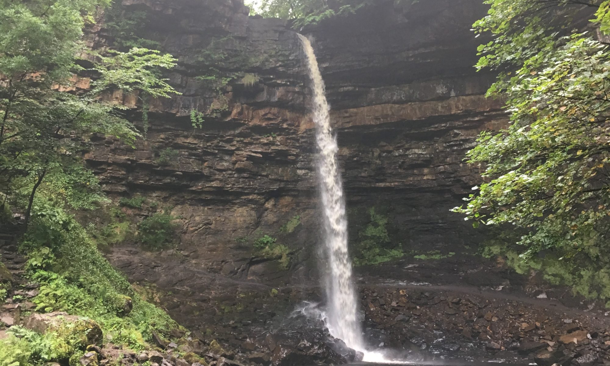
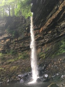
I woke fairly early after an earlyish night last night and whilst I lay listening to the stream I made plans to have a shower, partially pack up my things, go and have breakfast up by the waterfall then pack up my tent and head off. As I was about to spring into action it started to rain quite heavily (again! As I walked back from the pub last night it rained heavily for ages!) so I had a bit of a re-plan – pack my stuff up first and see if it would stop. Thankfully it did so I popped out for a quick shower (the first in a few days – bliss!) then grabbed my stove and some breakfast items and headed up the track to find the waterfall.
I heard it long before I saw it. The stream was busy but as I neared the waterfall, tucked away behind a bend, I could hear the thunderous pounding of water falling from a great height. I even felt the waterfall before I saw it, there was an intense, powerful energy I could feel as I got closer. Rounding the final corner it suddenly comes into view, this dense stream of water pouring straight off a rounded, hollowed-out cliff face high above, smashing onto the rocks in the pool below. It’s not the widest or biggest waterfall ever but it is the tallest single drop waterfall in the U.K. and it is breath-taking! It falls into a round pool at the bottom of a half-bowl-shaped canyon, where the rocks in the cliff face are layered in different colours – oranges and greys and whites – and the rocks at the base are grey and smoothed by countless years of water and many footsteps. The air is slightly misty from the waterfall but the most notable thing is the noise. There is the sound of the water hitting the rocks and tumbling down into the pool and then the echo of this ricocheting around the walls, almost thunderous! I couldn’t believe just how loud it was. It was almost too much for me to sit there and stay for breakfast but I found a flat rock near the stream and got some water boiling for a cup of tea whilst I munched on my granola. The water was mesmerising. After a while I tuned in to different aspects. The patterns the water made as it fell or as it hit the rocks and pool, the different sounds of the water and its echos, the hundreds of colours in the rocks and the little trees fighting for a foothold in the cracks in the cliff. I think moving water is just as entrancing as fire and it has a similar effect on me in terms of the way it makes me get lost in thought. But where there is almost something calming about flickering flames there was something wild and incredibly powerful about the falls. I was so glad I stayed here last night and got to enjoy the falls without anybody else around. I think if there had been other people here I would not have stayed as long and certainly wouldn’t have let myself relax and be fully present to the experience.
The U.K’s tallest single-drop waterfall. All to myself!A misty but beautiful breakfast spot!
Eventually I dragged myself away from the entrancing water and after packing up the rest of my tent I hit the road and started the long climb up Great Shunner Fell, the main ascent of the day. I saw a couple of guys up ahead and judging by the size of their packs (not quite as large as mine but still sizeable) I guessed they were doing the Pennine Way too. They seemed to be making good time up the hill and I wondered whether I would catch them. It was a muggy morning and I wasn’t feeling particularly quick today!
The path climbed up between tall stone walls for a while which meant not much view but after not too long I reached the beginning of the moor where the views opened out across Wensleydale and the surrounding valleys. Some of the hilltops were being hugged by light cloud but somehow Great Shunner, the tallest around, was clear. I hoped it stayed that way! It wasn’t a particularly tough climb but it was looong! It was just under 5 miles to the summit in a long curve which meant I could see the top from early on, and it never seemed to get any closer! It was a pretty walk but exposed and boggy, and I was glad that the weather wasn’t horrible!
A looooong ascent to the top!
Part way up I spotted the guys taking a break so I finally caught up with them. They looked a bit tired! It turned out they were on the second day of a four-day stint on the Pennine Way and hadn’t done much walking before, and one of them was suffering with bad blisters. They were nice guys and I gave them a few tips that I hoped might help them. They joked that they couldn’t complain though when they realised what I was doing! They told me there was a pub in Thwaite, the little village at the other side of the fell, which served hot food until 3pm, which was exciting news! I’d stocked up on a few things in Hawes as I wasn’t expecting anything on the route for a few days, but a midway pub stop was tempting! I left the boys to finish tending to their feet and continued my plod up the hill. Finally, after about 2.5 hours, I reached the summit, crowned with a stone wall in the shape of a cross with stone benches sheltered from the wind. This was the highest point of my walk so far, at 712m, something to celebrate! Unfortunately the cloud had really come down and I couldn’t see very far. Apparently you could see Tan Hill when it’s clear, and I imagine you could see Cross Fell (the tallest point in England outside of the Lake District and my destination in a few days) too. Despite the limited view it was quite cool to see the cloud coming and going and at points it wisped across my hill too. I’d promised myself a proper break at the top so I made a little picnic of the scotch egg and chorizo that I’d picked up yesterday, rounded off with a few of the pic ‘n’ mix Cheryl had brought me. Quite the treat! The boys passed me this time, on a mission to make the pub in time for something hot.
A luxurious picnic today
The way down was nearly as long as the way up, and equally boggy. I was thankful for my gaiters as I could just squelch my way through most of it. I felt sorry for a couple I passed who were picking their way through trying not to get their feet too wet – it must have taken them forever to get down! I was relieved to finally get into Thwaite and found Dan and Gareth sitting outside the pub-come-tearoom-come-shop eating lunch and airing their feet. I’d made it just before 3 so decided to order a coffee and a bowl of chips (Dan let me taste-test his first – they were definitely worth it) and I decided to join them in airing my feet. Even with my waterproof socks my feet feel a bit soggy – my boots are starting to show little cracks so I think their waterproof days are over…
The boys were also aiming for Tan Hill tonight so we set off together, after a hilarious sketch-worthy moment when they tried to lift my bag and thought it was stuck to the table. Nope, just heavy! I tried not to wet myself laughing as they struggled to lift it and looked at me, stunned and somewhat abashed, repeating once again that they really couldn’t complain at how heavy their bags were or how tired they were. I don’t get tired of seeing people’s expressions when they lift my bag, it’s my wicked sense of humour coming through!
I know I shouldn’t laugh…. 😉
After Thwaite we had a steep climb up through pretty fields, each with their own stone barn, to heather-clad hillside. I was out of breath pretty quickly and glad that the climb didn’t go all the way to the top! The path levelled out about halfway up the hill and followed the contours around on a tiny, rocky and sometimes boggy path which seemed far too small for the hundreds of people that walk the PW each year. The hillside was one side of the Swaledale valley and the river Swale was far in the valley below. At one point we could see hikers on the opposite hillside and it was only their miniscule size that gave an indication of how big the valley was. It was a beautiful natural path and a stunning valley, probably the best bit of the day. At points we could see impressive waterfalls as streams tumbled down the little valleys that joined the main valley opposite. Eventually the path started to drop and we reached the turn off for Keld, where I’d originally planned to stop for the night (incidentally Keld is one of the stops on the coast to coast path so I’ll get to stay there one day!). Not wanting to add miles on we didn’t detour to Keld, instead pushing on and crossing the footbridge over the pretty river, spying a waterfall the other side which of course we went to investigate.
Walking along the stunning SwaledaleAnother powerful waterfall
At first we missed the path and it was only when we realised the grass was long and unmarked that we realised we should have gone straight over and up, not along the field! Thankfully we hadn’t gone too far, and retraced our steps to follow a track up to a house further up the slope. It was a steep climb, rewarded by great views back down Swaledale, then back out onto the moor again for the last 3 miles to Tan Hill, the highest pub in Great Britain. The clouds started to gather behind us and we wondered if we’d make it before the rain came. The boys had a room at the pub, it was just me camping! Those three miles seemed to take a while – across the moors there’s not much by way of landmarks to gauge your distance – and the funny and now-familiar call of the grouse can only go so far to add interest along the way. Not that it was at all boring – the colours were fantastic and the view back to the hills changed every time we turned to look.
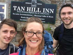
Eventually we crested the hill and we finally saw the inn about half a mile ahead and slightly below, in the middle of nowhere. It is an isolated place! We arrived tired and happy at the not too shabby time of 7pm and after a warm welcome from the barman (and the suggestion that the lads be chivalrous and let me have their room while they have the tent) I went to hunt for a good camping spot. I say hunt, as there wasn’t much flat even ground around! I found a spot between some rocks that was just about big enough for my tent and had a super view out over the endless moor. I pitched my tent in the windiest conditions yet (which actually dried it out quite nicely!) and for a while just sat looking at the view, listening to the wind and the occasional grouse. I felt very happy! This was the best camping spot ever! It was like the best of wild camping and campsite camping put together!
Tan Hill Inn in the distance – a very welcome sight after miles of lonely moor!We made it!Loving this camping spot!
A quick wipe over with a wet wipe (feeling slightly envious of the boys’ hot showers) and a change of clothes and I was ready for some food. Lasagne and chips and a cider on the boys, followed by a pecan sponge slice, in front of the fire, and I’m feeling pretty good about life! We get chatting to the barman, who tells me about the Orkney Islands where he grew up, and a fellow camper who is a wisened old Kiwi guy, fit as anything and like a slightly thinner Gandalf. He is walking the PW having already walked the South West Coast Path and is proper old-skool with his gear but a fascinating guy to talk to. He is very excited about all the English things to try, mainly food-related. He had his first cream tea the day before and tonight was his first English beer!
After a while I’m just too tired to stay up any longer, having already stayed up chatting longer than I would usually. The wind is whipping around the tent but I feel pretty secure, I figure the tent isn’t going to fly off with me inside it!
Tomorrow we all have a long day so the plan is to start fairly early, with the pub’s full English to help us.
Total miles: 16.1
Elevation gain: 1,730 ft
Time walking: 10am – 6:30pm
Miles to date: 725
A very satisfying day! It’s always a good sign when you wake up to a sunny morning and the opportunity to more or less dry out a dew-sodden tent! The pub where Nick stayed did breakfasts so we filled up well and headed out into a warm morning.
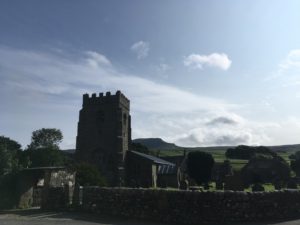
The pretty church at Horton-in-Ribblesdale and a beautiful sunny morning
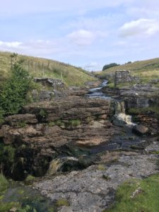
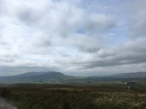
The way started with a slow but steady climb, following the bottom edge of the moor with pretty views over to Ingleborough (another of the Yorkshire three peaks) and back to Pen-y-Ghent. Just before Cave Hill we heard the sound of a waterfall over the wall. Peeking over we saw a gorgeous sight not marked on the map – a big stream dropped over a few gentle ledges then plummeted over a craggy ledge into a large hole in the ground! We nipped over a handy ladder-stile to have a closer look (trying not to get too close to the edge!), and could see a pool far below that the water was pouring into. It was a gorgeous spot! It would make for a beautiful picnic spot had it come later in the day.
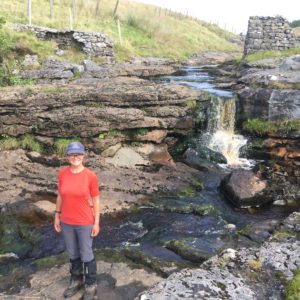
A beautiful spot and a stunning geological feature…stream being swallowed up into a massive hole in the ground!A rare opportunity for a photo of me that isn’t a selfie!
The next pretty and unexpected treat was Ling Gill nature reserve – a deep, narrow limestone gorge rich in waterfalls and trees. The path follows the top and sadly you can’t really see into the gorge but you can hear the water tumbling down and the dense tree growth after miles of open moorland is quite surprising! The path crosses the pretty Ling Gill Beck and then starts the climb up onto Cam Fell. There wasn’t much particular of note but the views were wide and open and pretty spectacular! Over to the west there was a great view to the many-arched viaduct which carries the railway line. The path turned into a gravelled track which after a few miles was pretty tough on the feet. The climb was long but manageable. My pack had been feeling really heavy early in the day but Nick had kindly offered to carry one of my water bottles which helped a bit. Some days it just feels extra heavy!
More stunning views
Eventually the path reaches the top of a deep and wide valley and the view is fantastic. The steep hillside is broken up by tumbling streams carving their way down the slope and the classic grey Yorkshire dry stone walls. We stopped for our lunch on a conveniently positioned slab of rock, admiring the view and the silence. The path follows the contours of the ridge all along the upper edge of valley until the view suddenly opens up to the east as well as the west, and Hawes down in Wensleydale.
As usual the descent feels long and it was very boggy! My left knee is getting tired on downhills now which is slightly concerning, it seems to be holding up but I do feel it by the end of the day. That and my left shoulder, which has a bit of tendonitis I think, are my biggest concern so far but they seem to be ok again each morning. So hoping they’ll hold out…still a long way to go!
We reach Gayle, the little village that merges into Hawes which is the biggest town on the Way so far and it feels quite strange to be plunged back into civilisation after a day on the moors. I can imagine that if I hadn’t had my rest day in a busy-ish place it would be even more of a shock to the system! We arrived at just after 4pm, a very civilised time, so we decided to have a cup of tea before Nick headed home. We found a lovely cafe (lots to choose from!) which did lemon scones with lemon curd and cream. Yum!
Lemon curd scones and tea…..how civilised!What, no candlestick maker?
Once I said farewell to Nick I popped to a lovely little old-fashioned grocery store to stock up on a few bits of food for the next couple of days which are quite remote. As it was early I decided to walk the easy and pleasant (other than the midges!) mile and a half up the path to Hardraw, passing through a field of sheep who followed me expectantly and seeing a hedgehog on the way. At Hardraw there is a nice little campsite just a short distance below Hardraw Force, the tallest single-drop waterfall in England. The site is owned by a nice pub (The Green Dragon Inn) with an open fire, and its from here that I write this blog. It was starting to drizzle when I arrived so I put the tent up quickly and came straight down to the pub. I’ll check out the waterfall in the morning! Sadly the pub has run out of dessert which is rather disappointing, as judging by the delicious giant Yorkshire pudding filled with sausages, mash, veg and gravy they would have been delightful!
Being herded by sheep…makes a change from cows 🙂
As I’ve cut a mile off tomorrow I’ve decided to do a bit extra and rather than staying at Keld I’m going to head to Tan Hill – where England’s highest inn can be found (and camping is available…just hoping for not-too-horrible weather!). Then I have a decision to make about whether to go for two long days with a rest day between or three shorter days. Think I’m going to go for the rest day option otherwise it’s two 10 day stints between rest days…
Anyway, time to leave this lovely fire and head into the chilly evening to my tent…! Thanks for reading – please keep your fingers crossed for decent weather over the next stretch, there’s some rather exposed walking (the highest points so far on the way) coming up.
Total miles: 15.2
Elevation gain: 2,800ft
Time walking: 9:45am – 6:30pm
Miles to date: 708.9
Today was a steady, enjoyable day. Three major climbs, a couple of icons and plenty of time to enjoy the walk. And possibly my favourite place name of the trip so far!
Another dry and sunny morning meant I could dry the tent out before packing it away, with a little help from the breeze and the handy fence I pitched next to. Whilst it was a shorter day I knew I had three climbs and no refreshments en route so I filled up on a good breakfast and a cup of tea whilst waiting for my tent to dry. Nothing like a good breakfast to get you started, even if it’s out of a boil-in-the-bag!
All fuelled and filled up with plenty of water (3 litres…3kg…) I headed the half mile to Malham Cove, a massive limestone cliff which thousands of years ago would have had a huge waterfall flowing over it. Even without the waterfall it was stunning – the path takes you along the stream to the bottom and when you look up you have to crane your neck right back, the people at the top looked tiny! The path then climbs lots (urrr!) of steps to one side to emerge out onto the higgledy piggledy limestone pavement on top of the cliff, where the views stretch for miles.
Malham Cove
The limestone was well worn and slippery in places which made for somewhat precarious teetering from slab to slab, balance always more challenging with a big rucksack on your back! Route finding was also tricky as limestone doesn’t make for an obvious well worn path! Eventually I picked my way around and found the grassy path which headed ‘upstream’ from the Cove, along a shallow valley between limestone crags. Another short rocky climb at the top and the path soon emerges onto flatter more open ground, near Malham Tarn. Beyond Malham Tarn the hills rise up again – Malham Moor and Fountains Fell, my next climb.
Higgledy piggledy limestone pavementDon’t look down?!Looking back down the valley towards the cove (not longer visible from this side!)
As I track around the Tarn and up past the field studies centre (with a handy public toilet and a queue of tired-looking Duke of Edinburgh students) I find some delicious raspberries to ease the gentle climb. I take a good break sitting on a bench overlooking the tarn, just enjoying the view. At one point something falls out of the tree but I think nothing of it, assuming it was a pine cone or something. A few minutes later a young bird, I think a wood pigeon, wanders through the grass and into the area where I’m sitting. He looks a little stunned – I think he must have been what fell from the tree! He seems to be ok, just a little unsure about what to do, but after a while he manages to fly a little bit so I think he must be ok.
The next section of my walk takes me up onto Fountains Fell and I’m a little apprehensive as the trail description said it was “deceptively difficult”. It was long, but I never really found it that difficult, thankfully! Some bits were quite boggy but other sections had been gravelled. Perhaps the gravelled bits were previously more difficult. I have mixed feelings when I see slabbed or gravelled sections. They certainly make for easier walking but there’s an element of it feeing almost like cheating! The gravel, in particular, also seems quite out of place. A bit too man made in somewhere so rugged! The views going up were wonderful and wild though, it’s a lonely part of the moors and I imagine it can be incredibly bleak in bad weather. I thank my lucky stars again that I have been so lucky weather-wise! As I reach the top, at some very distinctive tall cairns, the views the other side suddenly appear and before me is Pen-Y-Ghent, one of the Yorkshire Three Peaks. It’s a distinctive peak from most angles but it wasn’t quite so recognisable from where I stood. Still, Pen-Y-Ghent it was and it looked impressive! Steep sides dropped straight down to the valley below whilst the head of the hill jutted proudly out above lower ground stretching all around. I am going to be climbing that?! I recalled that the route description claimed this hill is “deceptively easy”….here’s hoping!
Fountains Fell – “deceptively difficult”KJ taking in the expansive view from the top of Fountains Fell
Before I reached the ascent of this rather attractive peak however I had to make the descent from Fountains Fell, mostly straightforward but a few ‘skiing’ moments where I very nearly ended up on my bum! Lots more squelching (my boots are definitely looking like they’ve walked 700 miles now!) and then there’s a bit of a break with 3/4 mile along the little road that runs down the valley. Pen-y-Ghent starts looking more recognisable as I get closer to the other end and there are some great little waterfalls cascading down its side.
Pulling silly faces at the 700 mile mark
A quick break and it’s time for the last ascent of the day. The first bit of the climb is very gentle, up and along a low ridge to the foot of the famous rocky outcrop that makes up the rest of the climb. It’s a steep climb! There’s some scrambling too, zigzagging along and up narrow ledges which would be fine without a pack but become somewhat more challenging when your centre of gravity is slightly out of kilter! It’s worth it though. The view from the top of the outcrop has a bit of a Lion King Pride Rock feel about it, and after a steadier climb further up along the ridge to the trig point you can see hills and fells in every direction. You realise just how remote and vast this county is!
Pen-y-Ghent – “deceptively easy”A real sense of the vast remoteness of this part of the country – from the top of Pen-Y-Ghent
My target for the night, the little village of Horton-in-Ribblesdale is visible down in the valley 3 miles away (it’s a slow descent down!) and I start looking forward to my dinner. The first bit of the descent is rather tedious – down big flagstone steps, too large for one step each but too small for two steps to be comfortable. I was glad to reach the more gentle slope of the gravel path which the rest of the route takes, winding its way down into the valley, Pen-y-Ghent getting taller and taller behind.
Nick, a colleague from SJP who has driven 4.5 hours to come up to join me for a day’s walking tomorrow, arrives in enough time to have a quick jaunt up the track to meet me and walk back into the village. I have a feeling Nick will win the award for longest travel time to walking ratio! It’s great to see him, and hear some of his stories from his original Pennine Way adventure. We find the campsite – right by the pub – and once again it wasn’t a problem to not have pre-booked. Although it’s a bit soggy underfoot it is nice and dry weather-wise to put up the tent, at a fairly respectable time of about 6:30pm. Then, it’s off to the pub! A delicious steak and ale pie and chips with extra gravy and I’m good for bed! An early night tonight, whoop! Tomorrow is supposed to be a great walk with lots of open space and spectacular valleys, and the weather is supposed to be fine until the afternoon…fingers crossed!