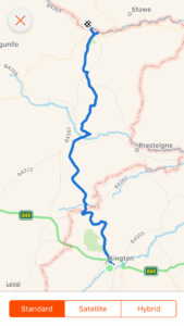
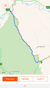
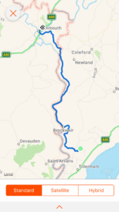
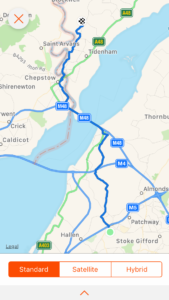
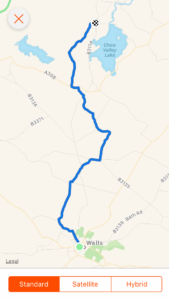
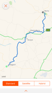
Day 28: Knighton to Cwm

Total miles: 13

Elevation gain: 3,498 ft

Time walking: 9am – 5:30pm

Miles to date: 412.1

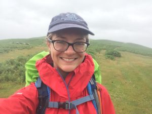
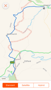
Wow. A pretty gruelling day! Today may have ‘only’ been 13 miles but this section (we nicknamed it “Switchback Sunday”) through the Shropshire Hills is generally acknowledged to be the toughest of the route and the elevation gain tells you why! It shoots the previous hilliest day (the very first day!) out of the water. And it starts straight away, at least from our campsite, by heading straight up Panpunton Hill, no gentle warm up, just straight up to 365m. To put it in perspective, my highest point on the whole of Dartmoor was 467m. These hills are pretty big!

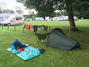
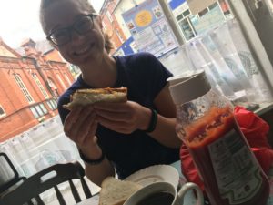
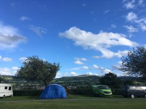
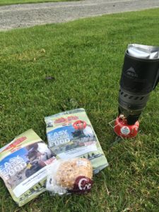
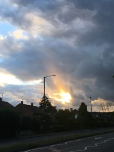
It was a soggy start too. After a fair bit of rain overnight (and lots of different owls calling too, which was beautiful!)  everything was feeling rather damp. My stuff in the tent was dry (except where I managed to brush my sleeping bag across the ceiling (trying to stretch) and covered it in condensation, oops!), but the tent itself was saturated, my bag was pretty damp and the grass around was long and wet. Thankfully it at least wasn’t raining, so although everything went away pretty damp we didn’t get too wet ourselves packing up. Alison kindly boiled me some water so I could eat my instant porridge for breakfast but we realised she too was running low on fuel so we went without tea. I thought back wishfully to yesterday’s bacon and egg sandwich and coffee, but I did at least have a banana that I brought the day before, which felt like a real luxury! Fresh fruit!

The drizzle came as we finished packing up so it was waterproofs on, bags feeling extra heavy from the additional weight of soggy gear. As we headed off to meet Pascaline I munched on some oaty biscuits and sipped my daily Phytosport ‘prepare and endure’ drink – today with added fizz stick (I could feel it was going to be one of those days!) and I was glad to have company for the day ahead, especially as my phone was dead.

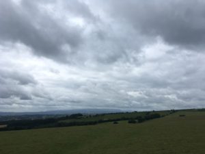
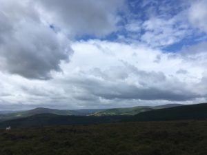
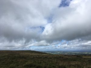
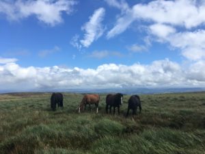
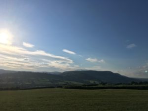
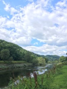
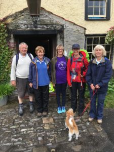
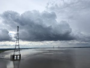
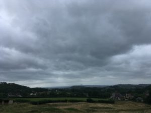
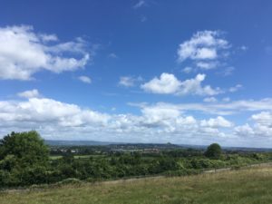
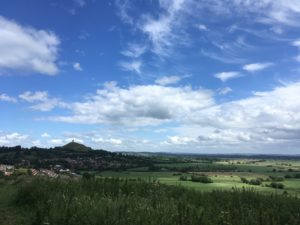
Pascaline looked bright and cheerful as usual and we definitely didn’t persuade her of the joys of camping, as we compared our evenings and morning! The ladies had an even longer day than me today, they had added a few miles on to cut out a day of the path, so they were keen to get going. The first hill slowed us down quickly though, as did the waterproof-removal stop when the weather decided it was going to give us a pleasant morning. After the tough climb the path levelled out to give great views back into Wales, down to Knighton and across to a beautiful viaduct in the valley. The short bit of fairly flat walking was a treat we didn’t quite appreciate fully at the time, but it felt great to be walking on the top of the world with nothing but the sky above, gentle sun and a little breeze. Memories of the soggy, phoneless, fuel-less night and morning faded away and this was going to be a stunning walk! There would have been a glorious photo opportunity of us hiking up along the edge of the ridge, but sadly I had no phone and so no means to take photos, something I’d lament often today! Thankfully Alison took a few key photos and has promised to send them to me when she finishes.

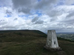
The path soon dropped a little around the head of a small valley then back up to our first trig point of the day at 405m. For a while (on the downhill stretch) I managed to keep pace with Pascaline and she told me of a wonderful Irish travel writer who has had all sorts of adventures. Her name is Dervla something and I must look her up!

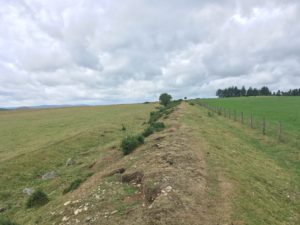
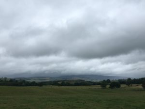
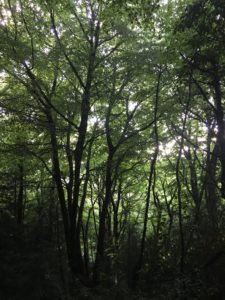
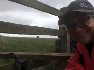
We quickly came to the first major downhill, a long, steep drop to the road, and we’re treated to the onward view. Hills. Lots of them! Like giant molehills, all squeezed tightly together with tiny winding roads between them. Gulp! Deep breath and it’s up and over the first little one (still 50m up and down, thankfully not up to the 345m summit!). Then we pass a farm with the promised and welcome water tap and we decide to take our first break before tackling the next long climb up to Llanfair Hill, an ascent of about a mile along beautiful but steep sections of dyke. At one point the path was practically a scramble, up a steep rocky section on top of the dyke itself, at a 60-70 degree angle! Once at the top we managed to catch our breaths a bit as the path followed a mile or so along the top of the ridgeway where the dyke is at perhaps its most apparent, a massive earthen bank and ditch heading off over the sheep pasture-covered hill, with stunning views all around.

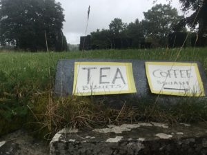
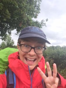
This was the pretty much the last flat bit of the day, and a further treat presented itself in the form of beautifully sweet wild raspberries growing abundantly along the lane for a good half mile. These gave us a nice little boost of energy to manage the long descent down to the valley below, near a little village called Newcastle which is the closest point of civilisation of the day. We resisted the temptation of a Sunday lunch in the pub as my friends’ guidebook had warned that the worst of the hills were yet to come. Instead we scrambled up the next hill and took a break at the halfway sign. Halfway!! 88.5 miles from Sedbury Cliffs and 88.5 miles to Prestatyn. This also meant I’d reached 400 miles at some point during the morning so we had some celebratory shortbread and jelly babies and contemplated our achievements while gazing out over the view.

Further on it started to spit with rain again and after a few minutes waiting to see if it would stop we opted for the waterproofs. Two minutes later it had stopped and the sun had come out again so it was another stop to take the waterproofs off again. Quite a palava, having to take a heavy pack off and back on again every 5 minutes!

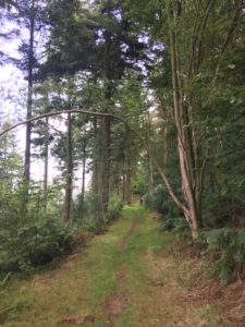
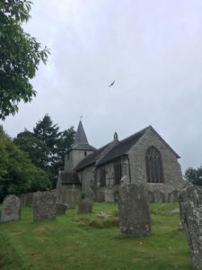
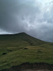
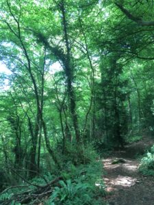
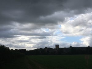
Soon we came to a bit of the path I recognised – a small section I’d walked (in the opposite direction) when I did a 23 mile charity walk back in May. It was a killer of a section! A mile or so of continual up and down without a break, and not even many views as it was all mini hills within hills. The section I knew ended with a longish and very steep wooded slope which was slippery in places – I’m amazed none of us went over on our backsides! Going downhill is just as tough, if not tougher, on the legs and feet, especially when you’re tired. And we knew the moment we got to the bottom it was immediately back up the other side for the toughest, but thankfully penultimate, climb of the day. Just before the climb there is a pretty little church and the place is called churchtown, but bizarrely there is no sign of a village there, just the church and one little cottage!

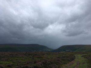
As we started to climb once again the rain started to come and we repeated the pattern of sheltering under a tree for a bit, deciding to put waterproofs on, continuing to climb, rain stopping. This was getting tiresome! I think at that point we gave up and left the waterproofs on, despite it being sweltering with the steep climb. Closer to the top the wind really picked up and we were buffeted about, which at least made the waterproofs seem less of a waste of time!

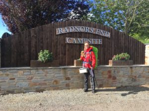
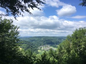
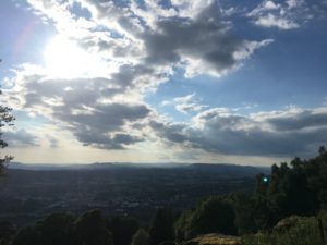
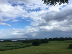
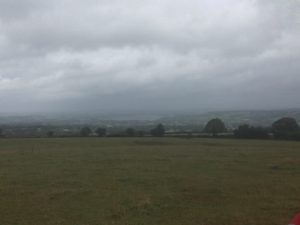
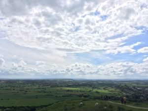
One more down, and I’m really starting to feel my ankle. Then it’s the last up, which is tough but not quite as long or as steep as the previous one. Alison and I plod on up the track and she reassures me that no day on the Pennine Way was as hard as today. Thank goodness! At the top we were rewarded with expansive views out across the Vale of Montgomery – we’d made it through the Shropshire Hills! The sight of lower, level ground was beautiful, and we all looked forward to an easier walk tomorrow! Then, the final rain of the day hits and it’s a heavy one, definitely more than a quick sharp shower! But I’m so close now I just focus on hobbling down to my B&B which is only about half a mile away, not even all the way down the hill! Pascaline and Alison decided to call it a day as they still had miles to go and were as tired and wet as me, so they came with me to my B&B to call a taxi. My lovely B&B host’s husband offered to drive them to their B&B! It sadly meant it was time to say goodbye to them, after the last few days of walking and camping with them, and I knew I was going to miss them! But we’ve swapped details and I might even join Alison for a bit of a 3 month walk through Europe she is doing next year 🙂

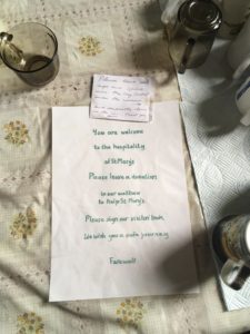
Thankfully my host Ceinwen has an iPad so I’m able to charge my phone finally, phew! She also makes me a proper pot of tea served in china cups and a big slice of homemade barrabrith slathered in butter. Amazing! It feels like a real treat to be back in a B&B and I quickly fill the room with my slightly damp gear, hanging it where I can to dry off. It’s amazing how much stuff comes out of my bag, I’m always amazed at how much I actually manage to fit in there!

I’m tired but warm, clean (although looking forward to doing some laundry tomorrow) and dry and I am making the most of the tea, hot chocolate and biscuits in the room. I’m feeling pretty chuffed at having covered over 400 miles, reaching the halfway point of Offa’s Dyke and surviving the toughest day, now about a third of the way through my entire trip. I’ve now been walking for four weeks which feels crazy! It’s going so quickly!

Tomorrow I have a shorter, flatter day, with just one long climb at the end. Weather is supposed to be pretty much the same, but I’ve been so lucky so far I don’t think I can complain!

Night night! Xx

Day 27: Kington to Knighton

Total miles: 16.4

Elevation gain: 2,683 ft

Time walking: 10am – 5:30pm

Miles to date: 399.1

Thankfully after the rain of last night it was dry this morning, which meant we could hang out our damp stuff from yesterday to get it a little bit drier, and the tent was almost dry. Putting up a tent in the rain is one thing, packing it away in the rain is the worst!

Trying to dry everything out!

We had spotted a promising looking cafe in town and headed there for some breakfast. It was a real gem. Bacon and egg sandwich on proper doorstop bread and a coffee for £3.50! It tasted heavenly too! After wolfing that down I headed to the post office to get my first official stamp of the trip so far (not very good at finding post offices when they are open!), which added a little extra to my journey but was definitely worth it.

Yuuuuum!

The route started pretty much uphill through the town save for a brief descent to the main road, then steeply climbed up to the edge of Bradnor Hill with its golf course, the highest in England and, I found interesting, grazed by sheep! Thankfully the path didn’t go right to the top but veered away to summit Rushock Hill instead. After a momentary heart sinking moment where I thought there was a big bull in the field ahead (I was very glad to find there was actually a fence between us!) the path finally met back up with Offa’s Dyke, and the path followed it for much of the rest of the day. It’s pretty impressive that something built so long ago (well over 1000 years) still remains so intact today, albeit not at the same height or magnificence of its time.

A section of dyke

Dropping all the way down to Lower Harpton there was a rare half mile of flat walking, along a road but a treat nonetheless, before gradually starting to climb again along a really well preserved section of the dyke with stunning views back to Hergest Ridge from yesterday (somewhat better weather today!). It looked surprisingly close, but Kington is on a bit of a loop in the path so there’s not as much progress North in that section. Not long along this section I finally caught up with Alison and Pascaline, who tend to be a bit better at getting going in the morning than me! We walked the rest of the day together, which made a really nice change from walking alone, as much as I love it. Pascaline walks very fast as she is (sensibly!) b&b-ing and has a much lighter pack, so she has to keep waiting for us slow coaches bringing up the rear!

Pascaline making short work of one of the many hills!

The hill we are climbing is the second of the three big  hills today (each just shy of 400m), and it does seem to go on and on. Lovely views from the top though! At the bottom of this one we cross the (prettier than the name suggests) River Lugg and I learn about hollow ways from Alison, ancient walkways used as ‘highways’ by our nomadic ancestors, lined with trees and hollowed out through use over time. Alongside the fascinating history lesson we all started singing Dolly Parton songs as we headed into a little village called Dolley Green. I appear to have made some friends who are as bonkers as me! Which really helps, when you see the final hill you have to walk up…! Offa certainly didn’t do things by half. The dyke runs straight up hills, at the steepest gradient, and the path follows…!

Some more great views

Again the views are fantastic but my feet are starting to ache a little which surprises me as it hasn’t been the longest day.  Still, the last couple of miles into Knighton felt long, but we arrived at not too shabby a time and thankfully found a pub/hotel where we celebrated our arrival with tea and tea cakes. Alison and I then headed off to find out campsite which was a little way out of town but along the path. We were slightly concerned it didn’t exist any more as we saw no signs of other campers, however when arrived at Lower Panpunton there was indeed a campsite, just a walkers and cyclists only campsite, basic but peaceful and beautiful. We were the only two there tonight! We got out tents up before the rain came and poor Alison had to walk back into town as she’d arranged to meet friends. It was just me, myself and my stove tonight! Unfortunately my phone charger cable wasn’t working and my battery died so it really was just me! It was somewhat frustrating as I wanted to write my blog and later as it started raining and I was confined to my tent it would have been really nice to chat to friends. I also realised I had no way of knowing the time, having dropped my (thankfully cheap) watch in the canal a couple of weeks ago, but I decided it was the universe’s way of reminding me to appreciate where I was, in this beautiful spot, and to get comfortable with being alone.

As I was cooking dinner (aka boiling water for my dehydrated chilli con carne) it started to drizzle so I moved everything into the tent and prepared to eat under my little porch (fashioned out of my walking pole, an elastic band and the tent door (I feel like a proper hardcore camper now, using my hiking poles to do things other than walk with!)). Suddenly I hear the sound any person halfway through cooking dreads to hear…the sound of the gas running out. Noooo! I check the stove. Sure enough, I’m out of fuel, before my water has boiled. Thankfully it is steaming so I figure it’ll just about rehydrate my dinner and warm it up…which it did, just, and it still tasted fine. And I had some goodies bought from the Spar in town to supplement my meal too, so it wasn’t all bad, sitting in my tent eating my not-quite-hot meal out of a packet listening to the rain patter on the tent!

I’m aching though, and conscious that I haven’t done enough stretching today. It’s a bit hard, when you’re confined to the tent! I use my little roller as best I can on my feet, legs and butt, and figure that’ll have to do til morning! Now the owls are calling and it’s very peaceful listening to them. Just a shame about the rain…!

Route day 27

Day 26: Hay-on-Wye to Kington

Total miles: 17.2

Elevation gain: 2,337 ft

Time walking: 10am – 6pm

Miles to date: 382.7

Another damp day! Thankfully it was dry to put the tent down and pack up this morning. In fact, thankfully my tent was still there…the wind during the night was so strong I thought I might blow away at points!

After a breakfast overlooking the view I headed off a little later than planned as it took a while to make sure my phone was charged – my charging cable has gotten all twisted and I have to hold it in place to charge…I’ve ordered a new one now to pick up en route in a couple of days as mine is pretty much a goner, eek!

I don’t know if it was because I was tired from not much sleep (wind, rain and helicopters!) or because of the threat of rain or something else, but I found the first few miles slow going and not terribly interesting. I think yesterday spoiled me! The first bit along the river was pretty (although somewhat disconcerting to be following it downstream…) and then it was a mixture of fields, tracks and roads, all of which were perfectly pleasant but not terribly exciting. A nice surprise was bumping into Rob from Sydney, we’ve been following each other on instagram and hoped our paths would cross today. It was quite by luck that they actually did in the end as he had to get a lift to Hay so couldn’t do the full walk, but I happened to be walking along that bit of road as he got dropped off! We chatted for a bit – it wasn’t quite the pub/cafe/hill we’d imagined but it was nice to meet and he donated to the cause which was sweet.

I contemplated taking a break as I was getting a bit hungry but as the rain kept coming and going and I had heard rumours of a church a few miles ahead that offered refreshments to hikers I decided to push on. The tiny little church of St Mary’s in Newchurch did indeed offer refreshments and shelter (no loo sadly but can’t have it all!). There was a kettle, tea, coffee, squash and biscuits, with a lovely note and a request for a donation in return for the refreshments. It was such a lovely gesture, so welcoming, and welcome! I duly made myself a cup of tea, had a biscuit and some of my snacks, while reading the visitors book and drying off a little. I love reading visitors books. People come from all over! There were lots of people walking Offa’s Dyke who were very glad of the shelter and warm (or cool!) drinks. I looked through to see if I could see any other end to enders, but I didn’t come across any. My friends from yesterday, Pascaline and Alison, who were about an hour ahead of me, had stopped there earlier – I could tell because they had written in the book too!

A very welcome invitation

Back out into the drizzle feeling refreshed after my warm drink my spirits soon lifted further as the path headed out into a common, and although the views were partially obscured by clouds there was still a marvellous sense of openess and space and I felt myself finally getting into my pace. It was only about 4 miles to Gladestry where the route description promised a pub, so I decided I’d stop there for the loo, some chips and a sock change. Sadly the pub was not open (I shouldn’t be surprised really, as pubs in the sticks rarely open outside of lunchtimes and evenings, but as it was specifically mentioned in the official route description I had high hopes!). Thankfully, the beautiful church in Gladestry, also a St. Mary’s, had taken after the other St. Mary’s and opened its little kitchen up to hikers. It went one better and also had a toilet, which I gratefully used! I nearly didn’t stop for another cup of tea but decided it probably would be a good idea to change my socks and have a rest before the final few miles up over the hills, so I sat and enjoyed the peaceful church for a while, musing over the hospitality my fellow hikers and I had been shown.

This kept running over in my mind as I walked the next few miles and I thought about how wonderful it was that these tiny communities had thought to open their doors to people passing through, regardless of their faith or beliefs. It really warmed my heart and not for the first time on this walk it made me question what small things I could do to make life better, or nicer, or easier, for others. One tiny act on one person’s part can have a much greater impact on someone else’s life. I thought of the cup of tea, and the £1 donation I had given for it and it struck me that in today’s society we seem so intent on getting everything for the lowest price possible, not giving thought to the value of what it took to produce a particular product or service. Take the cup of tea today. The £1 I gave might seem a lot to some people – after all, you can buy a whole bag of teabags for a pound (and I’m ignoring water, milk, electricity here) – but for a cold, wet and tired hiker seeking shelter from the rain, that cup of tea, and the thoughtful hospitality behind it, were priceless!

St. Mary’s number 2!

Anyway, as I climbed the hill – the largest of the day – onto Hergest Ridge – I was very glad I’d stopped for the break and warming drink as the weather quickly began to close in. It was a couple of miles of ridge walking, although not as high as yesterday, and it was very atmospheric watching the mist roll in! Sadly it meant I didn’t get to witness the supposedly brilliant views but walking up there in the mist and rain was still wonderful!

Moody weather over the hills
Rain can’t stop me smiling!

Dropping down off the ridge, back in England again after spending the majority of the day in Wales (save a brief jaunt over the border in the middle of the day, a theme that is to be repeated over the next few days) it was a mile or so into the little town of Kington, which seemed like it would be quite pretty when it was open and not raining. The campsite was a short way out of town and when I arrived I spotted Alison who had just finished putting up her tent. I wasn’t as far behind as I thought I was! It was still raining so I quickly put my tent up too and got my bag under cover, a bit pointless really as it was already soaked, but thankfully everything in it seemed pretty dry. A lady in a camper van near us came over with a big umbrella and offered me a cup of tea! Today seems to be the day of kindness and tea!

I was contemplating whether to hide out in my tent and cook dinner with my stove (I say ‘cook’, I actually mean boil water and add to dehydrated expedition food…!) or to brave the rain and head to the pub. Alison helped me decide by inviting me out with her and Pascalina (who is taking the sensible person’s option of staying in a b&b each night..!). Pub it was, and right decision too. Steak and chips at the Oxford Arms. Best chips I’ve had in ages! And it was lovely getting to know the two women and hear about their respective long distance walking adventures. I may have added a few more to my list…!

The rain had more or less stopped for our walk back to the campsite which was nice, and it’s supposed to be dry in the morning so I’m hoping I might be able to dry a few bits out before I go. A slightly shorter day tomorrow, supposedly only 13.5 miles, but then I’m a bit suspicious about their measuring as today was only meant to be 15….still, it shouldn’t be one of the longer days! Which is good, as it’s supposed to start raining again mid-morning…!

Well, it’ll be what it’ll be..! Night night! xx

Route day 26

Day 25: Pandy to Hay-on-Wye

Total miles: 17

Elevation gain: 2,385 ft

Time walking: 9:30am – 5:30pm

Miles to date: 365.5

Wow, talk about being in my happy place today! I absolutely loved it. Rain and all!

The steep climb right from the off seemed a bit daunting after a big full English, cereal, tea, coffee and all, but as Pandy is sat right under the Black Mountains there really isn’t any choice but to shoulder your pack, take a big breath and prepare yourself for 3 miles of uphill walking!

Thankfully I felt strong and well-rested after my day off yesterday and my pack, which sometimes can feel like a dead weight on my shoulders, just felt like a big hug. I think you could say I attacked the climb with gusto and after reaching the hill fort (whoop! The largest in the area), I was very grateful to be waterproof-free! It didn’t take too much longer for the first rain to arrive so I duly donned my red, black and green combo and made a start on the remainder of the hill. Of course, it was merely a warning shower and the next hour was rain-free which usually would be unpleasant in the waterproofs but given the ever increasing wind it was actually nice to have the extra layers.

The path kept climbing and eventually I found my first trig point, an exciting moment as not only did it mean I could accurately pinpoint my position on the map (on an otherwise fairly featureless ridge) but it also meant the worst of the climb was behind me! The views were already spectacular. I could see back where I had come from the previous day to one side and the rest of the Black Mountains to the other side. Ahead, the stunning ridgeway that I’d be following for the next 9 miles, broad and grassy, falling away on one side to the patchwork countryside of Herefordshire and down into the steep-sided valley where Llanthony and its priory offer respite to walkers who want to break the long day. It would be nice to see the priory but it felt to me like my day had barely started and besides, I didn’t think it seemed like the easy option to walk down the steep valley then have to come right back up the next morning!

Trig point number 1!

By this time the first rain had come and it was squally and blustery. I was glad of my heavy duty waterproofs! As the path climbed higher the views were ever-changing, mainly due to the changeable weather. Clouds were rolling in from the mountains side and where the plains to my right were in sunshine, the high hills to my left were dark and misty. It kept changing – sometimes it would clear over the hills and sometimes there would be rain down below. I could see the weather heading towards me over the hill, it was fantastic!

The weather coming in!
Looking out over the ridge towards Herefordshire
Horses on the hill!

There was plenty to keep me entertained on the long ridge walk. Lots of ponies with their foals, lots of sheep, the clouds, a fighter jet and two helicopters practising their flying skills up the valley. The path was very clear too, so little thinking or navigating was required. I think even if the weather had really come down it would still have been easy to follow. But it wasn’t overdone, which was nice. Just some gravelly rock here and there, some flagstones, it all looked very natural and in keeping with the surroundings, and it was still very wiggly!

I actually came across fellow walkers today too! A few other brave (or crazy) folk out in the weather, some coming my way, some always just ahead of me. I caught up with a couple of ladies walking Offa’s Dyke and we passed each other a few times before eventually, below Hay Bluff, walking together the last few miles into Hay.

So today I went over the highest point both of Offa’s Dyke and my route to date, at just over 700m. The views were just incredible. I literally could see for miles and miles, I was on top of the world! As I neared Hay Bluff (the path doesn’t actually go to the trig point and having been even higher I didn’t go down to it) I was intrigued to see a few more people about, some of who were in questionable footwear. The reason became clear as I rounded the hill – there’s a car park not far from the top!

There were fantastic views back toward Hay Bluff and its companion, Lord Hereford’s Knob (I kid you not!), although the ridgeway we’d come along was well hidden from view. The route then dropped steadily down through a series of fields and tracks before suddenly Hay-on-Wye comes into view right in front. We welcomed the sight of the first cafe and gladly dropped our packs for a coffee, cake and wee stop! Other than to take photos I hadn’t stopped once since putting on my waterproofs so it was quite a treat to lose the pack for a bit! I wasn’t sure how I’d cope putting it back on to walk the final mile on to the campsite but fuelled with coffee and cake and a new friend for company it wasn’t such a hardship!

Looking back up at Hay Bluff

The campsite is gorgeous. It’s called Radnor’s End and is very small but has stunning views back to the hills and overlooks the town. The facilities are great too, there’s even a little portacabin for tired wet hikers who don’t want to hide in their tents, although thankfully the rain is well gone now and I’ve enjoyed a sunny, if breezy, evening sitting out with the view. We even had a red kite fly over!

Arriving in the sunshine!
Not a bad view! Looking back towards Hay Bluff
Face of a happy camper!
Gourmet dining

Gourmet dining tonight – boil in the bag chicken tikka with rice and chickpeas, followed up with chocolate pudding and a herbal tea. Yum! It’s starting to get a bit chilly now and I’ve added several layers. It’s only 8:30pm but I expect I will head into my tent and curl up in my sleeping bag soon!

It has been an amazing day, and I’m really glad to be camping tonight, it has really rounded the day off nicely! I am absolutely loving this. I am so happy 🙂

Much love to you all, and I hope you do something that makes you happy tonight 🙂 xx

Route day 25

Day 23: Monmouth to Pandy

Total miles: 19.1

Elevation gain: 2,150ft

Time walking: 11am – 8pm

Miles to date: 348.5

Today was a very nice day. The weather was beautiful (if a little hot!), the scenery was beautiful, the path was clear and I was feeling good! The slightly bizarre thing was that today was pretty much heading west. Feels strange to be going west when my overall route is north-east, but that’s what happens when you don’t take the direct route I guess..!

After picking up a few supplies in Waitrose in Monmouth (which made me miss cooking!) and strolling over the famous mediaeval bridge, the path didn’t take long to head out into countryside and the first few miles were along easy (albeit uphill!) forest tracks. The dappled shade was welcome respite from the already hot sun and apart from the birdsong and the breeze in the trees it was peaceful and quiet.

The Monmouth Bridge

I missed the shade when the path headed out into farmland, but the views over rolling pastures were beautiful. Lots of sheep today. I like sheep – they look soft and cuddly and they rarely want to chase you! I did have a few cows today but all were very well behaved. I like these welsh cows! Even the two bulls I passed barely batted an eyelid at me. Phew!

The going was easy today, even with a few hills (nothing compared to yesterday, even though the elevation gain wasn’t much smaller!), with obvious, well signposted paths, and, NO STILES! I didn’t think I would actually get a stile free day but today it happened. Very exciting! My legs were very grateful, given the distance I had to cover.

Beautiful farmland looking out to the Black Mountains

I found a beautiful spot for some lunch, a big old oak tree in the middle of a field overlooking the Brecons and Black Mountains, which had a perfect seat-shaped hollow. As I ate my lunch in the oak’s dappled shade I was treated to an aerial display by a red kite – my first of this journey! I love red kites, I’ve been fascinated by them ever since I read a book about a boy who rescued a red kite chick from poachers and raised it. They used to be virtually extinct in the U.K. but were reintroduced and are now thriving. They are more beautiful than buzzards, with a reddish-brown colour and striking white and black undersides to their wings, and a distinctive fork in their tails. Buzzards are more of a uniform golden-brown, paler underneath with a wedge-shaped tail. Kites also have a more dramatic flight and are fun to watch!

Just hanging out in a big oak tree..!

The next exciting part of the day was visiting the White Castle, a well-preserved 12th and 13th century castle on top a hill with fantastic views all around. Remarkably (compared to English standards), it was free to visit! I explored a little having left my bag on the bench, bouncing around and walking rather strangely without the weight on my back!

The White Castle

With only 5 miles to go and a beautiful evening I didn’t feel too tired despite having walked 14 miles already. A few steep sideways downhills though took their toll on my ankles and at the next uphill I started to tire quickly. Thankfully there was a well-placed pub at the top of a particularly steep section and I had to give credit to whoever does their marketing – strategically placed posters started to appear on gates along the path from about a mile away, with a “well done! Only 200m to go!” sign with a picture of a nice cold pint at the top. I didn’t need further encouragement – I’d forgo the pint but a half of coke with ice and lemon, yes please! The pub was right next to a very beautiful and slightly unusual white-washed church and the beer garden was sunny and peaceful. I could have stopped right there, and if it hadn’t been for the fact that I already had a long day on the next day of walking I probably would have!

Well, it’d be rude not to!

As it was I pushed on for the last two miles to Pandy and had a glorious view of the Black Mountains as I crested the hill. Suddenly Dartmoor seemed quite small…! I was suddenly very glad I’d decided to take a rest day tomorrow! The day after tomorrow I have a long climb up to the top of the Hatterell Ridge, and a long, high walk for the majority of the day. I am really looking forward to it, but it will be a tough walk and I’m relieved that I have a rest day to ensure I’m fresh for it!

The onward route!

Dropping down into Pandy I had a half mile walk along the road to reach the Old Pandy Inn where I am staying for the next two nights. Very relieved to have found somewhere, given that I only phoned around this morning! I struck lucky too, I’m staying in the bunk room but I’m the only person in there! It’s a comfy room too, with sofas and an ensuite! Big room for one at dorm prices, amazing 🙂 Celebrating the long walk and the accommodation win with a glass of wine, a big bowl of pasta bolognaise and a sticky toffee pudding and feeling rather satisfied! I have a feeling I will sleep well tonight…!

Xx

Route day 23

Day 22: Chepstow to Monmouth

Total miles: 15.8

Elevation gain: 2,486ft

Time walking: 12 – 7:30pm

Miles to date: 329.4

Today was a lovely, uneventful, sunny day! Yay! It started off with a relaxing morning drinking tea and eating breakfast by the Rayburn looking out at the beautiful view. I was tired from yesterday and didn’t have too long a day today so let my body rest a bit, which it was very grateful for!

Today was my first full day on the Offa’s Dyke path and I was looking forward to getting stuck into it. I had walked part of today’s section before so I knew I was in for a lovely day. The first part was through lovely beech woods on top of the steep slopes above the River Wye, with classic views down to Tintern Abbey, before dropping down to Brockweir right on the the river itself. The path splits here and you can choose a higher or lower option. For once I chose the lower option, which followed the river for 3 miles rather than going up over a common. I’m glad I made that choice as there were a few big hills still to come!

Looking down to the Wye and Tintern Abbey

It was warm again today and out of the pleasant shade of the trees I could feel myself baking, such a change from yesterday! The riverside path was very pretty and easy going and apart from one field of very docile cows for once there was no other livestock to contend with! I was actually a bit dismayed when I saw the cows, less for the potential for being chased and more for the letdown of now not being able to triumphantly declare it a cow-free day! It was definitely a bull-free day though, whoop! It was also nearly a stile-free day too which made a pleasant change!

The rest of the day mostly went through beautiful woods with nice cushioned ground to walk on and some (empty!) fields. There were a couple of hills to contend with, the last one being particularly long and tough. That was all worth it though for the view when I finally got to the top. It is at the Kymin, which has a naval monument and a Georgian banqueting hall. The view drops away down to Monmouth below and out to the black mountains beyond – my destination for a few days’ time!

Looking out to the Brecons and Black Mountains

The last couple of miles down into Monmouth were steep and I ended up jogging a few bits to avoid too much pressure on my knees! I arrived later than I would have liked but still in plenty of time for a cup of tea, a shower and a good feed! And some washing! It’s only 10:30pm now but my eyes are drooping and I’m going to head to bed as it’s a longer day again tomorrow. I head to Pandy, and I haven’t arranged my accommodation yet, oops, so chances are I’ll be camping! I’m hoping to take a rest day in Pandy so I miss the forecasted bad weather and build up some energy for the Black Mountains!

Much love, and keep smiling!

Jen xx

Route day 22

Day 21: Bristol to Chepstow

Total miles: 17.7

Elevation gain: 1,631 ft

Time walking: 9am – 7pm

Miles to date: 313.6

I cracked 300 miles! Wow! That feels pretty good. In fact, it was a reasonably momentous day in terms of the journey as a whole: I passed 300 miles (pretty much 1/4 of the way now!), crossed into Wales (then promptly back into England again!) and started my second leg.

Still tired from yesterday and with the rain starting just 5 minutes into my walk it wasn’t the most promising start to the day, however the prospect of walking across the Severn Bridge and having some friends join me gave me something to look forward to and I set off at a good pace aiming to get a few miles under my belt.

The first few miles were wet but uneventful, and then the theme of the day made itself apparent; today it was the day of the double stile! A lot of the fields were separated by a hedge and a rhine (water-filled ditch) which meant a stile, then a little bridge, then a stile. Thankfully they weren’t too overgrown but it was still tiring doing the double climb each time, especially as I had to be extra careful with the wood being slippery!

After a while the rain stopped for a bit and I had a welcome break from hood-up overheating and I did the 300 mile happy dance 🙂 Then, oh hello field of young bulls, what a surprise! These seemed fairly skittish and at first ran away from me – albeit unfortunately in exactly the direction I was headed – but they soon got more confident and there was one rather large one with horns that seemed particularly keen on getting close. Each time they got a bit closer I’d eye the big, deep ditch beside me and contemplate whether I could escape into it if necessary! Thankfully that decision didn’t need to be made and I eventually made it out of the field a little sweatier and more tired than I’d entered it, but in one piece. There were only a couple of fields to go now before I reached the pub where friends were meeting me, so I put in an order for a bowl of chips and picked up my pace. Across another watery ditch and it’s another field of bovines, females this time, with calves. I’m not too worried, even though they eye me half curiously, half warily. I’m sure if I skirt around them I’ll be fine. And then I see him. The bull. A heavy, thickset bull with horns and curly hair, and rather large, well, manly bits! He comes a bit closer to take a good look at me and keep an eye on his girls as I lean on the gate, eyeing up the distance to the gate on the opposite side of the field. Seriously, I am so over cows now! I really don’t want to go in that field with that bull! I check my map, but today there is no obvious alternative way around, without either retracing my steps completely (back through the field of young bulls) or taking a route that adds about 2 miles. I can’t even try and get through by crossing into the adjacent field thanks to the massive watery ditches in the way! I eye the bull. He eyes me. We weigh each other up. This goes on for about 10 minutes, by which time some of the cows have lost interest. I tentatively take a step or two through the gate, they all back off, including the bull. He doesn’t look terribly ill-tempered, I think he may be a dexter bull (beef, not dairy…supposedly beef bulls are friendlier…). As I move towards them they all move off and more confidently I make it halfway across the field before my back has to turn on them. They spot their chance to move in on me. I try my yelling and waving arms trick although I’m a bit nervous to yell too loudly at the bull. It seems to work and they back off a bit. It’s the same game as with the younger bulls, but my heart is pounding a lot more at the sight of the heavy bull each time he breaks into a lumbering run and I have to work very hard to not break into a run myself. “Don’t run. Whatever you do, don’t run!” I keep telling myself. About two thirds of the way across the field the cattle decide I’m probably safe now and thankfully they finally all stop and watch me make my way to the gate. I climb through gratefully, legs a little on the wobbly side, just as the heavens open. Dripping wet I wobble my way the short distance to the sanctuary of the pub in Aust. Oh happy sight!

300 miles!
I was definitely not pleased to see this hefty fella blocking my path!

Greeted at the pub by big hugs and cheers of welcome and congratulations, and presented with a glass of coke and a (fresh) bowl of chips, I immediately start to feel better. My t-shirt is soaking wet (not quite sure whether from the rain or sweat, or both), but I dry out soon enough while we watch the rain pelting down, thankful we aren’t out in it just yet!

Emma and Mike from Scrubditch Care Farm (one of the charities I’m supporting) have come to wish me well and brought me the first fig from the polytunnel (ohhhh it was divine!) and a bunch of sweet peas that smell heavenly as they are tucked into the side pocket of my rucksack. Then Pam, Lorraine and Ian from Watershed Riding for the Disabled (another of the charities) have come to walk over the bridge with me, braving the rain!

Moral support!

It was great to have company over the bridge, partly because it was a really cool thing to do and partly because it’s a surprisingly long walk from Aust to Chepstow! 6 miles! The views from the bridge were spectacular, especially with the moody clouds over the estuary and the second bridge. Sadly there was no “Welcome to Wales” sign on the footpath – it’s only on the road – so I didn’t get a picture with that one. Ah well, I know I made it to Wales! Amazingly the rain held off and we even had a little bit of sun as we crossed, and the others stripped off their waterproofs. It was too much effort for me with my pack, and I didn’t trust the looming black clouds so I kept mine on, which proved a good idea as the heavens opened again just as we walked through the thick town walls. And I’m talking monsoon-type downpour here, not just your average British summer shower! Tesco was just in front of us so we dashed down to shelter under the covered walkway, the water working its way down between my pack and my back as I hurried along. The road turned into a river and we weren’t the only ones taking shelter. It didn’t look like easing off so we downed packs and decided to wait it out. It was a good idea, as soon came the thunder and lightning, and several more heavy downpours. I was incredibly glad we weren’t still on the bridge! We ended up eating most of our picnic there under the shelter, with a beautiful view of the Tesco petrol station!  Not quite what I had planned, but we all found it quite hilarious!

On the bridge!
Looking out to the new bridge, from the old bridge, across the River Severn
The closest as I could get to a Wales sign!
Not the most salubrious of picnic spots, but it’s out of the rain!

Once the rain finally eased off again we headed towards the old bridge to find somewhere for a hot drink, all plans of a picnic abandoned in favour of getting warm and dry. We found a nice wine and coffee bar on the river who let us bring our little dog in and we gratefully stripped off our waterproofs. I also gratefully took my boots off which I could have done with doing earlier as my feet were wet which wasn’t doing my blisters any good. Thankfully with a bit of airing and drying off, and swapping to my waterproof socks, the impact doesn’t seem to be serious or permanent!

Soon it was time to say farewell to my walking party so they could get a taxi back to the other side of the bridge and I could walk the final four miles to my bed for the night. I had originally planned to walk down to the very start of Offa’s Dyke path but I made the decision that walking the extra two miles there and back probably wasn’t a great idea given the weather and my feet and other than getting a photo at the starting point I probably wouldn’t be missing out on all that much. It was definitely the right decision as the last four miles got tough. The path was pretty at points then would return repeatedly to the road and it felt like I was doing lots of zigzags. But each time I’d be a bit higher and the views, back across the Wye in one direction and the Severn in the other, were beautiful.

Views back out to the Severn Bridge

The path eventually headed into the woods and picked up the actual dyke. Suddenly I realised just how high I was as the woods steeply dropped away to one side. There was a real sense of space and I didn’t envy the Welsh trying to get into England all those hundreds of years ago! From time to time I stopped to listen to the raindrops falling softly from the leaves, to land muffled on the path below. I was looking forward to walking more of the route tomorrow but first I had to take a small detour to my accommodation for the night, the parents of a friend. The highlight of the evening was discovering that my friend’s dad is a dairy farmer so the milk they have comes pretty much straight from the cow! No wonder the tea tasted so good…!

My feet are really aching tonight. I don’t have to dash off early tomorrow so I’m going to give my feet a good rest while I can. Fingers crossed they start to toughen up again!

I am so tired now so am going to publish this then come back and add photos tomorrow. Bear with me!

Night night xx

Route day 21

Day 20: Chew Stoke to Bristol (and beyond)

Total miles: 19.3

Elevation gain: 2,436 ft

Time walking: 11am – 9pm

Miles to date: 295.9

Another long day today and my feet are feeling it now! I’m getting used to the longer days now and whilst I know I can’t keep doing days this long, I’m finding that my body is adjusting and I can cover 14-15 miles fairly comfortably before my feet and legs start to complain. Having said that, the first 5 miles today seemed to be painfully slow. I wasn’t walking particularly slowly, but early on I dropped below a 2mph average which was pretty frustrating! It turned out that it was going to be one of those days where lots of little things kept happening to slow me down and test me, and there were tears at a few points! I knew that I’d probably find today hard having stayed with good friends last night and seeing Eunice for the first time in three weeks, and I missed them after just a couple of miles. I love meeting new people but it hit home how much I miss the friends I usually see very often, and I miss their hugs!

Still, I set off in the beautiful sunshine trying to focus on enjoying the walk, which was quite lovely to begin with. I was following the Monarch’s Way for the first part of the day and my route initially took me through meadows of beautiful flowers and butterflies gradually climbing out of the Chew Valley. There was one section of path that was fairly overgrown and I picked up my first nettle stings of the day early on, on both the legs and the hands. Ouch! I always feel that nettle stings should hurt less as you get older, but they really don’t!

With a couple of my fingers tingling angrily I soon realised today was going to be the day for scratches and struggles, in particular wading through waist-high grass and trying to squeeze through small prickly gaps without getting stuck or snagging my bag. Sometimes it was gates or stiles that were overgrown with brambles or blackthorn, another time it was climbing through a barbed wire fence to avoid a particularly overgrown section of path, another was along a tiny winding path between gorse, wild roses and hawthorn, and once it was squeezing through a gap in the fence to avoid a long diversion where the footbridge I needed was closed for repair. Oh and there was the continuation of yesterday’s theme of kissing gates that are too narrow. Picture a fairly snug kissing gate. Picture trying to get through it with a pack on your back that at least doubles your ‘depth’. Now imagine brambles and nettles growing close around it…. sometimes I can just about make it through by hitting the right angle and breathing in just enough to squeeze the gate past, wedging my pack into the fence. Often, I have to climb up on the lower rungs of the fence and kind of straddle/hover over the gate as it opens, semi mission-impossible-style. It involves a lot of effort! And my speed is inversely proportional to the number of such obstacles encountered….

Cows, particularly young bulls, seem to be the order of the week. I passed through a couple of fields where they barely looked at me, then one field where the whole herd clocked me the moment I walked into the field and I had to make my way slowly across the field, turning every couple of steps to shoo the curious/indignant creatures away. I’m getting better at it, and more confident, but it’s slow and tedious – every time you turn your back they start to gain confidence and if you go more than a few paces they start to try to run at you! I wasn’t even wearing my red coat at this point..!

Once again being escorted none-too-politely out of a field!
A slightly friendlier welcome!

Talking of the red coat, the weather was supposed to be awful today so I kept my waterproofs handy. The moment it started to rain they were out of the bag and on. And then the rain would stop. A while after I’d stop, remove the jacket and carry it for a while. Then I’d stop and attach it to my bag as carrying it is a pain. Then it would threaten rain again, and I’d repeat the process. after all of that it didn’t rain properly the whole day! I know I should be glad about that, but the waterproof dance is tiresome when you are trying to cover some distance!

A very short while after the field of young bulls I was faced with a long field, up a steep hill, with, of course, more bulls. These ones looked older though, and bigger. There were only five or so in this field but I just couldn’t face it! I checked the map. If I followed the road up I could take a slightly different route which wasn’t much longer. Excellent! Up the road I trudge and initially I take the wrong footpath. Thankfully I realise before I’ve gone too far, but every wrong turn adds to my already long day and I really want to get to Bristol, yet I’ve somehow only managed to cover 5 miles and I’ve been walking for 3 hours already! I find my footpath, through another field of cows, and promptly slip on a massive cow pat and go flying. It’s the first time I’ve fallen on this trip and although I’m not remotely hurt I now have cow pat all over my boots, gaiters and waterproofs and that finished me off for the morning! The tears came, and part of me just wanted to sit down in the middle of the field and cry! It was probably a good thing that it was a field of cows (other than the fact their presence led to the existence of the offending cow pat in the first place) as it encouraged me to keep moving, and then, as I came over the crest of the hill, in front of me was a view that should have lifted my spirits – the whole of Bristol spread out before me, with the Clifton suspension bridge in clear view, both Severn bridges and the Black Mountains beyond. I took the obligatory photo but sadly was too grumpy at that particular moment to fully appreciate the fact that days of walking lay out in front of me. Whilst trying to wipe as much cow pat off as possible (jeez that stuff really smells!) I consoled myself with the fact I’d probably laugh at the incident later (which I did), but also half laughed, half cried about the fact that of all the days I could cover myself in cow poo it would be the day that I was meeting a friend for coffee in fancy Clifton a few hours later…!

A few ripe blackberries cheered me up a little and I stopped for some food under an overpass just in case the rain came (it still didn’t) and that freshened me up a bit. I came up through the village of Long Ashton and cut through the beautiful Ashton Court Estate (although sadly had to skirt around the red deer park as they’d temporarily closed the footpaths), on my way to finally reach Clifton Suspension Bridge, one of the highlights of the day. It is such an iconic bridge and one I’m certainly not a stranger to, so walking over it as part of this journey felt pretty special. Also, I was meeting a friend of a friend, Jonny, and his wife and baby, on the other side for previously mentioned coffee break. They very kindly treated me to a coffee and a bacon roll and didn’t seem to mind too much that I had gotten a little closer to the countryside than even I would have liked. It did feel quite weird, walking through Clifton in my full hiking gear! But at least at this point I deemed it probably safe to finally remove my waterproof trousers, and gosh what a relief!

King Jennifer enjoying the sun in front of Clifton Suspension Bridge

Despite making it to Bristol I was still barely only halfway to my stop for the night which is up near Cribbs Causeway. I could have cut straight up through the city (although even that would have been about 7 miles!) but as usual my route took me the scenic route, now following the Community Forest Path, which cuts across Clifton Down, Snead Park (very nice looking area!), Sea Mills and then the Blaise Castle Estate. It’s hard to imagine, as you’re walking along the wooded paths and meadows and then along a semi-landscaped river valley, that you are just a stone’s throw away from the bustle of the city! If you haven’t been, I thoroughly recommend you go and explore it! Whilst beautiful, it was getting late and suddenly my body decided to remind me it needed some more calories. I demolished the remainder of the jelly babies, Kendal mint cake and an entire bag of trail mix, which seemed to do the job, at least to tide me over til I arrived for the night. I also had a lovely call from my brother which lifted my spirits. He was telling me about how everyone he knew had been asking about me and wondering how I was getting on, and apparently they are planning some fundraising events in support of my charities! I love how people are all pulling together, so many people are going to benefit from that!

The peaceful footpaths of the Blaise Castle Estate

All but the final mile from there was along urban roads and it felt strange again to be walking through the outskirts of the city on a Saturday night in my hiking gear. I certainly stood out from the people who were just headed out for the night!

The last mile was along footpaths through fields, with one remaining cow-infested field to navigate, the aforementioned barbed wire fence and, as a reward, another beautiful sunset!

A stunning sunset

After 19 miles I was very glad to arrive at Lizzie’s and very happy with the prospect of takeout pizza for dinner. It’s now stupidly late and my eyes are drooping but wanted to get this written before I forget anything!

Tomorrow I’ll pass 300 miles and enter country number 2, whoop! It’s another long day but I’m looking forward to it as I have some company for the bridge crossing and hopefully some friends for the picnic! Now just need to speak very nicely to the weather gods…!

Night night! Xx

Day 19: Wells to Chew Stoke

Total miles: 15.5

Elevation gain: 2,008ft

Miles to date: 276.6

Time walking: 10am – 5:30pm

Wet!! I can’t complain, given my luck with the weather to date, and actually I won’t anyway because I quite like the rain! Not that I want it every day mind you, but it does give everything a rather atmospheric air. The main downside is walking in waterproofs – hot, sticky and rustly! Oh, and cows like to chase things in bright red….!

It looked like rain all day so I figured I’d start as it meant to go on and go for full waterproofs from the off. Halfway up the big hill out of Wells, with no sign of imminent rain I changed my mind and gratefully stripped off the jacket. It was a bit of stop and start morning. Stopping for waterproofs on or off, stopping for a stone in my boot (which, incidentally, disappeared the moment I took my boot off before reappearing the second I started walking again), stopping for a loo break and coffee (Wookey Hole! I didn’t visit the caves sadly – you can’t buy a ticket for just the caves 🙁 ), stopping for several breathers up the very steep hill out of Wookey up onto the Mendips and, finally, stopping to admire the views from the top!

Glastonbury Tor looked quite small from up here, and rather far away. It was weird to think I was there less than 24 hours ago. It’s quite amazing how much distance one can cover on foot. Barely anything compared to in a car, but once you slow down to walking pace for a while, and look back at the hills and landmarks you’ve come from, distance takes on a different meaning!

Glastonbury Tor under a moody sky

Across the top of the Mendip hills the rain finally started to come, albeit in fits and bursts. It was quite satisfying for it to finally start, as walking in waterproofs when it is not raining seems like an unnecessary hardship. As I already said, I also like the rain. There’s something about being out in it, especially when you’re up high (and knowing you’re safe), while everyone else is tucked away indoors, that is incredibly liberating! There may have been a few “whoops” into the wind and the rain today…!

Loved this sign!

Passed through a fair few fields of cows today, all resulting in different reactions from said creatures. The only one that was somewhat nerve wracking was the field of young bulls who saw me from across the field and came over fairly rapidly to have a look. A few of them skittered as I waved my arms and whooped at them, but a couple were quite insistent and headed straight for me, only stopping at the last moment.  Of course, the worst thing you can do with cows is run away – they’ll only chase you – so every couple of steps I had to turn and wave my arms at them again. Thankfully they didn’t come too close, but I was definitely very firmly escorted out of that field!

After that field I was following the Monarch’s Way for a while (said to be the route that King Charles (I or II, not sure) fled from his enemies). It takes quite a wiggly route and he seemed to favour hills – I’m not sure whether for the views or for drier ground. Either way it makes for some undulating walking and, thankfully, is graced by the associated views, at this point of Chew Lake stretching out below (fading into the rain). It was a satisfying view, due in part because my stop for the night was at the other end of that lake, so my target was in sight!

Chew Lake through the rain

My route doesn’t take me the quickest way but it does avoid the main road, and as the rain has started in earnest – proper, constant rain – I determined to make speedy progress. I lost my favourite hat on the way, but I couldn’t face retracing my steps up the hill so I guess it’s farewell to that one 🙁

Not much to report for the last few miles other than lots of rain and having to squeeze into a hedge to let a massive camper van past, oh and a hare and a deer! My feet were starting to ache a fair bit as I hadn’t taken a proper break for a while because of the rain and my feet were a little damp – no matter how good the boots, wet grass always gets through eventually! I was very glad to make it down into Chew Stoke and to Kim and Ann-See’s, at the reasonable hour of 5:30pm, arriving dripping wet but still smiling. Eunice (my housemate, dear friend and healing worker of magic) is coming down tonight too, so I get a big hug and some more sports massage and rock taping, yay!

Tomorrow I walk to Bristol and am excited to cross the Clifton Suspension Bridge. I just hope it isn’t too windy and it’s a little drier!

Then on Sunday I cross over the Severn Bridge (who’s joining me?!) for my fourth county, second country, second leg AND the 300 mile mark! Wow!

xx

Day 19 route

Day 18: Langport to Wells

Total miles: 22.7

Elevation gain: 1,619 ft

Time walking: 9:15am – 7:15pm

Miles to date: 261.1

Days walking: 16

Today was a really lovely day. It was long but beautiful and my feet and legs held out well!

I wasn’t sure how today was going to pan out at first. After a fairly good night’s sleep (I woke up a few times thinking I’d fallen asleep mid-walk and had to get up and keep walking…!) and an amazing full English breakfast thanks to Rich, I set off feeling refreshed and renewed however my pack felt seriously heavy. I couldn’t work out why. I knew I was carrying the new nutrition supplies but I wasn’t carrying excessive amounts of water or anything else, so I put it down to just having softened up on my rest day! I was a bit apprehensive though, knowing how far I had to walk today (and at that point I was expecting it to be 19 miles). Thankfully after a few miles the pack started to feel a bit more normal, so I must have just taken a while to get used to it again!

Heading out of Langport my first footpath was blocked off thanks to the Somerset Steam and Country Show so I had a bit of a diversion along the road, but at least I didn’t have to retrace my steps this time. My route took me along the Woodbirds Hill track which skirts a pretty hill to one side and an orchard to the other and although the vegetation was long (and wet, after the rain!) it was a nice track to follow, the air was all fresh and clear after more rain overnight and the day was looking promising.

Dropping down to a long, straight road then tracking due north along the levels I was expecting the next hour or so to be a bit monotonous, but actually it wasn’t at all. There were hills to aim for, the light was beautiful, there was a nice breeze, lots of pretty willow trees, ripe blackberries, puddles to dodge and the ground was nice and soft after the rain. So I made really good progress towards the Polden  Hills and even the climb up wasn’t too shocking. The view from the top however was stunning! The Polden Hiils form a ridge separating the levels around Langport from the levels around Glastonbury and I could look back from where I came and, for the first time since Dartmoor, I could see my onwards route as far as tomorrow morning! Glastonbury Tor stood high and proud out of the levels and it was exciting to know I’d be up there later this afternoon.

A beautiful fresh day, from the Polden Hills looking onwards to Glastonbury Tor

Even though my feet were feeling pretty good I stopped for a rest with my boots off and enjoyed sitting in the sun admiring the view. I was satisfied with the time I had made, which made a bit of a change! The next bit of the route took me down through fields of horses, where I made friends with a foal who I am convinced was a mule (horse crossed with a donkey). Whatever he was, he was very friendly, or at least very curious, and wanted to nibble everything! When I got to the first few houses a smell suddenly stopped me in my tracks. I looked around and then saw it – a eucalyptus tree! You don’t often see them in this country (although there was one in our garden growing up) but what amazed me was how striking the smell was, even from over 100m away! It suddenly felt like I was walking in Australia!

It took about a mile of walking through the quieter bits of Street to reach the high street. Street used to still be classed as a village (the largest in England apparently) despite its size, I’m not sure if it has now made it to town status but it really should have. I wandered along the high street and then up through Clarks Village where I decided to stop for a coffee and doughnut. It felt slightly bizarre being there as I went to college in Street and we also used to come here as children and spend the day at the outdoor pool, which is still there but looking distinctly less busy than how I remember it.

Coffee and doughnut break!

Leaving the bustling Clarks Village I took the main road out of towntowards Glastonbury then cut up onto Wearyall Hill, a small ridgeway which has some great views and cuts out a section of busy road into the town. I had some more great views of the tor and as I got closer I could make out the winding path and the people on top of the hill. It was definitely a (planned) diversion but I couldn’t go to Glastonbury and not climb the tor, it was one of my favourite things to do as a girl. The way up had me out of breath but wasn’t nearly as tough as I remember…possibly just me getting fitter…but the views were just as good as I remembered! The Somerset Levels just stretch out for miles in every direction, at sea level, and I tried to imagine what it would have looked like when the levels were covered with water, or even mist. Even today you could see the weather varying in different directions, one moment the sun would be shining on Exmoor and rain would be threatening over the Mendips, and then it would shift and the sun would briefly highlight my destination, the tiny city of Wells.

Glastonbury Tor from Wearyall Hill
Glastonbury Tor

Far-reaching views

There were lots of people out on the hill and it was very windy, so I didn’t stay too long after eating my lunch but I dropped down the other side feeling very glad I’d taken the diversion! My route from the Tor took me east for a few miles before turning to head towards Wells. I couldn’t cross the five miles as the crow flies due to all the water channels (rhynes) crossing the moor, so it was a big loop around, slightly frustrating when you can see your destination right there tantalisingly close in front of you!

Still, it was a pleasant walk and there were fabulous views back to the tor. After a few miles I headed north again, and I realised that it was the first time this trip I had actually been walking north for any significant length of time! I initially twigged the change in direction when I realised that the sun for once was shining on my left arm, not my right arm (seriously, my tan lines aren’t just dodgy, they are lopsided!). It was quite gratifying to know I was now making some headway northwards, rather than just eastwards!

Looking back at the Tor from the east

I had a couple of footpath-not-being-obvious-or-easily-accessible moments but thankfully at one potentially sticky spot involving a stream a friendly farmer spotted my confusion and came to help me out. They’re not all bad! The main issue was that I was running very low on water (I’d forgotten to  refill in Street, oops!) and there was nowhere really to refill. It’s amazing how conscious you get of how much you drink, when you don’t have much left! As if in answer to my water troubles the sky suddenly darkened and it threatened rain. I spoke to the weather gods very nicely and asked if they could hold off until I reached Wells, and I am very grateful that other than a little drizzle (which gave Wells cathedral a very “huddled down” look about it), the threatening clouds remained nothing more than that!

Wells Cathedral
The Bishop’s Palace

And so, a little later than intended given that the day turned out to be over 22 miles, starting to feel it in my feet (but thankfully nowhere near as badly as I had in Taunton), I walked into Wells past the Bishop’s Palace and along its lovely streets to arrive at tonight’s bed for the night, with the lovely Vanessa who is a friend of a friend, with dinner ready on the table and a big glass of water, perfect!

I was very good and did a good stretching session tonight, and although my feet ache and my blister is just beginning to grumble again, I think they should be ok by tomorrow. “Only” 14 miles tomorrow…and I might stop off at Wookey Hole Caves on the way!

Night night x

Day 18 route