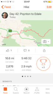
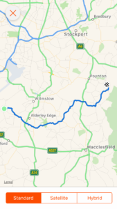
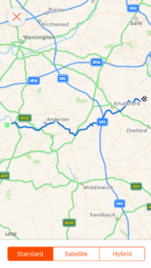
Day 48: Ickornshaw to Malham

Total miles: 18.5
Elevation gain: 2,481
Time walking: 10:15am – 7:15pm
Miles to date: 693.7

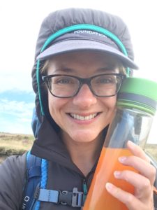
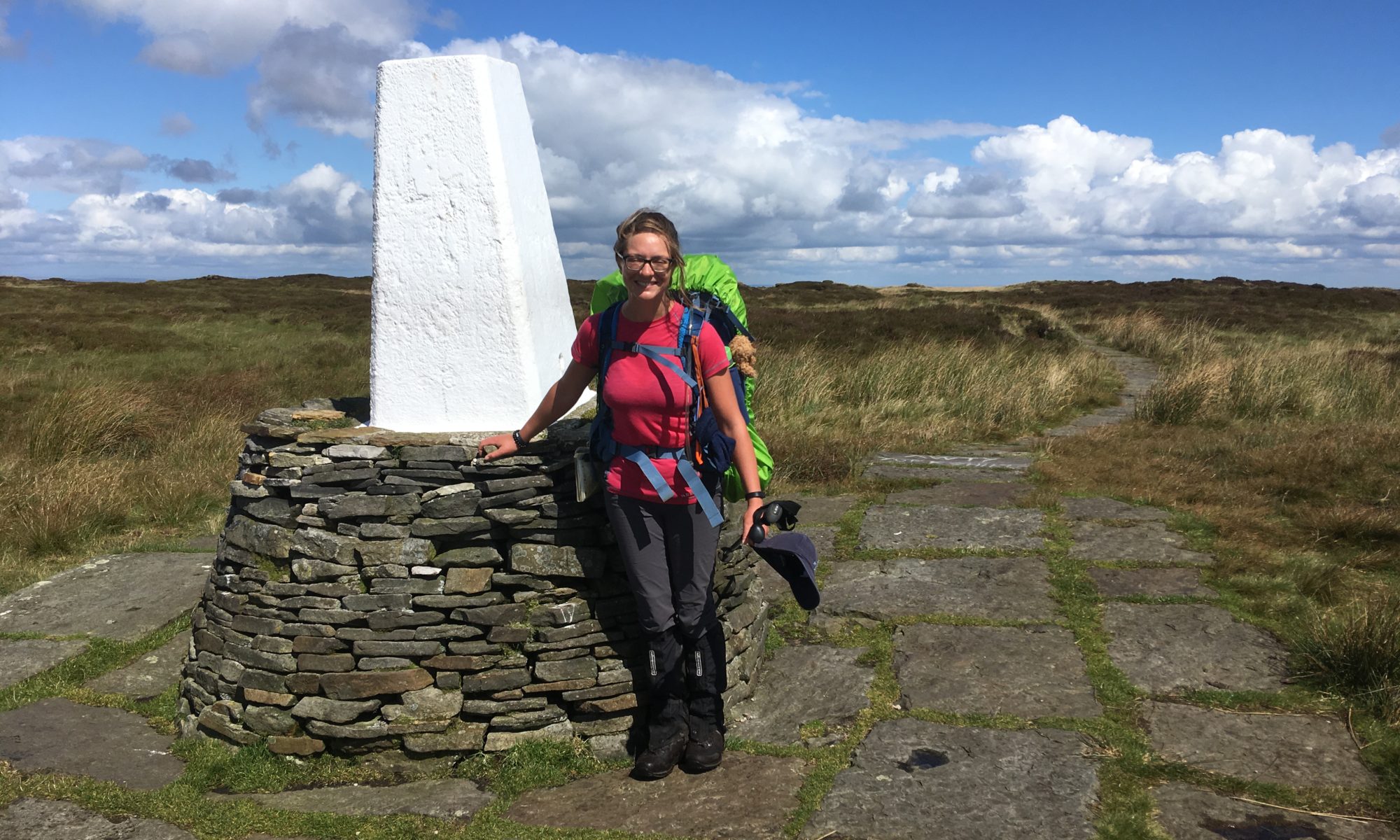
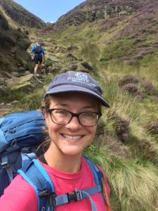
Today was long mileage wise but Mike (one half of my friends Mike and Anneliese who I stayed with the last two nights) joined me today and company always makes the miles go faster! It wasn’t so tough in terms of terrain or hills today either, and although my bag is heavier after yesterday’s restocking I felt well rested and managed the day fairly well.

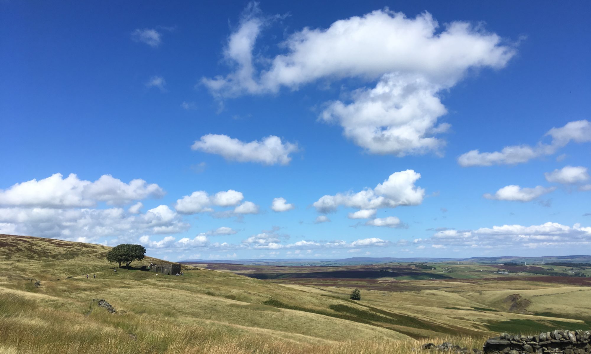
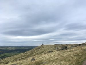
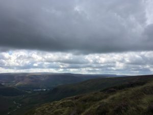
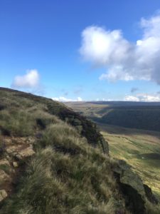
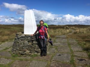
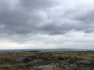
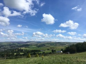
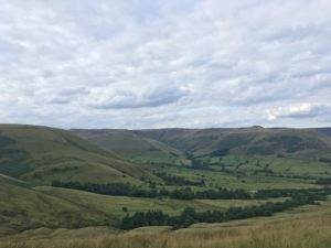
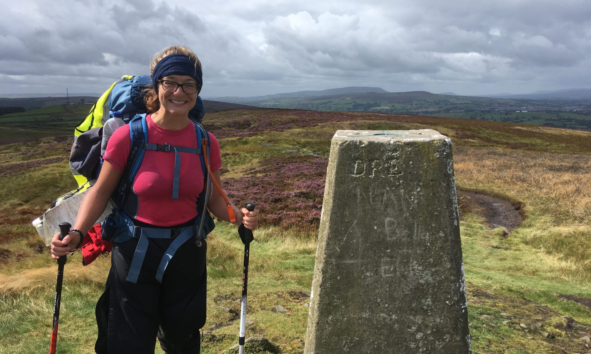
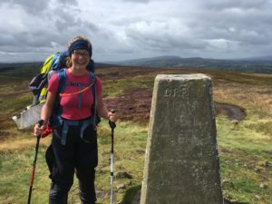
The first third of the walk was hilly, with a climb up Cowling Hill and then another climb up over a stretch of moorland to Pinhaw Beacon. Halfway up to the beacon we pass a group of men fixing a drystone wall. One of them takes one look at Mike and I and jovially calls out to Mike (who has a small daysack) “you pick your women well – getting her to be your Sherpa!” We laughed about that for the rest of the day. Jen the Sherpa! He was a friendly chap and he told us, in a thick Yorkshire accent, “ah, you’ll be headed to Malham then. All downhill from here to Malham.” Excellent news! Confirmed (sort of) by the next man we saw – “ah it’s a nice flat walk to Malham.” I’m liking the sound of this!

Just before reaching the top we stopped to chat to a woman in her 70s out walking on her own. It turned out she was walking from John O’Groats to Land’s End! That makes two people now! She is definitely the oldest though – apparently she is 74! Some people amaze me. She is Australian and travelling the world, so this is only part of her adventure! I guess the Pennine Way is the most likely place for me to cross paths with other end-to-enders – it’s the most obvious route down the spine of England whereas there are lots of alternatives at different parts of the country. I wonder how many more I’ll meet!

The wind was fierce at the top and my arms were getting chilly in my t-shirt but I didn’t want to stop to get my jacket out – we had already stopped a few times for waterproofs on or off – so I stuck it out until we got a bit further down and the wind showed no signs of relenting. Mike had a good routine though – every time we stopped to add or remove jackets we got to eat a couple of jelly babies. I like this man!

Windy Pinhaw Beacon

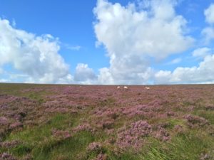
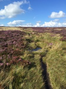
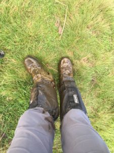
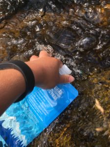
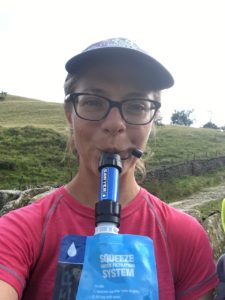
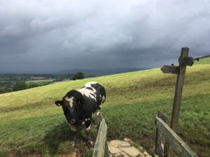
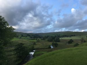
The paths were boggy today after lots of rain the past couple of nights/days and we got very muddy. My nice clean waterproof trousers didn’t stay clean very long! The re-waterproofing does seem to have worked though which is good news. After squelching our way down off the moor we entered farmland, which we would be walking through for the rest of the day. As we came to cross a bridge over a ditch into a field of cows we came face to face with a massive bull standing on the path, right by the bridge, facing us. Ah, ok…. I walked towards him, within the safety of the narrow bridge. He stared back at me from his heavy face, nose ring glinting in the light. I take another couple of steps. He takes a couple backwards. A few more from me and he swings away slowly, turning to look at me as I venture a step off the bridge. He really is massive. I wouldn’t fancy that bowling down the hill towards me! Thankfully with a few more steps he gets the idea and moves further away, apparently more interested in grass and an easy life than chasing wary hikers.

So much for flagstones…
Errrrrr…….

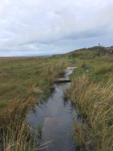
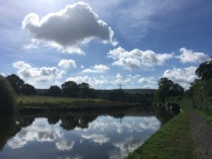
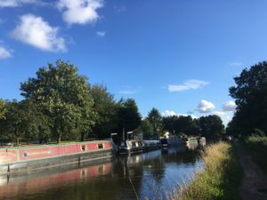
After squelching our way through some deep cow-churned mud and (up!) a couple of small hills we reached Thornton-in-Craven, a pretty village but nothing there, so quickly headed on through more fields for a couple of miles to join a short section of the Leeds and Liverpool canal which took us into the tiny village of East Marston. As we came up off the canal a man called out to me/us – “ah, you’ll be a little mildew-y by now”…! Well, I’ve not heard that one before! Second favourite comment of the day! Just off the canal there was a quaint little tea shop/restaurant where stopped for a quick break. Ahhh that cup of tea and tea cake tasted so good, after 9 squelchy miles! We were making good time and the rest of the walk should be fairly flat…

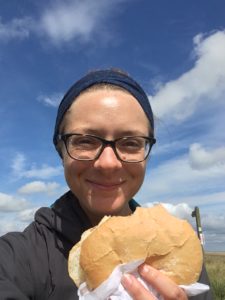
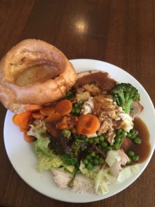
Two miles (and a couple of small ‘undulations’) later we arrived into Gargrave, a pretty village with several options for lunch (and some public toilets, for future reference). We went to the White Cottage Tea Room, a fantastic choice! After a delicious triple decker ham, Wensleydale cheese and chutney sandwich with a generous garnish of salad, coleslaw and crisps we felt fuelled up for the last 6 easy miles to Malham.

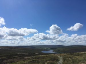
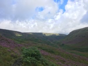
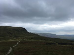
Well, I’m not sure I’d call them ‘easy’..! As we climbed up the seemingly rather large hill out of Gargrave we kept chuckling at the “all downhill to Malham”…wondering when this downhill would appear… We did finally seem to reach the last major downhill and could just make out the limestone outcrops above Malham Cove in the ridge in front of us, with just a small hill obscuring the cove itself. Then we dropped down to the river Aire which we followed, squelching, into Airton where we met up with Anneliese and Daisy who had walked to meet us from Malham.

Malham Cove in the distance

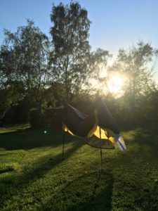
Apart from one climb up away from the river at Hanlith and then a drop back down, it was finally pretty flat, but with the soggy ground it wasn’t particularly speedy walking. It was pretty though, following the fast-flowing river, spotting herons and ducks and cute baby cows along the way. We eventually arrived in Malham about 7pm and Annie and Mike headed to the pub to find a table while I headed up the last half mile to the campsite to get my tent up before dinner. I was sorely tempted to stop at the pub, but thankfully they encouraged me to do my tent first, sensible people! The camping field was very soggy and windy but I found a flat-ish spot and pitched quickly before shedding my boots and heading back down to the pub, staaaarving!

At the pub I met up with the lovely Cheryl who had driven over an hour to meet me for dinner and to bring me some supplies and the four of us ate together. Lamb shank and potato rosti followed by fruit crumble and custard. Yum! Cheryl gave me a lift back to my campsite to save me the walk in the drizzle and I dove into my tent and shut out the weather as quickly as I could! Thankfully it’s not terribly chilly tonight, but the wind is strong and I’m hoping my tent stays firmly grounded! The river is quite loud here and I have a feeling it is going to make me want the loo all through the night…

Tomorrow; Malham Cove, Malham Tarn, Fountains Fell and Pen-Y-Ghent – should be a good (if tiring!) day 🙂

Day 47: Rest day

Miles: 0!

Lots of delicious food, lovely showers with gorgeous Arbonne products (ohh I’ve missed them!) and a trip to Go Outdoors to restock up on dehydrated foods and other bits and bobs I needed. Also, kitting Anneliese out with things she will need when she joins me for 10 days in Scotland, yay!

Home to Anneliese and Mike’s house to wash and re-proof my waterproofs, gaiters and boots, then chill out on the sofa, lots of tea and a meditation session. Ahhh!

Day 46: Colden to Ickornshaw

Total miles: 15.1
Elevation gain: 2,285ft
Time walking: 10am – 6pm
Miles to date: 675.2

Three moors, lots of heather, Bronte country and a bit too much sun!

Today was a beautiful day. After a very wet night, with thunderstorms, and more rain this morning which meant I ate breakfast and packed up in the tent, going without a cup of tea, the sun came out and I didn’t need my waterproofs! Everything was sodden underfoot and it made for squelchy walking, which was quite satisfying after several dry days.

My first stop of the day was at May’s store, or Aladdin’s Cave as it is known, just up the road from Jack’s Bridge and 200 yards from the path. Its owner won a prize for it being the most remote shop open so many hours and it was a real treat! Apart from the incredibly friendly ladies there (including May herself) it was amazing how wide a range of goods they stocked. Unfortunately they didn’t stock the dehydrated camping meals I hoped they might, but they did have a very tempting range of cakes and biscuits! They also made ‘sandwiches’ (which up here are very large baps) so I got myself a nice tuna mayo sandwich, along with some crisps and cake so I could have a semi-proper lunch.

Loaded up with new foodie goodies I headed out onto my first moor of the day – Heponstall Moor, which was covered in heather. Under the warm sun it smelled divine and all around I could just see more rolling purple moorland hills. The path was rough and muddy but easy to follow and it was a pleasant start to the walk. As I gained some height I could see back to Stoodley Pike, which looked smaller now but still very distinct up on its hill. I munched on some cookies as I walked, having only had some granola from the bag and a banana for breakfast, quickly demolishing four in a row. I love how I can just eat whatever I like, in terms of calories, even though I do worry about how much ‘junk’ I am eating. Having been so careful about my diet over the past few years it makes me a bit nervous to be eating so much bread and dairy, but I’m struggling to get enough calories in as it is and it would be so much harder if I was sticking to my usual diet.

The beautiful heather on Heponstall Moor

Coming around and down off Heponstall Moor the path drops sharply down into a clough and then back up the other side. I could have taken the slightly easier option of following the bridleway along by the reservoir (to avoid the drop into the clough), but that just seemed like cheating! I’m sure there will be days to come where the easier option will be the no-brainer choice… The path then climbed gradually along a track before reaching the lower of the Walshaw Dean reservoirs, stunning blue under the sunny sky. Signs warned of the danger of swimming in the cold reservoir water and I could see how people could be tempted on a hot sunny day. Apparently the water is incredibly cold though, about 12 degrees, as the reservoirs are so deep, and suddenly the water looked less tempting! At the middle reservoir I decided it would be a nice spot to eat my enormous tuna roll (which I’d been thinking of all morning), and it was delicious. They certainly didn’t scrimp on the tuna or mayo! I decided to push the boat out and have my chocolate bar too, feeling a bit sick but well fed, ready to tackle the steady climb onto the next moor.

Looking back at the Walshaw Dean reservoirs

This section was flagstoned but there were bits where the moor had taken over – one bit disappeared right into a stream! There was a well trampled path on top of the reeds to one side so I followed this to find a safe place to cross. Crossing successfully, I made the mistake of not returning immediately to the flagstones, instead deciding to follow another reasonably well trampled path which presumably met up further on, cutting off the corner. I wonder how many other people have made that silly mistake…presumably quite a few, given the path, but it took me over a few small but deep little streams and boggy sections which resulted in ankle-deep sinking a couple of times. The most unnerving thing though, losing the flagstone path. I was no more than 5 metres away but it was impossible to see and it made me realise how easy it would be to leave the path. I decided to head straight for the direction I knew it must be, being a little more careful about where I put my feet this time. When I found it, I stuck to it!

It was a straightforward climb from there and as the path rounded the summit the next set of hills and valleys came into view – all heather covered and glorious in the sun. These hills are said to have been the inspiration for Emily Bronte’s Wuthering Heights and there is a little ruin called Top Withins, which the path passes, particularly associated with her. As I crossed this bit of the moor I became aware of how exposed the moors were – it was a hot and sunny day and there was no shade anywhere, save for an old sycamore tree under whose shade I paused while I made this reflection. I realised that I was getting through my water quickly and thought I’d have to refill when I got down to the valley.

Bronte/Wuthering Heights country. The ruin of Top Withins just to the left

I ignored the signs to the cafe when I got to another(!) reservoir at the bottom, thinking I’d find somewhere a bit further along. I didn’t find somewhere further along! Argh! I should have knocked on a farmhouse really. So as I climbed up the rather steep climb up into Ickornshaw Moor I started to be a little more sparing with my water which wasn’t really ideal on such a hot day. I knew Annie (my friend who was meeting me tonight) would bring me some water, so it wasn’t completely dire, but I did feel a little foolish!

Ickornshaw Moor was beautiful; wild and expansive, and windy, unlike the previous two. The path was very un-improved and it was glorious! Very muddy though and I ended up ankle-deep a couple of times. It meant I had to concentrate carefully where I was walking, so I had to stop from time to time just to look up and take it all in. I was tired, which made it harder to fully appreciate the beauty, and I tried not to wish it away so I could just finish and rest. The path doesn’t go up to the appealing white trig point on a handsome outcrop of rocks, instead circling at some distance, however as the path rounds the hill the view suddenly opens up in front, but for once not of more moorland; this view was of rolling hills of fields. In the far distance talker peaks could be seen, including (possibly) Pen-Y-Ghent, one of the Yorkshire 3 peaks, which will be the conclusion to Sunday’s walk.

Rather indistinct and boggy path on Ickornshaw Moor

As always with the last descent of the day, it was a long one! It wasn’t helped by a particularly boggy section near the bottom of the moor where water was held up by a big wall, making the ground a mass of streams and bogs and soft squelchy moss. Here I had my first boot-sucking-bog encounter, going in up to my calf and having to pull very hard to retrieve my foot, thankfully with boot still attached! That half mile stretch got me the muddiest I’ve been all trip! I still had a big smile on my face though, with mud all up my gaiters (thank goodness for gaiters!) and my trousers too, and I felt like I had now been properly initiated into the Pennines!

Properly initiated now!

A short stint up and down through farmland which was much easier going than the moor, a pretty waterfall then a steep drop down the hill into the tiny bit pretty village of Ickornshaw, tired, hot and thirsty but happy, marked the end of my day, and the end of seven consecutive days walking. It also marked my halfway point! At least, I think so…not being exactly sure of what my total mileage is going to be! The gorgeous Anneliese was there waiting for me, ready to whisk me away to comfort for my rest day with a huge bottle of water. It’s wonderful how the smallest of things can make you so happy!

Tonight I am really tired. My legs, feet and body are definitely ready for a rest day. I just hope they are ready to start walking again on Saturday! I may be halfway but I still have some of the hardest walking ahead of me…

Day 45: Standedge to Colden

Total miles 17.6
Elevation gain: 2,167 ft
Time walking: 10am – 7pm
Miles to date: 660.1

Windy! Definitely the theme of the day. As soon as Jane dropped me off at Brun Clough Reservoir the wind was there and it stayed with me all day. It certainly blew the cobwebs away!

The route today stayed high for most of the day, following the edge of the moor along rough paths of sand and gritstone, the wind ever whistling in my right ear. I was feeling tired today (it was a pre-workout powder and fizz stick combo today in my water!) and I was glad that after an initial short climb the path stayed high and relatively flat for several miles, even if the terrain was rough and required picking through.

Today’s walk looked a lot like this!
Fizz stick plus pre-workout today! Tiiirrrred!!

Just before midday I dropped down to the little parking area on the A672 just off the M62, thrilled to see the snack van there. I had two rolls that Jane had made me for lunch in my bag but I had a feeling today was going to be a hungry day so I stopped for a coffee and a bacon and egg roll! I was lucky, he was just packing up, but he made me my roll and ohhh it tasted so good! I ate it sat on a welcome flat rock (there aren’t many places to stop and sit up on the moors – it’s all heather and bog or too windy (with the risk of getting chilly) up on the gritstone edge) and had a bit of a rest. Jay, who is also walking the Pennine Way and appears to be following a similar route, passed through while I was stopped, and for a while I could see the little blue rucksack about half a mile ahead of me, heading up the hill. There’s something quite nice about knowing there’s someone else out there. I really enjoy walking on my own but there is a sense of camaraderie about knowing there are others out there on the same trail.

Yuuuuuum. They do baps properly up here!

The path headed across the M62 – over a rather vertigo-inducing bridge – and up along Blackstone Edge. The views and sense of space were great, but I have to admit that after the sensational views the past few days, it probably didn’t wow me as much as it should have! At points I could see Manchester – now to the south west, having over the past week seen it to the north east, the north, the north west and the west – only now will I finally start leaving it behind me!

Feels very strange to see a big busy motorway after days of solitude and expansive moorland

The wind was still a constant companion and it made it hard to control my temperature – I wore my insulated jacket at times but it would get too warm after a while (think I need to get myself a light shell) – cue me deciding to see whether I could take it off whilst walking without taking my backpack off. The first attempt ended up with me doing all sorts of contortions and very nearly getting stuck…but me being me, once deciding on a challenge I tend to stick at it (you know, crazy things like walking the full length of Great Britain…) and eventually I pulled my jacket off and triumphantly waved it in the wind, with nobody to witness my incredible achievement but a few bemused sheep. Still, with this new found skill I headed down the hill towards a rare pub, satisfied and ready for a celebratory coke.

The Aggin Stone, a mediaeval way marker

The next section of the route follows gravel tracks around some reservoirs, not everybody’s cup of tea but it was a welcome respite from the rough terrain which makes for tiring walking (far more tiring than the mileage or elevation suggests). One section of the path was closed due to works on the reservoir and a diversion headed around the prettier northern edge. It was slightly longer and a rougher, more boggy, path but it was pretty, winding through the heather and under gritstone outcrops. Far nicer than trudging along a gravel track! Once the reservoirs were cleared, eventually the awaited Stoodley Pike came into view. I’d been previously warned that this massive monument looks nearer than it is, due to its size, and sure enough looking at the map it was a good 2-3 miles away. Still, it gave me something to aim for and it did gradually get closer.

Stoodley Pike, gradually getting closer

By the time I arrived at Stoodley Pike I was ready for another rest and to eat my final roll. A muscle or ligament in my left knee/hamstring is feeling a bit strained, and I’m hoping it will last the day – another 5 miles and a big downhill and big uphill – and rest up overnight. I definitely don’t want any knee trouble over the Pennine Way!!! Just off the hill I have the option of detouring into Hebden Bridge where I was originally planning to stay, however a lack of camping options in the town and the desire to knock a few more miles and another hill off tomorrow’s route means I continue along the path. (For future reference I think the detour would be worth making, apparently Hebden Bridge is a lovely place and has lots of amenities!)

Thankfully as I drop down off the hill I finally lose the wind and there is some variety in the path as it passes through farmland and then pretty woodland down into the Calder Valley. In the narrow valley there is a bustle of activity – in the space of about 50m there is a river, a canal, a road and a railway line! Route finding up the other side of the valley is tricky – there are countless zigzagging paths. I thought I was on the main one until it practically went through someone’s back garden, but I managed to join up with the main path fairly easily so it seems that as long as you’re headed roughly up, you’ll come out at the right place. The guidebooks call this a “tortuous” climb. I think that’s a bit extreme, but it was tough at the end of the day and it was nice to know I didn’t have to do it in the morning. Once up on the top I could see Stoodley Pike standing proudly atop the hill on the other side of the valley. It really does stand out for miles!

A sneaky steep little valley and a narrow, deep path down the side of it marked the last bit of my day as I turned off just before the bottom to detour to the New Delights Inn at Jack’s Bridge where I’m camping for the night. The pub offers the camping at £5 for Pennine Way hikers! Thankfully I was planning on cooking my own dinner as it turned out there was no chef on at the pub tonight, but first things first – get the tent up and make a cup of tea! The midges were back again but nowhere near as bad as the other night, and I’ve beaten them to it tonight by covering up as much as I can and spraying any exposed bits with deet! The smell takes me back to Asia, where deet was a multiple-applications-a-day routine. I’m determined not to get bitten tonight, my bites from the other day have been itching like crazy!

The car park is only distinctly average… 😉

My tea, biscuits, and pasta-and-sauce packet, followed by Jane’s fruit salad and a hot chocolate, taste amazing! Heavy rain is predicted for overnight, and it is starting to drizzle now, but cosy in my tent I’m not bothered…I just hope it dries out by morning!

Day 44: Crowden to Standedge

Total miles: 11.8
Elevation gain: 2,193 ft
Time walking: 9:30am – 4pm
Miles to date: 642.5

Today was a shorter day though still pretty big on elevation, and after yesterday I was grateful for the slightly easier walk. I was also lucky with the weather again!

The day started off well, dry putting the tent down, an expedition rehydrated breakfast with tea, followed by a bacon and egg roll from the campsite shop-come-mini-cafe that Stuart bought for me. A double breakfast is always a win!

Stuart and I walked together today and it was nice to have a bit of company again. He has walked the Pennine Way before so could remember the route which was handy, not that route finding was particularly challenging today thanks to more flagstones in the tricky bits.

The first few miles of the day took us up a pretty heather-clad valley with a couple of stream crossings and a fairly strenuous climb up to Laddow Rocks. My thighs could really feel yesterday’s climbs and I was a bit nervous about how tired I felt. I kept reminding myself that yesterday was one of the hardest days and that it would get a bit easier for the next few days, otherwise I think I would have worried about how I would keep going! Thankfully the views along the valley and back the way we came were worth it. The sun sent cloud shadows scuttling over the hills opposite and the white and black of the stream bubbling below contrasted beautifully with with green and purple of the heather.

Looking ahead to Laddow Rocks

As we climbed higher we started to see the hills we had come over the day before – right back to the Kinder plateau! It looked a long way away! Eventually the path reached the top of the wide valley and headed across moorland steadily climbing up to Black Hill, the highest point of the day. Once again I was grateful for the flagstones, whilst they are a little tedious I bet that is nothing compared to wading through sticky bogs for miles…! Stuart has long legs and a lighter pack than me and he makes rapid progress, he has to keep stopping to let me catch up. He’s very patient with me, but I do worry about slowing him down. A black cloud comes our way and it starts to spit with rain so we quickly don waterproofs, knowing we are due a shower. Five minutes later (as I’d predicted – I told Stuart of my (lack of) luck with waterproofs and rain showers…) the sun was back out and the black cloud had dissipated. That was it for rain for the day!

Looking back to the distant hills of yesterday
Don’t look down…!

As we came over the summit of Black Hill we gasped as the view suddenly stretched out in front of us. It was big. Biggest of the trip so far I think, the only potential rival being the Black Mountains day! Right from east to west the country just stretched out, with cities touching the sky on the horizon, and the onwards moors to the north. There is a massive but slender tower on top of a small hill visible from here (and for miles around) which apparently is a TV mast. Grandest TV tower I ever saw!

The trig point at the summit of Black Hill
Quite the view

After a long steady descent from Black Hill, pausing for a brief lunch with a view, the path scrambles up the side of a small clough and pops over a road before dropping down again to Wessenden Resevoir, the water a bright blue against the green hills in today’s sun! The path follows a track which gradually descends to be almost level with the reservoir and it makes for pleasant, easy walking. We see a young man walking towards us, we guess from his suntanned face and big rucksack that he has been walking for a while so stop to chat. It turns out he is walking John O’Groats to Land’s End! I’m excited to meet a fellow end-to-ender and we swap stories for a bit. He has been camping pretty much the whole way, hats off to him!

A bit further along the path dropped steeply down to the stream that runs down the valley from the reservoir, then straight back up the other side. Jelly babies were required, and a rest at the top on a helpfully placed slab of concrete. The good news was that this marked nearly the end of the ascent for the day (for me at least!), and I was glad I only had a couple of miles still to go as my legs were feeling pretty heavy.

The final couple of miles took us back up into moorland past some smaller reservoirs where the wind was fierce, the water choppy and the sky moody. It was quite atmospheric up there! Dropping down slightly we could see a little boating lake and a pub, but sadly for us the pub wasn’t open in the afternoon. For me the car park next to the next little reservoir marked the end of my day (so happy to be finished so early for once!) but Stuart had a fair few miles still to go as he is pressing on more quickly than me. We said farewell, sorry that our paths wouldn’t cross again on this route, and he headed off up over the next bit of moorland.

The moody Black Moss Reservoir

Tonight I have had the treat of a lovely bath and a massive BBQ at Jane’s house. Jane is the cousin of a friend’s mum and she and her family are so lovely, I’m really thrilled that they offered to put me up for the night! And my room has beautiful views out to a heather-clad hill so I don’t feel too far away from it all. I’m really tired now and the bites from last night’s midges are starting to itch like crazy, argh! I’m so glad I’ll be missing the worst of the Scottish midge season! I’m not quite sure yet what tomorrow will bring – my notes and what I’ve read on the national trail website differ in terms of distance for the next section – but I’ve decided to add on a couple of miles to get another hill out of the way and to shorten the next day (a longer day) a little. Camping again tomorrow, yay!

Day 43: Edale to Crowden

Total miles: 18.3

Elevation gain: 2,611 ft

Time walking: 11am – 9pm

Miles to date: 630.7

Wow! Today’s mileage and elevation, whilst reasonably impressive, don’t give a real indication of how big today was! The last 6 weeks have been a mere warm up. This is SERIOUS walking!!! There’s no doubt about it, the first day of the Pennine Way is tough. They say that half of the people who don’t complete the Pennine Way give up on the first day (I’m not sure how they can actually measure that statistic, but it’s catchy, so I’ll let my inner actuary let that go… 😉 ), and boy I can see why! It’s long, it’s hard, the terrain is tough and it’s lonely walking. But it is also stunning! I’m glad I’m tackling the Pennine Way as fit as I am, as although I am now tired, I’m not exhausted. My thighs definitely got a good work out and my knees started to really tire on the final descent, my feet are sore from the pounding on the gritstone and flagstones, but now I’m in my tent and fed, I feel pretty good. Definitely going to feel it in the morning though! Thankfully tomorrow is a shorter day, though equally hilly I’m sure!

The weather forecast didn’t look promising first thing – indeed, I only needed to look out of the window to see the drizzle. It was supposed to clear by 11 and then return for the night at 5. Not exactly the weather I’d choose for my first day of the Pennine Way but probably weather I’d have to get used to! As it happened, I ended up not being ready to leave until well after 10, oops, but this did mean that by the time I actually set out it was dry! Dave and Wally were going to walk the first few miles with me, so I got a good chance to hear more about his JOGLE adventure (in pre-internet days, as if it isn’t already challenging enough logistically) and get the lowdown on what lay ahead for the next couple of weeks.

From Edale we took the alternative start to the route (it used to be the main route, with the current main route being the poor weather alternative, before increasing numbers of walkers made the route unsustainable) which climbs up Grinds Brook to the escarpment, which it then follows before meeting up with the main path at Kinder Low. It’s a route I never would have known to take if it wasn’t for Dave’s local knowledge, and oh my goodness what a pretty route! The path follows the brook up an ever steepening little valley, at times the brook joining the path (cue the first mud of the day), picking around boulders and rocks and ending up with some steep scrambles to get up to the escarpment. And the heather! It is so beautiful at the moment and smells gorgeous, almost like a gentle waft of honey. The sun was peeking out and the purple of the heather, green of the scrub, black and white of the water against the blue and white sky was too pretty for words. Above us were dramatic cliffs and behind us our little valley (“clough” up here) stretched down and rolled away to expansive views out to the southern part of the Peak District. It was a tough climb, especially with my backpack, but I felt strong and fit and I couldn’t stop smiling! I got to the top with muddy hands, a grazed knee, burning thighs and a massive sense of elation!

Looking back down Grinds Brook
David travelling light and fast up ahead!

Once at the top the views out west were incredible and I could see Rushup Edge from where I’d descended into the Edale valley yesterday and beyond to the hills of Lyme Park. The path passed many weird and wonderful rock formations, one like a flying saucer, one like a pig’s head and many more just round and smooth and tall. I saw my first real peat and boggy ground of the day, although thankfully there was a route around the worst of the boggy bits!

Awesome rocks!
Wally

When we reached the trig point at Kinder Low it was time to say goodbye to Dave and Wally and head out on my own. The path, although not always obvious, was fairly easy to follow as it hugs the edge of the escarpment for several miles. I crossed Kinder Downfall easily, the waterfall being rather unimpressive at the moment because we haven’t had much rain.

I passed a few day hikers along this section and chatted to a guy called Stuart who is doing the whole of the Pennine Way, but once I’d dropped down from the escarpment and then back up to the lower, rounded summit of New Mills I didn’t see a soul!

Day one used to be an incredibly boggy day and this was one of the worst stretches. A few years back, to try to slow the damage to the peat and heather, authorities laid massive flagstones in the bog to make a clear and firm path. The flagstone paths are controversial – some think they ruin the look of the moor and make the walk too easy – but looking at the bogs either side I was rather glad of them! I would have been knee deep for a good mile or so! They also protect the delicate peat and heather from severe erosion from countless trampling feet, which in turn helps the heather regenerate and makes for a much prettier and healthier moor.

Looking back along the flagstone path to New Mills and the Kinder escarpment

The winding flagstone path from New Mills to Featherbed Moss and then the Snake Pass Road seemed to go on forever! With no real landmarks there was little by which to judge the distance. It was wide open, lonely walking and I can only imagine how demoralising that stretch would have been before the flagstones, squelching through the bog, and even these days, in poor weather. The sign at Snake Pass pointed back 2.5 miles. Wow, it wasn’t just an illusion – it really was quite a long way!

There were a few cars parked at the side of the road here, a couple of families on an afternoon stroll, but after I’d passed them, heading up the long, rocky, twisty path up to Bleaklow Head, I didn’t see another person for hours. The views back across to the Kinder escarpment were great and really gave me a sense of how far I’d come, but soon the views disappeared as I followed what looked like semi-dried out river beds winding amongst the deep peat, often criss crossing little streams as they ran along the path. At one point I surprised what I think must have been a large water vole and he dive bombed into the stream. He quickly realised he wasn’t particularly well hidden though (he had dived into a rather shallow section) so he scuttled on and found a deeper section of stream a bit further on! The path continued to twist about and it was quite disorienting. At times I would start to wonder if I had lost the path, and it was quite eerie with no other people around and very limited view because of the deep banks, but every now and then there would be a well-placed way marker etched onto a rock, or the reassuring sign of multiple bootprints in the mud. I was getting low on water so I was glad to reach running streams (on the moor it is mainly standing water which really is not very appealing, even with a water filter!) but when I got my water filter out it wasn’t working. Completely blocked! Nooo! Not only disappointing given I’ve only used it once, but also incredibly bad timing given that I still had about 5 miles to go with virtually no water. Eek!

Eventually the path opened out onto Bleaklow Head which is a very rounded hill top and not the highest in the area, but as bleak as the name suggests. I was incredibly glad of some way markers here as the path was indistinct and I didn’t particularly feel like having to navigate my way off the hill through heather and bogs on compass alone! The maps are a bit deceptive because once you get to Bleaklow it feels like it should be a short drop down and you’re done, but it’s actually quite a gradual descent at first, working your way along a stream that gradually cuts deeper and deeper down the hillside. The path was indistinct here and I lost it at first so ended up trampling through heather and soft peat, but thankfully I knew I had to follow parallel to the stream dropping ever deeper into the clough below. As the stream dropped right down far beneath me I re-found the path again (phew), following it around the ‘headland’ of the hill, it seeming to stretch on forever! Other than a couple of sheep and the occasional grouse startling from the heather with its amusing clacking and whirring call (it sounds like a cross between a duck quacking and someone saying ‘go back go back go back’!) it was lonely and silent up there, albeit incredibly beautiful with the heather and tumbling streams!

Bleaklow Head living up to its name

Eventually a corner of the reservoir comes into view, and gradually more and more of it opens up in front and finally the end is in sight. It was a steep descent down to the water and my knees were really starting to feel it. I was very much looking forward to a drink and some dinner! Thankfully Dave had warned me that it is still quite a trek from reaching the reservoir to the campsite, not helped by me missing the path that would take me over the dam and probably adding half a mile to my journey, so I just got my head down and plodded along as quickly as I could. I paused briefly to admire the silvery shimmer of the water in the fading evening light, with the high hills rising steeply behind it. You certainly get a feel for how far you’ve come down, when you look back up!

Taking a moment to enjoy the calm, silvery water as the light fades

Just before 9pm I finally trudged into the campsite, just as it was starting to drizzle (I can’t really complain – the rain was supposed to start at 5!) and saw Stuart who had been keeping an eye out to check I arrived safely. A friendly woman in a neighbouring caravan came and offered me a cup of tea and biscuits which I gladly accepted as I quickly worked to get the tent up before it started raining more heavily. The main issue though – the midges! Ugh they were horrible and everywhere, and what with them and the drizzle as soon as my dinner was cooked I retreated to my tent and ate inside with the door zipped up. A few still made it in and I now have little but irritating bites around my ankles and hands, little buggers! Still, I’m here, I’m safe, I’m warm and dry and I’ve had a stonking day! No phone signal, so I’m doing exactly what I need to do and heading to sleep!

Day 42: Poynton to Edale

Total miles: 16.6

Elevation gain: 2,876ft

Time walking: 11am – 6pm

Miles to date: 612.4

And she’s back! Today was glorious! Yesterday’s extra food intake and earlier-than-planned finish, along with waking up to a gorgeous sunny morning, seems to have done the trick and my spirits were high. I had the much anticipated Lyme Park to look forward to and I would finally reach the Peak District and its glorious hills! And I’d hit the 600 mile mark! 600 miles! My mind is just blown by that figure…

After a slow start (making the most of the sun to dry out my tent!), I headed back to the canal for a short while, squeezing through the tiniest gap in the wall to reach it. It was one of those beautiful, fresh and delightfully sunny mornings and it was very peaceful along the canal and in the fields as I climbed up my first hill of several today. Passing through a small farm I came across three women with a group of dogs, looking rather puzzled. I soon saw why. The path into the Lyme Park estate went over a huge ladder stile and there wasn’t a big enough gap in the fence to enable to the dogs to squeeze through. The ironic thing was that there was a sign right there saying that dogs were welcome but they had to be kept on leads. Welcome…if you can work out how to get them in! After a little bit of encouragement they managed to persuade the younger dogs to climb/jump up the stile and down the other side but to get the older dog over they had to have one of them pick the dog up (and it was a collie, we’re not talking a small dog here!) and pass him to someone waiting at the top, to climb down with. Quite the operation for a gentle walk in the countryside!

A promising start to the day

The path continued to climb and the views out across Cheshire behind me were growing increasingly expansive. I also came across my first heather of this section of the journey, its soft honey fragrance wafting through the warm sunny air. I could have laid down in the heather, face bathed in the sun, listening to the gentle munching and grunting of the sheep grazing nearby, all day! But I had the promise of a home-cooked roast dinner waiting for me which was just about enough to keep me on my feet!

I could tell I was nearing the main part of Lyme Park as the number of people started to increase, the paths started getting more distinct and the surroundings grew more formal and landscaped. Sure enough it wasn’t long before the big house came into view, the bustling car park just below. Lyme Park is a gorgeous stately home which became particularly famous when BBC’s Pride and Prejudice was filmed there. “The” Mr Darcy scene (the one with the lake and the white shirt….) being the most memorable for many! You have to pay to get into the house and the immediate grounds and apparently it is well worth the visit. I didn’t have the time to do it justice today so I just did the loop around the outer fence, not quite close enough to get a really good shot of the famous view of the house overlooking the lake, but good enough to feel I’ve seen it.

The scene of THAT scene!

It was quite bizarre to be surrounded by people again, even though it wasn’t long since I’d walked a short way through busy Chester. It always seems strange, to see people out enjoying their Sunday, when for me it’s just one more day on my long journey. Some people look at me curiously, some smile, a few say hello or ask where I’ve come from/where I’m going. Some are absorbed with their children or dogs or each other and don’t notice this little slice of adventure walking past them. It’s not a complaint or a judgement, it’s just an interesting reflection about all the things around us that we maybe don’t see!

I walk up the hill to a viewpoint overlooking the back of the house, out to Manchester and “The Cage”, a tower within the park which stands on its own little knoll with stunning views. I didn’t walk out to the Cage, figuring I’d have plenty of my own views soon enough as I climbed higher into the Peak District. My route skirted up and past the Red Deer Park (gosh those deer have a good view!) along a section of the Gritstone Trail to Bollinhurst Bridge. A few squelchy fields later and the view opens up to the moors ahead of me, the Kinder Plateau looming on the horizon, still impossibly far away and yet only a day’s walk away. My heart quivers with excitement. they always look beautiful, but in the bright afternoon sun they look crisply enticing, and I can’t quite believe I have the good fortune to be headed that way!

KJ enjoying a spot of sunshine with The Cage in the background
Deer with a view…
Tomorrow I’ll be walking along the ridge in the distance (Kinder Plateau)

On the way down into Furness Vale I very nearly had a run-in with some cows, the first I’ve encountered in a while. As I was walking through the field towards them, a group of young beef bulls I think, they spot me and start trotting in my direction. I eye them warily, wondering if they are going to break into a full on gallop. I eye the dry stone wall next to me. It’s about hip height. I look back to the oncoming cavalcade…and decide to hop over the wall, heart racing a little and feeling incredibly grateful for a solid stone wall rather than flimsy and spiky barbed wire! The bulls reach the wall and look at me rather confusedly, as if they are wondering how I escaped them or were disappointed not to have a game of football with me. I joke, but cattle can actually be very dangerous. I know I’ve been lucky so far, and my heart was pounding as I got lucky once more. Thankfully the cattle quickly lost interest and headed on the way I had come, as I had to cross back into the field a bit further on in order to reach the stile at the other end.

Passing a pub in Furness Vale I decided to pop in to use the loo and see whether it would be a nice place to stop for a glass of something cold. It wasn’t! You know that feeling when you walk into a room and everyone turns to stare….yeah, that! It didn’t feel like the sort of place a young, single woman would usually venture on her own, let alone a foreigner to these parts! As I was there I used the loo anyway, but promptly hurried out without buying a drink, deciding I’d stop for a break part way up the next hill instead.

Heading out of Furness Vale (via Gowhole, Shedyard Clough and up to New Allotments, if you’re trying to figure out my route on a map!) the route climbed up. And up. And up! A couple passed me as I paused for breath and I looked enviously at their light day packs. I passed them a bit further up as they stopped for a break, then they passed me again when I finally stopped for my lunch at the top, looking back out to the Cage in Lyme Park, which seemed to be too far away to have walked past it just a few hours earlier. After my lunch I negotiated some muddy paths churned up by mountain bikes and horses to find the path I wanted which headed down to the Chapel Road and up to join the Pennine Bridleway.

Now I felt like I was properly in the peaks! Looking at the map it amused me to see I’d be heading south for the last few miles to reach my destination – Edale. A sensible person would continue East-North-East and pick up the Pennine Way north of Jacob’s Ladder, but this crazy fool is determined to start the Pennine Way from the very beginning! Of course, there’s the friendly host and roast dinner to look forward to in Edale too, so it’s not completely nonsensical! I did manage to confuse a couple of mountain bikers who stopped to chat. they assumed I was walking JOGLE rather than LEJOG. I could see them questioning my navigation abilities and wondering whether to correct me when I told them no, I was indeed walking to John O’Groats. they actually seemed somewhat relieved when I told them why I was currently heading south, rather than north!

My route followed the Pennine Bridleway for the next 4 or so miles, an absolute delight on a sunny summer’s afternoon. I skirted the deliciously named hilltops of Mount Famine and South Head and paused for a break in the pleasant little nook of Roych Clough where several streams sparkle their way down off the moors and converge to cross the path at a ford and small bridge. My water was running low and getting rather warm in the heat of the day so I decided I would christen my water filter. I’d bought it for emergencies really, but a friend had pointed out that it would make sense to make use of it more generally, to save me carrying so much water! And oh, what a good suggestion. Not only was it rather fun to collect water from the stream and suck it through the filter, it was refreshingly cool and thirst-quenching to drink. I had a good guzzle then refilled once more and, feeling enlivened by the combination of fun and rehydration, quickened my pace for the last few miles.

Christening the water filter
Fun and refreshing!

I left the Pennine Bridleway to drop down over Rushup Edge along the Chapel Gate track into the Edale Valley. Ahead of me I could see the approximate route of the Pennine Way snaking through the valley, meeting the hills at the notorious Jacob’s Ladder, which was just tucked away out of sight. It was strange, to think I’d be walking back that way tomorrow morning! The path into Edale from the tiny Barber Booth was well signposted and I arrived with perfect timing, just as David, my host for the night, pulled up in his car!

The Edale valley and the route of the start of the Pennine Way below
Useful signs in these parts!
Made it – back on track!

I was excited to meet David – not only a fellow actuary but also a fellow end-to-ender! He did the route in reverse, walking from John O’Groats to Land’s End 20 years ago, and it was great to swap experiences. He ‘reassured’ me that the feeling probably would come back in my toes….although it might take 12 months…(yikes!). David and his partner Ally had cooked me a gorgeous (and huuuuge) roast dinner which needless to say got wolfed down rather hungrily. Followed by a delicious homemade sponge pudding with custard. And wine. Heaven! I know food always tastes better after exercise, but this was seriously good food. And such gorgeous people. Once again, one of the best things about this journey is the incredible people I’m meeting, the new friends I’m making!

Tomorrow is set to be tough but brilliant – the notorious first day of the Pennine Way! I can’t express how excited I am, although that excitement is tinged with a little apprehension. They say that a large proportion of people who start but don’t finish the Pennine Way give up in the first two days! Eek! I figure I’ve had a good warm up though… David is going to walk the first few miles with me so it will be lovely to have a spot of company again, and we are going to take the original starting route rather than the route that goes up Jacob’s Ladder. The Grindsbrook route is apparently far prettier, albeit a little more challenging. The Pennine Way, finally here!

Route day 42


Day 41: Knolls Green to Poynton

Total miles: 14.8

Elevation gain: 1,122 ft

Time walking: 10:30am – 7:15pm

Miles to date: 595.8

I’m pleased to report that today ended a lot better than most of the day went! For some reason I found today really, really hard. It was not a challenging walk and there was nothing in particular that went wrong, I just struggled to get into my groove. I guess the obvious reason is that I was tired from yesterday, a long day, and knowing I had a long day again today (something I’ve tried to avoid) put the pressure on a bit. I started off slowly even just getting out of bed, and regretted not doing a few more stretches before I fell asleep, but Carl and Jen made me a lovely breakfast and coffee so although I didn’t start until an hour later than planned, I felt pretty good.

And then I felt the blister. Insert horrified/terrified emoji here! It was only a teensy tiny blister, just on the inner edge of the ball of my right foot, closer to the arch than my previous blisters. I could instantly tell it was the result of walking in wet socks for a couple hours yesterday, and I kicked myself for my laziness in not changing into waterproof socks when my boots got wet. Lesson learned! Thankfully it was early days and with a compeed on it, it hasn’t given me too much trouble. Phew!

The first few miles I decided to follow a slightly more direct route on country roads rather than heading on random wiggly footpaths – I figured I could use the shorter distance, and it would allow the fields to dry off a bit before tackling them! This of course meant a few miles of tarmac but progress was swift and steady, save for the occasional dives into hedges at the sight of a particularly juicy looking blackberry (they are amazing up here!) and the frequent map consults to confirm my route. I passed lots of big houses and shiny cars…well, I am near Wilmslow and Alderley Edge!

At one point I passed a huge tomato farm and it was quite strange to see the massive greenhouses housing giant tomato plants with fruit that looked like it surely must be sprayed with something resembling steroids. I thought appreciatively back to Jen’s homegrown tomatoes last night. When you see how fruit and veg is grown en masse, it really makes you think a bit more about what you are eating! When we are wandering around the supermarket trying to find the cheapest offer out there, I think we forget to wonder where that food has come from…

Soon after the tomato farm I enter the village of Nether Alderley. I’d planned to get up the hill to a viewpoint to stop for a shake and a break but I was feeling peckish so stopped to get something tasty from my bag. An elderly gentleman who lived across the road came over to ask if I was ok, and when he heard what I was doing he invited me in for a cup of tea and a biscuit! I nearly refused politely as I wanted to get on, but he seemed so sweet and I supposed that I could use a loo break, and a cup of tea would go down nicely! So I went in with him and sat chatting to him and his wife over a lovely cup of tea, getting some love from their gorgeous and friendly cat Shadow at the same time. I managed to avoid a rain shower too! I didn’t stay long as we all had things to do but they gave me a donation and wished me well. They were very sweet, and I think I made their day!

Beautiful carving from an old tree stump

As I headed up the hill, much later than planned and now even hungrier, another rain shower came over so I had to stop again to don the waterproofs. Halfway up the hill, rain stopped and the sun came out, roasting! Stop again to take the waterproofs off. I haven’t even gone 5 miles yet! Given I had an 18-20 mile day, this wasn’t a good start! When I finally got up the hill I picked up the North Cheshire Way which I’d be following for most of the rest of the day, and I started to look for a nice place to stop. As much as part of me really didn’t want to stop again, I could feel myself getting tired and my resilience slipping, so I told myself I’d find a pretty spot and have a proper break, some good sustenance and a mindset change! Thankfully I found a nice spot in the sun on a fallen tree trunk in a pretty wood, so I sat myself down, made my shake and gave myself a pep talk while drinking it!

I did feel better after that, so started to make quicker progress again with fewer stops. It was still a case of checking the map at every turn, as the NCW wasn’t always clearly signposted, although thankfully the paths and stiles were fairly clear.

I could feel that I was tired though, and for the first time so far this trip I wasn’t sure if I would be able to make the distance, at least not arriving at any sort of sensible time! This got me down a bit, as I really didn’t want to fall behind, but I figured I’d keep going and see how I went. At least I knew I had plenty of daylight left! The walk was a pretty one, across fields and through little woods, and every now and then I could see the uplands of the Peak District where I was headed, albeit just to the very edge tonight.

By the time I neared the village of Addlington, about 8 or 9 miles in, I was finally feeling like I was back in my stride a bit, albeit tired and really feeling the weight of my pack. It feels like it’s just a bit too heavy now, like it has just tipped over the weight I could manage, but unless I take out some of the food which I need for the Pennine Way there’s not much I can do about it! At Addlington there was a pub so I decided to stop for a break and to use the loo and maybe get a bowl of chips to keep me going. It turned out it was a Toby Carvery, which only does roast dinners, but given it was only £6.49 I decided to go for it. The moment I ate the first mouthful I realised just how ravenous I was, and I demolished the rest of the plate rather quickly! And I felt so much better after that! I guess my body just really needed some extra calories today! Someone did warn me that about a month into the journey my body would suddenly catch up with me in terms of the number of calories I’d need to eat. I had been feeling rather smug about how well I seemed to have been managing my calorie intake and maintaining my weight, but clearly today, about 6 weeks in, my body finally caught up! Lesson learned…

Before…
After…

My boots were off to give my feet a breather so I checked my map, and spotted another campsite I hadn’t noticed before. I hadn’t looked at it because it was this side of Lyme Park which I was supposed to go through today, but when I measured the map it would only add 4-5 miles to tomorrow to stay there tonight. Given that tomorrow was originally going to be a shorter day, and that the shortening of today would save me 4 miles, I decided to go for it.


Best decision ever! After a lovely walk along the canal in the early evening sunlight, I arrived at the campsite just after 7, which meant I have had lots of time to rest, do some stretches, dry out the tent and eat a second dinner (and write this blog!), so hopefully I should feel more rested for tomorrow. It will mean an early start, but I felt I needed to listen to my body (and my emotions!) and not push it today.

A beautiful evening along the canal
Drying off..!

Tonight is a beautifully clear evening, which means it will be cold and dewy but also that it is perfect conditions to watch the Perseids meteor shower! So I’m going to go and see how many meteors I can spot 🙂

Night night! Xx

Route day 41

Day 40: Acton Bridge to Knolls Green

Total miles: 20.5

Elev gain: 914 ft

Time walking: 10:45am – 7:45pm

Miles to date: 580

Today was always going to be a long day and I knew it would feel harder having said goodbye to Eunice and with a much heavier bag following a restock of supplies. But considering I started out feeling a bit flat, and not quite as energised by my rest day as I would have liked, it turned out to be a better day than I thought it might!

The first part of the day followed the River Weaver, spotting great crested grebes with their funky hair-do and grey herons with their long legs and slow, steady flight. I followed the river as far as the big double locks where the river splits into two to create the Weaver Navigation (I think effectively a canal straightening out bits of the very wiggly river). The locks were huge – big enough for two narrow boats side by side – but sadly I didn’t get to see any boats going through. Shortly after the locks I cut up to the Trent & Mersey Canal, just a short distance away up a big bank, which I’d be following for the next 5 or so miles.

Canals can be both beautiful and a bit dull to walk along. This one was actually fairly interesting as it was quite busy with boats and the landscape changed around it quite frequently – tunnels, bends, woodland, marinas – and of course the famous boat lift at Anderton, where a (now electrified) contraption literally lifts boats from the Weaver Navigation down below to the Trent and Mersey canal at the top, and vice versa.

After a quick coffee and loo break (got to make the most of civilisation while it lasts…not long til 3 weeks of fairly remote walking on the Pennine Way!) I continued on into another leafier section of the canal and see two boys climbing in and out the hedge. One sees me and comes running along. Reaching me, he excitedly offers me a slightly squashed blackberry. “Would you like a blackberry? It’s not poisonous!” he announces proudly. I take offered blackberry, smiling at him. He smiled and looked at me with big eyes. “You’re very pretty”, he told me sweetly. Awww! Followed by “please can I have your number?” Oh dear….being chatted up by a 7 year old….well there’s a new one!

A few miles out of Anderton, skirting around the northern edge of Northwich, the canal passes some big industrial areas. I assume they are salt works, as Northwich (and the other wich-es in the area) grew up around the salt industry. The factories were big, noisy and smelly, fascinating but a world away from the quiet, beautiful hills and mountains in Wales and the remote moors and upland I’d come across once I reached the Peak District and onwards!

It’s not always all green and beautiful!

I left the canal just as I reached this industrial section and headed across country following footpaths across fields and a long track following the course of the railway, headed for the village of Plumley. I managed to pick up a post office stamp here, not technically the finish point but I didn’t think I’d get to the post office in Knutsford. There was also an open pub just down the road, the Golden Pheasant, so I popped in for a quick (and expensive!) glass of coke, well-timed as I missed a good drizzle shower!

I had intended to cross the M6 at what looked like an underpass on the map – a little road went right up to it and there was a matching track the other side – but frustratingly when I got there it was a dead end, with no way across. Argh! It had started to drizzle and I was supposed to be meeting Jen (my host for the night who was joining me for the last few miles of today’s walk) not far from the other side of the non-existent underpass, so I was somewhat annoyed! Thankfully I managed to find a different path on the map which wasn’t too far out of the way and had a very clear crossing of the M6 alongside the railway. I had to fight through some waist height nettles and a short section of ankle deep mud to get there (clearly not a very well used path, but good prep for the Pennine Way?!) but eventually I made it over the motorway. I distinctly remember driving under this bridge (or at least, a similar one in the vicinity) about 6 weeks ago on my way home from a meeting in Manchester. I remember thinking “I’ll be walking across that soon!”, and can’t believe that has now actually happened. It all seemed a bit of a distant dream back then! The motorway was very busy this evening and even though it was misting with rain and I was getting a little damp, I still didn’t envy all the people in their cars, stuck in the heavy, near-stationary traffic!

I’m wet, but at least I’m not stuck in traffic!

I probably should have put my waterproofs on at this point but I was hot and already damp, and I figured it wouldn’t be long until I was done for the day. It was a silly decision! The drizzle kept going steadily, the kind that craftily gets you really wet without you realising, and although after meeting Jen (having successfully arranged a slightly different meeting point) we followed roads for a while along the southern edge of Knutsford, it was not long before we were back in fields with crops and long grass. I soon wished I had my waterproof trousers on! My boots and trousers quickly became saturated, but thankfully at least it wasn’t cold!

We walked past some beautiful big houses – Cheshire has far more than it’s fair share, I’m sure – and properties with big gates hiding from view the mysterious homes beyond. This is getting towards the land of the footballers!

At one point our path followed along the edge of a damp and overgrown maize field and as we reached the hedge to cross into the next field we were faced with maize as far as the eye could see, with our path squeezed between rows of towering, wet plants. There was no way we were getting through there without getting absolutely soaked through, if I could even fit through with my pack! We ended up cutting along a private track which took us to the main road through Mobberly, and managed to find another (far more forgiving) track beyond two very nice looking pubs. So tempting to stop right there…! Along the track Jen showed me some plants which I have seen lots of already, but what I didn’t know was that if you touch the seed pods they explode! Cue lots of fun, shrieks and giggles as I had to find all of the seed pods to touch…

Errr…maybe not…!

Finally we made it to Knolls Green which was our target for the day, wet and rather hungry. Jen’s other half was picking us up, and when we got home it was a very welcome cup of tea, a hot bath, dry socks and a BBQ with meat from the local butcher. Yum! That meat was amazing! And home grown tomatoes, divine! Happy face! After 20 miles I’m exhausted, and slightly worried about the fact that I have another 20 miles to do tomorrow, in wet boots. But I’ve had a lovely soak in the bath and tomorrow I’m headed past Alderley Edge and then through Lyme Park, where Pride & Prejudice was filmed, which I’m looking forward to! For now…sleeeeeep!


Route day 40

Day 39: Rest Day

Total miles: 0!

Actually not quite true, my B&B host Sue kindly ran me into Frodsham, the local market town, to do a few errands and pick up some supplies.

Then I rested, ate lots, had a nap, and planned the next few days walking…

Eunice arrived late afternoon and it was so good to catch up properly. The sun was out so we sat in the garden with a cup of tea, playing with Sue’s very cute dog and admiring her apple orchard (she makes her own apple juice!).

I worry I’ll find it hard to get going again tomorrow!