
Total miles: 15.2
Elevation gain: 2,800ft
Time walking: 9:45am – 6:30pm
Miles to date: 708.9
Today was a steady, enjoyable day. Three major climbs, a couple of icons and plenty of time to enjoy the walk. And possibly my favourite place name of the trip so far!
Another dry and sunny morning meant I could dry the tent out before packing it away, with a little help from the breeze and the handy fence I pitched next to. Whilst it was a shorter day I knew I had three climbs and no refreshments en route so I filled up on a good breakfast and a cup of tea whilst waiting for my tent to dry. Nothing like a good breakfast to get you started, even if it’s out of a boil-in-the-bag!
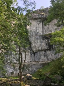
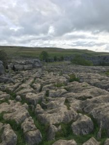
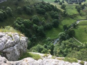
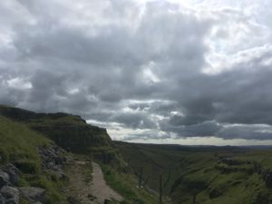
All fuelled and filled up with plenty of water (3 litres…3kg…) I headed the half mile to Malham Cove, a massive limestone cliff which thousands of years ago would have had a huge waterfall flowing over it. Even without the waterfall it was stunning – the path takes you along the stream to the bottom and when you look up you have to crane your neck right back, the people at the top looked tiny! The path then climbs lots (urrr!) of steps to one side to emerge out onto the higgledy piggledy limestone pavement on top of the cliff, where the views stretch for miles.
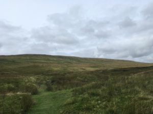
The limestone was well worn and slippery in places which made for somewhat precarious teetering from slab to slab, balance always more challenging with a big rucksack on your back! Route finding was also tricky as limestone doesn’t make for an obvious well worn path! Eventually I picked my way around and found the grassy path which headed ‘upstream’ from the Cove, along a shallow valley between limestone crags. Another short rocky climb at the top and the path soon emerges onto flatter more open ground, near Malham Tarn. Beyond Malham Tarn the hills rise up again – Malham Moor and Fountains Fell, my next climb.
As I track around the Tarn and up past the field studies centre (with a handy public toilet and a queue of tired-looking Duke of Edinburgh students) I find some delicious raspberries to ease the gentle climb. I take a good break sitting on a bench overlooking the tarn, just enjoying the view. At one point something falls out of the tree but I think nothing of it, assuming it was a pine cone or something. A few minutes later a young bird, I think a wood pigeon, wanders through the grass and into the area where I’m sitting. He looks a little stunned – I think he must have been what fell from the tree! He seems to be ok, just a little unsure about what to do, but after a while he manages to fly a little bit so I think he must be ok.
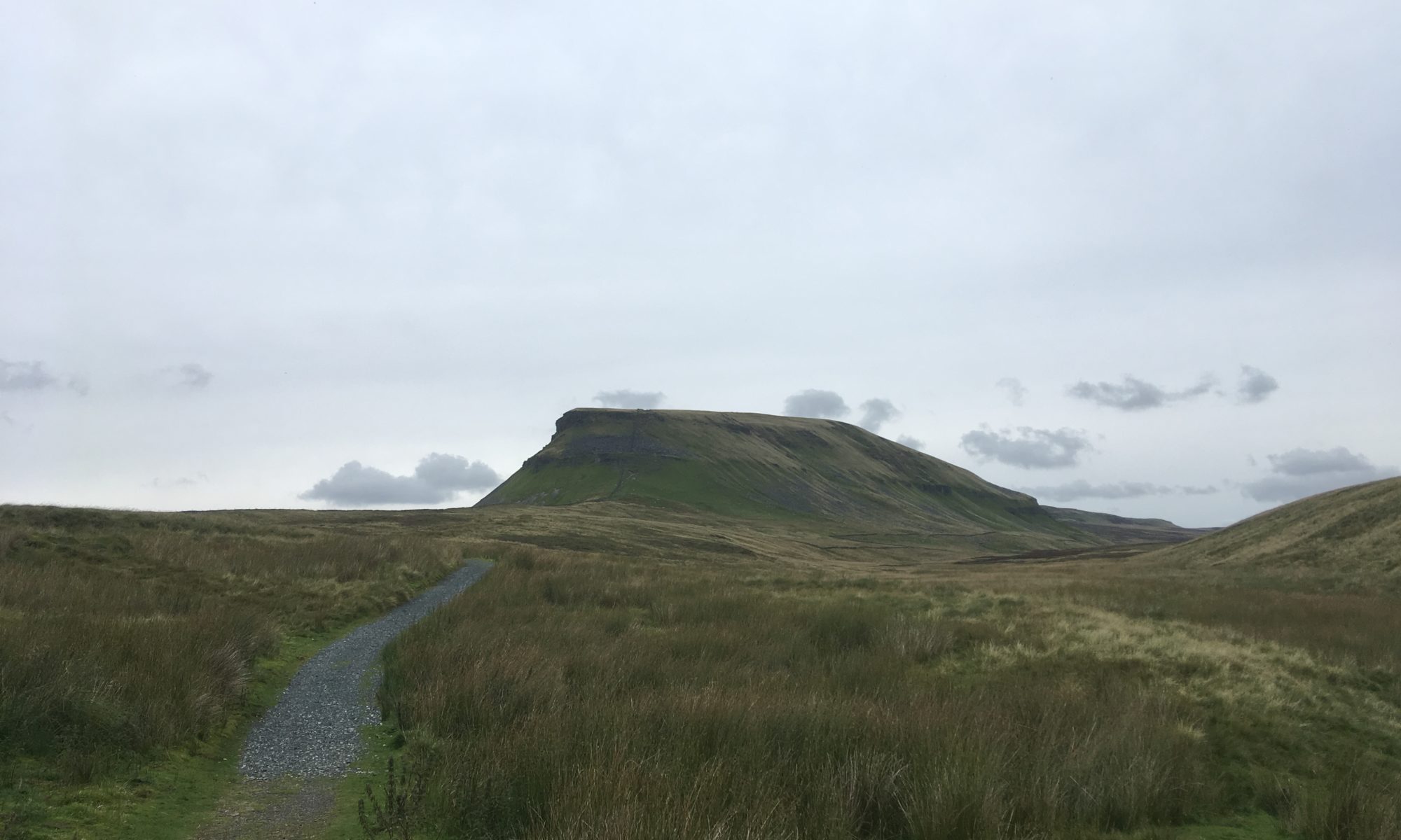
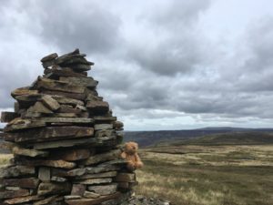
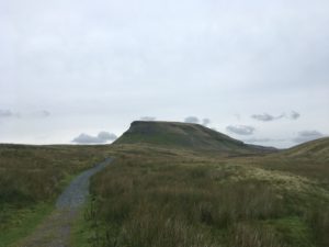
The next section of my walk takes me up onto Fountains Fell and I’m a little apprehensive as the trail description said it was “deceptively difficult”. It was long, but I never really found it that difficult, thankfully! Some bits were quite boggy but other sections had been gravelled. Perhaps the gravelled bits were previously more difficult. I have mixed feelings when I see slabbed or gravelled sections. They certainly make for easier walking but there’s an element of it feeing almost like cheating! The gravel, in particular, also seems quite out of place. A bit too man made in somewhere so rugged! The views going up were wonderful and wild though, it’s a lonely part of the moors and I imagine it can be incredibly bleak in bad weather. I thank my lucky stars again that I have been so lucky weather-wise! As I reach the top, at some very distinctive tall cairns, the views the other side suddenly appear and before me is Pen-Y-Ghent, one of the Yorkshire Three Peaks. It’s a distinctive peak from most angles but it wasn’t quite so recognisable from where I stood. Still, Pen-Y-Ghent it was and it looked impressive! Steep sides dropped straight down to the valley below whilst the head of the hill jutted proudly out above lower ground stretching all around. I am going to be climbing that?! I recalled that the route description claimed this hill is “deceptively easy”….here’s hoping!
Before I reached the ascent of this rather attractive peak however I had to make the descent from Fountains Fell, mostly straightforward but a few ‘skiing’ moments where I very nearly ended up on my bum! Lots more squelching (my boots are definitely looking like they’ve walked 700 miles now!) and then there’s a bit of a break with 3/4 mile along the little road that runs down the valley. Pen-y-Ghent starts looking more recognisable as I get closer to the other end and there are some great little waterfalls cascading down its side.
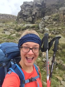
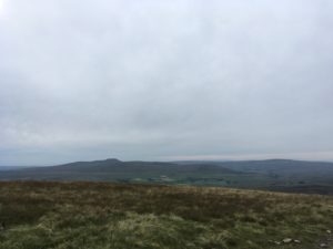
A quick break and it’s time for the last ascent of the day. The first bit of the climb is very gentle, up and along a low ridge to the foot of the famous rocky outcrop that makes up the rest of the climb. It’s a steep climb! There’s some scrambling too, zigzagging along and up narrow ledges which would be fine without a pack but become somewhat more challenging when your centre of gravity is slightly out of kilter! It’s worth it though. The view from the top of the outcrop has a bit of a Lion King Pride Rock feel about it, and after a steadier climb further up along the ridge to the trig point you can see hills and fells in every direction. You realise just how remote and vast this county is!
My target for the night, the little village of Horton-in-Ribblesdale is visible down in the valley 3 miles away (it’s a slow descent down!) and I start looking forward to my dinner. The first bit of the descent is rather tedious – down big flagstone steps, too large for one step each but too small for two steps to be comfortable. I was glad to reach the more gentle slope of the gravel path which the rest of the route takes, winding its way down into the valley, Pen-y-Ghent getting taller and taller behind.
Nick, a colleague from SJP who has driven 4.5 hours to come up to join me for a day’s walking tomorrow, arrives in enough time to have a quick jaunt up the track to meet me and walk back into the village. I have a feeling Nick will win the award for longest travel time to walking ratio! It’s great to see him, and hear some of his stories from his original Pennine Way adventure. We find the campsite – right by the pub – and once again it wasn’t a problem to not have pre-booked. Although it’s a bit soggy underfoot it is nice and dry weather-wise to put up the tent, at a fairly respectable time of about 6:30pm. Then, it’s off to the pub! A delicious steak and ale pie and chips with extra gravy and I’m good for bed! An early night tonight, whoop! Tomorrow is supposed to be a great walk with lots of open space and spectacular valleys, and the weather is supposed to be fine until the afternoon…fingers crossed!