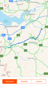
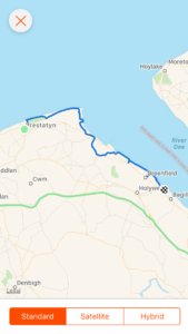
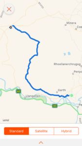
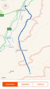
Day 38: Chester to Acton Bridge

Total miles: 18.6

Elevation gain: 1,037 ft

Time walking: 9am – 6pm

Miles to date: 559.5

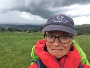
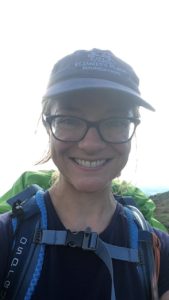
Today was a nice day. It wasn’t remarkable as far as days walking go, but there were some lovely bits, my body survived the third long day in a row, and I got to meet up with some old university friends for an early lunch en route.

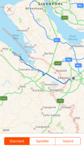
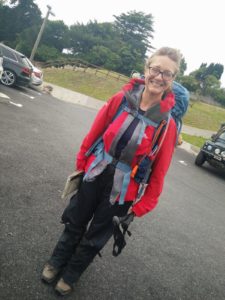
I made an earlyish start from Chester, a little sad that I didn’t have more time to explore but given that the reason I’d moved my rest day (originally planned for today) was so that I could spend tomorrow afternoon and evening with one of my dearest friends, it was a sacrifice worth making!

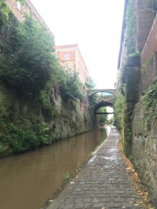
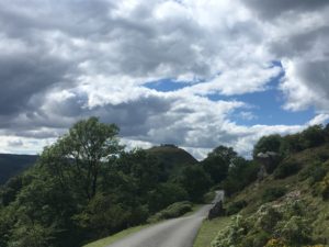
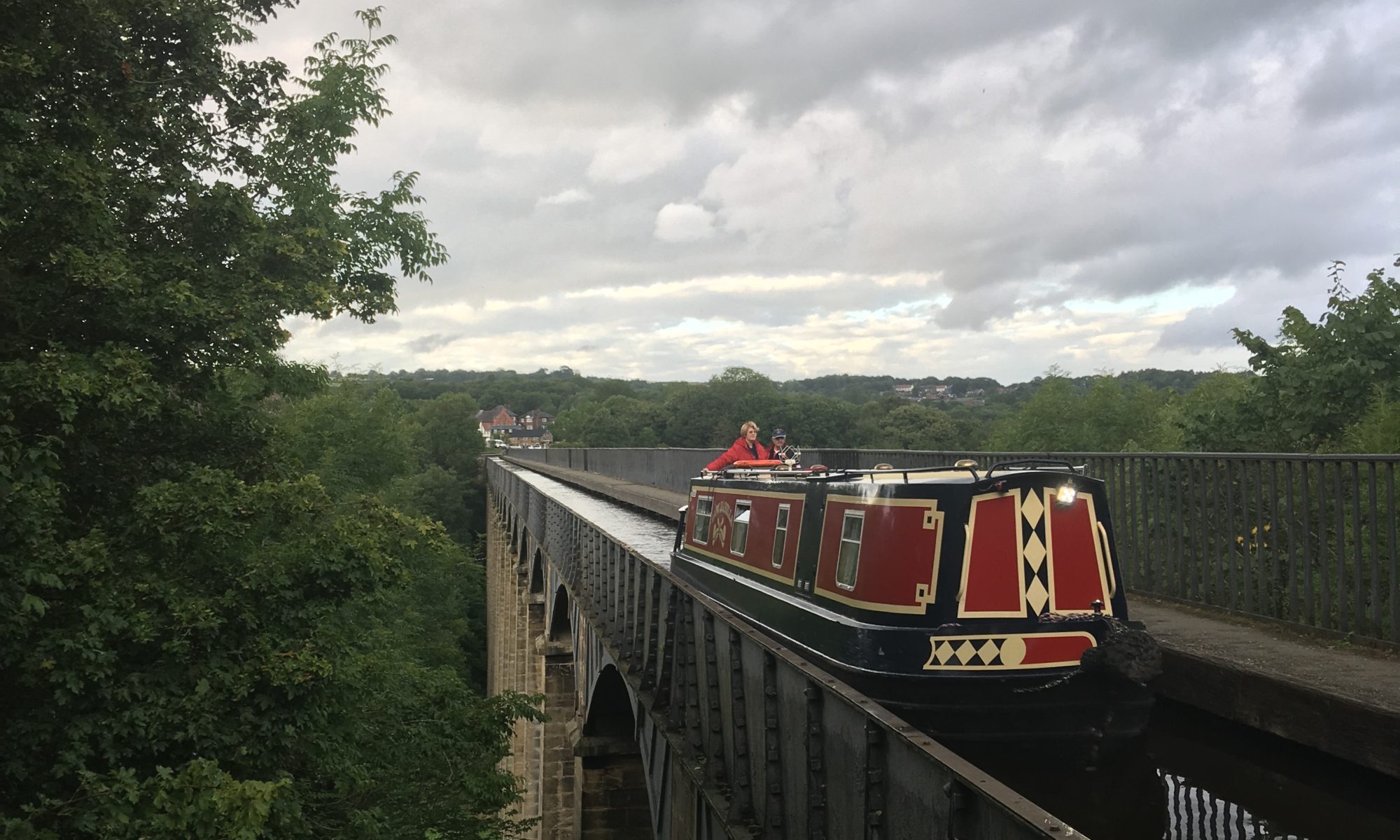
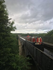
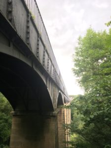
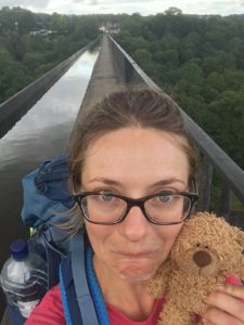
I don’t go through many big towns and cities on this route but when I do there is always an art to finding the prettiest route in and out. For Chester, this was the canal. I dropped back to the spot where I’d left it last night and followed it for another mile or so before cutting up along some suburban streets to pick up the Longster Trail. Along the way a friendly postman came over to chat, it turns out he is a keen backpacker too and we had a nice conversation, with him wishing me well as I headed on. I always find people’s reactions interesting. Some people are utterly amazed at what I’m doing, some think I’m bonkers, others think it’s pretty cool and are a little envious. You can always tell fellow hikers though, there is a sense of respect, understanding, shared passion and support. We are a crazy bunch, us hikers!

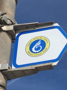
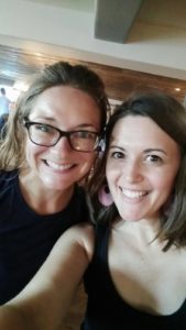
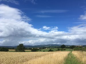
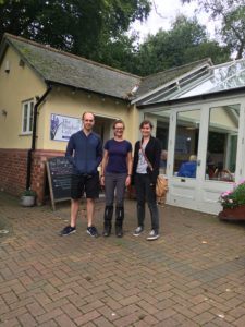
I picked up the Longster Trail – which disappointingly has a very uninteresting waymarker – just an arrow with “longster trail” written on it (I think it’s a Cheshire thing, I followed three different trails and they all had the same style waymarker!) – and followed it across pretty farmland up to the village of Great Barrow. There is a gorgeous little cafe called the Bluebell Cafe on the Barrowmere Estate where I met up with Jo and Rich who I hadn’t seen since Durham! Kudos to them on logistics – they were returning to Durham from the Isle of Man via Rich’s parents in Liverpool and managed to work in meeting me en route! We had a lovely early lunch together (a huge tuna melt jacket potato, scrumptious lemon curd cake and a latte) and I could have curled up and snoozed afterwards! Alas I had another 13 miles to go so I had to get a wriggle on!

So lovely to see these guys again!

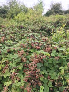
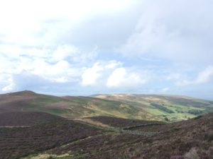
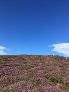
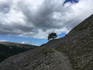
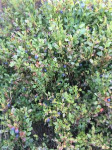
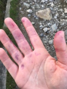
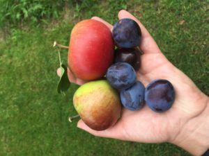
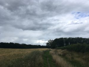
Soon after Great Barrow I left the Longster Trail to cut across farmland on other footpaths until I picked up the Baker Way. As I faced overgrown field edges I thought longingly back to the lovely clear Offa’s Dyke and Coast paths! The first field was the worst (pushing through waist high broad beans tangled with brambles, thistles and nettles….) and then thankfully it got a bit easier. The plus side was that there were soooo many big fat juicy blackberries today. I wished I could have collected some…not that I could have eaten any more…!

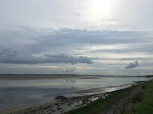
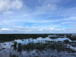
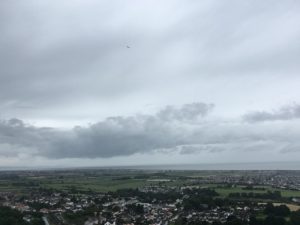
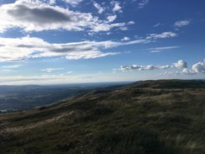
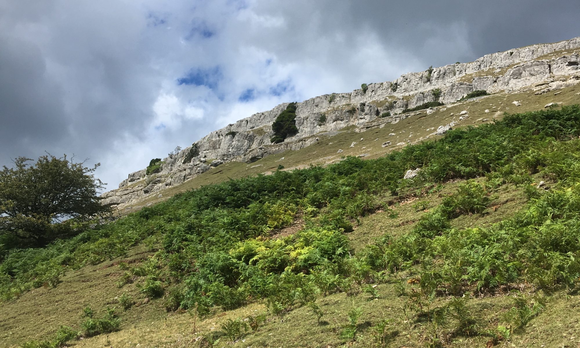
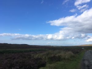
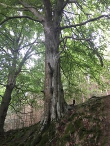
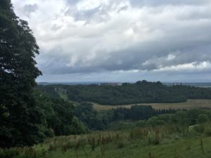
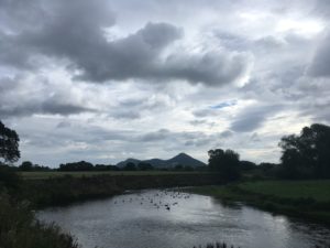
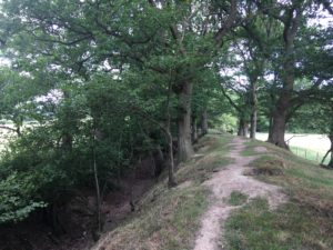
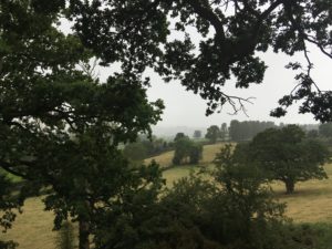
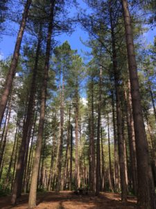
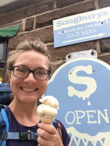
My route took me to the edge of Delamere Forest and once there I took a big deep lungful of the pine-filled air. Ahhhh. This was heaven! Soft walking along pine needle-coated paths, muffled footsteps and the sound of the breeze high up in the tree tops. I love walking through forests with pine trees, the smell takes me right back to when we used to go camping at my favourite campsite, where my friends and I would run around for hours through pine forests. I followed a slightly circuitous route as I wanted to head to some toilets marked on the map. Frustratingly they didn’t exist so I looped back to the next promising spot – Delamere train station, where I knew I could also stop for some ice cream (recommended by Rich). The path took me around Blakemere Moss, a lake in the middle of the forest, but you only got a few glimpses of it through the thick trees that lined the shore. Great for the wildlife, not so great for people wanting to see the wildlife! The route also went under the Go Ape course which looked really fun. It’s still something I’ve never done! One for the bucket list. Arriving at the station I saw the cafe but couldn’t see any ice cream. Ah well, I needed a break so I had a pot of tea and a lovely apple and cinnamon scone while I took my boots off and had a look at the rest of my route. I was pleasantly surprised to find I only had another 4 or 5 miles left! My feet and legs were starting to feel it though, so I was pretty glad.

Delamere Forest

When I re-booted, loaded up and headed off, I finally spotted the ice cream just around the corner from the cafe. Doh! Still…it only took me a couple of seconds to decide to have an ice cream too! It was delicious!

Finally found the ice cream!

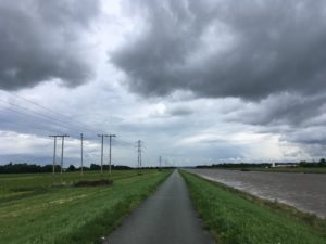
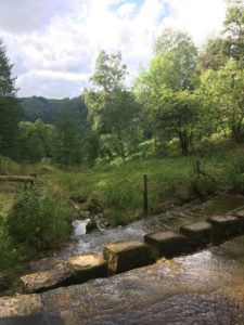
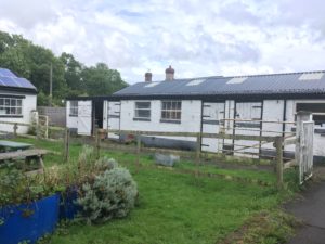
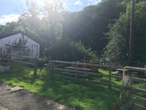
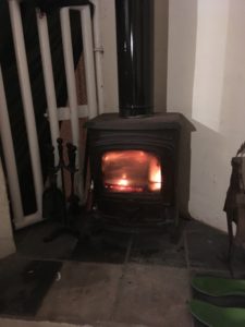
I followed the Delamere Way out of the forest and caught up with a woman out walking with two boys who were sword fighting with sticks. We chatted as we walked together for about half a mile, before I suddenly realised I had missed a turn while we’d been chatting! Feeling rather sheepish, I said farewell and made an about turn, picking up the right route once more. I had a long stretch along the mostly quiet road to Crowton before picking up a nice bridleway for the last mile or so to my stop for the next two nights, Ash House Farm B&B. Oh my goodness this place is beautiful! I am staying in one of the rooms in the converted fruit store and it is luxurious compared to my hostel and camping nights! I even have a bath!

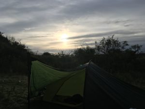
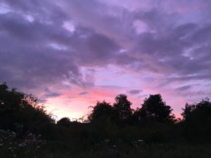
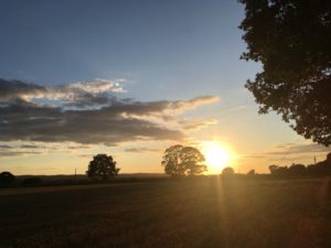
After making the most of the bath I headed out for the 1 mile stroll to the nearest pub for dinner. It probably seems a bit daft to walk another mile after walking so far already, but it’s amazing how different it is walking without the bag and in different shoes. Not that flip flops can really be called shoes, and they aren’t exactly ideal walking attire, but they make a change for a gentle stroll! It was a stunning golden-sun evening and it was pleasant to stretch the legs and meander leisurely. The food at the pub was basic but delicious and everyone was so friendly. A local couple donated £10! By the time I was done it was mostly dark, but there was enough light in the sky to find my way back and it was incredibly peaceful (other than when the trains came whizzing though (it’s on the west coast mainline!)). The moon was just past full and was just rising, a beautiful and slightly eerie orangey yellow. It would have been a stunning night to camp. Still, I’m incredibly happy to be curled up in my nice comfy bed…!

Beautiful evening for a stroll

Tomorrow is my rest day which is definitely needed after three days of 17 mile plus days in a row. In fact, in the last 7 consecutive days of walking, only two days have been shorter than 17 miles! I have a couple of long days coming up too, so I’m going to make the most of putting my feet up. Eunice (my housemate and one of dearest friends) is coming up tomorrow for the night and bringing me hugs and more supplies. Can’t wait!

Route day 38

Day 37: Bagillt to Chester

Total miles: 19.2

Elevation gain: 451 ft

Time walking: 8:30am – 5pm

Miles to date: 540.9

Today was a day of three distinct sections, and although I finished relatively early compared to some of my long days, it felt loooong!

The day started off perfectly, with an early start, making a cup of tea and munching on some granola as the sun rose all hazy over my campsite. There was a very heavy dew which meant my tent was rather damp but it was so fresh and peaceful that it didn’t really bother me. I packed up and made a move, supplementing my breakfast of granola and welshcakes with the numerous blackberries growing along the path.

The best bits about camping!
Breakfast!

My plan was to make it to Flint, about 4 miles along the coast, for a second breakfast and to pick up some water (I didn’t really bring enough with me last night). I didn’t go as quickly as I’d planned as it was just so beautiful! I remembered how much I love walking in the early morning and decided I would try to have a few earlier starts. The estuary was incredibly calm and peaceful, the water was so still it reflected the clouds nearly perfectly. The only life seemed to be a handful of seabirds flying along, suddenly plummeting into the water to catch fish, then rapidly rising and continuing their flight, leaving only the slow circular spread of ripples to mark their dive. I made my way along fairly slowly, just enjoying the peace, feeling incredibly happy and lucky to be doing what I’m doing. I wanted to make the most of the wide, calm estuary and fresh air as I knew soon I was heading towards the much more industrial section of the Dee!

A peaceful start to the day along the Dee estuary

As I neared Flint I kept an eye out for the castle. It is one I’ve wanted to see ever since I saw Shakespeare’s Richard II, one act of which is set in Flint Castle. I was surprised that it only made an appearance as I rounded the last bend, past the old Flint dock. It was tucked away much more than I expected, from the seaward side at least. It’s much more prominent from the other direction which seemed the wrong way around to me. The castle itself isn’t huge, but the four corner towers and connecting walls are all there, albeit in a state of ruin. I learnt that the castle was deliberately ruined after the civil war, when the new parliament didn’t want to risk it being used in future conflict as it had been by both sides during the war. There was a picture suggesting what it might have looked like before it was ruined and it did look quite impressive with the water coming right up to the walls (which it no longer does).

Flint Castle

The short detour into Flint itself was a bit of a shock to the system after the quiet of the estuary – busy roads and bustling with people – but civilisation does bring the benefits of coffee and loos! I came across the characterful Court House Cafe which claims to be based in the second oldest building in town. After thoroughly enjoying my soya latte and breakfast panini a family stopped to talk to me and ask me about my trip, making a donation too. Then the owner of the cafe came over and gave me some bottles of water and juice for free to take with me. People really are so lovely!

Leaving Flint, the path soon left the estuary and followed the main road for a number of miles, into Connah’s Quay. It wasn’t the nicest section of the walk, but it was interesting to see all the massive power stations, factories and other big industrial plants which was a first for this journey. My feet didn’t enjoy the miles of tarmac, but there was plenty of that still to come!

At Connah’s Quay the path rejoins the Dee, which is just a wide brown river now, with no hint of the lazy, expansive estuary it becomes a mile or so downstream. There is a good view of the Flintshire Bridge from here, which I had been able to see since yesterday. It’s the largest asymmetrical cable-stayed bridge in the UK and it is quite beautiful, in a modern architecture way. It reminded me of a smaller, asymmetrical version of the old Severn Bridge.

The Flintshire Bridge, surrounded by the industry of Connah’s Quay

At Queensferry, after a quick detour into the Asda there (once again feeling rather out of place in all my hiking gear when everyone else is just going about their daily business!), the path shared the cycle path along the River Dee into Chester. It was four miles of perfectly straight, flat walking and it was dull and painful! For some reason (I suspect human intervention) the river here is dead straight. It was plod plod plod, with no real landmarks by which to judge distance, and by this point my legs and feet are aching. Flat walking might be quicker but it can be just as hard on your muscles as it is so repetitive, there is no alteration to gait or pace, and my legs and butt started to seize up. I had to keep stopping to stretch out and to relieve the monotony with some chocolate or sweets! The weather kept me on my toes with big black clouds all around – I could see the sheets of rain coming down – but I willed it to go around me, not over me, and remarkably other than a little drizzle I stayed dry!

Four miles of monotony

Reaching the first bend in the river was a relief as past here it was only a mile to Chester, with the Welsh/English border to be crossed for the final time this trip. The border is marked by two standing stones and a “Welcome to Wales” flagstone. Interestingly, no welcome into England! On the edge of Chester I joined the Shropshire Union Canal and watched some boats going through the locks, then followed the canal along a section of the city walls before heading off to find my hostel, not far from the canal itself.

The canal into Chester

Remarkably, despite my long day, I managed to arrive at 5pm! If I hadn’t have been so tired it would have been the perfect opportunity to explore the city a little but after a couple of long days in a row I was exhausted. So my evening consisted of doing some much-needed washing, having a shower, drinking tea and stuffing myself with an amazing Indian takeout! Thankfully I have visited Chester before, so I don’t feel too bad about not going out. One more long day tomorrow and then a rest day, and I’ve found a nice b&b to stay in near Acton Bridge so it’ll be a little bit of luxury for two nights!

Route day 37

Day 36: Prestatyn to Bagillt

Total miles: 17.5

Elevation gain: 895 ft

Time walking: 9:30am – 6:30pm

Miles to date: 521.7

The start of the third leg of my journey! This leg is the least planned of the trip other than the final leg, and as I set out this morning I had no idea where I would be staying tonight! It’s not the best way to start a day’s walking…! My hosts started me off in a better fashion, with a cup of tea and a huge bowl of porridge, for which I was very grateful. I was also grateful that the weather looked decidedly more friendly than last night, which made for a promising day of coastal walking. After not terribly successfully trying to reassure Anne that I really could carry my bag myself (she was horrified at the weight of it), she strongly recommended that I find a nice strong man to walk with me and carry it for me…. 😉 (Any takers?!)

It being just my pack and I for now, I said farewell and retraced my steps back into Prestatyn to get a post office stamp (it’s getting quite addictive!) and to make the most of actual shops to pick up something for lunch, also picking up some friendly “good lucks” as I went along.

Heading back to the seafront to pick up the Wales Coast Path, my route for the next two days, I couldn’t seem to shake a strange unsettled feeling. I don’t know exactly what it was, perhaps the combination of leaving the familiar Offa’s Dyke path, not knowing where I was going to be staying tonight and the slightly eerie air of faded seaside holiday resorts that always set me on edge for some reason! I tried to shake it off with some good deep breaths of fresh sea air but it stuck with me for a large part of the day.

A new set of Way markers to follow

It was nice to be by the sea again, which I last saw over a month ago, even if the north Wales sea doesn’t compare to the Cornish coast (sorry Wales!). The coastline was flatter, definitely, which was both strange and a relief, having climbed twice the height of Everest already this trip. Flat also means you can see for miles and indeed the coast just stretched away out either side. Across the estuary is the Birkenhead peninsula and back to the west the mountains of Snowdonia huddle on the horizon.

The first couple of miles were through sand dunes which made for hot and tiring walking, with limited views of the sea. I could hear it though, the constant coming and going of the waves on the shoreline, and the sun felt nice on my face. I had accidentally left my hat in Aurelie’s car yesterday which meant I couldn’t escape the sun very well, but I resorted to wearing my buff as a bandana to help keep the sun off my head and hair out of my eyes. I’m not sure I pull the bandana look off very well, but in the end the sun hid behind clouds for much of the rest of the day anyway.

There was a variety of wild flowers in the dunes including a striking sea holly which had a beautiful blue tinge to it. It almost looked like somebody had crept down overnight and spray painted them all, they didn’t quite look real! After the dunes came some wildlife rich mudflats, followed by beach walking. The tide was coming in which meant there wasn’t any hard sand to walk on and it was slow going, but it was pretty! Here and there I’d come across more populated sections of the beach, where people had parked up and brought their families to play, then other sections were much quieter. Stark objects like an old lighthouse standing half in the surf and well worn driftwood lying twisted on the sand made for some arty shots, and I started to relax a little. I think at this point I figured that if I didn’t find accommodation I’d just find a nice spot in the dunes to camp, and once I’d made that decision I stopped worrying about where I’d stay and just kept an eye out for a promising looking spot!

Wildlife-rich mudflats
Coastal walking

At Talacre, a little resort just around the ‘headland’, I made the most of the public loos and a lovely little cafe called Lola and Suggs which served gluten free bread and almond milk! So I decided to stop for elevenses/early lunch and rest my feet for a bit, even though I was only 5 miles in.

Not far from Talacre (and its slightly creepy gas plant) the official route heads inland from the village of Ffynnongroyw (with the most derelict churches on one street I have ever seen – I counted about 6!) up into the woods in a gentle u-shape back to the coast at Rhewl-Mostyn. I was hopeful of a pub in Rhewl-Mostyn (I’m not sure why, given my usual luck with pubs at lunchtime) but here the pub wasn’t only closed, it was non-existent! So it was back down to the estuary and on towards Greenfield (down the hill from Holywell) for supplies and hopefully somewhere to stay or to pitch my tent. I had one last search online for accommodation in Holywell and found a guesthouse run by nuns, next to a convent. For a few moments I thought it might be quite an interesting place to stay, and quite fitting given that I was a pilgrim of sorts (Holywell, with its holy waters from St. Winnifred’s well, is a place of pilgrimage for some), but in the end I decided it might be a little awkward and I had pretty much set my mind on camping now anyway.

King Jennifer enjoying the view on a short break

It was a beautiful evening and I wasn’t feeling too tired so once I reached Greenfield and stopped to consult my map I decided I’d walk on a little further towards Bagillt to find somewhere to camp, to reduce tomorrow’s mileage. First I had to pop up into Greenfield to pick up some more water (and happened to find another post office yay!). It was a little bit of a backtrack but without water I couldn’t camp. Refilled with water I headed back onto the path, passing a group of men stood chatting and watching the dock for the third time, smiling at them and saying hello again. They asked me if I was lost. No, just getting supplies, I told them cheerily.

There was a pretty stretch of marshland between the estuary and the path which might have been an appealing camping location had it not been subject to flooding when tides were high…I didn’t think it would be a problem but thought best not to risk it – I didn’t much fancy writing a story about waking up to find my tent inches deep in muddy estuary water in the middle of the night! Thankfully further on there was a little headland just before a small stream entered the estuary. Here the path cut straight along one side but the headland itself was a mixture of grass, scrub and mini hills with nice flat areas in between. A perfect spot to pitch my tent, out of the way but with plenty of space. The tent was still damp from the other day so I draped it over a tree while I made a cup of tea and did some stretching. A couple came through whilst picking blackberries and we had a pleasant  conversation, they didn’t seem remotely perturbed to find me camping here! It is a lovely, peaceful spot and the sunset was a stunner, and having eaten my gourmet dinner of boil in the bag chilli con carne rounded off with some chocolate buttons and another cup of tea, I’m feeling rather contented! Time for a good night’s sleep so I can be up and gone early, and ready for the long walk to Chester!

A peaceful spot
Feeling very happy to be alive and out camping on a beautiful evening!
Route day 36

Day 35: Bodfari to Prestatyn

Total miles: 13.6

Elevation gain: 2,353ft

Time walking: 12pm – 7pm

Miles to date: 504.2

Last day of Offa’s Dyke! I can’t quite believe it’s over, it is a path I have wanted to walk for so long and now I’ve gone and done it! I have to say I’m glad that this isn’t the finishing point for me, as it is for most people, as I don’t think I’d be ready to stop!

Today wasn’t an easy day, despite the shorter distance, for a number of reasons. Firstly, it was goodbye to Aurelie and the girls all too soon 🙁 thankfully before we said goodbye we had a wonderful breakfast together in Dyserth (after I’d carefully repacked my bag with all the new supplies they had brought with them, and re-waterproofed my jacket, trousers and boots!). Secondly, my bag was heavy again, thanks to the replenishment of supplies. Thirdly, it wasn’t the most interesting of days, after yesterday’s epic. Fourthly, the rain…

It seems a bit unfair to call the walk uninteresting as it certainly wasn’t really, in the grand scheme of things. But after two weeks of stunning walking, there’s something about the final day that just makes you want to get it done! There were a couple of hill forts, but none as spectacular as the previous day, there were some good views, although the sea never seemed to get any closer, and there were some great blackberries and raspberries! But it felt like a bit of a trudge. It didn’t help that the rain was threatening again and I put up with drizzle for a while before finally donning the waterproofs as it got heavier and heavier. For the first time on the walk the wind and rain combo actually made me feel cold and I wondered whether I should have worn the long-sleeved top that Aurelie had brought up for me! Thinking of the rain over the last couple of weeks I worked out that in the two weeks of Offa’s Dyke I had only had four days where it hadn’t rained. A little different to my first three weeks when I only had three days where it did rain! I guess my weather luck had to run out at some point. Still, I guess it’s a good sign that even with the rain I still loved Offa’s Dyke! The other good news is that my boots appear to be waterproof again, having treated them this morning. Whoop!

Ready for the off…and the rain!

To make the walk a little easier I kept playing silly games with myself. Up the first hill (and a stretch along a road) it was the blackberry game. Basically, head to the next promising looking blackberry  bush and reward myself with a few blackberries. It was slow but steady progress! The second was splitting each hill into little sections of 10 or so steps. “It’s all miles”, I kept repeating to myself. Every step is one less step to do!

About 7 miles in I paused on a wall for a break and to munch on the bakewell slice Aurelie bought for me from the cafe that morning (yuuum!) as the rain came down, and that cheered me up a little. I was also cheered by the fact I didn’t have to climb the impressive looking Y Foel but could admire it from below.  Same for Graig Fawr which on another day would probably have been quite appealing!

I didn’t escape the climb up to the Prestatyn Hillside but happily it wasn’t too arduous a climb considering the views and the steep drop down into the town the other side! Perhaps it was just that I got distracted by the huge patch of raspberries on the way up…! As I walked along the (rather overgrown and therefore wet) path along the top of the hill I could hear a bell tolling in the village below (the call to Sunday evening prayer I’m guessing) and a line of John Donne’s poem came to me – “Ask not for whom the bell tolls, it tolls for thee”. I can’t remember the whole of the poem but I knew it at one time, it is the “No man is an island, entire of itself” poem. It seemed quite fitting, for it to come back to me now, as I walk alone, but not on my own (see my second post way back before I started this walk!).

Finally, Prestatyn and the finish point in view!

This proved to be a walk that keeps giving right up to the end and just when I thought the hills were over, even on top of the hillside there was another final climb before the descent at last into Prestatyn. Even then it was another mile to the actual finish, right down along Prestatyn high street! Being Sunday evening most things were shut except some bars and restaurants. I’m tempted to stop for dinner there and then so I don’t have to come back out in the rain, but part of me really wants to just finish, get in, dump my pack and have a hot shower! So I keep heading down to the beach (up and over the railway station which confused me a bit!) and the restaurants etc peeter out. The beach is deserted, hardly surprising I suppose, but there is the official finish point, complete with sculpture representing the rising or setting sun (depending on whether you are starting or finishing). I found it amusing that on the signpost it says “Chepstow 182 miles” when every single bit of literature everywhere states that Offa’s Dyke path is 177 miles long, and even the halfway sign is 88.5 miles each way. Not sure where the extra 5 miles came from! Still, I know I’ve done more than 177 miles anyway by the time I add in all the diversions to accommodation etc, so who’s counting… 😉

Apparently it is tradition to finish the walk by taking your boots off and walking into the sea. With the rain and the tide being out I was tempted to skip that bit, but tradition is tradition so I headed down towards the waves, getting incredibly sandy in the process, and stripped off my boots and socks to have a quick (and cold!) paddle. Offa’s Dyke officially completed! Which also marks 500 miles of my journey complete – I can now officially start singing the Proclaimers’ song….!

The sculpture marking the end of the trail

Now both wet AND sandy I headed off to find my accommodation which thankfully was right on the sea front about 500m from the finish point. My lovely Airbnb host Anne quickly took all my wet gear and hung it up to dry then made me a cup of tea and fed me some biscuits, exactly what was needed! My plan was to shower and head out to find some food but as the rain showed no signs of relenting Anne and her friend Mike refused to let me go back out and instead very kindly made me some (delicious!) dinner from bits and pieces they had in the house. So sweet! They also made me a hot chocolate and we sat in front of their cosy wood burner sharing stories. Eventually I had to excuse myself so I could head upstairs and try to find accommodation for tomorrow night, as unfortunately it turned out the campsite I thought was in Holywell is actually nowhere near it! The search has been unsuccessful so far, so not quite sure yet where exactly I’ll be staying, but I’m sure I’ll find something…

Anyway, tomorrow is the start of leg 3, probably my least planned leg…who knows what it will bring!

Route day 35

Day 34: Llandegla to Bodfari

Total miles: 18.8

Elevation gain: 3,258 ft

Time walking: 9:30am – 7:30pm

Miles to date: 490.6

Today was a big day! Big hills, big views, big smiles! (And big aches in my feet…!). After a bit of a soggy start (amazing how one short drizzle shower can make a tent so damp!) I got packed up and headed into the village to stop off at the wonderful Llandegla Community Shop and Cafe. This place is a little gem! Well stocked little shop with friendly staff and a cafe serving coffee, cakes etc and light breakfasts (bacon and egg bap, yuuum!). Always a good start to a day!

The first few miles were over farmland, heading towards the ridge that is the Clwydian Range – a narrow band of hills that stretches for 20 miles north to south from Prestatyn. I saw my first big black cloud of the day, thankfully it seemed to be passing me by to the north, so I stayed dry for now.

Missed that one, thankfully!

Once I reached the hills it was a steep climb up, but interestingly the path skirts most of the actual hilltops rather than go up over them. I wasn’t complaining! The views from the side of them were pretty spectacular anyway, out across the wide vale to the west, right across to Snowdonia (when the clouds permitted!).

Just as I neared the bottom of the first couple of hills I finally felt a few spots of rain and the waterproofs were straight on – this was definitely going to be more than a drizzle! I munched on the slice of barrabrith I had bought in the cafe while the rain pelted down, strangely content! Barrabrith finished, I headed on into the rain, dreaming of the waterproof gloves I’d ordered that would be with me next week.

The shower didn’t last too long and the wind, although chilly, dried me out fairly quickly. A mile and half later, as the path dropped to a main road between two big hills, I could see another cloud. This one was spectacularly angry looking, and it was headed right my way. I could see it already emptying part of its contents onto the valley below and as I already had my waterproofs on I just watched it coming closer. It was pretty amazing, seeing the weather sweep across the valley! Soon it hit – first the slow and steady pitter patter of big fat drops and then gradually getting heavier and heavier. And heavier! I paused under a bank of trees on the track that led towards the next hill, a big, exposed hill, grateful that I wasn’t already up there! The rain kept coming, and when I looked more closely I realised it was actually hail! A group of walkers joined me under the relative shelter of the trees and I felt sorry for them – they were in shorts, trainers and puffa jackets! As the track slowly turned into a little stream gushing down the hill, carrying twigs and even little pebbles, the thunder and lightning came. I thanked my lucky stars for a second time that I was not stuck on the hill!

It would be pretty cool, if it wasn’t headed straight for me!

Eventually the rain eased off and it looked like the thunder and lightning had abated so I headed on, and up the really steep sided Foel Fenli, a hill fort. The Kendal mint cake came out for this! It was very steep! And not the easiest path – slippery in places and little grip. Offa’s Dyke path skirts the hill just below the summit but I decided I’d climb right to the top. The views were stunning, although it was a bit unnecessary really given I’d be summiting a taller hill soon. Still, always love a good hill fort! The clouds coming across the valley looked like they might contain more lightning so I made a quick exit off the hill (as quickly as a steep slope permits!) and down to a car park with the most people I’d seen all day. Ah, of course, it’s Saturday! It still wasn’t hugely busy, I guess because not everybody is mad enough to venture out in a rainstorm…! The most exciting thing about this car park was a wooden caravan which turned out to be a little mobile cafe. Amazing! I dug around in my wallet for my last remaining change while chatting to the owner, and when I asked what I could get for the £2 I’d managed to find, the lovely lady said I could have whatever I wanted. I love her! I asked for a latte and she offered me a large one, bless her. I knew I’d probably regret it when walking across the exposed, toilet-less hillside, but I was so grateful I accepted her kindness.

I had been planning to rest my legs for a bit but as it started to drizzle again I kept going, up the gradually rising path the mile and a half towards Jubilee Tower on top of Moel Famau, the tallest hill around. I was amazed at how many people I saw who were wearing clothing completely inadequate for the weather! So many people didn’t have anything resembling a coat, which just seemed crazy given that it was a showery day (as forecasted). I wondered if they all thought I looked strange, plodding on up the hill in my full waterproofs…

I could tell that the view from the top would be amazing, as the views just walking up were incredible. The southern section of the Clwydian Range stretched out to the south, down in the vale below were little towns and villages and a patchwork of fields, and in the distance I could see Snowdon. Actually, I could see 3 very tall mountains, each a fair distance apart, and I didn’t know then exactly which one was Snowdon (the map at the top confirmed it was the furthest north of the three) but I figured it had to be one of them! Once I reached the top I could also see out to the other side, to Cheshire and my route after Offa’s, and north to Liverpool and the sea! I took a quick break to change my socks (boots very wet!) but it was chilly at the summit so I added my warm jacket to my layers, and didn’t stay too long. I could see the next few hills I had to tackle and it looked like I still had a long way to go, although I think it was ‘only’ about 6 miles.

Part of the view from the Jubilee Tower on Moel Famau
Looking out to Cheshire and beyond
The onward route

A short while further on the coffee (and all the water I’d been drinking) really didn’t want to wait until Bodfari. Now I’ve had a wee in plenty of hedges on this trip, but an exposed hillside in a popular area on a Saturday is not the ideal place to need a wee! But I was desperate so I headed off over the edge of the hill to a spot not visible from the path and just prayed nobody wandered over for a better look at the view! It was definitely the best view I’ve had from a loo before, hehe.

Feeling lighter, I ate my oatcakes on the go and jogged down a couple of the hills to make them go quicker. There were some very steep bits, sadly followed by equally steep bits going up the other side. One of these was up the side of Moel Arthur, another hillfort, this one on top of an apparently perfect cone-shaped hill. Splendid spot for a hill fort – these Iron Age folk chose their spots well! The path once again skirted just below the top and this time I stick to the path, my legs were feeling the mileage and the hills now. I’m glad I did though, as rounding the side I met a couple out for a walk who had both (separately) walked Land’s End to John O’Groats! It was great to meet people that have actually done it! They wished me well and I was really pleased to have met them. The next people I met were a family panting their way up the steep hill I was coming down…I’m not sure what they made of my cheery ‘hello’ as I jogged rather haphazardly down the slope past them!

One final hillfort for the day, Penycloddiau, and this time the path goes right over the top. A sign informs me it’s one of the largest hill forts in Wales and it is certainly impressive. The views don’t get boring and with the golden evening sun (no more rain, yay!) the hill is just beautiful. The heather is in full bloom at the moment and its purple flowers, against the blue sky, green grass and golden sunlight, is breathtaking. Snowdon and neighbouring mountains are finally making a star appearance and I have a view out towards Llandudno and the wind farms off the north Wales coastline. If I wasn’t getting hungry and due to meet Aurelie and the girls in Bodfari I think I could have stayed there for hours!

Beautiful colours
Last hill fort of the day – hot and tired but happy!
A stunning evening to be up high!

I was definitely getting hungry though and jelly babies were no longer cutting it. I needed proper food! It was pretty much all downhill from here so I started running down every relatively safe slope. Aeroplane noises may have been involved…! (Well, if you can’t let your inner child come out to play when running down a big hill, when can you?!). I also started singing “she’ll be coming down the mountain” with numerous variations. “She’ll be running down the mountain when she comes” and “she’ll be craving mashed potato when she comes” being the most memorable. I’d had a very bizarre playlist, if I added all the random songs I’ve been singing this trip! I was clearly in need of good food and rest. Or I was just high on fresh air!

The last couple of miles were pretty but I was impatient to get to Bodfari and see the girls, and I was so glad when I finally made it to the pub (The Dinorben Arms – highly recommend it!) to find that Aurelie had managed to get us a table for dinner. Big hugs all round, oh it was so so good to see her and her two girls! They had come up to North Wales for the weekend especially to see me and bring me supplies, and I was staying with them for the night. The girls were fascinated by my adventure and had written down lots of questions which they proceeded to interview me with. I felt famous!

Yay!

The food was AMAZING! I had lamb shoulder with dauphinoise potatoes and greens and oh my goodness I was in food heaven! Rounded off with a banoffee waffle, it was a perfect end to a glorious day, and made the achey feet worth it. I have a feeling I’ll be hobbling a little in the morning, but it is a shorter day again so I’m not too worried!

Only one more day left of Offa’s Dyke, and tomorrow I’ll hit 500 miles – I can officially start singing the Proclaimers’ song!

Day 33: Pontcysyllte to Llandegla

Total miles: 13.1

Elevation gain: 2,172 ft

Time walking: 2pm – 7:30pm

Miles to date: 471.8

Gosh, I loved today! I wasn’t sure how it was going to go at first, as I woke up feeling properly tired. I was very grateful to my Airbnb hosts – they told me there was no rush to leave and so I had a relaxed breakfast in the sun in the garden with their gorgeous dog Poppy and cat Treacle. The slow start helped, so although I didn’t leave the house until just after midday I finally felt my energy coming back. The sunny morning and promising forecast probably helped too!

Leaflets in my room advertised canal boat trips over the aqueduct for a modest £7.50 so after detouring to the post office to collect another stamp I headed back to the Trevor Basin in perfect time to grab a coffee to take on the next boat. It would delay me by another hour but it was a sunny day, I had a shorter walk, I was fascinated by the aqueduct and I figured there’s no point in walking the length of Great Britain if I don’t actually spend time seeing it along the way!

It was a great trip and fascinating to learn more about the aqueduct and how it was built. Apparently the stone pillars are held together with a mix of lime and ox blood and the water channel was lined with flannel soaked in sugar. Don’t quote me on any of the exact details, but the girl telling us the history definitely joked that it was reassuring to know that we were travelling over something held together by treacle…! King Jennifer proved popular today and he got lots of hellos from people we passed on the towpath. I also had another couple sponsor me which was sweet!

Taking a boat trip
Feels like summer…

Canal trip over it was time to hit the path again so I waved goodbye to the sunny holiday scene by the canal and headed off towards the Llangollen escarpment, which I’d be following for 7 miles until Worlds End (and no, I’m not missing an apostrophe there, the place name doesn’t have one. Which slightly niggles me, grammar police that I am!).

The grammarless Worlds End…how many worlds are there, I wonder?

After a good crop of big juicy blackberries it was uphill through the Trevor Hall woods for a bit until it flattened out, leading to nice, easy and quick walking (save for where a fallen tree had blocked the path and some scrambling was called for!). As I cleared the woods I met up with a group of walkers from the local “University of the Third Age” and we paused together for a breather. They were doing a short stretch of Offa’s for the day so I joined them for a bit until they stopped for a longer break. The path joined a tiny road at this point which it followed for several miles, right around the escarpment, halfway up. For once I really didn’t mind following a road as this was small, open and made for easy walking, which given the STUNNING views which opened up all along the Llangollen valley to Castell Dinas Bran, I was quite happy about! I hadn’t realised quite how beautiful today’s walk was going to be. I mean, I shouldn’t be surprised by now as every bit of this trail has been stunning, but today really was fantastic. Castell Dinas Bran is a ruined castle perched on top of a tall, steep, conical hill and must have incredible views up and down the valley. Silhouetted against the sky it looked impressive even in its ruined state. Across the valley were huge, rolling hills, above me were craggy cliffs and scree-covered slopes and ahead of me was high moorland, where I was headed.

Castell Dinas Bran

Eventually the path left the road and followed a narrow track on a steady incline, ever winding in and out with the line of the escarpment. The track was clear but the slopes were steep and I could almost have been walking in the alps. There is a semi-euphoric feel to heading up a narrow path that curls up and around the contours of the slope, disappearing in front of you where you can see masses of sky above and around, and nothing but more hills around you and the distant sound of the stream flowing along the valley floor. I felt so happy to be alive, and out doing this!

A pretty spot for a break

Eventually the path dropped down slightly, via a massive patch of wild raspberries, to meet the little road again at Worlds End. There isn’t actually anything at Worlds End other than a hairpin bend at the head of the valley, and a stream gushing downhill crossed by a ford and some stepping stones. It did feel satisfying though, to know I was right at the head of a deep valley which went on to join the main Llangollen valley, and the view as the road rose up on the other side was the best yet of the day. Not a building, road or other person in sight, just hills, trees, rocky crags, and a whole lot of sky!

Stepping stones at Worlds End

A short steep climb took the road up onto open moorland, ah as if the day could get any better! The road continued to climb steadily and every now and then I’d pause to catch my breath and listen to the vast peace. It was so quiet up there! I could see back out to Snowdonia with the peak of either Cadr Idris or Snowdon (not sure which!) peeking out from the top. In front of me, as I crested the hill, I could see out to the massive estuary of the River Dee with Liverpool beyond. Over into England I could make out the faint outline of the Peak District, my destination in just over a week when I head there to start the Pennine Way.

My happy place…

The moor yielded up an exciting and bumper harvest of bilberries which are just heavenly! They taste like a cross between a blackcurrant and a blueberry and there were masses of them up there today. I ate so many I’m surprised I didn’t make myself sick, although I did tire my back somewhat from repeated bending down to pick them. I also managed to stain my hands a spectacular shade of purple, oops!

Bilberries!
Oops…

The last section of the day headed down through Llandegla Forest, a dense conifer plantation where the woods either side of the path are so dense and dark it looked like dusk had come early! It was a little bit eerie and I felt like I should be tiptoeing through as quietly as I could!

Tonight I am camping at the Llyn Rhys farm campsite which is pleasant and has views out to the hills. Sadly the road is quite busy here, which is a shock to the system after the quiet of the hills. There are also some very noisy flocks of sheep!

With my fuel gone (more coming tomorrow, yay!) I can’t make a cup of tea which is a shame, but thankfully the pub is just 100m away and it did some lovely food, and tomorrow I apparently pass the local community shop and cafe, so I’ll stop there for breakfast.

A welcome sign!

A long day tomorrow with lots of hills (and hillforts!) so going to try to make an early start. The rain is also supposed to return, so looks like my waterproofs will be back on the outside of my bag again (today they made it into the pack for the first time in nearly 2 weeks!).

Nearly the end of Offa’s Dyke, I can’t believe it! The end, in 2 days’ time, will also mark the 500 mile point where I can officially start singing the Proclaimers’ song…!

Happy weekend everyone xx

Day 32: Llanymynech to Pontcysyllte

Total miles: 19.9

Elevation gain: 3,362 ft

Time walking: 10am – 8pm

Miles to date: 458.7

Fourth longest day, second toughest in terms of total elevation gain and the muddiest by far! No wonder my feet and legs are aching now!

The weather wasn’t set to be great this morning but thankfully it wasn’t pouring with rain. Very blustery which I think kept the worst of the rain away and left me with drizzly showers rather than heavy downpours. I started off in a jumper for the first time this trip (yesterday was very muggy, today was pretty fresh with the wind!), although it soon came off once I’d warmed up climbing up to the Llanymynech Rocks nature reserve and former quarry. Walking around the skirts of the old quarry rock faces was very pretty, lots of dramatic cliffs and beautiful wild flowers, with old quarry relics dotted about like limekilns and brake drums. There were views back out across the Severn plain to the Breidden Hills and up to the Beacon Ring of a few days ago.

Relics of the limestone quarrying days
The former quarry is now a beautiful nature reserve

After crossing back into Wales the path headed around the edge of the cliffs and eventually dropped steeply down the western edge and despite only being a couple of miles in my legs were feeling it already. My knees were giving me a bit of pain on the steep downhill and I had a horrible feeling it was going to be a looong day! I tried to stay positive though and told myself it was just my body warming back up after my rest day!

At the bottom of the hill I made the first waterproofs-on stop, having stuck out the first drizzly shower but not trusting my luck with a second. Preoccupied with rearranging my jacket comfortably I missed a turning and ended up wandering quarter of a mile out of my way before realising that something wasn’t quite right. Sigh! When I got back to the right spot, 20m from where I’d put  my waterproofs on, I could have taken them off again, typically, but soldiered on for another half a mile before giving in halfway up the next hill!

The rain was constantly threatening all morning and I had several drizzle showers, but having already stopped three times in three miles I was risking getting grumpy at my slow progress so I opted just to get wet instead! It turned out to be the right decision as none of the showers really came to anything.

Up on the second hill, Moelydd, (summited with the assistance of jelly babies) there was a topograph naming all the hills I could see. Sadly I couldn’t actually see all that many today, but apparently Snowdon was only 44 miles away! It was very windy up there though, and I was semi-convinced I was actually going to get blown off the ridge!

Lots of things to see….if it wasn’t so misty!

Just outside the village of Trefonen (with another closed-at-lunchtime pub), 7 miles in, I stopped to rest my feet and have a protein shake, and I reflected on my attitude towards the 7 miles I’d walked. There was part of me that was impatient that I’d only covered 7 miles so far, and then another part reminded me that 7 miles is in itself a decent walk and the fact that I can walk 7 miles just like that (carrying a 20kg pack) is quite amazing! So I tried to stop berating myself for my slowness and tried to celebrate what I had achieved instead. Not always easy, and I do have to remind myself sometimes that I’m supposed to be enjoying the journey, not just the getting there!

Rejoining Offa’s Dyke itself for the first time today the path dropped down towards Candy Woods which rose up steeply on the other side. Every step down the hill made the next hill to climb look bigger and bigger! It was a pretty walk up through the woods though, although fairly dark because it’s quite conifer-heavy, and up to the old Oswestry Racecourse on top of the hill fort. The views hinted at by the 325m height of the fort were mainly obscured, either by trees or by the drizzle sweeping over that particular section of the English countryside, but you did get a sense that they might have been pretty good at some point in the past! Ruins of the former grandstand were small but interesting and with a bit of imagination I could imagine them racing horses up here in times gone by, before travel by train meant horses could be taken to larger racecourses in other parts of the country.

11 miles in at this point, my morale and energy are given a boost by a lovely patch of raspberries and a nice couple who donated some money and stopped to chat for a while. Turns out his parents lived in Castle Cary in Somerset (where I went to secondary school!), small world. They were really sweet and chatting to them put some spring back into my step. Shortly after meeting that couple I was singing the Hokey Cokey to myself (out loud…) when I suddenly hear a cheerful ‘hello’ from the hedge. I jump, and immediately pray that the smiling man sat on the bank didn’t hear my crazy singing! Turns out he is walking Offa’s Dyke in the opposite direction, only the third person I’ve crossed paths with in a week and a half! We chatted for a while until a) the rain started to come again and b) the bulls who had been quietly minding their own business suddenly decided to head our way, rather loudly and rapidly. I waved good bye to the fellow walker and am not ashamed to admit I hoped the bulls would follow him rather than me. Of course they didn’t. They came straight for me…. I made my way as quickly as I could to the edge of the field whilst trying to shoo them off as I went. Once over the safety of the fence I turned to watch them amazed (and mildly terrified) at how quickly and brusquely they approached. I shuddered. Cows!!

A pleasant downhill stretch along a pretty track, improved further by the consumption of a Cadbury’s Boost bar (“a boost of chocolate, caramel and biscuit energy”! Haven’t had one in years!) led down to Craignant, with the knees seeing to have warmed up now, phew, and once again it’s straight back up the other side. The drizzle starts again, slightly heavier this time, but having avoided the waterproofs since I removed them the first time I carried on, figuring a little rain wouldn’t hurt. After about 10 minutes and halfway across an open field, the rain growing steadily heavier, I started to question the wisdom of my oh-sod-the-rain attitude. When I reached some shelter under the trees and passed a group also walking Offa’s Dyke, kitted out head to toe in soggy waterproofs, I finally admitted that this rain shower was less of the short-and-sharp variety and more of the settling-in-for-the-afternoon variety. With a sigh I donned my waterproofs. The rain persisted for a while and even though it didn’t prove to be “in” for the rest of the day I was thoroughly glad of my waterproofs when I came across some sections of firstly knee-height then shoulder-height undergrowth along the path, which would have had me soaked through in seconds!

Fantastic sections of the dyke

The path followed the dyke steeply downhill with views out to Chirk, with Chirk Castle sitting grandly atop the hill opposite, and the flat country beyond. The ‘official’ end of today’s section is at the bottom of the hill, by Castle Mill, but I’m pressing on to where I was able to find accommodation, all the way in Cefn-mawr the other side of the famous Pontcysyllte Aqueduct, halfway through the next section! This meant I had the steep (but not quite as big as the earlier hills) climb up onto the same hill where Chirk Castle sits (which meant I got good views of the back of the castle too!), but it was the last biggie of the day and the views from the top were far-reaching. I’m not exactly sure which part of the country I was looking at – my little Offa’s Dyke OS map book only gives small strips of map and I’m not always very good at looking at a bigger map to find where in the country I am!

Chirk castle

This section was easy walking along country roads and as it was starting to get a little late I decided to make a tiny shortcut and head straight down to the canal rather than do the strange little zigzag the official route takes. I soon realised why the official route goes the way it does – my shortcut took me to the wrong side – the towpath-less side – of the canal! Durrrr!! So I had to walk along the main road for a bit, fearing I’d missed the chance of walking over the aqueduct and would have to take the road route (which involved even more descent and ascent!). Thankfully the road meets the canal briefly and from there the towpath runs on both sides of the canal for a stretch. Phew! I happily walked along and soon I saw the aqueduct in front of me, narrow and very very tall, spanning the valley. A canal boat was coming across which was pretty awesome to see, then it was my turn to cross. Pretty nerve wracking, actually! I wouldn’t want to be up there with vertigo or in the wind! The views were great, over to the railway viaduct, back to the old road bridge and down to the fast flowing River Dee. I held onto the railing, even then I kept feeling like I might fall into the canal! The trickiest bit was passing two women and their dogs – someone has to let go to let the other pass!

The Pontcysyllte Acqueduct
Beautiful engineering
Don’t look down!

Making it safely over the aqueduct into Trevor Basin it was only a short walk to my Airbnb for the night. Thank goodness, as my feet are seriously aching now! I am greeted warmly by my hosts with tea and Welsh cakes, and quickly invited to have a glass of wine after my shower. Amazing!

I am now very tired and somehow I don’t think sleeping will be an issue tonight! I should really do some stretching and massaging my feet but I think I’m going to just sleep and I’ll spend some time doing it in the morning. The good news is that the extra few miles today means for a few miles less tomorrow so I don’t need to be in a rush to leave, yay!

Day 30: Buttington to Llanymynech

Total miles: 12.4

Elev gain: 518 ft

Time walking: 9am – 2pm

Miles to date: 438.8

A lovely short(ish) and flat day today, which I was glad of given the weather! I had an earlyish start as the friend I was staying with had to head to work, but this was pretty good as it meant I’d end up with a rest afternoon as well as a rest day!

Today’s route took me across the Severn plain. The river here is pretty small and lies low beneath deep banks, quite different from the Severn I crossed just over a week ago! Apparently it can flood here though, so I was thankful that we hadn’t had an awful summer. Apart from a short stretch along the disused but pretty Montgomery Canal the first two thirds of the day followed the river through fields with views to the ever-nearing Breidden hills and the massive quarry that scars the western side. The banks of the river are quite overgrown so sadly I didn’t get too many glimpses of the river itself but there were a few wider stretches around lazy corners where I saw swans and flocks of geese. Lots of sheep and cows today. Thankfully none of the cows paid me too much attention so my faith in cows is starting to return!

The Breidden Hills over a wider stretch of the infant River Severn

The most exciting part of the morning was coming across lots of plum and apple trees right on the path! There were masses of small but beautifully sweet plums and I collected as many as I could carry and/or eat. Fresh fruit isn’t something I’ve had a lot of on this trip so it felt like such a treat! I collected a couple of apples too, and wondered if I’d find a good patch of blackberries to complement them in a hedgerow dessert.

Nature’s bounty!

The rain was on and off for a while and it was back to the waterproof saga. It seems to be a pattern this week – the weather starts out dry and promising, then there are showers, then a period of consistent heavy rain. After the first shower I made it to Four Crosses and hoped the pub might be open for some lunch and a sit down but sadly, as is the case with most pubs I come across, it was closed, so it was a case of continuing on for the last few miles to Llanymynech. Just outside of Four Crosses I rejoined the canal and it was a very pretty stretch. It’s a shame it is no longer in use as it is getting covered in weed (which makes funny trails where the ducks swim through!) but there are some clear parts where the trees reflect in the water.

It was here that the rain started in earnest, after a good few rumbles of thunder! This was proper rain, the kind that feels like it’s starting to seep through even the toughest waterproofs. It didn’t help that it took me 20 minutes to realise that my pit-zips were still open…oops! There were a couple of pretty, but incredibly narrow, locks and a big beautiful house right next to them. It was very picturesque but it was so wet I didn’t dare get my phone out to take a photo!

I arrived in the little village of Llanymynech, where the English/Welsh border is the high street, soaking wet but pleased to see a post office – I can collect another official stamp! There are three pubs, an Indian restaurant and a takeaway (possibly Chinese) but of course none were open, however thankfully the shop with the post office was filled with all sorts of useful foods so I dropped my bag and went shopping! The prospect of two nights in accommodation with a kitchen was very exciting and I determined to make the most of it. Of course, a little convenience store doesn’t give masses of choice but I was still pretty impressed and managed to put together a nice basket of meat, veg, rice, eggs, tea, biscuits and cake. And a warm sausage roll! Heaven to a wet and hungry hiker who has survived on lunches of oatcakes and peanut butter for the last few days! I even bought a paper. Mainly for the purpose of stuffing my wet boots with, but I figured it would be interesting to see what was going on in the wider world and I could see if my brain was still on form with the puzzle section 🙂

A very exciting shop

Stuffing what I could into my rucksack, the rest went into a bag for life and I was glad I didn’t have far to go to my stop for the next couple of nights. I had a few options in terms of route and decided to continue to follow the canal along Wat’s Dyke Way (which I think I follow again when I head to Holywell from Prestatyn) which a) was flat, b) avoided the main road and c) went past some old Limekilns. Ok, so I didn’t know about c) when I took that route, but this area is famous for its history in limestone quarrying so it was interesting to see! The farm I am staying at is just beneath Llanymynech Rocks which is the old quarry and now a nature reserve. Earlier quarrying was for copper in the Roman times and silver later on, then limestone in the 19th and early 20th century. The canal was used to transport quicklime (the product of burning limestone) westward to the farmlands of the Severn plain, and limestone eastwards to be used in removing impurities in the making of iron and steel. The canal wasn’t in action for long before the railway came along and it fell into disuse. The railway is also now disused, but is much less obvious than the canal!

The last short burst of uphill was tough after a flat day and with the extra weight of my shopping but I soon made it to my farm. And what a spot! I’m staying in a converted bull barn (thankfully bull-free) on a tiny farm (Underhill Farm) that is being run as an eco-venue. The stables have been turned into a kitchen and a bathroom, and larger barns are used as meeting rooms or accommodation for larger groups. Everything has been upcycled, recycled or reclaimed so there is a higgledy piggledy air to the place and it is very peaceful. Aside from a tiny amount of road noise in the distance the main sounds are the sheep in the next field and the buzzards and peregrines! My room is basic but has plenty of room for me to spread my stuff around to dry out, including my tent which is soaking wet! I have a little wood burner which is making the room quite cosy, and I managed to Skype in to my Tuesday yoga class! I love how I can be in the middle of nowhere and still benefit from technology. The yoga is definitely needed, I’m getting a little stiff again! I’m hoping that in Chester, my rest stop next week, I’ll be able to find another sports massage!

Underhill Farm
Looking from my room over to the kitchen
I’m in the little white building – the old bull barn!
Cosy!

My plans for my rest day are to sleep, eat, drink copious cups of tea (they have teapots!), do some stretching, plan the next week or so of accommodation and meet the lovely Chris and Karyl Iles for lunch. It’s a hard life!

Route day 30

Day 29: Cwm to Buttington

Total miles: 14.3

Elevation gain: 1,670 ft

Time walking: 11am – 6pm

Miles to date: 426.4

Today started with an amazing breakfast! Always a good way to start the day! I slept so well last night after three nights of camping and some tough walking and I woke up to the gorgeous view over the Vale of Montgomery out towards the hills in the distance. After some tea in my room while catching up on my blog I headed down to breakfast and my, what a spread! Cereals, yoghurts, fruit, all sorts, and then a delicious full English. The most exciting thing though was the marmite and the Nutella! I probably ate a bit too much toast but yuuum! Ceinwen was a lovely host and I’d definitely stay there again, it was a little bit of luxury. I even got to meet two of her gorgeous granddaughters who were charming young girls with pretty Welsh names.

After donning my now dry gear I headed off, for once downhill to start with! The path quickly joined the dyke itself again as it headed down past Mellington Hall. Just a note if anyone reading this plans to walk the route and stay or eat there… despite making a big deal of the fact they are right on the path there isn’t actually any access from the path (and some big signs warning you not to cross the fence!) except right at the end of a very long drive which would make it a very long round trip to get there and back! The path passes through pleasant woodland though and I was glad of the shelter of the trees as the first shower of the day passed overhead.

The dyke

Crossing over the bridge at Brompton it was back into England, a crossing I’d make several times today as the path and the dyke follow the true line of the border for several miles. Often I’d be walking with one foot in England, the other in Wales, sometimes crossing from country to country when the path switched sides over the dyke. Aside from that amusement the path wasn’t terribly interesting for a few miles, it followed a very straight line through fields and although the level walking made a pleasant break from yesterday’s ups and downs it made for very few good views.

Walking through lots of fields
Welcome to Shropshire! I was welcomed several times today!

Passing the market town of Montgomery a mile to the west, with its ruined castle up on the hill, I decided not to take the detour into the town as I wanted to press on and I didn’t really need anything. Although I did see a sign advertising the official Offa’s Dyke path beer which would have been tempting had I been a beer drinker!

The view finally opens out

Leaving Montgomery behind and heading for the first tiny hills of the day the black clouds started to roll in, looking spectacular over the plain but indicating that I was probably going to get wet soon! Thankfully I made it halfway up the hill and to the shade of a big old oak tree before it came, and after 5 minutes of waiting to see if it would pass, when the raindrops started to make their way through the canopy, I finally relented and donned the waterproofs.

I think I’m about to get wet…
Sheltering under an oak tree as the rain comes in

The waterproofs came off again half an hour later, only to be back on again 5 minutes after that. I keep thinking I should just put up with walking with the waterproofs on, but when it is not raining they quickly get hot and steamy, especially with a 20kg pack on your back!

The only real bit of note along that little section, other than the waterproof dilemma, was being chased across a field by a herd of sheep. I don’t think they were chasing me away, I think they were pleased to see me! Perhaps they thought I had food or something, but the moment they saw me they all pelted towards me baa-ing and ran right up to me, trying to come through the gate with me. I have to say, I much prefer being chased by sheep than by cows! They bleated after me longingly as I made my way into the next field, and I felt sorry that I wasn’t the bearer of food that day.

Half a mile out of Forden the path finally started to climb properly as it made its way into the woods of the Leighton Estate. It was pretty much a mile of forest paths which levelled out after the first climb. Approaching the head of a valley I spotted a young pheasant scuttling out of my way, and then another. Aww, how cute, I thought! Then I rounded the corner and was faced with hundreds of young pheasants all suddenly dashing for cover every which way. Like, seriously hundreds! There were pheasants everywhere! On the path in front of me, dashing up the bank beside me, scrambling up crumbling rock faces, diving down the bank on the opposite side, leaping off a bridge and attempting to fly away. I clearly had come across a pheasant farm but I have never seen so many in one place…it had the makings of some sort of low-budget, pheasant-themed horror movie!

Pheasants everywhere!

Leaving the pheasants behind, the path continued past a serene little lake then out onto a tiny road where it started to climb up the remainder of the hill. Eventually the path comes out into the open and the tree covered Iron Age hill fort – The Beacon Ring – comes into view, shortly followed by stunning views to either side. At the top an information board informs me that one side of the view is England, the other is Wales. Amusingly, it is beautifully sunny in England and cloudy and rainy in Wales! In between rain clouds the mountains of Snowdonia are silhouetted on the horizon and they look very majestic. Part of me wishes I was headed that way as there is always something incredibly inspiring about walking towards something so visible  in the distance, and Snowdonia is somewhere I definitely haven’t explored enough yet! But, for now, that adventure will just have to wait for another day.

Looking out to a rainy Wales (Snowdonia is somewhere behind the clouds)
Hill fort happiness

The climb of the day complete, it’s time to head down down down towards the Severn plain (I’m trying to figure out where I must have crossed the River Severn to get back to the eastern side, but haven’t worked it out yet!) to my finishing point for the day at Buttington. My toes and ankle are feeling the downhill and my boots are quite wet so I’m looking forward to getting them off.  I make it only a few minutes before I’m due to be picked up which is a good thing as the pub wasn’t open yet!

There was a crooked man, who walked a crooked mile, he found a crooked sixpence, on a crooked stile.

Staying with my friend Rhian tonight and she took me out for a massive pub dinner. I had roasted belly pork and mashed potato with a whole heap of vegetables. Amazing! Only a short walk tomorrow and then a rest day, yippee!

Night night x

Route day 29