
Total miles: 18.3
Elevation gain: 2,611 ft
Time walking: 11am – 9pm
Miles to date: 630.7
Wow! Today’s mileage and elevation, whilst reasonably impressive, don’t give a real indication of how big today was! The last 6 weeks have been a mere warm up. This is SERIOUS walking!!! There’s no doubt about it, the first day of the Pennine Way is tough. They say that half of the people who don’t complete the Pennine Way give up on the first day (I’m not sure how they can actually measure that statistic, but it’s catchy, so I’ll let my inner actuary let that go… 😉 ), and boy I can see why! It’s long, it’s hard, the terrain is tough and it’s lonely walking. But it is also stunning! I’m glad I’m tackling the Pennine Way as fit as I am, as although I am now tired, I’m not exhausted. My thighs definitely got a good work out and my knees started to really tire on the final descent, my feet are sore from the pounding on the gritstone and flagstones, but now I’m in my tent and fed, I feel pretty good. Definitely going to feel it in the morning though! Thankfully tomorrow is a shorter day, though equally hilly I’m sure!
The weather forecast didn’t look promising first thing – indeed, I only needed to look out of the window to see the drizzle. It was supposed to clear by 11 and then return for the night at 5. Not exactly the weather I’d choose for my first day of the Pennine Way but probably weather I’d have to get used to! As it happened, I ended up not being ready to leave until well after 10, oops, but this did mean that by the time I actually set out it was dry! Dave and Wally were going to walk the first few miles with me, so I got a good chance to hear more about his JOGLE adventure (in pre-internet days, as if it isn’t already challenging enough logistically) and get the lowdown on what lay ahead for the next couple of weeks.
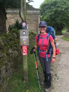
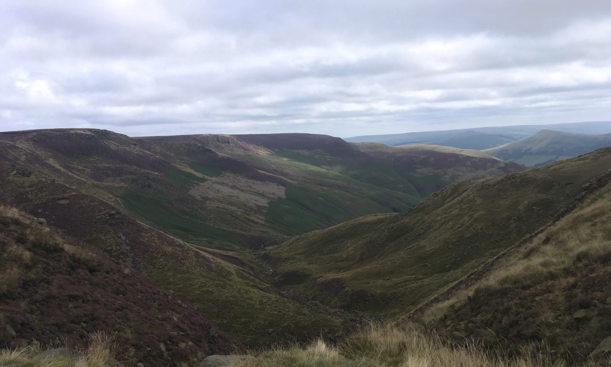
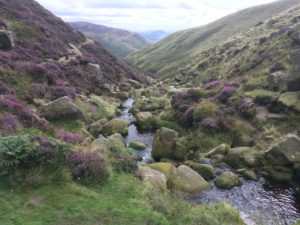
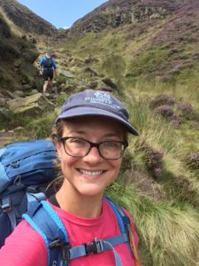
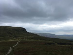
From Edale we took the alternative start to the route (it used to be the main route, with the current main route being the poor weather alternative, before increasing numbers of walkers made the route unsustainable) which climbs up Grinds Brook to the escarpment, which it then follows before meeting up with the main path at Kinder Low. It’s a route I never would have known to take if it wasn’t for Dave’s local knowledge, and oh my goodness what a pretty route! The path follows the brook up an ever steepening little valley, at times the brook joining the path (cue the first mud of the day), picking around boulders and rocks and ending up with some steep scrambles to get up to the escarpment. And the heather! It is so beautiful at the moment and smells gorgeous, almost like a gentle waft of honey. The sun was peeking out and the purple of the heather, green of the scrub, black and white of the water against the blue and white sky was too pretty for words. Above us were dramatic cliffs and behind us our little valley (“clough” up here) stretched down and rolled away to expansive views out to the southern part of the Peak District. It was a tough climb, especially with my backpack, but I felt strong and fit and I couldn’t stop smiling! I got to the top with muddy hands, a grazed knee, burning thighs and a massive sense of elation!
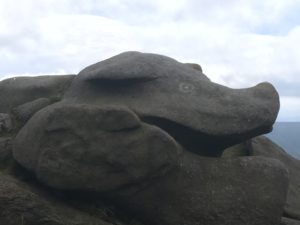
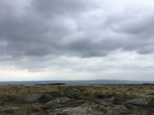
Once at the top the views out west were incredible and I could see Rushup Edge from where I’d descended into the Edale valley yesterday and beyond to the hills of Lyme Park. The path passed many weird and wonderful rock formations, one like a flying saucer, one like a pig’s head and many more just round and smooth and tall. I saw my first real peat and boggy ground of the day, although thankfully there was a route around the worst of the boggy bits!
When we reached the trig point at Kinder Low it was time to say goodbye to Dave and Wally and head out on my own. The path, although not always obvious, was fairly easy to follow as it hugs the edge of the escarpment for several miles. I crossed Kinder Downfall easily, the waterfall being rather unimpressive at the moment because we haven’t had much rain.
I passed a few day hikers along this section and chatted to a guy called Stuart who is doing the whole of the Pennine Way, but once I’d dropped down from the escarpment and then back up to the lower, rounded summit of New Mills I didn’t see a soul!
Day one used to be an incredibly boggy day and this was one of the worst stretches. A few years back, to try to slow the damage to the peat and heather, authorities laid massive flagstones in the bog to make a clear and firm path. The flagstone paths are controversial – some think they ruin the look of the moor and make the walk too easy – but looking at the bogs either side I was rather glad of them! I would have been knee deep for a good mile or so! They also protect the delicate peat and heather from severe erosion from countless trampling feet, which in turn helps the heather regenerate and makes for a much prettier and healthier moor.
The winding flagstone path from New Mills to Featherbed Moss and then the Snake Pass Road seemed to go on forever! With no real landmarks there was little by which to judge the distance. It was wide open, lonely walking and I can only imagine how demoralising that stretch would have been before the flagstones, squelching through the bog, and even these days, in poor weather. The sign at Snake Pass pointed back 2.5 miles. Wow, it wasn’t just an illusion – it really was quite a long way!
There were a few cars parked at the side of the road here, a couple of families on an afternoon stroll, but after I’d passed them, heading up the long, rocky, twisty path up to Bleaklow Head, I didn’t see another person for hours. The views back across to the Kinder escarpment were great and really gave me a sense of how far I’d come, but soon the views disappeared as I followed what looked like semi-dried out river beds winding amongst the deep peat, often criss crossing little streams as they ran along the path. At one point I surprised what I think must have been a large water vole and he dive bombed into the stream. He quickly realised he wasn’t particularly well hidden though (he had dived into a rather shallow section) so he scuttled on and found a deeper section of stream a bit further on! The path continued to twist about and it was quite disorienting. At times I would start to wonder if I had lost the path, and it was quite eerie with no other people around and very limited view because of the deep banks, but every now and then there would be a well-placed way marker etched onto a rock, or the reassuring sign of multiple bootprints in the mud. I was getting low on water so I was glad to reach running streams (on the moor it is mainly standing water which really is not very appealing, even with a water filter!) but when I got my water filter out it wasn’t working. Completely blocked! Nooo! Not only disappointing given I’ve only used it once, but also incredibly bad timing given that I still had about 5 miles to go with virtually no water. Eek!
Eventually the path opened out onto Bleaklow Head which is a very rounded hill top and not the highest in the area, but as bleak as the name suggests. I was incredibly glad of some way markers here as the path was indistinct and I didn’t particularly feel like having to navigate my way off the hill through heather and bogs on compass alone! The maps are a bit deceptive because once you get to Bleaklow it feels like it should be a short drop down and you’re done, but it’s actually quite a gradual descent at first, working your way along a stream that gradually cuts deeper and deeper down the hillside. The path was indistinct here and I lost it at first so ended up trampling through heather and soft peat, but thankfully I knew I had to follow parallel to the stream dropping ever deeper into the clough below. As the stream dropped right down far beneath me I re-found the path again (phew), following it around the ‘headland’ of the hill, it seeming to stretch on forever! Other than a couple of sheep and the occasional grouse startling from the heather with its amusing clacking and whirring call (it sounds like a cross between a duck quacking and someone saying ‘go back go back go back’!) it was lonely and silent up there, albeit incredibly beautiful with the heather and tumbling streams!
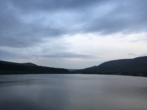
Eventually a corner of the reservoir comes into view, and gradually more and more of it opens up in front and finally the end is in sight. It was a steep descent down to the water and my knees were really starting to feel it. I was very much looking forward to a drink and some dinner! Thankfully Dave had warned me that it is still quite a trek from reaching the reservoir to the campsite, not helped by me missing the path that would take me over the dam and probably adding half a mile to my journey, so I just got my head down and plodded along as quickly as I could. I paused briefly to admire the silvery shimmer of the water in the fading evening light, with the high hills rising steeply behind it. You certainly get a feel for how far you’ve come down, when you look back up!
Just before 9pm I finally trudged into the campsite, just as it was starting to drizzle (I can’t really complain – the rain was supposed to start at 5!) and saw Stuart who had been keeping an eye out to check I arrived safely. A friendly woman in a neighbouring caravan came and offered me a cup of tea and biscuits which I gladly accepted as I quickly worked to get the tent up before it started raining more heavily. The main issue though – the midges! Ugh they were horrible and everywhere, and what with them and the drizzle as soon as my dinner was cooked I retreated to my tent and ate inside with the door zipped up. A few still made it in and I now have little but irritating bites around my ankles and hands, little buggers! Still, I’m here, I’m safe, I’m warm and dry and I’ve had a stonking day! No phone signal, so I’m doing exactly what I need to do and heading to sleep!