Orcadian adventures

Bloody Orkney

This bloody town’s a bloody cuss
No bloody trains, no bloody bus
And no one cares for bloody us
In bloody Orkney.

The bloody roads are bloody bad
The bloody folks are bloody mad
They’d make the brightest bloody sad

In bloody Orkney.

Oh bloody clouds, and bloody rains
No bloody kerbs, no bloody drains

The Council’s got no bloody brains
In bloody Orkney.

Everything’s so bloody dear
A bloody bob, for a bloody beer

And is it good? no bloody fear
In bloody Orkney.

No bloody sport, no bloody games
No bloody fun, the bloody dames

Won’t even give their bloody names
In bloody Orkney.

Best bloody place is bloody bed
With bloody ice on bloody head
You might as well be bloody dead
In bloody Orkney.

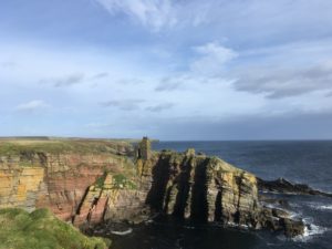
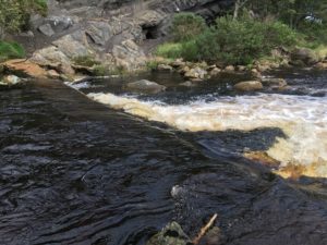
Well, I have to say that whilst it makes me chuckle, I think it’s a little harsh! I loved Orkney! Yes, it’s a little remote, a little bleak, but it is also incredibly beautiful, fascinating and friendly.

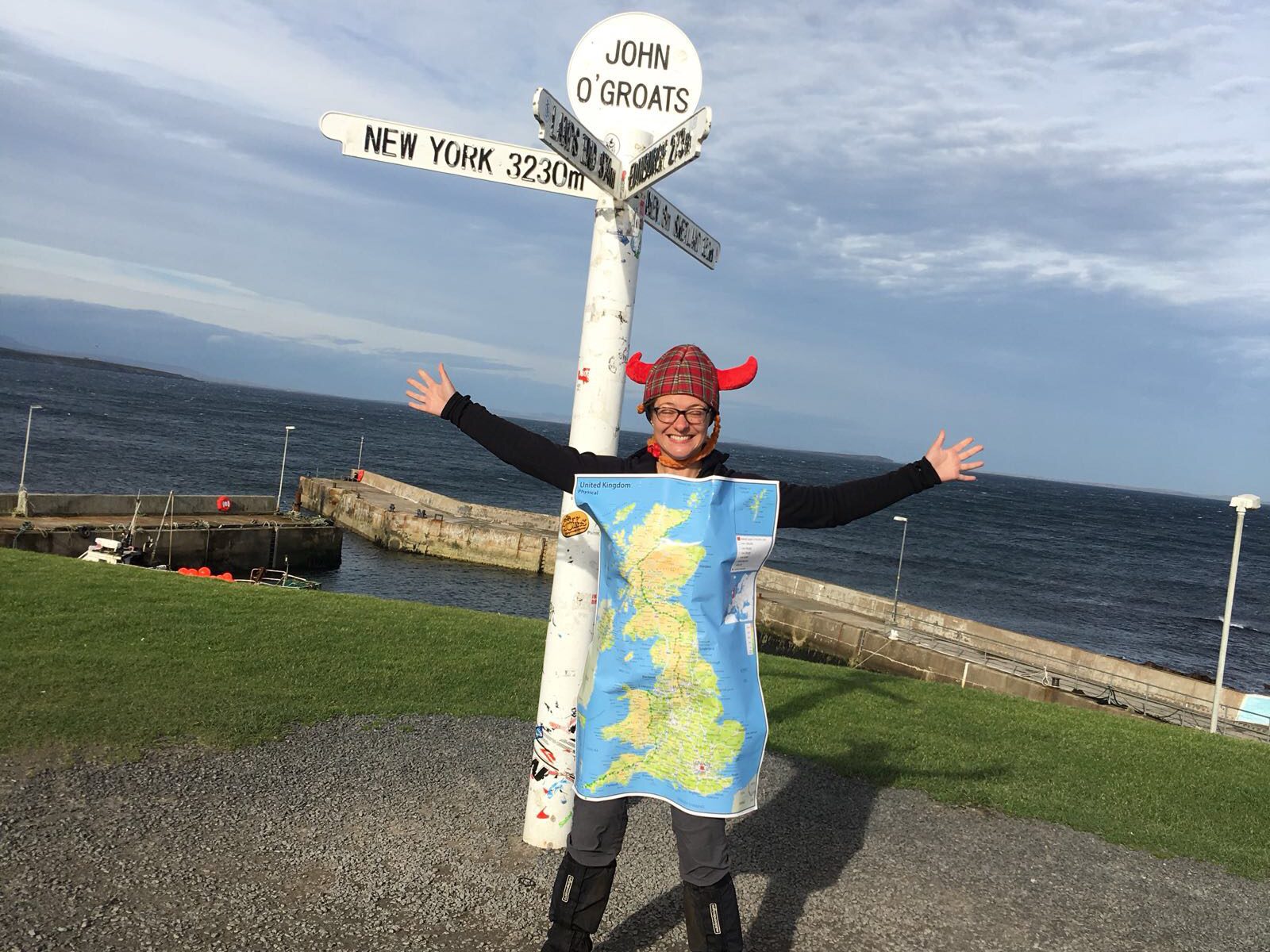
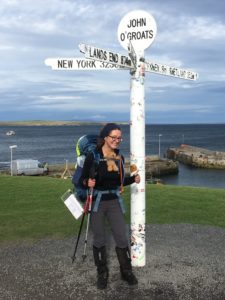
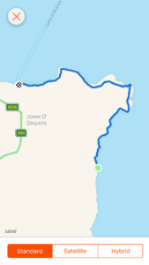
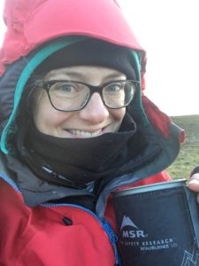
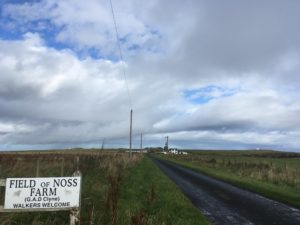
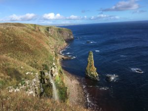
As you’ll know if you’ve been reading my blog for a while, I took the decision to take a little trip to Orkney once I reached John O’Groats. I knew that going home too quickly would be a little too much of a shock to the system, and it seemed a crime to be so close to these intriguing islands and not pop across to explore. My plan was to do a mixture of sightseeing (Orkney is famous for its history, right through from the Neolithic to Viking to World War periods) and relaxing, so I’d planned a day on the mainland at either side of my trip and then three nights on one of the most north-easterly of the islands, Sanday, to rest, read, write and take walks along its famous beaches. Definitely needed!

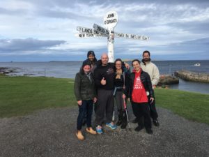
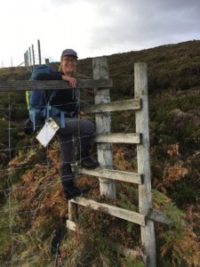
The ferry to St. Margaret’s Hope only took an hour and I had the company of Paul, my lovely next door neighbour who was one of the crazy friends who drove up to meet me at John O’Groats. It was really nice to have the company, it helped to have someone to babble away at! I’m not sure how many times he had to put up with me shaking my head in amazement and saying “I can’t believe I did that”, but he was very patient! It was also great to have someone to share the first few tastes of Orkney life with. Walking (yes, walking…!) from the ferry towards the little village we were staying in that night, only about half a mile, a friendly man pulled up and offered us a lift. For the first time in the entire journey I could say yes!!

When we reached our home for the night – a quaint little pub – we were shown to our simple rooms and then headed down to the quiet restaurant. There was only one other pair eating there but the bar itself was pleasantly busy with locals and I got a sense of the community spirit that still exists here but has been lost in so many village pubs back home. Once again I was glad that Paul was with me so I wasn’t drinking my celebratory glass of wine alone! The friendly waitress came over and apologised that the chef had gone home sick but that if we wanted food (er, yes!) there were a few dishes she could make herself. Thankfully, we both fancied something simple, so it worked out perfectly (and I think she gave us extra large portions, judging by the size!) and I have to admit the wine went down very well. After the buzz of the day I went to bed exhausted, still not believing that my walk had come to an end.

The next morning we were down at breakfast at the specified time, to find the lights off and nobody around. Our table was laid and the cereals etc were out, but no milk, butter etc. Once again very pleased to have each other’s company, we wondered if we had been forgotten, then Paul suggested that maybe the chef was still off sick. Ahh, that would be it! Ever enterprising, and figuring that they wouldn’t mind (they seem quite relaxed, these Orkney folk) we headed into the kitchen and helped ourselves to milk, butter and the kettle. I made tea, Paul made toast, and sitting down to our breakfast we chuckled about having to survive in “the wild”. And then, to our slight embarrassment, in walks the owner, ready to make our breakfast! Oops! We sheepishly admitted we’d helped ourselves, and I couldn’t decipher whether she was half amused, pleased, surprised or just still half asleep! Either way, she cooked me some lovely scrambled eggs which complemented my makeshift breakfast perfectly.

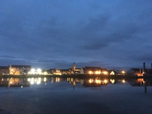
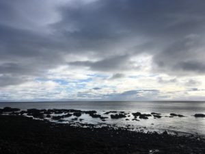
We headed out to catch the bus to Kirkwall, the main town on Orkney. Oh, one thing I learned very quickly, it is most definitely “Orkney”, not “The Orkneys”. That’s one way to get a glare from a true Orcadian! Well, maybe not a glare. Perhaps a mildly exasperated but patient sigh… I still haven’t worked out whether you are “in” Orkney or “on” Orkney though… Anyway, there is a surprisingly good bus service in/on Orkney. The buses are frequent, clean, efficient and, the best thing, they tie up with other forms of public transport! The buses actually meet the ferries. I swear the rest of the country could learn something from them! The other thing I love is that you can hail a bus from anywhere, as long as it’s safe (except in Kirkwall where there are designated bus stops). You just stand by the road and wave! Our chosen bus-waving spot was just by the bay and we gazed out over the perfectly calm water, breathing in the beautifully fresh, clean air. A storm was supposed to hit later but right now, amidst this stillness, it was hard to imagine!

The calm before the storm?

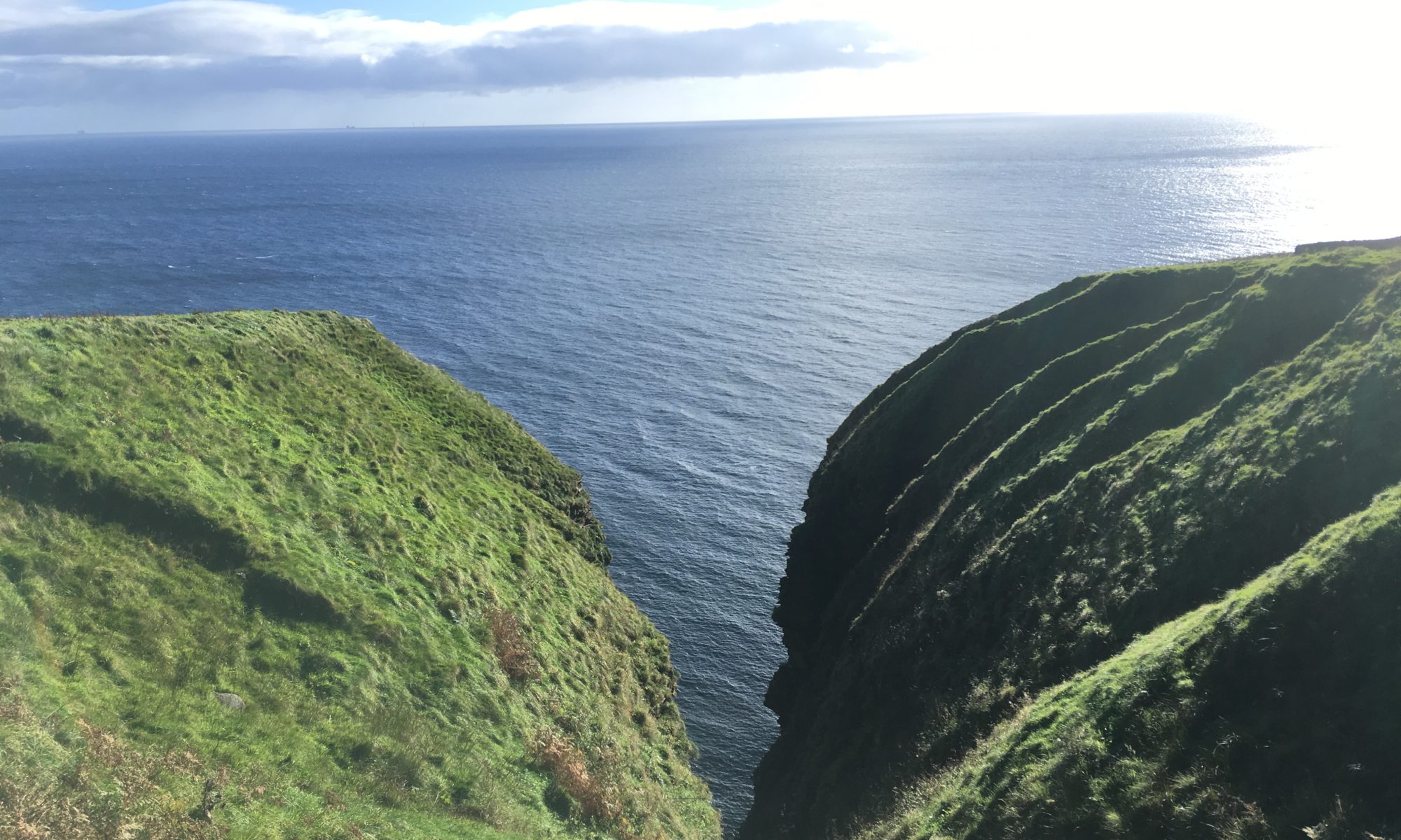
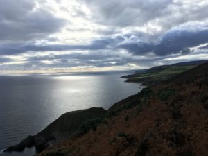
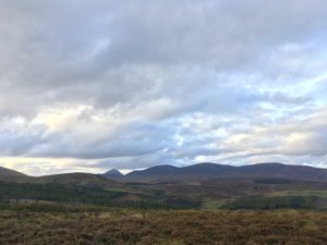
The journey to Kirkwall was probably the most scenic 30 minute bus trip I have ever taken. Sea every which way, little beaches and the outline of other islands and the hills of Hoy on the horizon. The island of South Ronaldsay (where we stayed the previous night) is linked to mainland Orkney (and a couple of tiny islands in between) by four causeways built at Churchill’s command during the war, to prevent German submarines entering Scapa Flow where the British naval fleet was based. The causeways now provide a very useful road transport link!

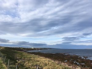
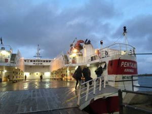
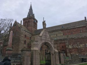
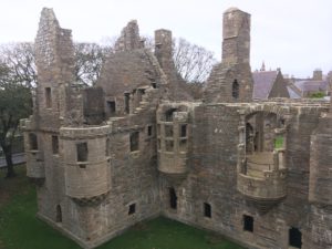
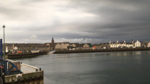
Arriving into Kirkwall we were surprised at how big it was. Part of me had expected a small-ish town and although it certainly wasn’t massive, it was definitely much more than a couple of houses, a ferry terminal and a corner shop! I was first struck by the exciting-looking new hospital being built on the edge of town (coolly doughnut-shaped) and then by the big Tesco and Lidl stores side by side near the bus station. But the best bit for us was wandering around the stunning cathedral, the ruined Bishop’s and Earl’s palaces and the fascinating Orkney Museum which was a treasure trove of artefacts and information right back from Neolithic times (c.5000 years ago) through to the modern day. We were so absorbed we nearly lost track of time and suddenly realised we didn’t have long before our respective ferries were due! Paul was heading back to mainland Scotland and I was headed to Sanday, an hour and a half’s ferry ride away.

St. Magnus Cathedral in Kirkwall
The Earl’s Palace

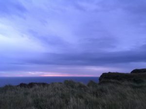
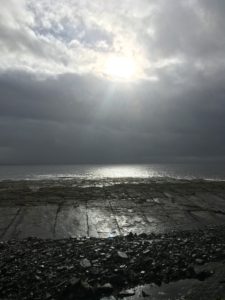
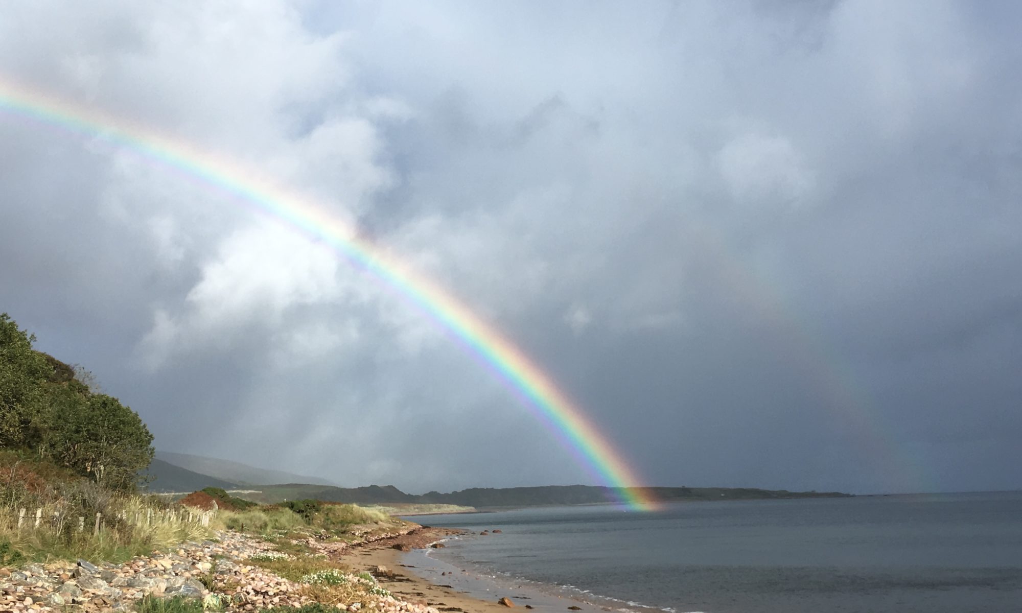
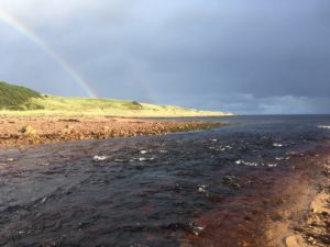
I was relieved that the ferry was still running – Ex-Ophelia (the remains of the hurricane headed over from the US) was due to pass through later in the evening and there was a possibility some of the sailings might have been cancelled or brought forward. I was also glad I wasn’t going to be camping through the storm! The ferry pulled out of Kirkwall just before 3:30pm but already the sky seemed to be darkening, the automatic street lights flickering on. I knew we were fairly far north but it seemed a little early for night to be falling! It soon became apparent that it wasn’t nightfall – the eerie dusky-grey-yellow haze in the sky was the brewing of a brilliant storm. The colour was down to the hurricane blowing Saharan sand up into the atmosphere, but the whole sky and air had a feeling of bated breath, anticipation, the build up of Nature’s energy.

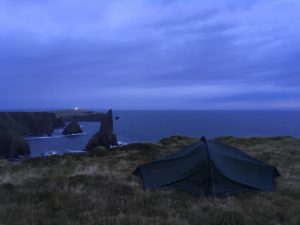
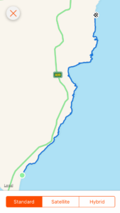
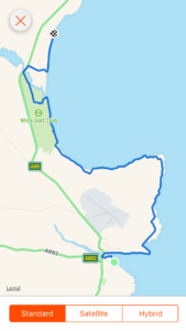
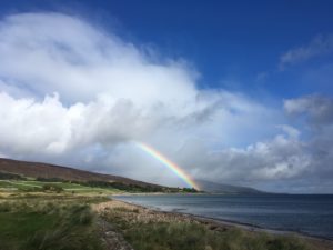
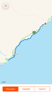
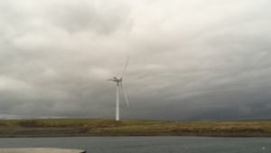
As the ferry pulled into the dock and I jumped onto the Sanday bus (a community-run minibus/taxi service) the five wind turbines on the south-eastern end of the island loomed out of the moody sky, tall, graceful, stark. A vital source of energy for the island, which although connected to the National Grid, sells electricity back to it! There were a couple of other islanders on the bus and I was the last to be dropped off so I had quite a tour of the island. It is only 16 miles long, and narrow, with a bit sticking out which makes it look like a chunky, upside down T on the map. The bus driver acted as my guide, pointing out some of the interesting features we passed, including the huge sand dunes at Cata Sand and the main village, Lady, with its community centre, heritage centre and shop. Across the flat, open space of the island, and its countless beaches and rolling surf, the sky was glorious, and it wasn’t long before the storm broke. Retina-burningly bright flashes of lightning lit the sky, followed by the searing crack of thunder and its growling rumble fading away into the distance. The air was perfectly, breath-holding-ly still in between flashes but as we watched out for the next we could all feel the quiver of energy, the anticipation and excitement that comes with such a storm. I made it to my home for the next three nights just before the rain came. Proper, stormy rain. The type of rain that falls in heavy sheets and makes you call any other rain shower you’ve experienced in the past a mere drizzle. The type of rain that is made for curling up on the sofa with a cup of tea while you listen to it pounding out its tune on the roof. And then came the wind. Gusting, gale force winds, throwing the rain in hellbent splatters at the window. I hugged my tea a little closer and once again thanked goodness that I wasn’t camping!

Leaving Kirkwall as the storm begins to brew
One of Sanday’s turbines against a broody sky

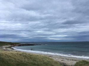
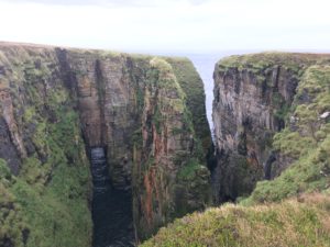
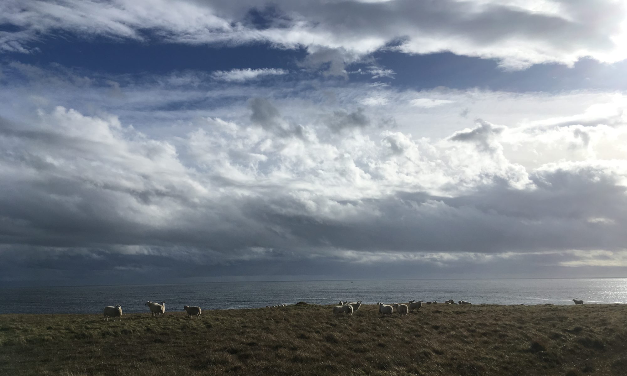
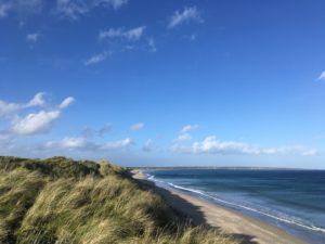
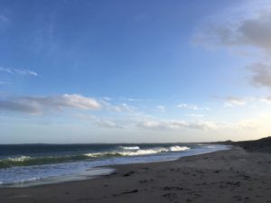
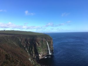
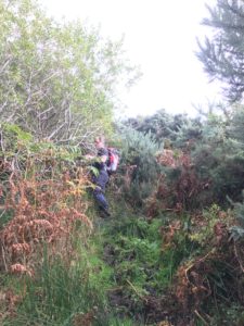
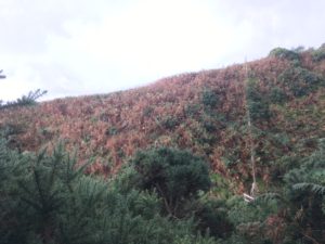
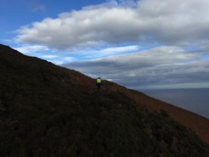
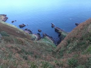
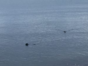
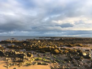
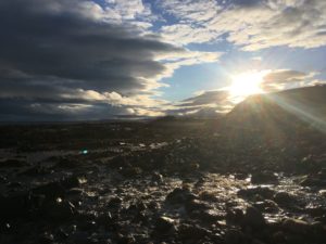
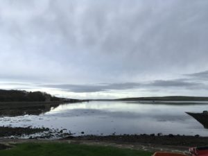
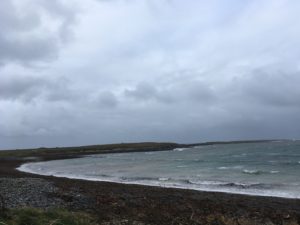
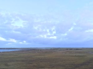
The next three days were spent pretty much as I had planned. I had lie-ins and drank tea in bed while writing and brainstorming about what I’d learned from my journey, what I was going to do when I got home, where I wanted to focus my business. I went for gentle strolls along the beach and noticed how it changed each day and in different light. The first morning the winds made it hard to stand, to walk, to breathe. The sea was whipped up into a boiling frenzy of waves and foam, the only real visual indication of the wind’s force given the absence of trees (they were all cut down for wood thousands of years ago and never replanted), and the few birds who braved the ex-hurricane fought to fly in a straight line. It was exhilarating! I had wrapped up in multiple layers, hats and gloves and was toasty warm but the wind made my eyes and nose stream. I walked around the bay and up to a cairn on a little peninsula where the tumultuous sea spread out all around me, the waves from the east crashing on rocks below, the water in the bay behind me slightly more sheltered. The water of the loch behind the house was choppy but provided some shelter for ducks, sea birds and swans. All around was space. A handful of buildings huddled down against the weather, small farms dotted around the landscape, but all else was just water, land and sky. It was wild and glorious! I had only walked about half a mile, the weather and my tired legs deterred me from going too far, but I didn’t need to. Wilderness and space was right here on the doorstep! As I retraced my steps to the house a few seals popped their heads up out of the water, curiosity beating their desire to shelter out of the storm down below the waves. Orkney has 15% of the world’s population of grey seals and a large number of them make their home on Sanday’s beaches. They’d even had their first seal pup of the season just before I arrived. Jo my host showed it to me, fluffy and white, on the Sanday seal cam.

The bay just outside the door!
Sunset after the storm

My hosts were very generous and as I didn’t have a car with me they took me on a tour of the island and ran me to the two shops on the island to pick up some food. These shops were awesome! Considering how small they were they had absolutely everything you could need. They even had a decent selection of gluten free items and dairy free milk! Jeff was explaining that the shops basically stocked whatever people wanted and anything they didn’t stock they could usually get hold of. Sometimes you just needed to be a bit organised and remember to ask for it a few days in advance (something most of us don’t do much of these days, with everything on demand). But then life here is much slower, much more laid back, and time isn’t so much of an issue. What did surprise me at first was that Jo and Jeff have only been back to the mainland twice in the four years they’ve been living in Orkney. Once for Jo’s daughter’s wedding and once for a hospital appointment in Aberdeen (a three day round trip for one appointment!). They even don’t go over to mainland Orkney all that often, as they can get hold of pretty much everything they need on Sanday, and even a trip to Kirkwall involves carefully planning around the two ferries a day and often can result in needing to spend a night “in town”. At first I thought this must leave them feeling incredibly isolated, but it’s actually the opposite. The islanders are friendly and involved. They all chip in, they all help each other out. There is a thriving school and lots of community activities. I expected an island with a population of 500 to be insular, old fashioned, sleepy, but although it is certainly quiet and peaceful (don’t go there if you’re looking for a Chinese takeout or a cinema etc), and it is old fashioned in its values and behaviour (nobody locks their door and keys are left in car ignitions because the ferry owners would immediately notice if a stranger was driving somebody else’s car), it was incredibly open, welcoming, and progressive. My hosts’ next door neighbour recently married his boyfriend and they are both going to be living on the island. Amazing! Other random facts include drivers not needing a drivers licence on the island – they can drive on a provisional licence indefinitely provided they don’t leave the island, and similarly cars don’t need at MOT, because there isn’t a garage to test them!

Sadly not all the islands are thriving quite so much. I didn’t visit any others (it’s quite an epic and logistically challenging trip to island hop unless you take the plane) but I learned in particular of little North Ronaldsay, the most northerly of the islands (and famous for its seaweed-eating sheep!), which has a population of just 65 and their last child just left school. But I really hope Sanday continues to thrive as it is a beautiful place. I don’t feel I really did its beaches, nature or history justice, but it definitely gave me what I needed – peace, space and time to relax and think.

All too soon it was time to return to mainland Orkney and the minibus and ferry journey was repeated in reverse. I loved listening to the thick Orcadian accents of the locals chatting on the bus. I had to really listen hard to understand what they were saying, especially as they kindly included me in their conversation! The light was fading as the bus dropped down the only hill on Sanday towards the ferry dock, just as the ferry was approaching the island, its lights shining brightly out of the dusky gloom. Once on the ferry I watched Sanday slowly shrink and disappear into the twilight until only the froth-topped waves trailing behind the ship were visible. The trip back to Kirkwall took a little longer than the outward journey as this time the ferry stopped off at Eday, another of Orkney’s islands, dropping off and picking up a handful of passengers and cars.

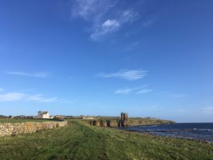
It felt strange to be back in Kirkwall again, I guess on reflection it’s the only place on this trip that I’ve actually returned to. It also seemed quite big and bustling after the peace of Sanday. I had to remind myself I was still on a relatively remote island! The supermarkets were useful but seemed excessive in their stock – after all, those little island shops had pretty much everything anyone needed, so what else was filling all these shelves?! The choice was almost overwhelming, but I picked up a few things to cook for dinner and to eat for lunch the next day and escaped as quickly as I could. I was fortunate to have a room to myself at the hostel but there were some people in the living room who were nice to chat to, and I realised that this was effectively the last night of my trip before I started heading home, which was a weird realisation! I had one day left of exploring the island and then it was the night ferry to Aberdeen and then gradually making the homeward trip from there.

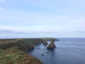
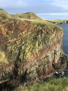
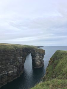
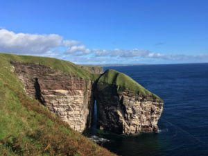
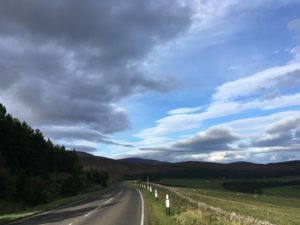
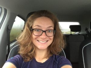
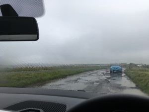
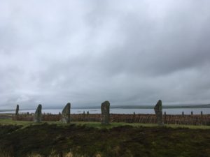
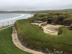
For my last day I had decided to hire a car so I could explore properly (public transport is brilliant for getting around the island but not for sightseeing). I suddenly realised when I sat in the car that I hadn’t driven for nearly 4 months…eek! Thankfully it really is like riding a bike and the roads are quiet and decent, so I quickly relaxed and enjoyed the new form of transport. It was quite refreshing to be able to pootle about and not have to think about carrying all my stuff, or how far anything was! Even so, there is a huge amount to see on such a tiny island and I had to choose my sights carefully. I settled on heading to the Stones of Stenness, the Ring of Brodgar (both incredible Stone Age standing stone circles, pre-dating Stonehenge), Scara Brae (Orkney’s most famous site, an incredibly well-preserved stone-age village), Mar Wick (a beautiful bay full of sea birds and a prominent headland), and Maeshowe (a spectacular chambered cairn).

A new mode of transport…
Rainy rainy day

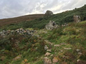
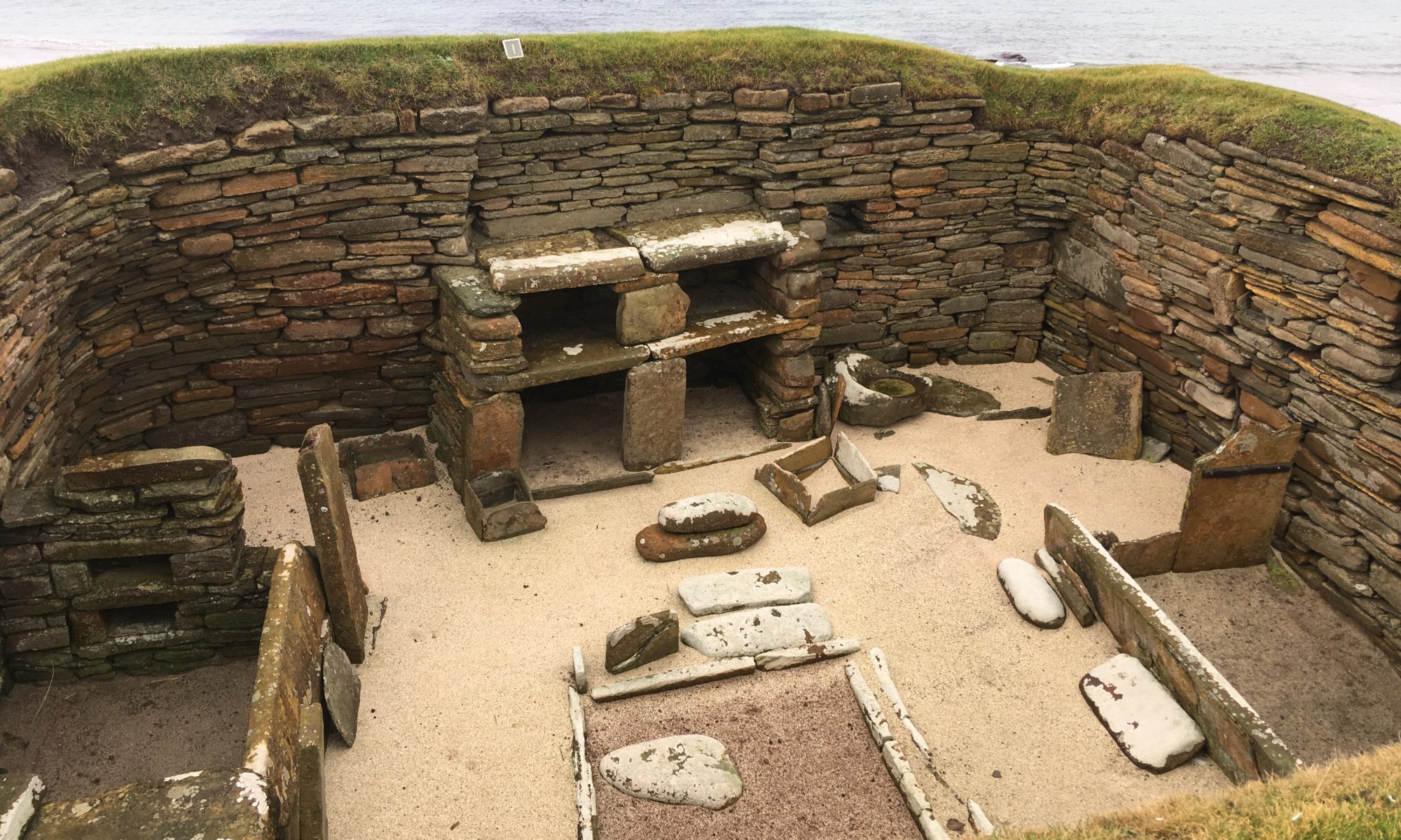
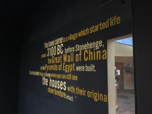
All were fascinating. Only a handful of stones remain at Stenness but they are huge and intriguing. The Ring of Brodgar, just up the road, is much more complete and stands on a slight rise overlooking two lochs and the hills in the distance. It is incredible to think that these enormous stones were erected 5000 years ago. To think that there were organised communities living all that time ago. Living, working, farming, socialising, worshipping. And yet we only know fragments about their lives. I suppose it is remarkable just how much we do know, but so much has to be left to the imagination. Scara Brae gives us more of an idea. It is a village of houses built out of stone partially (and purposefully) buried in earth mounds, joined together by narrow passageways. The village was only discovered in the 19th century when a massive storm blew away the sand that had covered the village for thousands of years. The village itself is tiny but there is a fascinating exhibition explaining what is known about the village and the people who lived there, with artefacts discovered during the excavations such as whale bone jewellery, cattle bone and stone tools, crude pots and flint arrowheads. There is a reconstruction of what a complete house would have been like that you can walk into. I was blown away, and still can’t get my head around that there were people living in peace and civilisation all that time ago. What on earth happened in the thousands of years in between?!

The fascinating Ring of Brodgar
Exhibition at Scara Brae
Scara Brae

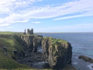
After a brief trip to sleepy Stromness, the second town on the mainland (which was very beautiful and I wish I’d had more time to explore), my final visit of my day was to Maeshowe, a magnificent chambered cairn. Visits are by guided tour only but I was the only person on my tour (one of the benefits of visiting in shoulder season!) so I had the knowledgable guide, and the chamber, all to myself. From the outside it just looks like a big grassy mound, with sheep nonchalantly grazing on and around it, unaware of the historical and anthropological significance of the ground beneath their feet. The entrance to the main chamber is through a long, low and narrow entrance “hallway”, and you need to crouch right down to walk along it. The main chamber itself is very tall, cathedral like, but not large. Massive stone pillars form the corners but they are not thought to be structurally important (one theory is that they were erected before the cairn itself was built) and there are three small chambers off the main chamber. The purpose of the cairn is a mystery but it is thought that it had some relevance to worship and was potentially (but probably not exclusively) used for burials. Its position is significant – at sunset on the winter equinox the sun shines directly up the entrance passage and lights up the wall of the back chamber. But perhaps the most fascinating thing to see in the cairn comes from a later period in history. Sometime in the 12th century Vikings broke into the cairn and sheltered there from a fierce snow storm for 3 days. The graffiti they carved into the walls is the largest collection of Viking runes outside of Scandinavia, and it’s fascinating! Most of them say something mundane along the lines of “Frank carved these runes” (the Viking equivalent of “Frank was here”), but the inscriptions give an indication of the pride the vikings (both male and female) took in their rune carving. One boasted that “the finest rune carver west of the sea carved these runes”!

The waterfront at Stromness

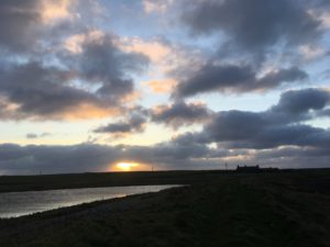
I headed back to Kirkwall feeling that I’d barely scratched the surface of this fascinating island but so glad that I had come at all. It was a satisfying end to the trip and the sky treated me to a beautiful sunset to round the day off. I sat by a little lake, “the Peerie Sea”, in Kirkwall as the light faded from the sky and was replaced by the orange glow of street lights. I was sad to be leaving, but it seemed right too. I felt ready to start the journey home.

Night falls over Kirkwall. A beautiful view to finish off my trip!

Day 103: The Stacks of Duncansby to John O’Groats

Total miles: 3.6
Elevation gain: 614 ft
Time walking: 10am – 11:15am
Miles to date: 1,398.8

I did it! My 1,400 mile journey has come to an end and I can’t quite believe it is over. After the highs and lows and aches and pains along the way, today I felt fairly calm. It seemed right that this journey was coming to its end but I couldn’t quite work exactly how I felt.

I woke with a mixed sense of excitement, nervousness, sadness and relief. I say “woke” but I didn’t really sleep much at all. From excitement, you might think, but in fact it was because the winds picked up overnight and not only was it incredibly noisy with the wind flapping my tent but I was genuinely worried that I might actually get blown off the cliff into the sea! I have never seen or heard my tent get as battered as it did last night and was terrified that this would be its end, after all its faithful protection along the way. I was envisaging ripped canvas and broken tent poles but in the dark of the night, in raging winds, on the edge of a cliff, there was nothing I could do but sit tight and question the common sense of camping on a clifftop hill exposed to the weather of the bleak north and east.

At some point I must have finally dropped off for a while as I was woken by pain deep in my hips and glutes (a near-nightly occurrence – they regularly seize up when I’m asleep). The contrast in the weather was eerie, everything had gone still and the night was now beautifully calm. I could have cried with relief! It was still dark and I slept on and off as I rolled over time and time again in an attempt to ease my cramping muscles, listening to the wind gradually growing in strength again but thankfully not quite to the ferocity of the middle of the night. Bit by bit it began to get light and I poked my head out to see if there was a pretty sunrise. In front of me the Stacks of Duncansby loomed out of the half-light and to the south east the small golden red patch of clouds indicated where the sun would come up. It wasn’t a spectacular sunrise, but it was pretty, and I wrapped up warm and climbed out of the tent to take it in. I was amazed at how stiff I was this morning. I’m always more stiff after camping but it was as if my body knew that this was it, the last time it would have to get up and walk on this trip.

Sunrise

It wasn’t quite as peaceful as it looked, what with the tent flapping around madly, but as I grew in confidence that it wasn’t about to blow away I was able to relax and enjoy my final morning. I wasn’t in too much of a rush as I was timing my arrival for when Eunice and the minibus gang were due to arrive. I took my time drinking my tea and eating my lovely warm porridge, trying to let it sink in that this was the end. I was so grateful that once again it wasn’t raining. It had rained heavily overnight, on top of the wind, but the tent had been blown bone dry and the sky was clearing. Not bad, considering originally it was supposed to rain heavily all day! I gave one last thankful prayer to the weather gods and packed up everything in my bag except the tent, a skill learned in the rain but useful now in the wind, and contemplated how on earth I would manage to get the tent down without it blowing away! In the end I took the pole out before any of the pegs and sat on the canvas, taking one peg out at a time and rolling it up roughly. It still managed to fan out like a kite and I could feel the power of the wind. Don’t let go!! I rolled the tent up rather haphazardly but managed to get it down, only losing a couple of repair patches from the bag in the process. One was bright yellow and I watched it flutter off into the wind over the cliff, soaring up above the waves. Ah well, hopefully I won’t be needing those!

The Stacks of Duncansby at dawn, and my tent doing its best to not get flattened by the wind!

And then, it was time to make a move. This was it, the final leg. Only a few miles, barely time to warm up. My feet were quite painful to start with and I wondered whether I’d be hobbling to the finish line but thankfully they did ease a little. The view of course was stunning. The waves were crashing around the base of the iconic stacks and the craggy cliffs were just as striking and interesting as they had been along the rest of the coast. My first goal was the lighthouse on Duncansby Head, whose light I had been watching flash over me steadily through the night, marking the most north-easterly point on mainland Great Britain. I passed several people, the most people I’d seen in weeks, out to take photos of the famous sight. Reaching the lighthouse felt strange. You can’t actually get right up to it, so you can’t actually stand on the very most north-easterly point, but I stood as far as I could go, gazing out to sea with only the outer Orkney isles in sight.

I’d like to say I was overwhelmed by the sense of achievement at how far I’d walked, lost to know I’d run out of land to walk on and flooded with relief that I was done. But it just felt surreal! I have grown so accustomed to walking every day that to walk a bit further just seems natural. My backpack, although heavy and now causing some pain, is a part of me and my journey, and this was just another day. Part of me almost wished that I had reached this point limping and practically crawling, so that it felt like more of a momentous occasion! Don’t get me wrong, I did feel an incredible sense of pride and achievement, I just took it all rather more calmly than I thought I might! I think having spent the evening before with the end point in sight, having time to reflect and come to terms with the fact that this was the end, had prepared me somewhat.

Duncansby Lighthouse
I ran out of land to walk on!

Even so, it wasn’t quite the end just yet! I still had the mile or two to walk to John O’Groats itself, the last little bit of the John O’Groats Trail along the coast. The trail skirts the lovely Bay of Sannick, a sandy beach where seals bob idly in the water watching passers-by with curious faces, then the grassy headland of Ness of Duncansby where the famous Seaview Hotel of John O’Groats finally comes into view. At that point I felt a quiver of excitement – that really was the end point, and my friends were waiting. I scanned the coastline to see if I could spot them but they were too far away, too small. It occurred to me that they would be doing the same for me and I perhaps should have worn something more visible – I was in my usual black and grey! A family on the headland stopped to chat, asking when I had finished, amazed when I told them this was me finishing now! My pace quickened as the path turned towards the finish line, now eager just to be done and to give my friends a big hug, to lose my bag – my rib giving me particularly bad pain.

The Bay of Sannick
The Seaview Hotel in the distance

That last half mile seemed to go on forever! The path turned to gravel, there were a couple of gates and then, there they were, waving at me! From the wrong side of the fence! It was actually me who was on the wrong side, somehow, but I wasn’t going to let one final barbed wire fence get the better of me! I hopped over easily and finally got my big hugs. Still not at the end though…a final 100 metres to get to that iconic finishing point – the final signpost. I was there. I’d actually done it!

I had to wait a few moments for some motorcyclists to finish having their photo taken. Gosh, I wonder how long it took them to ride up?! 😉 They shook my hand in amazement when they realised I’d walked the whole way, over three and a half months! And finally, it was my turn. There at the finish line, and a big round of applause from not only my friends but everybody else that was nearby. Cue happy dance!

Made it!
Crazy bunch of people!

Someone offered to take my bag for me and suddenly I didn’t want to take it off! I realised that this really was the end, and although my travels would be continuing for a few days longer, me and my bag, somehow taking it off now was incredibly symbolic! But off it came and my shoulders breathed a sigh of relief. I walked more lightly without it, but felt rather lost, almost naked, without it on my back. I’ve realised that my bag has become part of my identity – with it, it’s clear that I’m on some sort of long distance hike, without it, well, I’m just another person. And that will take some getting used to!

Another sign! And a crazy hat!
The final tally
“Aaand I would walk 500 miles…”

So me and six crazy friends – Eunice, Ken, Paul, Steve, Justin and Daddy Ken – who had driven up overnight in a minibus, went to find some obligatory souvenirs and a celebratory breakfast/brunch. We spent a few hours in that tiny place with an (un)surprising number of cafes, gift shops, craft shops etc (even a Christmas shop!), exploring the shops, taking photos next to the sign and the boulder sculptures and eating a ridiculous amount of ice cream (hey, I earned it!). And then it was time to head on. The crazy minibus crew had to turn around and drive all the way back again and I had to catch a ferry to Orkney. I was glad that I had something to look forward to. Whilst I was sad to say goodbye to my friends having only just seen them, I am glad to have given myself some space and time to reflect on it all before I return home to whatever the new normal will be.

Celebratory ice cream
The next adventure…by public transport this time!
KJ on the ferry to the Orkney Islands

And that is the end of my LEJOG adventure. I’m sure that you, like me, will feel like it has ended rather suddenly. I know that you have been along on this journey with me and I daresay we will all feel a little lost without it! But it won’t be the end of my blogs, there is still a lot to reflect on and write about over the coming days and weeks, perhaps longer, so do keep coming back to visit!

And finally, a thank you. To you for reading this, either as it happened or when it is long in the past, for all the wonderful messages of encouragement along the way. For everyone who believed in me, for everyone that helped me in some way along the way. It all mattered. Thank you xx

Day 102: Keiss to the Stacks of Duncansby

Total miles: 11.6
Elevation gain: 1,522 ft
Time walking: 9:45am – 5pm
Miles to date: 1,395.2

I am sitting outside my tent, wrapped up in multiple layers, with a spectacular view of the Stacks of Duncansby, and Duncansby Head just beyond. If you aren’t familiar with the geography of north east Scotland that basically means two things. Firstly, I am about 2.5 miles from my finishing point at John O’Groats. Secondly, that I have one of the most spectacular camping spots in the country! My incredible journey ends tomorrow morning when after 103 days and a fraction under 1,400 miles I finally reach that famous signpost at the very top of Great Britain.

Most of today felt surreal. I woke up to a beautiful morning, in a room overlooking the sea and the sunrise, and after a lovely breakfast Neil dropped me back at Keiss to start my penultimate leg and last full day of walking.

The morning’s path took me between the two Keiss castles, one old, one new, the old ruins standing tall against the blue sky beside the sea, the “new” castle (18th century) tucked back a little. More beautiful coastline, the cliffs gradually starting to get a little higher again. The rocks here are really blocky – almost like the gods have been playing a giant game of Tetris! I pass a large broch which looks like it had inner and outer walls and multiple outer buildings, and a strange broch-like monument built in honour of the man who first excavated the settlement. It’s amazing to think that people were living here well over 2000 years ago, tucked away among those walls!

Keiss castles, old and new

Some soggy walking alongside a pig farm was rewarded by the dramatic ruins of Bucholly Castle, perched high on what is virtually a sea stack, just the tiniest ridge of rock connecting it to the mainland. It was blustery, so I didn’t venture over for closer inspection! Around the next headland I have a great views of Freswick Bay, with Skirza (the last little settlement before John O’Groats) spread out in the middle and Freswick Castle at the southern end. My route past Freswick Castle took me through a large patch of nettles but thankfully Jay had warned me of these so I was ready to switch into scrub-bashing mode! Down onto the beach and then quickly back inland slightly to get across a burn that I couldn’t be bothered to ford. Back on the beach and then a bit of field walking. Thankfully the cows that had left cowpats and deep hoof marks were nowhere to be seen!

Bucholly Castle

The path drops down to the beach again below shallow cliffs where there are fantastic colours and interesting rocks, then up to a bench made out of boulders and pebbles overlooking the bay, a bench that Neil had made! I had reached my lunch stop.

Neil’s bench

It’s funny how I expected this section of the journey to be really remote and lonely – I’ve ended up making lots of friends in these parts! Neil made me a delicious lunch of homemade soup, chicken sandwich and a cup of tea, which was all much more civilised than I had expected for my last day! I didn’t dare stop too long as I didn’t trust myself to get going again, but Neil walked the next half mile with me which was nice.

The weather wasn’t so nice by the time I was rounding Skirza head and onto the home straight. It could definitely have been a lot worse though – it was dry at least – so I’m not complaining! Lost in my thoughts and carefully picking my way around a couple of narrow geos sudden movement ahead makes me jump. A young red deer skitters out of the dip in front of me and starts to run away along the cliff. He tries to jump the fence but fails, crashing into wire, sending it shivering. He panics, and bolts back towards me, passing me just a few metres away, scarily close the the cliff edge. He was so close I could see his patchy fur and the wild look in his eye. I watched him dash off and leap on his way over ditches and, more successfully this time, a fence or two. I’m amazed at how many deer I have seen in the last week. From resigning myself to perhaps not seeing any, to seeing deer most days! Just the one stag though. He was very special!

I could tell I was getting further away from civilisation as the fences eventually ran out and the path wandered along on open moorland with not a house in sight and dramatic cliffs below. I soon reach Wife Geo, one of the more famous geos on account of the stunning near-stack right in the middle and the through-cave in one of its sides. It was an impressive sight, too much to capture in a decent photo, but standing near the edge made me a little giddy (it is a particularly deep geo) and I continued a little further away from the edge. The path was distinctly visible here, a sign that despite being away from major settlements it was reasonably well used. Given the scenery, I’m not surprised, and it was pleasant to walk along a decent (if at times boggy!) path for a change. I still didn’t actually see anyone though!

Wife Geo

Ahead was a slight rise – the Hill of Crogodale. It was barely worth calling a hill really but it certainly deserves that title for the view it delivers. There is no higher ground between the Crogodale and the islands of Orkney, which meant that I had a clear view down to the Stacks of Duncansby, Duncansby Head, John O’Groats and the islands beyond. Tiny Stroma, the closest island, was clear and distinct, with the hills of Hoy shadowy in the background. South Ronaldsay, linked to the mainland, was also clear, and the tiny island of Muckle Skerry with its lighthouse over to the east, with nothing but wide open sea beyond.

Gosh, I could see my end point! And what an end point. I’ve only ever questioned my south-north choice once, and this afternoon, looking at that view, I was heartily glad I’d stuck with my decision. The Stacks of Duncansby are genuinely spectacular. I wondered whether they might be famous solely on account of their proximity to John O’Groats, but no, they are stunning. Tall, triangular, pointy, majestic. Combined with Duncansby Head and Orkney behind, sea all around, they make for a breathtaking sight and a fitting end to my journey.

The Stacks of Duncansby, with Duncansby Head beyond

I had one last challenge for the day – finding a dry, flat camping spot. I’d set my heart on camping overlooking the Stacks, so at least that narrowed my search slightly! It actually wasn’t as hard as I had thought it might be. There were a few flattish spots and a couple were even more or less dry. My spot is ever so slightly lumpy as there’s nowhere with just plain grass, but I have to say it is actually quite cosy – the lumps are fairly squashy so provide a bit of cushioning! The main plus point though: the view. I am sitting outside looking right at the stacks. I am so happy to be here. At first when we made the plan for me to get to John O’Groats sometime in the morning I wasn’t sure it would be a great idea – part of me just wanted to get in and finish at the end of the day. But now I’m in this spot I’m incredibly grateful at how it has worked out. I have had the evening to sit and gaze at this beautiful view, contemplating my journey and preparing myself for the finish tomorrow. Some time for it to sink in that I’ve actually done this thing that I set out to do. When I started it didn’t know if I could do it. I believed I could, but I just took each day as it came and suddenly, somehow, I’ve walked nearly 1,400 miles.

I’m going to need some time to process it all, and I’m so glad I have some time in Orkney to do that. I daresay I’ll be writing a few more blog posts to wrap up the adventure, but I’m not entirely sure the magnitude of what I’ve achieved will ever really sink in!

For now though, I’m wrapped up in as many layers as possible (including a headband, hat and three hoods!) and have just added my sleeping bag to the mix. It is now dark and I can see at least 7 lighthouses and a few other lights on the islands. There’s something quite reassuring about the regular flash of the lighthouse beam as it passes my way. It has clouded over slightly now but there are still a few stars about and I can hear the waves far below. It’s a magical spot.

All wrapped up with a nice hot cup of tea!

So, tomorrow…! The journey ends but it will also mark the start of something new. There’ll be a few more blogs to come, so if you’ve enjoyed following my posts do stick around for whatever comes next…and I daresay there’ll be another big adventure to write about in the not too-distant future!

Route day 102

Day 101: Wick to Keiss

Total miles: 12.9
Elevation gain: 652 ft
Time walking: 10:15am – 5pm
Miles to date: 1,383.6

I’m pleased to report that day 101 was considerably better energy-wise than day 100! Whether it was the restful B&B, the bath, this morning’s pre-workout drink (my last sachet…I’d been holding out until I really needed it!), the slightly easier path or just because, after the initial aches and pains and stiffness I seemed to get into my stride again. It started off wet and wild in Wick, with a wet and blustery trip around the headland, and ended up a stunning (but still blustery) day walking along the gorgeous Sinclair Bay. Funny how it turns out!

As all good days should start, breakfast was plentiful and delicious, brought to my room on a tea trolley and eaten overlooking the harbour where the sun was making a halfhearted attempt to break through the clouds, creating beautiful scenes in the sky. The walk started by heading into the town along the busy marina where yachts, fishing boats, wildlife cruise ships and ferries all bobbed along together. Wick itself looked grey, all the buildings hunkered down against weather that hadn’t yet appeared. I’m sure on a sunny day it looks much more cheerful, and perhaps if I was feeling slightly perkier and my feet didn’t hurt suspiciously I would be more inclined to appreciate it! My feet weren’t just aching this morning, there was actually a pain in my left foot, along the bones of my mid-upper foot. It hurt to press it, and I’m not sure my feet were thrilled to be stuffed into my boots again. I hoped that once I got going they’d warm up and relax a bit (thankfully they did seem to, but every time I stop and the boots come off it gets a little more painful!). It sounds terrible, but it really wasn’t that bad really. Just the worst it has been so far!

I had to pop into town to pick up a few last supplies – enough chocolate, flapjack and nuts to see me through to the end, and something for lunch. As I stood in front of the chocolate aisle I had a funny realisation. This would be my final chocolate bar selection! While I’ve been walking chocolate has been a daily habit. Before this trip I very rarely bought chocolate bars (I’m a good quality dark chocolate girl usually!) but it’s easy calories and a brilliant pick me up – physically and mentally – at sticky points in the day. But I wouldn’t be walking any more, in two days’ time! At least not to the extent that it required daily chocolate bars. Which left me with a tough decision….which two chocolate bars would it be?! Chocolate bars selected and some exciting bits picked up for lunch – I went one step better than my usual ham when I found an exciting pack of cheddar cheese sticks with a Branston pickle dip! Ham, cheese and pickle wraps it is then. And a last bag of crisps. A few odds and sods more and I went to pay. As I took my card out a voice behind me said “Here, I’ll get that for you”. I turned, amazed. The kind guy behind me told me he’d seen my picture on Facebook and therefore knew I was doing my big walk, and wanted to buy my shopping for me. I was so touched, such kindness! That really gave me a boost, and I had a nice warm spot in my heart all day!

Oh, and it was a Twix and a biscuit and raisin Yorkie 😉

The first couple of miles out of Wick were wet and blustery but thankfully not that cold. I was actually quite enjoying the wildness of it, watching the waves crash along the shore. I had been planning to camp tonight but I had just been put in touch with Neil who lives directly on the trail further north and had offered to put me up. With weather like it currently was, a bed and hot shower was a tempting prospect!

Out of necessity the route follows the little road out to Staxigoe for a few miles which was not the most interesting section but was at least straightforward and even! Staxigoe wasn’t the prettiest place (I have to say the houses up here all look a bit ugly from the outside…functional but not beautiful!) but its harbour was lovely. A useful information board told me that at one point it was the busiest herring-processing harbour in Europe! The road ended here and turned into the driveway of Field of Noss Farm, notable for its “walkers welcome” sign and the great view of the Noss Head lighthouse beyond. The walk then followed seaside fields overlooking shallow cliffs with crashing waves. I wonder if the sheep knew what a great view they had?! Approaching the lighthouse a huge wall cut across the field with only one way through – a rather innocuous looking gate. As I drew closer the gate resembled something out of a Krypton Factor challenge… The gate was crooked and rusty but the main obstacle was the huge pool of water and deep soft mud spreading out several metres from the gate on both sides. I tested the mud with my pole and it sank about half a foot. It didn’t look promising! I poked about a bit more and found some spots that were slightly less deep, aimed for the gate and made a dash for it. The damage wasn’t too bad…my feet were already slightly damp anyway… then on climbing the gate the far side wasn’t actually as bad.

Sunshine on a rainy day
Walkers welcome!

Not quite as muddy as I feared, I headed across towards the lighthouse and then suddenly noticed a large stretch of water to my left. At first I was a little confused, and I wondered if there was a loch I hadn’t noticed on the map, and then it twigged – it was the vast Sinclair Bay. Sure enough as I gained some height the rest of the bay stretched out in front of me, and, to my amazement and excitement, I suddenly realised that I could see Duncansby Head beyond the end of the bay. That’s the headland just beyond John O’Groats, the most north-easterly point of mainland Great Britain, my end point! The end was literally in sight! Just beyond I could see one of the Orkney islands, which gave the impression the mainland just kept going. I was glad it didn’t, even though it was amazing how close Duncansby Head looked. Still, I had the vast bay to skirt first, and my finishing point for the day was two-thirds of the way around it.

There were a couple of distinctive points of interest making themselves visible along the way. Firstly the ruins of Castle Sinclair Girnigoe, then beyond that the stately Ackergill Tower. And then the long stretch of sandy beach flanked by a tall narrow ridge of dunes, the only break in the sand being the River of Wester, not visible from this far away. It all looked at once achievably close and remarkably far away but as I made my way along the cliff tops everything started to gradually creep closer. First stop was the castle, with several of its ruined buildings intact enough to visualise how the castle might have looked in its heyday. It was built on an outcrop of land which was virtually a sea stack and a bridge took me over the deep ditch guarding the entrance. It would have been an impressive place to live, for sure!

Castle Sinclair Girnigoe

A semi-clear path led from the castle to a lovely beach at Ackergill. There was a gorgeous flat grassy spot just above the beach that I thought would make a beautiful camping spot, until I noticed all the cow tracks around…maybe not! Today the field was empty, thankfully. I seem to be getting quite lucky on the cow front at the moment. Cows up here aren’t so used to humans and you have to be a bit more careful near them, however a lot of the fields which clearly often contain cattle were miraculously bovine-free! Without the threat of being trampled by cows I wandered along by the beach enjoying the sunshine, spotting a couple of seals, a mum and her pup, doing the same. Enjoying the sun, that is…they certainly weren’t wandering! They were doing what every sensible being should be doing on a warm sunny afternoon, lazing about, looking very comfortable on their rock!

The path led into the little hamlet of Ackergill and then through a field to Ackergill Tower (a posh hotel). Unfortunately I spoke too soon on the cow front and discovered a small group of cows, plus big ugly bull, waiting at the opposite end of the field…right by my exit gate. I warily ventured into the field and headed their way, keeping close to the fence in case I needed to beat a hasty retreat. I made it about two thirds of the way along when one of the cows got nervous and shied away. That got the bull’s attention and he gave me a long hard look and then, with an almost audible sigh as if I was dragging him away from something very important (to be fair, he did look like he was doing a bit of flirting with the cow next to him), he started to take a few steps towards me. That was enough of a hint for me – I was over the fence and wall in a flash! I made my way down to the other end and the cows all watched me suspiciously from the other side of the wall. I was somewhat dismayed to find a damp, nettle-covered ditch beyond the wall at the other end. To get out I had to climb up onto the wall, shimmy along, pick my way over some barbed wire, then climb down by the gate I had originally aimed for. A bit of a palava, but I’d made it in one piece, and un-trampled by scary bulls, which was rather satisfying!

The path beyond the tower was almost a let-down – easy and obstacle free! On the plus side it came out onto the stunning beach just a little further on, and it was the perfect afternoon for it. Sun, blue sky, blue sea and a strong breeze blowing the tops of the waves backwards in a spray of white. It was incredibly picturesque and reminded me of Druridge Bay in Northumberland where the cover picture for this website was taken! I took the path through the tall dunes which wound around a little but was very pretty. It was also incredibly windy! At points I wondered whether I’d get blown off the top! A little further on the path took me down into the beach and I enjoyed walking along the water’s edge, but was glad I hadn’t walked the whole way on the sand as it was soft and hard going.

A while further and I reached the dreaded River of Wester. I had been apprehensive about this river – the biggest on the trail – since Loth Burn. There are several warnings about it – normally at low-ish tide it should be easily wadeable along the beach but at high tide or in spate it can get up to chest deep! The tide was only half in but I took one look at the river and it was an easy decision to take the inland route. It may well have been fine but I wasn’t taking any chances!

The dunes along Keiss beach

The inland route was a bit of a pain – finding the way into and across the golf course to a gate onto farmland, then cutting through fields to join the A99 to cross the road bridge – but it was safe at least. I also got to see a little of the Subsea 7 factory, a place where they make undersea pipelines in sections 7km long, then use a railway line to feed them into the sea! It was only a brief spell on the road then I cut back towards the sea through the dunes. The sun had gone from this section of the beach but it still shone on the sea and on the village of Keiss up ahead. There were massive rollers coming in from the sea and I wondered what they’d be like to surf. Not that I can surf, but I could imagine that those waves might have been pretty good! I took a while to make my way down the beach as I kept stopping to look at the amazing waves, especially when the wind blew the spray backwards off the top of the waves. White horses galloping onto the shore!

Fantastic waves, catching the late afternoon sun

The beach marked the end of my day and I was almost sad it was over. Neil, who I am staying with tonight, met me at the car park. He needed to pop to Wick to pick up a few things for dinner and it amused me how quickly we got there – a matter of minutes, after it had taken me 7 hours to walk! It was interesting to see the route from the car too, the way I would have walked had it not been for the JoG trail. It was still scenic, but had nothing on the coast path! The rest of the evening was very pleasant and definitely far more civilised and comfortable than if I had camped. Neil is a great cook and the multiple courses (including two rounds of dessert!) went down very well, although I fear I may now have to roll myself to the finish line!

Tomorrow is the final full day and it feels a bit strange to be honest! It shouldn’t be too challenging a day, the path starts getting a little more regularly worn at this end and it shouldn’t be a long day either. I’m just hoping the weather holds out as I’m planning to wild camp for my last night…currently the forecast shows heavy rain during Saturday night and all day Sunday…not really the weather I wanted to finish in but ah well, what will be will be!

Route day 101

Day 100: Whaligoe to Wick

Total miles: 11.4
Elevation gain: 2,589 ft
Time walking: 10:30am – 5pm
Miles to date: 1,370.7

Day 100! Wow! I’m not sure it has quite sunk in yet…I have been walking for 100 days and am just two days from reaching the most north-easterly point in Great Britain. Everything is aching and today the tiredness really hit, but I know I’m going to make it, and it’s an incredible, if somewhat surreal, feeling!

Today was another stunning day. Not weather wise (although the first few hours were gorgeous), but the coastal scenery continues to be extraordinary. Even more stacks, sea arches, caves, vertigo-inducing geos, calm havens and rocky headlands, with the added excitement today of a couple of blow holes and a hilltop bog! The path was much better today, still steep in places but mostly well trodden and grassy. The geos (narrow and deep clefts in the face of a cliff) get more impressive, although after a few it does get a little wearing to constantly have to walk around them!

My day started with an amazing breakfast at my B&B (Thrumster House, an elegant Victorian Laird’s house – highly recommend it!), I don’t know what the Scots do to their porridge but it’s always delicious! Topped up with granola, yoghurt and berries, then a full English with toast. What am I going to do when I’m not walking and can’t eat so much…?! Catherine and her mother were wonderful hosts and the house is gorgeous. I’m thinking of holding one of my first Wildfire Retreats up here…watch this space!

Catherine dropped me back at Whaligoe and my walk started off with the must-do walk down the famous Whaligoe Steps (all 330 of them), to get down to the natural (and otherwise inaccessible) harbour in Whale Geo below. I had the harbour to myself with the exception of some small birds singing, their bubbling notes echoing off the cavernous walls of the geo. The birdsong, the gentle lapping of the waves and the whistle of the wind that didn’t quite make it into the geo made for a calming combination, lulling me into a sense of peace that made me not want to leave. I “only” had about 11 miles to do today, but given I’d ended up finishing in the dark yesterday I didn’t want to take any chances!

Whaligoe Steps

Back up the steps and I was grateful to Catherine who had kindly offered to run some of my stuff to Wick which meant my bag was refreshingly light. The steps were still tough though. I tried to work out whether I could have climbed them more easily earlier in the trip…it feels like my fitness has started going backwards now! That’ll be the downside cumulative effect of 100 days walking then…the Law of Diminishing Returns in action…(oh dear…definitely still an actuary in there somewhere!).

It was a beautiful morning up on the cliffs but windy again and the sea was choppy below. As I rounded the cliff top fence there was a viewpoint just up on a higher bit of ground on a slight promontory, with beautiful views of the steep coastline ahead, the sun picking up the many colours in the rocks. There is a vibrant orange-yellow lichen that grows on the rocks up here and in the sunshine it almost glows! My first geo of the day, Ellen’s Geo, was a beauty, with really colourful rocks in hues of pink, white, orange and grey. As I walked up around the head, where a single house perched up on the hill, I waved and said hello to a chap in the garden. He came over and we had a lovely chat. He told me about the hundreds of birds that nest in the cliffs of the geo in the summer, including puffins! I also learned that the little dots I could see on the horizon were the huge bases of turbines that would make up a new massive wind farm off the coast. Gosh that will look a bit different! George took a couple of photos of me (he is an amazing photographer!) and gave me some sponsorship, bless him! He told me that there was someone else on the trail too, about an hour ahead of me. I wondered if I’d catch them!

The many colours of Ellen’s Geo

The route passed “The Rowans”, a small ridge too steep to walk between it and the sea, then headed into ground that felt suddenly more remote. At a small dip where a burn made its way to the sea the sun was warm and the spot was sheltered from the wind. Part of me was tempted to lie in the sun and have a nap! But of course I continued, past fields of wary sheep, to an uncommonly wide grassy area between the fields and the sea, where the magnificent Stack of Ulbster rose up out of the crashing waves below.

Walking along a narrow sheep track (with the odd waymarker indicating the general direction) towards a steep valley with a small burn to cross, I suddenly see movement out of the corner of my eye. A man! Below me, climbing up on one of the massive rocks coming out of the sea, camera in hand. Rather him than me, but I bet he gets some incredible photos! He sees me and we wave. That must be the guy George saw! He’s the first person I’ve seen on the trail and I wonder if he is one of the volunteers or a local in the know.

I turn my attention to finding a safe crossing place across the burn and make my way up the steep slope beyond, pausing to look back at the burn as it cascaded onto the rocks below. Then it was up and over, back to the breezy clifftops and almost moor-like terrain. Open, sparse, squelchy! And windy! But beautiful, of course. I passed by a blow hole – a hole straight down to the sea – and I could hear the waves crashing below. I was too chicken (or – probably, given the wind and my top-heaviness – too sensible) to peer right over to see the bottom, but the sound of the waves and the occasional faint gust of air that came up from below convinced me that it did indeed go right down to the water! I passed another further on, this one was less obvious, literally just a hole in the ground, without the rocky outcrops, and if it hadn’t have been for the startled bird that flew down into the hole I would almost have walked straight past it!

The next treat was the drop down into the peaceful Sarclet haven, another natural harbour no longer in use. Like so many other of the beautiful havens I’ve seen, this one had a ruined building (presumably once again a herring factory). It was hard to imagine it once being a hive of activity, it was so calm and quiet now, the only sound and movement the gentle lap of the waves on the rocky shore or the louder splashes of larger waves near the mouth of the cove. I rested for a while on a rock, once again surprised at the short distance I’d covered given the time that had passed. I munched on some flapjack, gazing out over the water and realised that I shared this quiet place with a lone seal. He spent a fair bit of the time underwater but would come up from time to time, give me a good look, then bob around for a while, looking rather unconcerned and content with life, before diving back down to swim around under water again. When I climbed up out of the haven on the other side I was struck by how clear the water was – I could see all of the rocks at the bottom but also my seal as he swam around. Amazing!

The next few miles were full of more open-moorland-next-to-the-sea walking, more long, deep, narrow geos (as pretty as they are, and all individual, I won’t miss the long treks in and out around each and every one!), a fantastically impressive sea arch, and very damp boggy ground! I don’t know if it’s just that my memory of the Pennine Way has faded but I swear I seem to be getting far muddier these last two days than I did through the Pennines! This particular section was due to the area being a moss – a boggy or swampy area – that drained into one of the geos (Ires Geo, in this case). At points I gave up trying to jump over the worst bits and just ploughed through, occasionally ankle deep!

As I rounded the head of Ires Geo, a slightly larger geo, I nearly didn’t stop to pay particular attention to it, but then I heard the haunting sound of seal song echoing up around the walls. It makes me think of the legends of selkies and sirens! I peered down to have a look and sure enough, several seals were hauled up on the narrow beach or bobbing around in the water. I watched them for a moment, they always bring a smile to my face, then as I was about move on I was surprised to see a bright red speedboat zipping along, full of neon yellow life jackets with heads and arms. The boat slowed, turned, and gently put-putted into the mouth of the cove. I expected a tumult of splashes and grunts as the seals raced to the water but this must have been a regular enough occurrence that it didn’t seem to perturb them significantly. I left the sea goers to their seal watching, wondering whether they’d spotted me up on the cliffs above, watching them. Seals are quite common in these parts…hikers, it appears, are a much rarer species!

The Needle sea arch

I was feeling tired by this point, even with several miles still to go, and it was an effort to keep plodding on. My ankles were feeling it in particular today, I think from the last few days of uneven grass and steep slopes. I was nervous that in my tired state I would miss my footing and go over on an ankle, which did happen from time to time but thankfully not severely enough to do any damage. Not for the first time I was grateful for my sturdy boots! I have felt myself gradually getting more tired more quickly recently, but today was the first day that I really thought, do you know what, I’m ready to finish now. Mentally and emotionally I’m not quite sure I’m ready for it to be over but physically, yes, I’m glad I only have a couple more days.

A few more spectacular sights, most notably the stacks at Girston, the seaward side of which were full of caves and sea arches that the sea rushed through with each wave, and the Stack O’Brough a little further on – a massive lump of a stack with a sea cave running right the way from one end to the other. From here the Castle of Old Wick was visible, and Wick itself on the skyline, oh happy sight. One quick glimpse of a tall and precarious slender sea arch (blink and you’ll miss it!) and it was on to the castle ruins. Not much left but it is impressive in its situation – built on a narrow promontory with sheer cliffs plummeting down into the sea on either side.

From the castle it was pretty much a case of just following the well-trodden path into town…still another weary mile or so…but straightforward at least. I passed an old tidal swimming pool (looking highly unappealing!), an old quarry and the harbour. It was weird, seeing all the houses across and around the bay…I hadn’t been anywhere this big since Inverness! I was so tired I almost felt like I could curl up and cry but thankfully my B&B, paid for by an incredibly generous person I’d met on the trail in Wales, is right by the harbour and is very comfortable. I even have a bath! Wet boots and socks off, a cup of tea, a biscuit (or three) and FaceTime with a dear friend and I was feeling chirpier. After a bath I felt even better!

This evening I wandered into town to find some food, for some reason having selected the restaurant furthest from my B&B, and passed some fishermen sorting through crates of crabs. One had escaped – not only the crates but also the fishermen’s attention – and I point it out to them (instantly regretting it…I should have supported the crab’s bid for freedom!). One of the men gets up and fetches the runaway, saying something completely unintelligible to me. I ask him to repeat it. I smiled, laughed, and walked on. I had absolutely no idea what he said, or even if it was in English! The Scottish accent is thick up here!

Full of food and a wee stretch of the legs and it’s back to my cosy B&B, with the aim of catching up on a few of the blog posts that are still only half written. Instead I have spent at least half an hour trying (and failing) to dig a rather painful, annoying, but ridiculously small splinter out of my thumb. Ah well… day 100 complete…hoping I wake up feeling a bit more energetic tomorrow! Also hoping the weather calms down…it is incredibly windy here and a bit wet. Apparently we are expecting gale force winds at the tail end of Ophelia….glad I’m not camping out there tonight!

Day 98: Berriedale to Latheronwheel

Total miles: 10.0
Elevation gain: 2,688 ft
Time walking: 10:30am – 6pm
Miles to date: 1,344.7

A “short” day that took a long time! Lots of bracken-bashing today, a rather addictive past-time, which was satisfying but made for slow progress. The reward: stunning clifftop walking, spectacular views of waterfalls cascading straight into the sea, precarious sea stacks and cavernous geos, all of which barely anybody else has seen. Not to mention the satisfaction of helping to create a new path that hopefully many people will go on to enjoy. The downside: aching a lot more than I should do after a ten mile hike!

It was another gorgeous sunny morning when I woke up, although much windier today than the previous couple of days and the sea was choppy and uninviting. Jay (who kindly let me crash on his floor) spent some time talking me through the rest of the route, pointing out potentially tricky sections, and then I headed out, looking forward to being able to take a slower day. I was anticipating, and looking forward to, a bit of scrub bashing on the way as Jay had warned me there were some very overgrown sections that were hard going, and I thought it would be nice if I could make a bit of a path for others to follow. The first section, from Jay’s house, was already well-bashed and easy to follow, although I kept cross referencing against the map and instructions so I could add comments if needed. There are some slightly fiddly sections cutting in and out of the clifftop fence but after a while I was able to stay outside of the fence for most of the way. This is much better where landowner relations are concerned, but currently much harder going!

The views quickly made it worthwhile though, the first extra special sight being a tall waterfall tumbling off the cliff into the sea below, shimmering silver and white in the sunlight against the deep blue of the sea and the pale blue of the sky. It was quite a sight, and I was struck by how nobody would have seen this unless they’d walked this path (which given there isn’t actually a path, isn’t all that many people!) or seen it from a boat. I felt privileged to be up there at that beautiful vantage point.

The waterfall soon disappeared out of sight as the path cut in around a narrow cove and onto the very wet ground above the steep gully through which the stream that fed the waterfall ran. Getting down to the stream was probably the trickiest bit of the day – wet, steep and overgrown with damp-loving plants – but thankfully this is a stream where a bridge has been built so once down it was fine. The way back up was steep but it was also south-facing and grassy, rather than bracken covered or boggy so although tiring it was straightforward.

I took a rest at the top on a handy rock and checked my tracker, amazed to find I had only covered 1.5 miles! The terrain makes such a difference. I hadn’t even been doing that much deliberate scrub bashing yet, just picking my way along the faint path, but I think a fair bit of time was lost crossing stiles and a couple of barbed wire fences (after tearing my waterproof rucksack cover the other day I’m a bit more careful now, although I still managed to catch and enlarge the hole in my waterproof trousers where the seam had started to disintegrate. Ah well, another item to add to the “things I’ve destroyed on this trip” list!).

Waterfall pouring into the sea…not a sight you see every day!

The next section was pleasantly grassy which made for slightly easier walking, although the grass was long and soft and hid the occasional hole. The wind was stronger too so I was taking it steady on the narrower bits! The next impressive sight was An-Dun, a hill-like outcrop of rock joined to the mainland by an incredibly thin ridge above a narrow sea arch. “Dun” usually indicates a hill fort of some kind…I wonder if people once lived on top of this one. It would be bleak up there on bad days! Pretty fine views though!

An Dun

Soon after An-Dun there was a gate which marked the end of the grazed section of cliff and I had been warned that past this gate it was very overgrown. Jay wasn’t lying! Up this far north the summer growing season is short but fierce, and unless an area is regularly grazed (or otherwise managed/trampled), bracken (and gorse etc) quickly takes over. Here it was bracken, but thankfully it is the end of the season and it is now dying off which makes it easier to squash! For the next couple of miles I made my way along, trampling a path as best I could. Fun, and satisfying, but slow. And surprisingly tiring! I must be slightly bonkers as it’s not like this journey isn’t challenging enough, without adding in scrub bashing to the mix, but it certainly has added another dimension to my adventure, and one I’m rather pleased about! I have to admit though that I was rather glad when I reached the point where the path leaves the cliff tops before Dunbeath Castle and cuts in through a field (how civilised!) before joining a well-maintained grassy path through the estate, near to but separate from the road. This path eventually joins the old A9 which is now a quiet, pleasant dead-end road leading past the castle driveway into the southern part of Dunbeath.

Rather pleased with my wee bit of trailblazing!
The Clett – a sea stack – and a pretty little waterfall

Along this road I met Ken, the dad of a friend, who lives in Dunbeath, and his lovely terrier. It was so nice to see someone with links to back home, and we chatted about my trip as we walked back to his house (which is right on the sea front!) for a cup of tea and a rest for my feet. The weather was just starting to turn, the wind was picking up and the clouds were looking moody, so it was nice to get inside for a bit. After tea Ken walked me around the harbour to the picnic area where the next section of path started, with a steep climb back up to the cliff tops. The going was much less overgrown on this section, but it was still a tough walk, as you’d expect for any coast path, let alone an unfinished one!

There were some spectacular features along the way – massive geos with sheer cliffs and rocky beaches, waves crashing at their feet, and sea stacks which looked as though they’d topple and fall with the next battering wave. Birds – buzzards, gulls, other birds I didn’t know – flew out of hiding places in the fragmented cliffs and soared over the sea spray and craggy headlands. There were views back towards Dunbeath Castle, its white walls standing out clearly against the dark slopes behind.

Sea stacks in a geo

The walk continued along the cliff top before retreating a safe distance back from the edge into fields. There was a slightly tricky section that is yet to be properly marked or constructed (i.e. stiles etc built) because the landowner is not playing ball. With the detailed instructions I was fine, but for once my progress was slowed not by heavy undergrowth but by the need to carefully cross barbed wire fences. In order to cross a stream that cannot yet have a bridge built over it the path veers inland toward the road and then back again, and as I was heading towards another set of fences, figuring out the best place to cross, I hear a quad bike draw up behind me. Uh oh!

I had an instant guilty feeling, even though I was perfectly within my rights to be there, and I wondered what the farmer was going to say. He was actually really friendly, and although I think his ulterior motive was to dissuade me from crossing his land, he warned me that the next few fields had cows and a bull in them and the trying to follow the coast was “very difficult”. I didn’t quite have the energy or the desire to explain that I had come across more cows and “difficult paths” than he could imagine and was so far coping very well, thank him very much, so I played the wide eyed schoolgirl and thanked him for the warning. His suggestion (clearly not meant to be ignored, despite saying it was of course completely my choice) was that I head back to the road and follow it into Latheronwheel, which would be easier. I decided it would be easiest just to go along with his suggestion (and to be fair, although the cows were at the far end of the field and would almost certainly have been absolutely fine, I had been eyeing them slightly warily) so retraced my steps across the field to easily join the A9.

I was disappointed to be back on the road as I was so close to completing the day entirely on the path. Furthermore there was a deer farm coming up with an enormous deer-fence-surrounded field which would make it impossible to cross back to the path before Latheronwheel, meaning a couple of miles on the road instead. I felt myself being a bit annoyed with the farmer. It must be difficult though, as a landowner. I can understand their reluctance to open up their fields to a potentially very popular long distance trail, which could see hundreds of hikers passing through, with the challenges that brings in terms of fence maintenance and livestock considerations. It wouldn’t be so bad if all hikers were considerate, but sadly it is still so common to see litter and all such things along trails. I’d like to claim that long distance hikers are perhaps a little more considerate and aware of their impact, but judging by the state of parts of the West Highland Way I’m disappointed that that might not be the case. I do hope that a mutually agreeable solution can be reached though, as it really is so lovely to not be walking along the road!

As I headed down the road I spotted a lay-by on the right and decided to see if I could find a way back to the cliff tops now I was at the far end of the cow field (and out of sight of the farmer!). The deer fence had just begun so I followed it back to the edge of the cow field, which was enclosed by a fence-topped wall. And then, result! I spotted a promising-looking space between the deer fence and cow field wall that looked like it would head right down to the cliff tops. The only problem was that there was a 5-6ft drop down a wall to get to it, not an easy prospect with a heavy backpack. I inspected the wall more closely and was happy (like, seriously happy – fist pump in the air type happy) to find there was a tiny stone ledge halfway down, just big enough for me to carefully climb down if I hung onto the fence and the stones at the top of the wall. Successfully landing ninja-like in the precious gap, I triumphantly headed down the slope, bashing my way through bracken, to pick up the path again.

I was so pleased with myself that I didn’t even worry too much about the rain that started to fall, even though it was pretty miserable. Thankfully I did at least already have my waterproof on, I just forgot to put my waterproof rucksack cover on and my bag got soaked! The path, although slightly covered with bracken, was fairly clear from this point and it was a pretty walk towards Latheronwheel. There was a lovely view of the tiny harbour and the path dropped down towards it over an old stone bridge, before climbing up the other side into the village. The path branched off back to the cliff tops but I was staying in a B&B run by Ken’s nephew right at the top of the village, half a mile further up. It felt like a long half mile after a tiring day, in the rain, as the light was just beginning to fade, and I was pleased to finally arrive, somewhat later than I had expected!

The pretty (but empty) harbour at Latheronwheel

I feel incredibly tired considering I’ve only walked ten miles today. The elevation gain is pretty impressive for that distance though which goes some way to explaining that, on top of the heavy undergrowth. It’s amazing what a cup of tea, a biscuit and a nice hot shower can do though! And I had a lovely dinner with Ken at the Bay Owl, the only restaurant in Dunbeath (felt strange, to be driven back to Dunbeath in a matter of minutes having spent two hours walking from there!), so I think I’m going to sleep pretty well tonight.

Tomorrow I’m merging two stages (the first of which actually started in Dunbeath) so it’s a slightly longer day at around 12.5 miles but hopefully slightly less scrub bashing on the way! It’s going to be a wet one underfoot, judging by the rain I can hear on my window right now…!

Day 97: Helmsdale to Berriedale

Total miles: 11.6
Elevation gain: 2,333ft
Time walking: 9:45am – 6:30pm
Miles to date: 1,334.7

Today was a fun day! I walked the first couple of miles alone, with the first hill out of two for the day (hilliest day I’ve had since before Inverness!) to get my legs warmed up, to a spot where I had planned to meet Jay, the trail guy. Jay had parked further up along the path and walked back to meet me, armed with loppers and a sickle. It was trailblazing time!

Over the next three hours we travelled all of about one or two miles, clearing the overgrown path on our way. It was slow but satisfying work – it felt great to actually be helping to “build” the path as I went! It was also amazing to have Jay guiding me through the potentially tricky section. It would have been hard to follow here, with such thick undergrowth and, until now, no waymarkers.

Jay leading the way through the gorse with the loppers
Believe it or not, that’s the trail AFTER we’d been through clearing it…!

The weather was stunning today, still and sunny, and hot at points! Well ok…warm…! It was the first real time being up on the cliffs instead of down at the beach which led to some amazing views. After the morning’s trailblazing, with gorse-scratched hands and aching arms (makes a change from aching legs I suppose), we headed out into slightly more open country, traversing steep heather and bracken-covered slopes that rolled down to the sea far below (not a section for vertigo-sufferers!). A few way markers got added here to help guide future users of the trail and then, after scaling a 6-foot deer fence (which thankfully had been graced with a ladder stile) it was time to head off on my own again, with a few more pointers from Jay.


The countryside opened up into coastal moorland and I was reminded of the Pennine Way. Happy memories, and I can’t believe that was a month ago already. It felt good to feel on top of the world again. The highlight of the afternoon was seeing a beautiful red deer stag run out of the heather just in front of me. He was majestic and magnificent and magical and a dream come true! When I first saw him out of the corner of my eye I thought it was perhaps a pheasant or something, but as he jumped out onto the rough track, barely 10 metres in front of me I was faced with a fully grown stag, with elegant antlers and a look of proud surprise in his eyes. I’d heard the red deer calling several times in Scotland, but I had barely dared to hope I might actually get to see one, let alone one so up close and personal. He trotted off ahead of me, before leaving the track and bounding away over the heather and out of sight. As if that wasn’t enough, later I saw a female deer and her calf too. I can tell it’s wild up here!

After this rather glorious section I had to detour from the trail to join the A9 – oh road of infamy on LEJOG! Sadly, the section of the trail that drops down into the deep Ousdale valley requires a burn crossing that is not safe for me to attempt on my own. It’s probably the only section of the trail I won’t be able to attempt, and I’m a little bit gutted, but safety comes first, and after my rather hairy crossing of Loth Burn two days ago I’m definitely playing it safe today! Still, I was quite intrigued to see what walking along the A9 might be like. I’ve heard that it’s awful and monotonous and comes with its own dangers (in the form of narrow verges and racing cars) – perhaps it is all part of the LEJOG adventure? [Edit: I believe this section of the trail has been much improved and there may even be a bridge across the burn now, hurrah!]

A tranquil shot of the A9

Well, the A9 wasn’t absolutely awful, but I’m glad I’ve not followed it for days on end! A mile or so was plenty! The scenery was still beautiful although of course you don’t get the stunning views of the sea, or the precipitous cliffs and crashing waves, and yes, the road was surprisingly busy.

I rejoined the trail at the Badbea clearance village. There’s little more here now than the tumbled ruins of cottages, and a monument in memory of the families who settled here in the 18th and 19th centuries after being evicted from their homes during the Highland Clearances. It’s a beautiful but lonely and exposed place, and even on a warm day the breeze gives a chilling impression of how tough life must have been up here. The ground was poor and rumour has it that in strong winds the villagers would tie their children and animals down so they didn’t blow off the cliff into the sea!

Some of the ruins at Badbea

I continued my walk in the glorious sunshine, giving my thanks to the weather gods, barely believing this was October! I smiled each time I came across the distinctive black and white octagonal JoG Trail way markers. the trail was easy and pleasant here. At points I had clear views out to mountains inland, and oil rigs far out to sea.

Approaching Berriedale I see two towers on the hillside. Known as “the Duke’s Candlesticks”, they look a little like chess pieces, and were used for navigational purposes. Fires would be lit in them and ships would find the safe approach into the harbour at Berriedale by ensuring the towers were in line.

The Duke’s Candlesticks

Dropping down into Berriedale itself I have a great view of the famous hairpin bends climbing up back out of the village on the other side. Articulated lorries have been known to get stuck there, and I’m glad to discover there’s a bridge over the river closer to the sea so I don’t need to take to the road again.

I’m staying just outside Berriedale, so I have to make the climb up the hillside, and the light is just starting to fade. The trail runs rather precariously close to the edge of steep cliffs here, and I have to hold both my nerve and my concentration. I skirt along the edge of a field of cows, unsure whether I more fearful of the cows to my left or the sharp drop to my right! Thankfully, they only half-looked at me before returning to chew the cud, and I breathe a sigh of relief, returning my focus to staying upright and on top of the cliff.

Don’t look down…!

Tonight the rain has come in and I’m listening to it drum on the roof. I’m in an attic room and the sound is glorious. Glad I’m not camping tonight though!

Day 96: Rest Day

A very restful day! My last rest day and not too much more planning to do, just a few tweaks to the split of the route, some accommodation booking and a little bit of train travel booking to get me home again after Orkney.

Can’t believe in one week’s time (next Sunday morning) I’ll be done! Less than 70 miles left now, which doesn’t feel much, although before this trip that was pretty much the furthest I’d ever walked in one go!

I had a nice short stroll down to the harbour for some fresh air and to stretch the legs a little, feet and knee feeling a bit sore but otherwise not doing too badly. Jay (the JoG Trail guy) took me for dinner at La Mirage, a bit of a legend in these parts, where the fish and chips are amazing and a “small” portion is enormous! Lots of useful tips from Jay about the upcoming stages, and some feedback from me on the trail and guidebook so far. Tomorrow Jay is going to walk me through one of the trickier bits of the path and, time permitting, we will do a bit of trailblazing with the slashers and loppers along the way!

Day 95: Doll to Helmsdale

Total miles: 16.2
Elevation gain: 931 ft
Time walking: 10am – 7pm
Miles to date: 1,323.1

Wow. After 95 days you’d think I would be getting used to everything that comes with long distance walking; the emotions, the aches and pains, the scenery, the joy, the challenges, the pride, the humility, the wonder, the excitement, the routine….but no, every day still hits me in some way, some more than others. Today was a big buffeting wave that rolled over me and somehow embraced and knocked me all at the same time, and I’m almost at a loss for words to describe it! Today’s walk was one of the most beautiful days and also one of the more challenging days and came with a huge mixture of emotions. I know it is one of those days that will stay with me forever.

As all good walking days should start, I had a good breakfast and a really lovely chat with my Airbnb host Caroline (I highly recommend her gorgeous, peaceful little B&B, Sputieburn, in Doll!). Once again, it proved that one of the most incredible things about this journey is the people I meet along it. I left the house in my waterproofs as we were due heavy showers all day but it wasn’t long before I took my jacket off. The showers came, on and off, but they were mostly light and the wind had dropped today so it was mostly warmer. The wind still picked up every now and then and prompted donning of the jacket for warmth (it’s around 12-14 degrees max during the day here now, but the wind strips away several more degrees!).

It was a short walk back down to the beach where I’d left off yesterday, where the pretty Sputie Burn cascades off a mini cliff down to a pool on the beach. A waterfall is always nice, but first thing – it’s a good beginning to a walk! The beach was still and beautiful. Without the wind the sea was flat, and silvery under a sky that hadn’t quite made up its mind, with gentle waves rhythmically lapping the tiny pebbles at the water’s edge. I was immediately filled with a sense of calm. The sound of the waves, the light breeze carrying scents of salt, fresh air, space and possibility, the serene light, all added to a sense of contentment and peace that went deep to my core. It was so beautiful, even right there, that I could feel tears and emotion welling up and the desire to impart even a little bit of this feeling, this sense of being right here right now, to everyone who needed it – present-ness, peace, fulfilment, grounding, alignment, connection – whatever you might call it. It was a feeling that stayed with me most of the day and I know it has some part to play in my future.

A calm and silvery sea

It was almost hard to keep walking at first. If it had been a shorter or easier day I might have sat on a rock there and then, and stayed all day! But I knew I had a challenging walk ahead and I did not want to be caught out by the light along a pathless coastline! I thanked myself for booking Orkney – where I’ll have time to sit on endless beaches – and carried on. A lot of the path merges into one in my memory, but the first two or so miles were reasonably straightforward as the path between Golspie and Brora, although not waymarked, is known and used. It was still quiet though, I didn’t see anybody else out, despite it being a Saturday! I wasn’t alone though – at one point I looked more carefully at some of the small rocks just poking out of the sea, swearing that they’d moved, wondering if my mind was playing tricks with me, when one of them disappeared completely, only to reappear again a few metres to the left. Seals! My first up close seals! There they were, just bobbing along in the sea, watching me curiously. Once I’d worked out what they were they were easy to spot – they bob along with their noses pointed up at the sky, then look around, then sometimes take a quick swim. They always look so happy, just floating around! I was thrilled to have seen them, but when I was a bit further along it got more exciting – there were a whole group of seals on the beach! At this point the path ran inside a field so I wasn’t on the beach which I was glad of, it meant I didn’t disturb them too much but also I got closer before they realised I was there as the field dipped out of view for a bit. As I drew nearer they saw me and some eyed me warily, some grunted and “oomfed” their way into the safety of the waves. They move pretty fast, for creatures without arms or legs! They are amusing to watch when they are lolloping their way into the sea. Is that a word?! Lollop? I don’t know, but it suits seals very well!

All this in about two miles. Today was going to be a glorious – if slow – day! I reached the seaside village of Brora which seemed incredibly sleepy for a Saturday but there was a nice little cafe open so I decided to stop for a coffee and some lunch as there was nothing between there and Helmsdale. The ladies in the cafe were so friendly, and even though they see many End-to-Enders they still showed a lovely mixture of admiration, interest and encouragement. The panini and coffee were delicious too, and set me up well for the next section.

The next couple of miles were easy and beautiful, along the edge of a golf course on a path through the sand dunes. The sky was a mixture of colours from grey to white to blue and the colours reflected on the sea. It was incredible to clearly see half the sea blue, half grey. Along the northern coast ahead of me the hills rolled into the sea with the sun and clouds dappling their bracken covered slopes. A light shower passed over me and headed towards the hills, momentarily veiling them in grey, and then, the most beautiful rainbow I have ever seen. It poured out of the clouds and into the sea, colours shimmering vibrantly. It grew brighter over the next few minutes and I kept stopping to watch it and to try to capture its brilliance on photo, expecting it to disappear any moment. It shone there for well over five minutes though, a beacon signalling my onward path!

Possibly the most beautiful rainbow I have ever seen!

At the end of the golf course the railway line, a near-constant companion throughout the day (although only about four trains a day I think) drew near to the beach and I had my first burn crossing. It looked narrow and easy. Unfortunately it was just wide enough that it was un-jumpable and just deep enough that potential stepping stones were submerged or dangerously slippery. After a few minutes of trying to figure out how I could get across without taking my boots off, I resigned myself to having my first enforced paddle of the day. I wasn’t bothered about getting my feet wet, it was quite nice actually, but it’s a real palava, taking the gaiters and boots off, rolling up waterproofs and trousers, crossing (literally in two steps) and then drying feet off properly and ensuring no sand is left to irritate my toes then putting everything back on again. It’s a lot of effort to move forward less than a metre!! Boots back on and feet feeling a little refreshed after their chilly paddle, the path crossed into a field on a small rustic stile, with white paint splashes on fence posts marking the way – always reassuring to find waymarkers, even when it’s reasonably obvious where you need to head….keep the sea to your right….! Out of the field the other side and across another small burn – this one small enough to half tiptoe half jump across.

The path then gets incredibly squeezed between the railway and the beach, and with the tide being mostly in there wasn’t much of an option to walk on the sand so it was a bit of boulder hopping along a rocky embankment beside the railway (with a handy fence in between to cling on to where bits got a bit narrow). There were small sections of grass covered bank too and as I walked along these I instinctively stepped over something in my path. I turned around to see what it was and to my amazement saw an adder curled up in the grass, sunbathing. I’ve never seen a live adder before! I didn’t get too close, adders being venomous (not quite your Aussie killers but can still do some harm!), but it was beautiful with its olive and black zigzags. Hard to tell how big as it was folded up in a concertina, but probably no more than two thirds of a metre, and much more slender than I expected. I left it be and headed on, a warm fuzzy feeling at having seen a little bit more of nature’s magic. A little further on was burn crossing number three, this one wider than the other two, a couple of metres from bank to bank. I spent a few moments looking for the best place to cross. The beach end was relatively shallow if I could dodge the incoming waves, with just one slightly deeper section that looked like it would require boots to come off. In the middle it looked like there could be some stones to hop across but the burn was flowing just a little too quickly – I didn’t trust my balance enough and envisioned an unwanted bath. I opted in the end to cross just under the railway bridge, where there was a slight ledge over which the water fell. It looked just about shallow enough to cross with my boots on (yes, I was getting lazy already!), although there was a small scramble down to get to that section. I made it across no problem, but I can tell my boots aren’t as waterproof as they used to be – or the morning’s wet grass had soaked them enough that they were just letting in any old water now – as although no water went over the top of my boots I still ended up with one slightly wet foot. In hindsight I probably should have just climbed up into the small railway bridge as I don’t think there was another train for ages, but somehow I preferred to face the water than a train!

Kept my boots on for this one…got wet feet!

The next section of path went through (thankfully cow-free) fields and was fairly easy to follow, with another rainbow showing me the way, this time a full arch right over the path ahead! When the path dropped back more or less to the beach I noticed movement in the flat sea beside me. I watched for a while, and a head popped out of the water, looking at me curiously. The seal dove under again, emerging a little closer this time, and then I noticed two others a little further away. They swam closer, inquisitive, and I watched them for a while before heading on along just above the beach. They swam along with me for a while, following me along the coast, and it felt nice to feel like I had a little bit of company! The path ventured up some bracken covered rough ground for a short while but although overgrown there were definite signs of a path which was promising – the trail is obviously being used at points by someone! Along here I saw yet another incredible rainbow, the best one yet, full, bright and a double, pouring into the sea. They are magical things, rainbows!

Company!

The day had gone well so far and I was coping well with the “rough” path. Then I reached Loth Burn! Yikes. The developers of the trail stress heavily that the trail is mostly unfinished and challenging in many parts, with a rating given to each section (red/amber/green) giving an overview of just how challenging/unfinished it is. This section is currently marked amber, and I think it’s probably all down to Loth Burn! I followed the instructions in the guide through fairly well beaten down vegetation to the edge of the burn just beneath the tall bridge over which the railway runs. My heart sank. The burn was wide – about 4 metres – and was flowing fast and deep. The guide suggested wading using a weir as a handrail and I could see the paint splash markers on the other side, but that river did not look remotely safe to even try to cross. I looked back at the guidebook, confused. It did say that it was the second biggest river crossing on the whole trail, and it had an alternative crossing suggestion at the beach, so I decided to try there. It was wider at the beach which meant the current looked much less fierce, and it wasn’t so deep. At least the bottom was a bit more obvious! It was cross here or retrace my steps and find an alternative…which definitely wasn’t ideal as the road had veered away from the coast a mile or so back. I looked at the river again and decided that it would be cold, but safe, as long as I took it steady. So it was boots off again, rolling my trousers etc to above my knees, getting the walking poles out and into the water I went. Brrr! It was chilly and quickly went calf deep, and it was uncomfortable and slow going on the pebbly bottom, but the flow wasn’t too strong and as long as I went steadily it was ok. There was a deeper section two thirds of the way across where the water went over my knees up to mid thigh, soaking the bottom of my rolled up trousers. I had to take a deep breath and remind myself to go slow – wet trousers were better than a full dunking! My patience paid off and I made it safely to the other side, where I rested (and recovered my nerves!) on a rock while rewarding myself with chocolate and jelly babies while my feet dried off a little in the faint sunlight. I’d made it! The river crossing had certainly made this section a little more intrepid though, and it took me a while to get back into the happy place I’d been in earlier on in the day, not to mention a little while for my feet and ankles to warm back up again! Brrr that water was fresh! I’d changed into my waterproof socks though, which were nice and cosy after my somewhat damp other socks.

[Edit: I spoke to the trail developer about Loth Burn and showed him some pictures of that river and a couple of the others. He said he’s never seen them that high before! Which explains why it has usually been relatively safe to cross Loth Burn beneath the bridge. They are currently trying to get a contractor to look at the crossing and provide a quote for a bridge, so hopefully the crossing will be much easier for future walkers!].

Loth Burn…not looking very crossable!

Loth Burn by the beach…a slightly better crossing option but still mid-thigh deep at points!

Thankfully the path took an easier route again after the river crossing, up into a sprawling, peaceful (and slightly eerie!) caravan park at Crackaig. It looked like people either left their caravans there or you hire a permanently-placed caravan. They were dotted along on top of the cliffs, with stunning views! You can camp there too. It was practically deserted, which I think is why it felt a tad eerie. It made for pleasantly easy walking on grass tracks for a mile or so though, which was nice but not fully appreciated until I came to the next section – a couple of miles pushing through long grass in sand dunes with little more than intermittent sheep tracks to follow. At least I knew what general direction I had to head! It was hard work but not unpleasant walking, with more deserted beaches and more seals. I didn’t spot this bunch until they saw me and noisily made for the water, from the safety of which they turned to watch me warily. There were at least twenty, possibly thirty there, all shapes and sizes (I’m assuming a mix of common and grey seals), and some of this year’s pups.

The last kilometre or so was a mixture of scrambles along narrow rocky escarpments and walking along the beach or sections of grass above, picking my way through on an increasingly well defined path. The sun had turned into that gorgeous golden late afternoon colour and bathed the sand and the rocks in a warm glow, silhouetting the coastline behind me and creating colours in the clouds on the horizon that reflected onto the sea. Once again I could have sat on the beach for ages, watching the colours change, but I was conscious I had a couple of miles to go before I reached Helmsdale and I definitely didn’t want to be caught on the coast path as dusk fell! Thankfully the path leaves the coast for the final stretch of the day, cutting across the railway at a level crossing and heading up a good track into the little village of Portgower. From there it follows a track inland and uphill to cross a burn then takes a back lane through Gartymore to drop down much closer to Helmsdale, crossing the bridge over the Helmsdale River with the A9. Daylight was fading as I walked through Gartymore and the lights in the town and around the harbour down below looked incredibly inviting! It started to drizzle as I headed down the hill and I was definitely ready for a cup of tea and a good sit down!

Gorgeous late afternoon sun

I am staying in a beautiful old house which is an Airbnb but I have the house to myself which is a treat. After the obligatory cup of tea I headed back out into the tiny town to find the one food shop, a Spar. This shop was amazing, it sold everything! I passed a couple of pubs and restaurants on the way and part of me was sorely tempted to duck in for some food but I also was very keen on the idea of having a hot shower, cooking myself something simple and healthy and curling up for an early night! I just about had enough brain power left to buy some sensible food for the next few days while I was there, without buying toooo many cakes and other such sweet treats…!

Today has been epic. I’m so grateful the weather was good as it would have been a lot tougher in the rain. The photos, while amazing, don’t really do it justice! I’m loving this trail. I didn’t realise quite how spectacular it would be. And river crossing aside, it hasn’t been all that bad. It gets less easy from here though, with most days except the last couple marked as amber or red. Tomorrow (a rest day, yay, my final one!) I’m meeting Jay Wilson, the trail developer, to pick his brains about the onward route. Watch this space…!

[For more photos from today, visit my Facebook page: @jlemarinel.lejog]

Route day 95