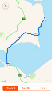
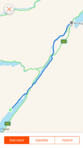
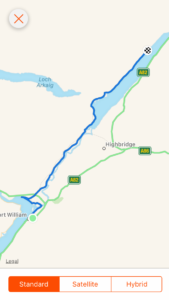
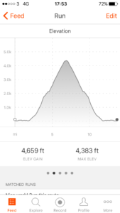
Day 93: Dornoch Firth Bridge to Embo

Total miles: 11.8
Elevation gain: 327 ft
Time walking: 12pm – 5pm
Miles to date: 1,290.4

Oh what a delightfully short and easy day! It felt like a real treat, if a little strange, to be able to slow down today and not rush or feel overly tired. Definitely a good thing, after the last week. My hips and gluts were really tight and aching during the night which, combined with the cold and the rain, woke me up several times. I still seem to not feel too bad once I’m up and moving though, it just seems to take a little longer each day to ease my muscles and joints back into action!

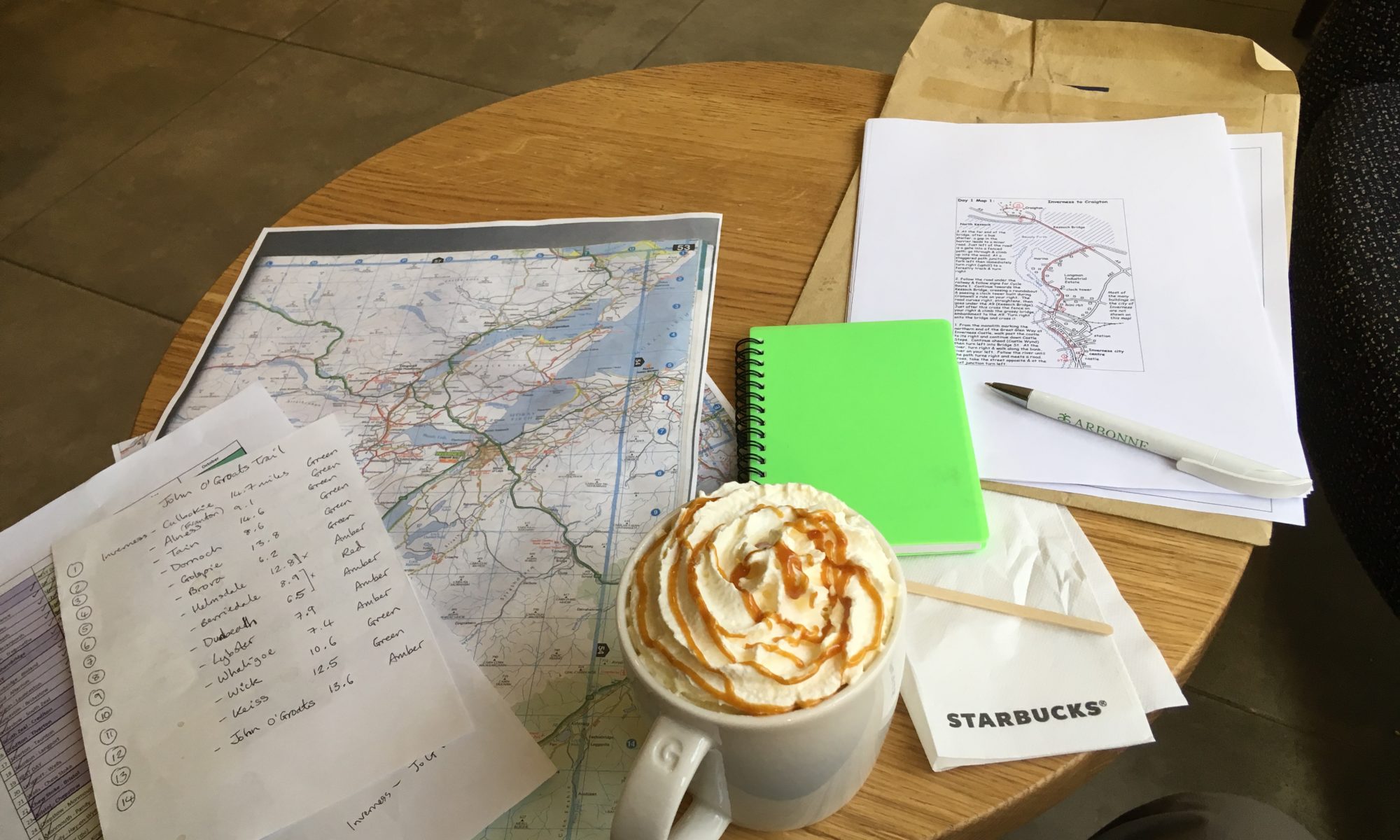
The morning was dry and semi-sunny so I made the most of it by having a leisurely breakfast while the tent dried out a bit after the rain. Then I met Jay, who is the guy who is heading the development of the John O’Groats Trail and gave me the draft guidebook to trial. He lives further north but was driving south and had a few more pages of the maps to give me. It was great to actually meet him after exchanging several messages and emails and he gave me some more tips about various sections of the trail further north.

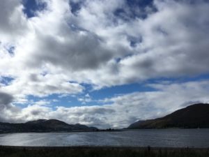
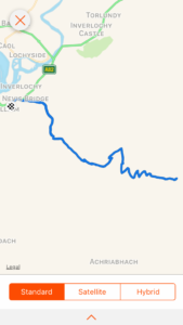
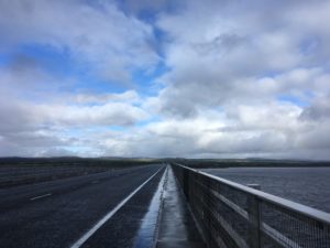
I finally headed off about midday, just as it started to rain, and was pretty much straight onto the long Dornoch Firth Bridge. The A9 wasn’t as busy as I’d expected but it was windy and there was lots of spray from the rain (which stopped when I got on the bridge thankfully), both worse when tall lorries barrelled by. I was glad of the very secure barrier/fence as occasionally the wind would nearly push me into it! Halfway across the bridge my rib started to hurt again and I sighed. Each day when I start out it is fine, and I have a brief glimmer of hope that it has magically got better overnight. Then a mile or two in the pain hits with a vengeance, and continues on and off for the rest of the day. The first few pangs always seem to be the worst, throughout the day the pain eases slightly (or maybe I get more used to it?). I try to breathe through the worst of it, which isn’t easy as it hurts more when I breathe…! Ah well, only a week and a bit left now…

Heading across the bridge, a rare moment of calm

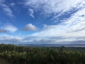
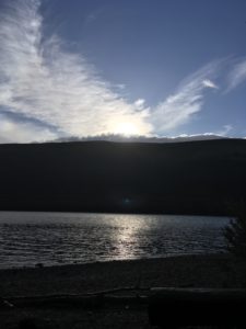
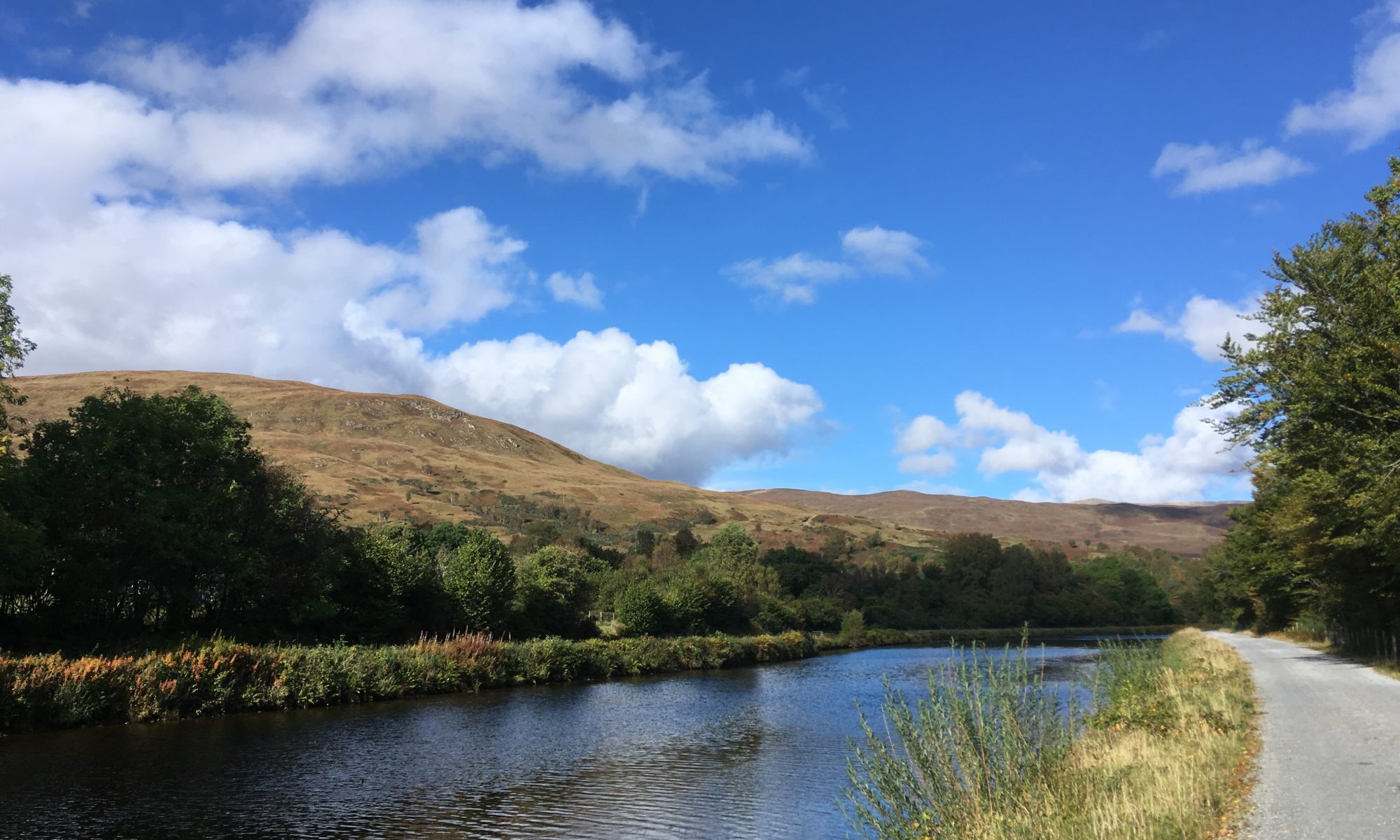
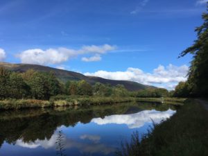
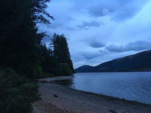
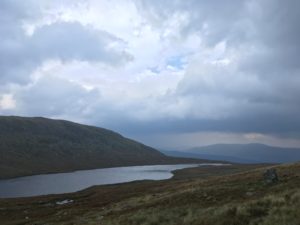
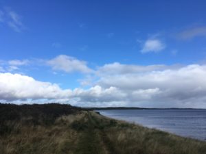
Reaching the end of the bridge took my mind off the pain for a while as I had to step over the barrier, climb down a grassy embankment and then climb a fence, to join a track which ran at the water’s edge. Definitely worth the slight scramble, suddenly the road was a distant memory and the calm of the shining water, ruffled by occasional gusts of wind, breaking around the rocks and seaweed at the shore, had an instant calming effect. The sun came out and it was perfect! I suddenly had a huge sense of happiness and gratitude, and realised I was looking forward to the next week or so, walking along the coast. How lucky am I, to be out here, up here, doing this?!

Fees so good to be by the water again

The track wound inland slightly after a bit and then headed into fields. All fine, until I spy in the field ahead two very large looking black cows with massive horns. They were possibly bulls, I’m not sure (due to the fact they were right at the other end of the field…not a lack of basic bovine anatomy knowledge!) but they were not your average cow…they looked something like a cross between a Highland cow and a buffalo. Whatever they were, I wasn’t convinced they would let me through the field without showing some sort of unwanted interest in me so I scouted out another route. Thankfully there was a semi-decent path the other side of the fence (maybe lots of other people also didn’t fancy their chances against the horned buffalo cows) so I did a bit of fence scaling and took the slightly less daunting route.

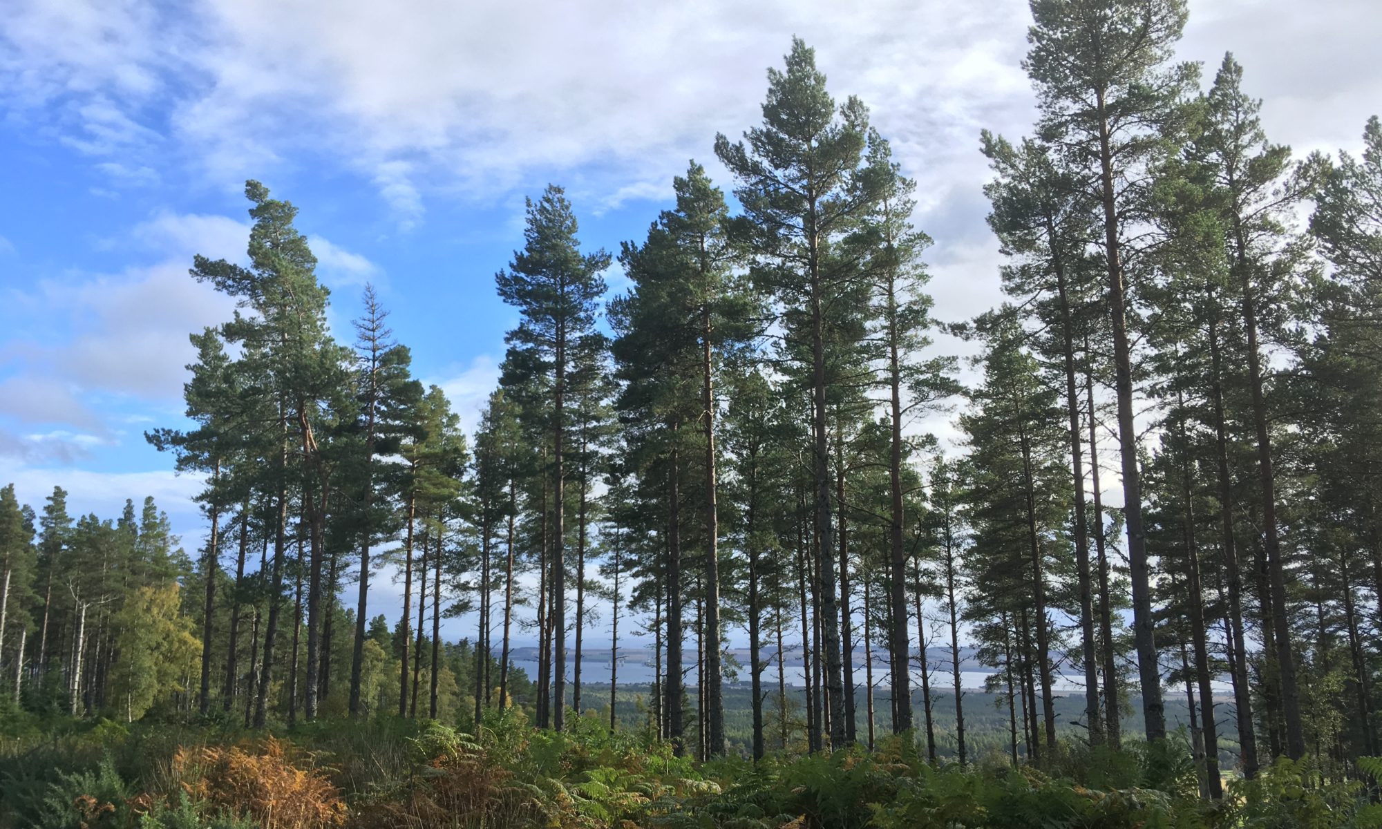
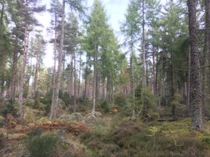
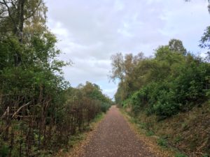
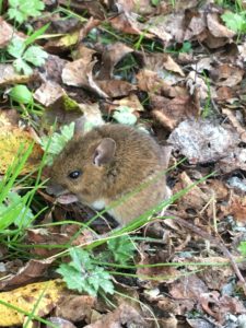
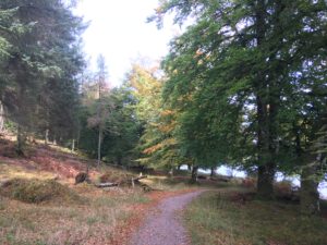
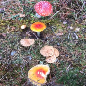
One more field, this one with good old sheep, and I was back to the safety of the road, this time a nice quiet back lane, and then into the pretty Camore Wood. Loads of funky mushrooms and toadstools in this wood! Big ones, small ones, bright ones, spotted ones. There were some flat-topped creamy brown mushrooms that looked just like creme brûlées! Sometimes I wish I knew more about mushrooms, but I’m not sure I’d actually ever dare to forage for them. Just too many deadly lookalikes! The wood was over far too quickly and it was back to the edge of a field and then a mile of pavement into the pretty little town of Dornoch.

A selection of funky mushrooms

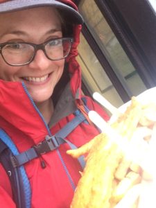
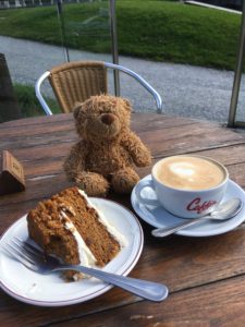
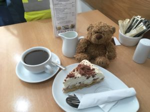
I stopped for a few cereal bars and snacks (and bananas, yay!) in a gorgeous little shop-come-deli that seemed to sell everything, then headed down past the old castle and beautiful 13th century cathedral to a little cafe in a shop-come-gallery. I had plenty of time so I had a nice rest there, enjoying lunch and one of the most delicious banoffee pies I have ever had! After two cups of coffee I figured I probably should make a move, especially when they started to prepare to close!

All King Jennifer seems to do on this trip is drink coffee and eat cake…!

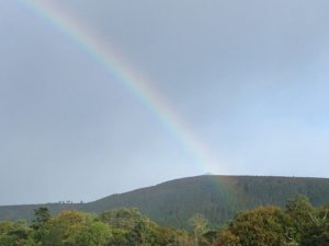
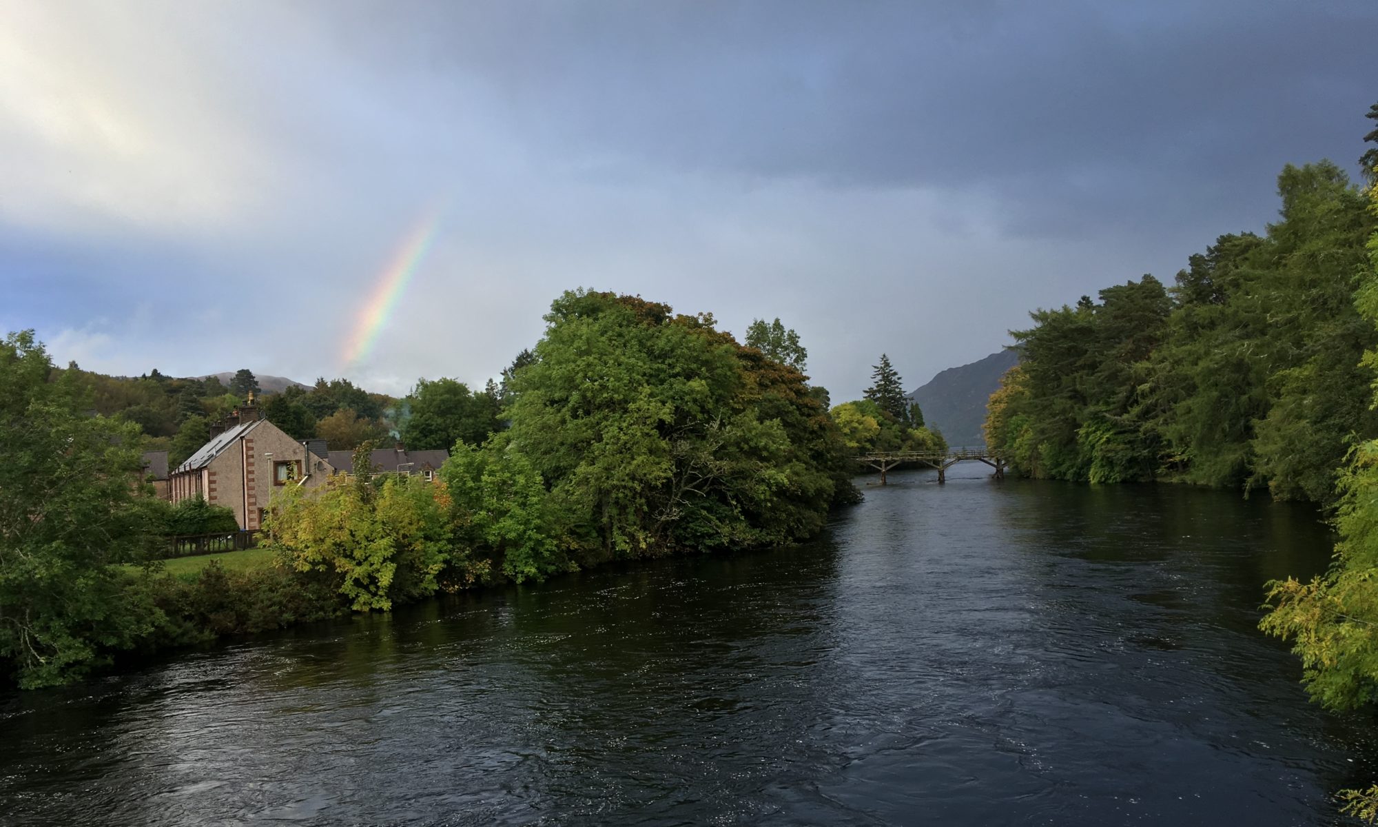
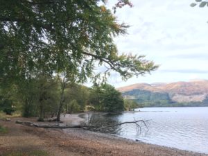
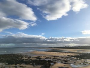
The sun was out again and I had a nice walk through the remainder of the town and out towards the golf course. This was on a slight hill so there were lovely views back across the Firth and out to Tain and beyond, and then as I rounded the corner the sea was there and I was properly on the coast! It was beautiful. Classic golden late afternoon sun bouncing off the sand, the sea, the rocks; patches of blue sky reflected in rock pools, dark rain clouds and black rocks contrasting with silvery water and the white froth of breaking waves. From time to time a rainbow would appear out to sea, and the light breeze brought the delightful taste of salty air. An instant feeling of contentment came over me. I love the sea. I always forget how much, until I’m by it again! I was suddenly really glad that I’d decided to head to Orkney when I finish, up until now I still wasn’t entirely sure if it was the right idea. But the instant I saw the coast I knew that a few days by the sea just relaxing, walking along the beach, watching the waves, would be just what I needed.

The coast

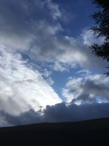
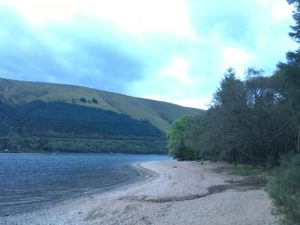
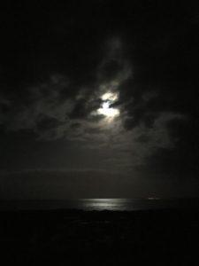
The last bit of the day followed the path between the golf course and the sea for a couple of miles, the weather constantly changing from sun to cloud to rain, which made for beautiful, ever-changing scenery. Soon I could see my destination ahead, the holiday resort/camping and touring ground at Embo, right on the coast. As I neared, and passed, all the static caravans I wondered whether I’d chosen the right place, it was very “resort-y”, but when I had checked in and went down to the non-electric tent pitches I was definitely happy. I’m on a little section just in front of the sea (far enough away that there’s no chance of getting wet!), away from all the cars and caravans. I think I have the best view of the whole site! And I’m the only tent here. It’s my own little patch of heaven, I can see the sea from my tent and I can hear the waves rolling up onto the beach and crashing on the rocks. Tonight, when I came back from the restaurant (where I had dessert again…talk about sugar overload today!), the full harvest moon was up and its reflection was shining like silver on the sea. I stood gazing at it for ages, watching the lighthouse far away steadily mark time with light, the silhouette of the rocks and the waves that broke on them. I could have stayed watching that beautiful scene all night, but even wrapped up in multiple layers it soon grew chilly and I retired to my tent. It’s very peaceful, listening the waves and the gentle breeze. It’s nice too, to feel both away from the crowds but not too far from civilisation. There is something comforting about knowing there are people nearby!

The full harvest moon shining on the sea

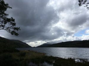
Tomorrow is a little longer but nothing like previous days. I’m looking forward to it, it’s pretty much all along the coast or around Loch Fleet, and I go through the little town of Golspie and past the huge Dunrobin Castle which I can see from here. Maybe I’ll even catch a sunrise in the morning…

Route day 93

Day 92: Evanton to Dornoch Firth Bridge

Total miles: 21.2
Elevation gain: 1,524 ft
Time walking: 9:15am – 6:30pm
Miles to date: 1,278.6

Another long day! Five of the last six walking days have been 21 miles. No wonder my legs and feet ache! I’m actually amazed at how I’ve managed to do that, I guess it is a sign of my fitness – before this trip I had only ever walked more that 20 miles twice, and never carrying so much weight. Now I’ve had over ten days that were longer than 20 miles, five of which were this past week. Crazy!

Today was a nice walk, far away from the busy A9 for which I am so grateful. It was a walk of two halves, the first half mostly on quiet roads or cycle tracks, the last half on forestry tracks and paths through beautiful forest. The weather was once again variable, ranging from lovely warm sunshine to bitter cold winds and squally rain. It was therefore a bit of an on/off with the waterproofs day, but it also meant I saw some beautiful rainbows!

A rainbow falls over the folly on top of the hill

The day started on the cycle track out of Evanton, which although tarmac was mostly set back from the road and ran through pretty trees. There was a rather long and dull stretch into Alness along a fairly busy road but there was a pavement at least and some views out to Cromarty Firth. I popped into the leisure centre/library on the edge of town to use the loo and then had a quick break on a bench by a children’s playground, wondering whether people might mistake my for a homeless person! Alness has a few shops but I resisted the urge to buy more food and weigh my bag down more, knowing that tomorrow I’d go through Dornoch and there were a few other small towns over the next few days. Every time I pass a shop though I feel like I should stock up, as I really feel like I am starting to head into the middle of nowhere! But people still live up here, as way up north as it is. There are some beautiful, but incredibly remote, houses up here. I don’t think I could do it!

Out of Alness the route follows a quiet country road for several miles. It was pretty scenery but tough on the feet, pounding along all those miles. I gave a bit of a cheer when the route diverted into a pretty wood. Suddenly to be fully back in nature, on a winding narrow path, surrounded by trees, ferns and heather, was really lovely, and it was a pleasant mile or so. Even some squelchy bits! At one point along a wider track a large tree had fallen across the path and as it was currently sunny and I was about halfway I decided to stop for some lunch. I used the tree as a drying rack for my tent, which had been wrapped up soaking wet in my bag for the last three days. Sooo nice to get it dry! It’s unpleasant enough carrying a wet tent around – it’s heavy and starts to make everything else damp – but climbing into a wet smelly tent on a cold evening is even more horrible!

The pretty woods of Badachonacher Moss

Getting going again after the extended break was a bit of a challenge, it took a while to warm up my muscles and joints once more, but it was good to have had the break. As I rejoined the road it started to spit with rain again but I was fed up of putting waterproofs on only for the rain to stop 5 minutes later so I tried to cover my head and the top of bag with my bright green rucksack cover. I’m not sure the look will take off….I resembled something like a giant lime green walking shower cap! Still, I managed without the waterproofs for that shower at least!

At Scotsburn the path finally left the road and headed up into woods, the first major uphill of the day (still not massive, but it got the heart pumping!) and some proper mud to negotiate. The forests around here are very pretty. They are still conifer forests but they are much lighter than those further south. There’s plenty of space between the trees for light to reach the forest floor which is a rich carpet of ferns, moss, heather and smaller trees. Once back on flatter ground the path gradually widened out into a gravelled forest track which somehow seemed more pleasant than some of the tracks I’d followed recently, I think just because the forests were more open. It helped that at this precise moment in time the sun was shining and it was a lovely autumnal afternoon. Occasionally the trees would open out and there were some super views back over the Cromarty Firth.

Stunning views back over Cromarty Firth

15 miles in and I was running low on water but I found a handy stream where there was a lovely wooden shelter so I stopped for a water refill and a quick break, pleased to shelter out of a brief patch of drizzle. It was uphill again from here but I saw a few other people which made a nice change, mainly runners and mountain bikers. I passed “A Dog’s Grave”, famous enough to be signposted, dating back to 1928! The grave read “Geordie, faithful friend and constant companion for 11 years of John Dewar. Killed by a road hog near Perth, 9th Aug 1928. Served with the 3rd Bat. The Cameronians 1917-1918”.

The path left the main track and led through more pretty woodland and felled forest, getting quite boggy in places (a nice change after days of firm forest tracks and roads), lonely but beautiful. This was Morangie Forest, it took me a while to figure out why that sounded familiar…think Glen Morangie whiskey! At a loch flanked by pine forest and tall breezy grass the scene was so Canadian I half expected to see a bear or moose lazily wander out of the trees to take a drink. Ahead the view opened out to the sea and as the path started to descend around a bend I had a glorious teaser of the coastline I’d be following in the days to come.

My feet and legs were really starting to feel it by this point and I was glad when the path finally dropped down to a track which would lead me pretty much to my campsite. It was 6pm already, later than I had expected given the good time I’d made earlier in the day. I guess there were a few more hills and it was a bit further than I’d thought, plus as I really should know by now, the second half is always slower as I get tired! Despite feeling rather pleased at my rapid progress over the last few days, I’m even more pleased to realise that today should mark the end of the long days. I slow down from here, with my longest day being in the region of 15 miles, with a couple of days as short as 8 miles. I won’t know what to do with myself!

I have to be more careful with evenings now though, the sun sets before 7pm these days and if it’s a rainy day the light goes really quickly! Still, I was at the campsite by 6:30pm which wasn’t too bad and I had the choice of pitches as I was the only tent there! The only downside was that the map had indicated there was a pub by the roundabout just by the campsite…sadly it turned out to be a Jehovas Witness Hall…not quite the same thing! Strange, for the OS maps to get that wrong?! Ah well, it was dehydrated chicken curry for dinner for me (actually really tasty!) huddled up in multiple layers as it is COLD tonight! I made the most of the benches and light though and stayed outside for quite a while…evenings are quite long and uncomfortable when they are spent sitting huddled in a small tent for the few hours before bedtime! I went through several cups of tea and a hot chocolate before eventually I got too cold to stay out, retiring to my sleeping bag wearing thermals, socks and warm hat, pulling every drawstring on my sleeping bag and its hood close. It’s a chilly one tonight!

Day 90: Rest (and major planning!) day

After 5 pretty big days it was time to make the most of the last major bit of civilisation to rest, restock supplies, see an osteopath and do some major planning!
I now have the (draft) guidebook for this final leg, it’s a bit daunting though as it’s a new trail which is incredibly rough in places (think no path, overgrown undergrowth, fields with no stiles, burns with no bridges etc) so need to pick and choose a bit. And winging it a bit with accommodation…need to book some in advance otherwise at this rate I’ll be wild camping every night…!

In other exciting news, I’ve spent part of today planning my gradual return to civilisation…starting by getting even more remote and taking a trip to Orkney for a few days! Then I’ll be making my way back over a few days, by overnight ferry, multiple trains, probably a few buses and hopefully a visit to a friend or two on the way back down!

Back on the trail again tomorrow, mixed feelings about it – part of me just wants it done, part of me never wants it to end!

Day 88: Fort Augustus to Drumnadrochit

Total miles: 21.5
Elevation gain: 3,755 ft
Time walking: 9:30am – 6:30pm
Miles to date: 1,214.7

Ok so I have to say, I am impressed with today! The route was awesome, the weather was beautiful and I made pretty good time on a day that was not only one of my longest distance-wise but was the biggest in terms of elevation gain of the entire trip (save Ben Nevis)!! No wonder my feet and legs are aching so much!

I knew that today was going to be a long day – it’s either a really short day stopping at Invermoriston or a really long day as there’s nowhere else to stay in the middle. I hadn’t quite anticipated the amount of elevation gain though and now don’t feel so bad that I had to keep stopping to catch my breath on the hills, some of which were very steep! I tried to make an early-ish start as with the nights drawing in I have less daylight hours to walk and 20+ miles is starting to push it. The hostel (Morag’s Lodge) did a good breakfast so I filled up and headed out onto the trail which conveniently passed the hostel. I’d risked leaving my waterproofs off for now as the forecasted heavy rain hadn’t quite materialised yet and I knew I had some hills to climb from the off.

After a brief stint on a quiet road the path heads up into the woods, the short but steep climb a bit of a surprise after the flat going the last couple of days. It levels out a bit when it joins a forest track which leads to the first main lookout across the loch. Shortly after, the path forks and there is a decision to be made – high route or low route?! High route, always! As far as I know the low route follows forest tracks (it is suitable for bikes and horses) and is mostly in the trees. The high route is only suitable for walkers and is relatively new – it’s not even marked on my OS map, just on my new Harvey’s map – and as the name suggests, goes up high, above the tree line. This does of course mean a bit of a climb, and a steep one at that, but it is definitely worth it! At first the path zigzags steeply up through the forest, closely following a tumbling stream which falls over a series of beautiful waterfalls. It was a bit of a gruelling climb but it was so nice to have a bit of a change of scenery.

TO BE FINISHED!!

Day 87: Glas-dhoire to Fort Augustus

Total miles: 15.4
Elevation gain: 440 ft
Time walking: 11am – 5pm
Miles to date: 1,193.2

As I start to write this blog I find myself thinking I don’t have much to say about today. I think my feet are aching so much they are drowning out the memories of the walk! After a beautiful morning at my lochside campsite the walk itself just seemed to go on and on – the scenery was beautiful but the incessant pounding along hard tracks made the day seem samey and I was so relieved to make it to Fort Augustus. With the benefit of hindsight and the comfort of a leather sofa and a cup of tea I can reflect and know that it was actually a very beautiful walk, but as a friend wisely put it, I may be suffering from “BSS” – Beautiful Scenery Syndrome…I’ve seen so much incredible scenery that I’m getting used to it, and after the absolutely stunning high level walking of the Pennine Way and the latter part of the West Highland Way low-level walking doesn’t seem quite as exciting! The killer for me today was the monotonous gravel tracks/unsealed roads, no twists and turns, uneven ground or ups and downs to shake up my gait a bit so my muscles and feet are really feeling the repetitive strain tonight.

I woke up this morning very early to the sound of rain after a very wet and windy night where I don’t think I got too much sleep. The wind was howling on the loch most of the night, frequently catching the trees and making them rustle and groan and occasionally reaching the tent and giving it a good shake. In moments where the wind eased a little I could hear the red deer roaring on the hill and all in all it made for a somewhat uneasy night! I distinctly remember two dreams that woke me with a start – one where the loch overflowed and flooded my tent and another where the red deer came down from the hill and stumbled over my tent! Despite the disturbed night’s sleep when I woke up for a second time at a more reasonable hour the rain had stopped and the air was still. I ventured out of my tent to find a promising looking morning, a weak but present sun and fresh but not too cold air. I was in no rush to get going as it was a shorter day today with a hostel at the end so I let the sun dry out my tent while I enjoyed a lochside breakfast. A cute little red-breasted robin flitted about, seeming quite companionable. I’ve seen lots of robins in Scotland, I like to pretend it’s the same one following me! The unease I’d felt overnight melted away and I felt happy and so so lucky to be out camping in such a beautiful spot. The sun was lovely and it was a real treat to be able to put the tent away completely dry!

A beautiful start to the day
The sun making its way up over the hill
My little red-breasted friend

The first couple of miles continued along the forest track above the loch before coming out into slightly more open sheep and holiday hut-populated land at the end of the loch. Time for the canal to recommence, at the Laggan Lochs, where there was an intriguing cafe/restaurant on a boat. It seemed a bit early to stop and the map said there was a cafe a few miles further on at the edge of Loch Oich so I continued. The stretch along the canal was pretty and my favourite bit of path for the day – a little forest path above the canal, covered in a soft coating of pine needles, a slight uphill and then emerging at the Lagan swing bridge. Here the path passed the Loch Oich Water Park, where there are lots of triangular holiday huts which looked cute but also mostly unoccupied…I guess it’s end of the season now. I popped in to the holiday park cafe which was empty but I was grateful for a sit down and the coffee, cookie and banana. Especially as it had just started to rain! I waterproofed up to head out and the rain promptly stopped, and it was a waterproof dance for the next few miles.

Just on from the holiday park was the old Invergarry station, just a platform and some track now, part of the never fully completed Fort William to Inverness railway which later fell in to ruin. I think here the path must have forked as although I took the obvious track which was signposted as the cycle path, a bit further on I saw a much prettier and more interesting path down below, running along the loch edge. The track I was on was the old railway and it was straight, flat and dull, with limited views of the loch and frequently running through cuttings in the rock. The path below kept coming into view but at first I thought it was a private track as there was a fence between it and the track I was on. This straight track really felt like a slog and I resorted to singing songs out loud to myself to make the journey more interesting. I think it was worse, knowing there was a prettier and kinder-to-the-feet path below! About halfway along the (comparatively) little Loch Oich (it’s still 4 miles long…!) there were some pretty views across to the ruins of Invergarry castle and tiny islands in the loch. I also came across another trailblazer campsite, this one with unlocked toilets! It was a pretty site and it’s a shame it’s so close (only about 8 miles) to the last one. The next one is on the wrong side of Loch Ness so is no good for me sadly. The path I’d spotted before went straight through the site and I debated following it to see where it went but I still wasn’t sure it wasn’t going to end me in a dead end so I headed back up to the tedious cycle track. After a while I changed my mind and made use of a hole in the fence to pick up the lower path, instantly wishing I’d done it sooner! It was such a relief to not be on that cycle track! Unfortunately I was nearly at the other end so soon I had to rejoin the track, although there was at least an interesting railway tunnel to liven things up a bit.

It felt like a large part of today looked like this…
But there were some pretty views, like this one looking back over Loch Oich

My feet were starting to ache a lot so I took a quick break by the Oich Swing Bridge and noticed that the river was flowing the wrong way. Then I remembered reading that Loch Oich was the highest point on the Caledonian Canal, which meant I was now heading “downhill”! The wind picked up and it started to spit with rain again so I didn’t stop long, I only had a few miles to go now! The last four and a half miles were once again along the canal, lovely and wide and wild-feeling, with a couple of lochs along the way, but I was feeling so tired and footsore by this point that I was struggling to appreciate it fully. There were lots of blackberries along this section though, in fact all along the Great Glen so far I’ve had some lovely big juicy blackberries, I don’t know if it is the location or just the time of year, but they make for a nice treat (and vitamin boost!) along the way. I even found a couple of late raspberries today! I wasn’t the only one enjoying them either, a gorgeous little mouse ran across the track in front of me and then sat nibbling at a berry at the side of the path, not seeming to notice me gradually trying to creep closer to it. I managed to crouch down right next to it as it happily munched away on its snack, it only jumped and ran away when I struggled noisily to get back onto my feet again!!

Another little friend!

Touched by the appearance of the mouse, and then shortly afterwards mountains on the skyline, I plodded on feeling a little more content, albeit still in pain (more so actually, after the crouching…bad idea to try to crouch down with a pack on your back when your knees hurt…!). Then the rain came! It was forecasted, but it was sudden. I had to dive into a block of trees for shelter while I quickly put my jacket back on, finding a frog trying to hitch a lift as I went to put my pack on again! The rain was heavy but quite refreshing and it was amazing how it changed the landscape around me. I passed a very wet-looking couple on a boat at one of the locks and we waved cheerfully through the rain. Fellow nutters! The rain persisted for a while, eventually easing off slightly but never completely stopping. But then the happy sight of buildings! I felt like I was almost limping at this stage, but definitely hobbling, I must have looked a funny sight to all the tourists who were wandering around the impressive series of locks that take the canal down into Loch Ness.

As I came into the tiny town the delicious waft of fish and chips came through the air and all intentions of cooking myself a wholesome and healthy dinner vanished! I figured if I ate now, I could spend the rest of the evening sitting down and relaxing…! I located the fish and chip shop and ordered takeaway, figuring I could go and eat them by the loch. Just as I was about to leave the shop the heavens opened and I ended up eating the whole lot standing in the shelter of the doorway! Not quite a gourmet dinner, but it filled a hole and tasted amazing!

Yuuum

This evening has been spent enjoying a good hot shower, drinking tea, eating biscuits and doing a bit of onward planning, followed hopefully by an early night. Tomorrow is a long day – 23 miles, and I’m dreading it somewhat! I’m just praying that my feet, ankles and knees feel a bit better tomorrow and that the path is a bit more varied, otherwise it could be a tough day! The morning is supposed to be wet but drying out by evening, which is great as I’m planning on camping again tomorrow, at a campsite this time though!

Route day 87

Day 86: Fort William to Glas-dhoire (Loch Lochy)

Total miles: 21
Elevation gain: 905ft
Time walking: 10:45am – 7pm
Miles to date: 1,177.8

Ahh what a beautiful day! A proper autumn day, where the sun is gentle but warm, the air is fresh, the leaves are turning and you can actually smell autumn. My favourite kind of day. And today was day one of the Great Glen Way, leg 7! A long day mileage wise but a quick one, the first 16 miles or so of which were far more picturesque than I expected and the last 5 miles less picturesque than I expected! Still, I am camped at a beautiful spot on the edge of Loch Lochy, so a gorgeous end to the day regardless!

The day started a little later than planned as I decided not to set an alarm assuming I’d be woken up early in the hostel. As it happened, either my fellow roommates were exceptionally quiet or I was really tired, and I didn’t wake up until nearly 9am! Without rushing I managed to pack up and eat a good breakfast of porridge and banana (haven’t had much porridge on this trip, it made a nice change!) and be out of the door before 11 which wasn’t so bad. My first challenge was to negotiate roads and a supermarket car park to find the start of the Way and then I was properly off. The Way starts by following the River Lochy before crossing it and heading along the top of Loch Linhe through the village of Caol. The water was lapping at a small beach and the smell of salt was in the air and I could almost imagine I was by the sea. Loch Linhe is a sea loch so I suppose I technically was! There were great views back to Ben Nevis which was currently still shrouded in cloud, and beautiful views down the loch and across to Fort William. A little further on and the path joins the Caledonian Canal which I will follow all the way to Inverness, with a few famous lochs (including the infamous Loch Ness) in between. I take the short detour to see the sea lock at Corpach (it looks just the same as any lock but it’s quite cool to think it’s the last barrier between the Great Glen and what is effectively the sea) and to visit the office there. I was planning to pick up a key which would give me access to some composting toilets along the way at some wild campsites, but frustratingly the office was shut for lunch and I didn’t fancy waiting around for 45 minutes for them to get back! The toilets there were also shut, so it wasn’t a particularly useful detour, but at least it was a pretty one!

Loch Linhe from Caol

A mile or so further on I reached Neptune’s Staircase, an impressive flight of 8 locks near the end of the canal. There was a lovely looking cafe halfway up and King Jennifer begged me to stop for coffee and cake as he hadn’t had coffee in 6 days. I gave in, and of course it would have been rude not to have a slice of cake while we were there… 😉 it was actually really lovely to sit out in the sun and enjoy the break and the little bit of luxury, even if it felt a bit cheeky after just 5 miles! Still, who knows where the next coffee stop will be! And I got chatting to a lovely couple with some gorgeous dogs at the next table (King Jennifer is definitely good at starting conversations, and my LEJOG tabard helps too), so it was a nice stop.

He made me do it!

The next 10 miles or so were just so pretty, really pleasant walking. The canal is wide and surrounded by hills and beautiful countryside, lined by trees that at this time of year are turning all sorts of stunning colours. There were some amazing shots back to Ben Nevis and the surrounding peaks, all of which had now emerged from the cloud. It looked like it would have been a stunning day to climb! The sky was blue with lots of fluffy white clouds and the reflections in the still waters of the canal were perfect. I felt so lucky today, to be out here in this beauty!

A cloud-free Ben Nevis!
Stunning reflections
Mirror-like waters

The section along the canal to Gairlochy followed the towpath which was flat and wide which made for fast walking. Every now and then a cyclist or two passed me by with a cheery hello, I only met one other hiker though. It doesn’t seem to be nearly as popular as the West Highland Way which is a shame as so far it is very pretty! Beyond Gairlochy, where the first section of canal gives way to the first of the lochs of the Great Glen, Loch Lochy, the path leaves the towpath and after a short uphill section on the road turns into a narrow forest track, criss-crossing but otherwise avoiding the road before heading down to the lochside. This was a very pretty section of the walk. Stony beaches with beautiful views stretching out across the loch in all directions, gentle woodland with a green mossy carpet and trees of all shapes and sizes, many with leaves of vibrant shades of orange and yellow contrasting against the green. At the far end of the loch mountains tumbled from the sky down to the water and back the way I had come the Nevis range dominated the skyline. There were a few potential camping spots along this section but whilst part of me was tempted to stop I knew I had a good couple more hours of walking in me and I was aiming for a particular spot – one of the “Trailblazer” wild campsites further along the loch.

A pretty woodland path along the lochside
Gorgeous secluded beaches

The trail stuck close to the loch until the tiny hamlet (literally a handful of houses) of Bunarkaig, where it then followed a road through a forest for a mile or so to Clunes, where there was nothing except a house and a signpost. From here the path left the road completely and headed off along a forest track into one of the more remote sections of the Way. This was the least interesting part of the day as the track just went on and on through the trees with few views of the loch and only the occasional waterfall or trickling stream to provide variety. I did see some pine marten poo which was quite exciting. Sadly it’s unlikely I’ll actually see a pine marten as they are incredibly shy and also mostly nocturnal but it’s great to know they are definitely around!

The sun had gone by this point, hidden by the growing clouds, and it grew almost gloomy among the trees. I was keen to get to my campsite before the sun set (at around 7pm these days) and although my feet were tired I pressed on. I didn’t really want to be camping on the edge of the track (even though there were potential spots) in the middle of the forest – pine forests scare me a little! It was also eerily quiet, and I hadn’t seen a soul since Gairlochy other than a few cars on the road several miles back. It seemed strange, after the busy-ness of the West Highland Way and Ben Nevis! Eventually the track started to drop a little after being higher up the hillside for a while and I could tell from my GPS that I wasn’t too far away. The track suddenly came out into an area of felled forest and I could see the little bit of land jutting out into the loch which was where the campsite should be. Then I heard a sound which made me stop in my tracks, puzzled. It was in the distance (thankfully) and sounded like a cross between a roar, a groan and a cheer. It took a while for my brain to register what it must be (it of course went through all the overactive imagination suggestions of bears, wolves and lions first) – it was the sound of male Red Deer in rut. They bellow challenges to each other and compete for mates and are most active at dawn and dusk. I was quite reassured to realise that’s what the sound was, although disappointed I couldn’t spot the stags themselves on the hillside – I guess sound travels a long way! Still, maybe a good thing not to be too close to testosterone-fuelled fighting deer?! I just hope they don’t keep at it all night!

As I dropped down to where my map showed the campsite being, I was slightly nervous when there was no sign of the paths that the map showed leading off the main track and my GPS indicated I had almost walked right past the site. I had a fleeting moment of concern that maybe the site was only accessible by water when suddenly I saw it, really obviously marked by the small block of composting toilets right by the track. Phew! The site is tiny, only space for a few tents, right on the shore of the loch. It is beautiful! It’s just a shame I wasn’t able to get a key for the toilets! I made it with about half an hour before I lost the light so I quickly put the tent up and went to fetch water. With the light almost gone I decided to try and make a fire as there was a fire pit and a bit of wood left nearby. It took me a while to get it going, but I was pleased as I only had a tiny bit of paper to get it started with and a lot of the wood around was a bit damp. Still, I eventually managed to get a small fire going well and finally started to cook my dinner (well…boil water and then wait for it to rehydrate…!). I ate it in the dark, with my head torch off, just watching the flames flickering and the headlights of the cars on the road that runs along the other side of the loch (it’s not quite as remote here as the path feels!). It was strange though, watching the cars and the few scattered houses on the other side. They were both not very far away and miles away at the same time. It made me realise that although I do like being on my own I do miss people too! I was a little sad to find that no one else was at this site, it might have been nice to have the company of fellow hikers. And maybe they would have thought to bring marshmallows!

Campsite on the shores of the loch
This gorgeous spot all to myself!
I made fire!

Still, it was quite nice sitting there watching the flames and embers (there’s something so primordial and entrancing about fire) and looking out across the loch which shimmered slightly reflecting whatever light was in the sky, with the dark mass of the mountains behind. Earlier on there had been a bat flitting around. He had gone to bed now but a bold little mouse ventured out a few times to nibble at a bit of rice I dropped. I hoped he was the biggest creature to come sniffing around the campsite tonight! I’m now in my sleeping bag, listening to the wind in the trees and the occasional light pitter patter of rain on the tent. My spot is fairly sheltered (thankfully, there are supposed to be strong winds a bit later in the night) but the wind is loud in the trees and on the water. Camping between a conifer forest and a valley loch isn’t the quietest spot on a windy night!

Tomorrow I leave Loch Lochy and head to Fort Augustus on the banks of Loch Ness. It’s a slightly shorter day of about 16 miles so hopefully I can enjoy my camping spot in daylight for a bit and get my tent down in between the two main periods of rain forecasted! For now though….night night!

Route day 86

Day 85: Ben Nevis

Total miles: 13.6
Elevation gain: 4,659 ft
Time walking: 9:30am – 5:30pm
Miles to date: 1,156.8

I am so happy I managed to tick off Ben Nevis! Last night I was feeling so gutted that I might not be well enough to climb it and this morning I still wasn’t feeling 100%. Even just a little way up the mountain path I almost turned back as I had a few minutes where I was feeling real pain in my shoulder/rib/lung (unfortunately while the osteopath managed to loosen me up a little he wasn’t able to fix the main issue I have) and I had to rest on a rock, almost in tears. On top of that the wind was forecasted to be 35-50mph (that’s pretty strong!) so I wasn’t sure if it would be safe to go all the way and knew that realistically I may well have to turn back before the top. But, I made it!! And I am so pleased!

The weather wasn’t looking too promising from the outset..

I made things a little harder for myself by deciding to walk from the hostel (which added 1.7 miles each way) rather than get a taxi, but I figured at least it would give me a warm up! I started to head up the hill itself about 10:15am and it was already a bit blustery and the hills looked moody. It didn’t bode well! It was beautiful though, in a wild Highland sort of way, and despite not feeling 100% it did feel good to be out and moving again, and it was heavenly to have such a light pack! Apart from the aforementioned pain, which came and went the whole day but thankfully not as badly as in that first section, I felt quite strong and made good progress up the first section of the track. It’s amazing how much easier it feels without so much weight on my back! The views were already great, looking up Glen Nevis and across to Dun Deardail, the hill fort I’d visited a couple of days ago. The track was fairly busy, but then it always is, it’s amazing how many people actually climb the Ben. I inwardly rolled my eyes each time I saw someone climbing in jeans, loose ankle boots or fashion trainers…at least no flip flops today, thank goodness!

The path goes up, up and up, as you’d expect for a mountain. It was a bit of a slog in that the path isn’t that interesting – a long straight gradual climb followed by a series of interminable zigzags – but it was eminently doable. It was rough and uneven in places but you could tell that thousands of people are able to climb it each year. It was tough, but I can really tell how my fitness has improved as it didn’t feel nearly as hard as Great Shunner Fell or Cross Fell, despite being much higher. I guess not having the heavy pack makes a huge difference though! Halfway up there were some rangers working on improving one particularly badly eroded section of the path. They were manhandling huge blocks of rock, breaking them up and rearranging them to make a rough path. A heavy, muddy task, but they were doing a fantastic job. I just hope the next thousands of hikers appreciate it!

It’s up all the way

There was a stunning view of the series of waterfalls as the Red Burn cascades off the mountain across the gulley, around the top of which the path then curves to meet the burn itself, with views back to the little lochan nestled in the saddle between Ben Nevis and Meall an t-Suidhe. And then, the zigzags begin! The path is rougher here, cut into the scree-covered slopes, but it is still obvious and clear. I meet the clouds one zigzag in but it’s the wind that is more of an issue. It’s not constant, thankfully, but comes in fierce gusts that nearly blow me off my feet. Slightly disconcerting when you’re on the edge of a tall, steep mountain! Thankfully most of the time I get an advance warning, hearing it blow up over the hill towards me, but not always! Sometimes it is so strong I consider turning back, but then it drops again, so I continue, carefully!

The Red Burn
A great view back to Dun Deardail and the last day of the West Highland Way beyond
The little lochan on top of the hill

The fog is eerie. It is strange how one moment I had far-reaching, if a little hazy, views over Glen Nevis, Loch Linhe, Loch Eil and back towards the last day of the West Highland Way, and then I was in mist and cloud, not even able to see 20 metres in front of me. The sound changes too, and suddenly I could be on the mountain on my own. It is eerily quiet, other than the gusts of wind that blow up or down over the slopes and the occasional chink or clatter of loose rocks which give away the not-too-distant presence of a fellow hiker. Then a figure or two would emerge from the mist, shadowy at first, then some definition and then colour, a smile and hello and then they were past, fading back into the mist once more. The hikers coming down look cold and damp. I’ve already put on an extra layer and my gloves, the temperature difference is noticeable even without the wind. I debate putting on my waterproof jacket but decide against it as I’m warm from the walking. I later regret the decision as I get very wet by the time I get to the top! It’s not raining, it’s just the cloud!

Heading up into the mist – still about an hour of ascent to go

The further up I get, the thicker the cloud gets and the more faint the path. It is still fairly straightforward to follow – the path is a loose rock and gravel of a pale grey and white whereas the surrounding rocks are more of an orangey brown and larger, but it still took focus to make sure I didn’t lose the path in the poor visibility. There were several large cairns on the way, which loomed out of the mist as I drew close, although randomly (and confusingly!) there were a few that weren’t actually on the path. Nearer the top the hikers coming back down gave encouraging cheers of “you’re nearly there now!” which was good to know – I knew where I was on the map but there was nothing to give away my whereabouts by looking around me – I could have been anywhere! Very near the top the path goes near a couple of the steep corries of the northern slopes – they suddenly appear, dropping down into nothing, heart-lurchingly close out of the mist. I pay extra special attention to the path! Then, suddenly, a dark mass looms out of the fog and I realise I’m there! The dark mass was a memorial cairn (or something of that nature), and the old observatory/restaurant building. There is an emergency shelter up there too, and then of course the trig itself! Of course there was no view but it was still pretty awesome to be up there, if a little cold and wet! I didn’t stay long, I was aware I was a bit damp and I had the long descent to safely get through, but I took the obligatory summit selfies and had a celebratory chocolate bar before starting back down.

We made it!
Whoop!

Cautious of tales of people straying from the path and falling down the northern corries or the notorious five-fingered gully I very carefully followed the path, ready to get my compass out if necessary. I was a tiny bit disappointed but also massively relieved that my compass wasn’t needed and the cloud wasn’t quite thick enough to obscure the way completely. I’d still highly recommend knowing how to navigate off the summit by compass if necessary though! Once off the trickiest bit the way down was easy, and not as hard as I thought it would be – once again it’s amazing what a difference not having the heavy pack makes! It will be a bit of a shock to have it back again tomorrow I think…! After a few zigzags I suddenly emerged from the cloud like it has never existed. It was bizarre, one moment misty, damp, poor visibility, next moment, suddenly I could see! I looked behind me, and yes, the cloud was still there, but it literally just hovered at a certain height and below that line it was clear. Still windy though, in fact I think it was windier than on the way up. I made my way down as quickly as I could safely, keen to get back to the hostel for a nice hot cup of tea! It still took nearly 3 hours, but it didn’t feel so bad and it was nice to have the views again.

A cairn looming out of the mist
Emerging from the cloud, Loch Linhe in the distance

Part of me was tempted to see if I could hitch a lift back into town (hitch hiking seems pretty popular and successful up here!) but ended up just walking back gently to try and walk out some of the inevitable post-climb stiffness. I reached the hostel at the very civilised time of 5:30pm and the evening has been spent relaxing, showering, eating and planning the next few days. Unfortunately I haven’t managed to pack my bag as planned as people in my room went to sleep early, so I’ll have to be a bit efficient and get it all done in the morning. Tomorrow I hit the road again, for leg 7 – the Great Glen Way. I’d planned to do it over 5 days but a fair few of the guides I’ve read seem to think it’s doable in 4 so I’m going to give that a go and then that gives me a bit more flexibility with the next bit. Camping again tomorrow and then, well, let’s see what the weather does… 😉

The mathematician in me loves the symmetry of this!
Route day 85

Day 84: Rest Day

A somewhat unplanned rest day, today was meant to be the day I climbed Ben Nevis (and frustratingly it was great weather for it!) but I desperately wanted to see an osteopath and the only appointment available was 11am today. I thought I might be able to see the osteopath and then go straight to climb the mountain afterwards but when I woke up I wasn’t feeling great so decided I would take it steady and try to climb Ben Nevis tomorrow instead. Definitely the right decision, as after seeing the osteopath (who was great) I felt exhausted and sick. I wandered slowly back to the hostel, climbed into bed and napped for a couple of hours!

It was a nice afternoon so I took myself out to the garden and draped my tent over the chairs to dry out. It was soaking wet! So glad to be able to get it dry before I next use it, and so I’m not carrying it around wet. Once the tent was dry and I’d caught up with some friends I popped into town to Cotswold Outdoor (one of my favourite shops ever!) to replenish my stock of camping food and to replace my hydration pack which was growing all sorts of horrible things and definitely needed to go in the bin asap! I also finally gave in and bought an anti-midge headnet. I’m hoping I’m past the worst of the midges now but given I’ll be camping by a loch for a few nights I figured I’d best be prepared…

Drying out the tent
A pretty spot for a hostel

On the way back I quickly popped down to the lochside which was beautiful (if I ignored the busy road behind me). I watched a cormorant fighting with an eel he had caught, dropping it every time he tried to swallow it and having to dive and catch it again. This went on for a good five minutes and I nearly cheered out loud when he finally managed to get the right angle to swallow it down! I did feel a bit sorry for the poor eel though!

Loch Linhe

I was feeling rubbish again by the time I got back to the hostel and retreated to bed for a bit before trying to eat a little bit of dinner. I was in bed by 8:30pm feeling thoroughly miserable and worried that I wasn’t going to be up for climbing the Ben in the morning. Rest days don’t seem to agree with me! I’m unsure as to whether it would be better to take more as I get near the end or just push on and get it done before I break completely!