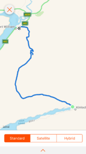
Day 83: Kinlochleven to Fort William

Total miles: 15.7
Elevation gain: 2,275 ft
Time walking: 9am – 4pm
Miles to date: 1,143.2

The final day of the West Highland Way and I have mixed feelings about it! It felt really tough and I’m not sure whether it was the terrain or just me feeling tired. The long trek through the Lairig was stunning but felt like it went on forever and was rough and wet underfoot, then the stunning views of Ben Nevis and Glen Nevis from Dun Deardail made everything worthwhile, even the dull anticlimactic trek along the road to the end of the Way!

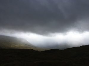
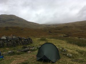
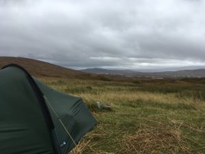
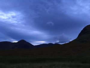
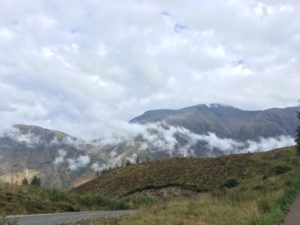
Once again the day started off wet, heavy rain on the tent and I could feel the damp through the groundsheet. Remarkably my sleeping bag remained more or less dry other than a damp patch near the feet, caused by the combined effects of condensation and heavy rain. So it was a case of packing everything up in the tent again, which I’m getting rather a dab hand at now, then out into the morning to face the rain and the midges. I don’t know what magic I have with the weather but the rain held off while I cooked my breakfast and made a cup of tea, I just had to walk around constantly while eating it to try to avoid the worst of the midges! The tent was soaking wet, even the inner tent, so I’m hoping I’ll be able to air it out at some point before I next use it. If nothing else, it’s amazing how heavy it is when wet!

Loch Leven

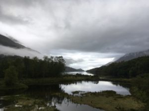
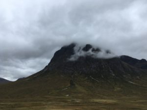
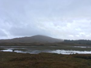
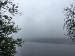
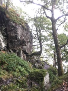
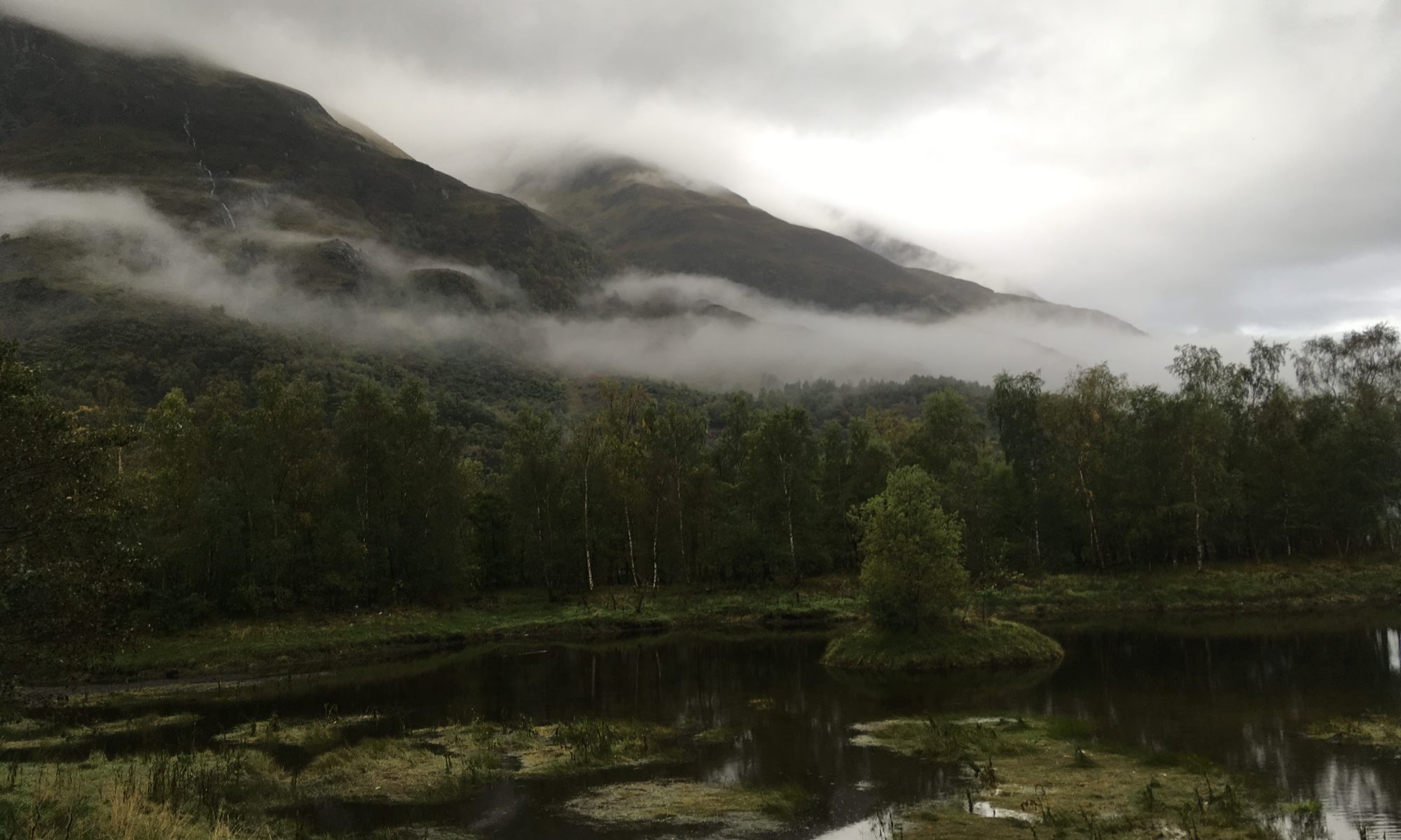
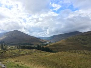
The loch and surrounding hills were beautiful this morning, with wisps of cloud drifting over the slopes. The first part of the route climbed up fairly steeply through pretty birch woods, emerging onto rocky outcrops with stunning views back down to the village and the loch. It was a tough climb for first thing in the morning though! It kept drizzling but it was also quite muggy and it was hard to know whether to stick with the waterproofs or not. I ended up ditching them and putting up with the drizzle, until a heavier burst of rain later in the morning.

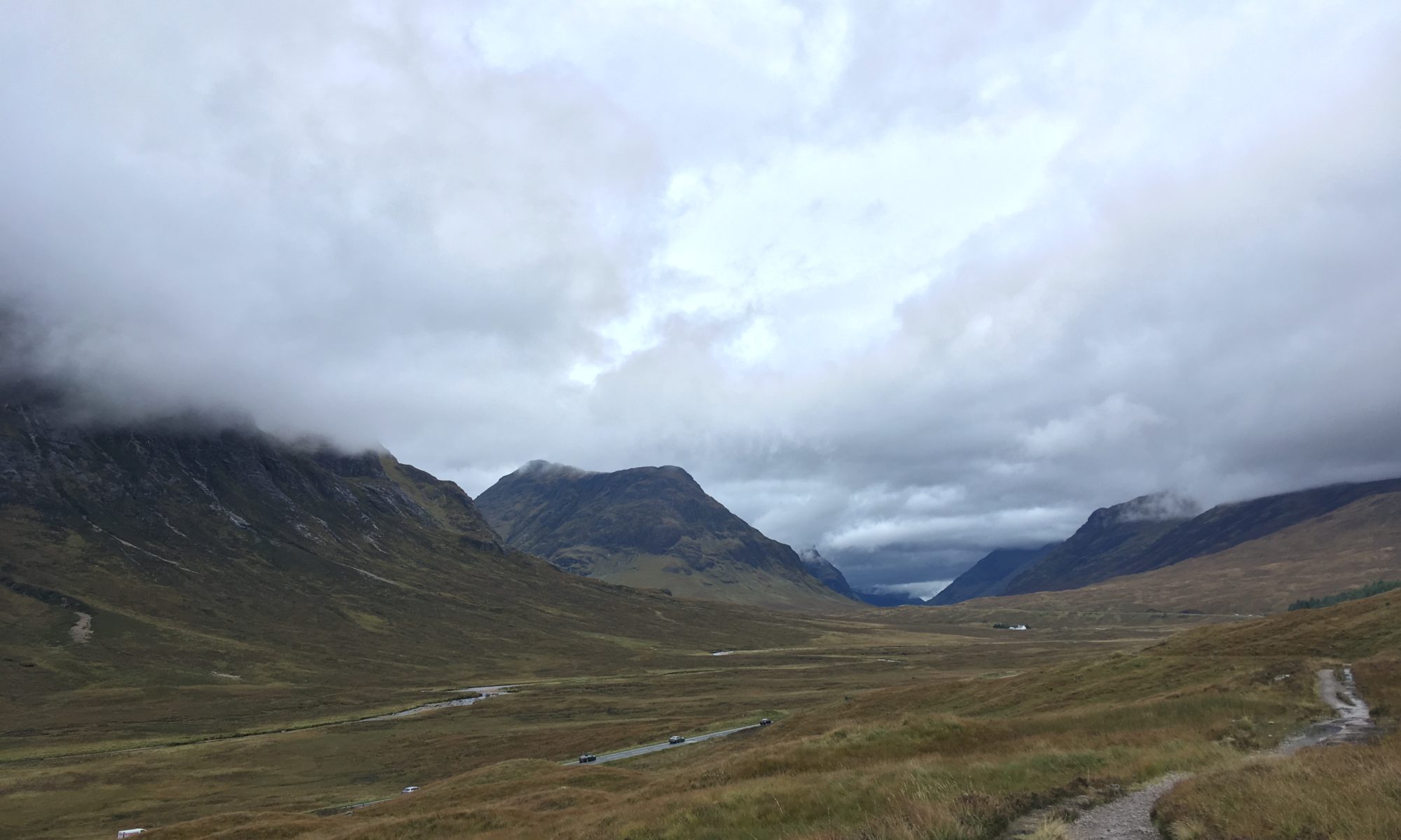
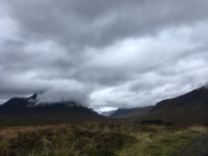
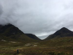
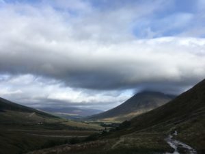
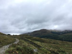
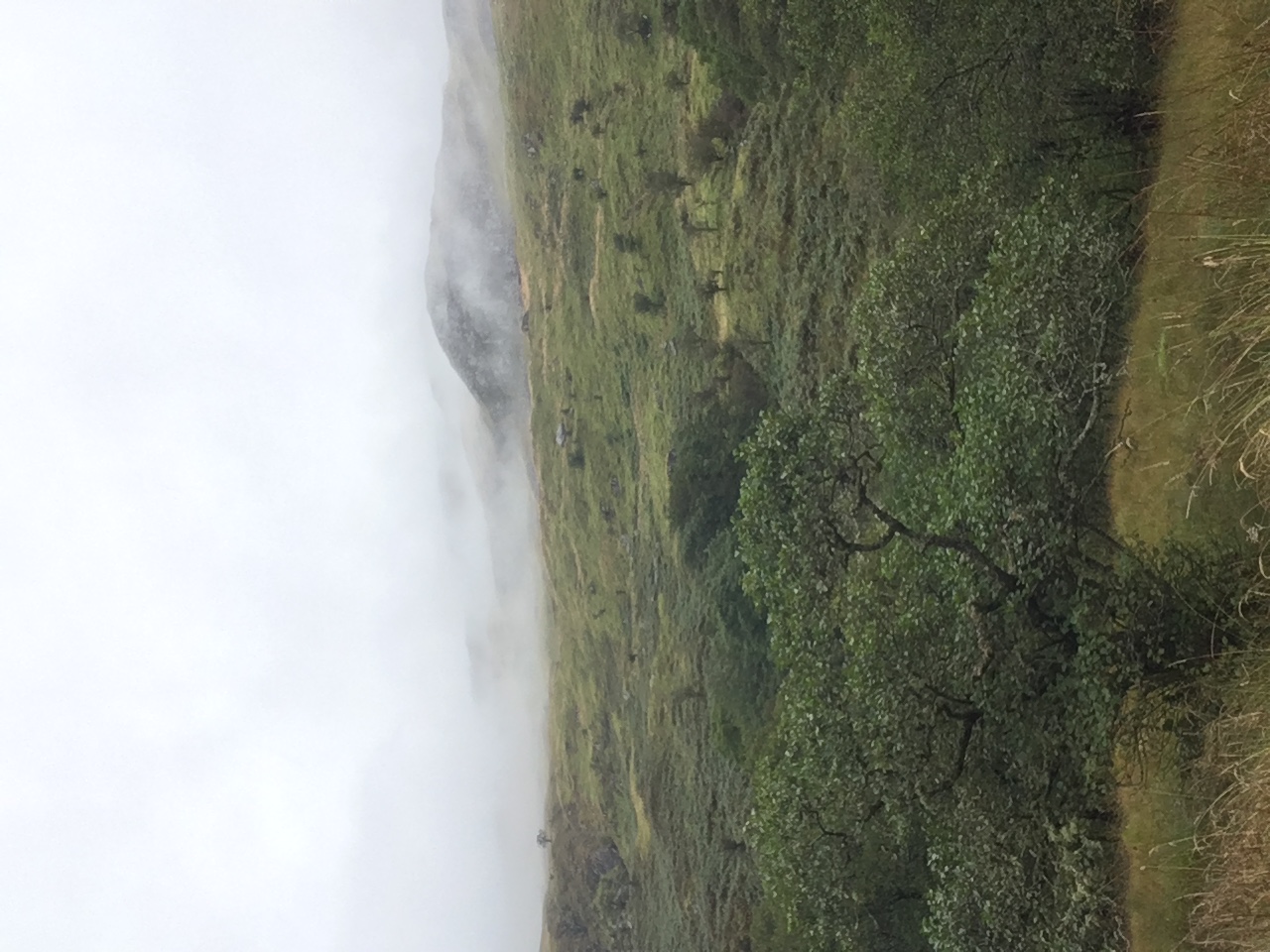
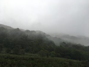
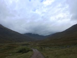
The last day of the trail follows an old military road up through the Lairig – a shallow U-shaped valley between stunning mountain ridges. It feels wild and remote, except for the somewhat incongruous wide stony track heading off endlessly into the distance and an ant-trail of fellow hikers. There are several potential wild camping spots here and although they all look a little on the damp side I bear them in mind for the future. It would be a stunning place to camp and although they are right by the path I think there wouldn’t be many people passing at the end of the day – perhaps just a few going north to south. I looked at my Strava app thinking I’d probably walked about 4 miles or so and was shocked to see I had only covered 2.8 miles. Oh dear, was it going to be one of those days?! My legs and feet already felt tired and it looked like the Lairig was going to be a bit of a long slog. There were lots of hikers sharing my path today, I could see them strung out ahead of me and behind me. Although I’ve seen lots of people on the Way it was strange to see so many all at once. It is definitely a popular trail! It was quite nice though, passing or being passed by people and starting to get to know them a bit. I bumped into the nice American couple again and they asked after my night wild camping, and later in the day I walked with two women who I had first chatted to a few days ago. It was also reassuring to see other people huffing and puffing a bit. The trail looked like it should be relatively easy, but it wasn’t!

The Lairig – the path goes on and on and on!

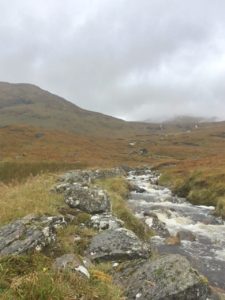
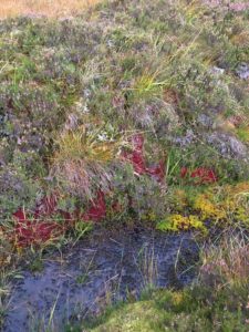
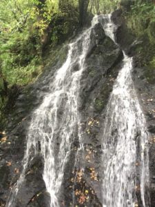
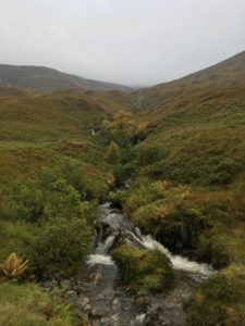
There were a couple of ruined cottages or farm buildings along the way and both sets had some areas of flat grass around them, another option for wild camping potentially. One thing that definitely wasn’t in short supply was water! The fascinating thing was when the rivers changed direction. Up until a certain point all the streams flowing off the hill had joined a river that flowed back down the valley to Kinlochleven, but there came a point where I suddenly realised all the streams were now heading to a river flowing in the opposite direction, down the valley in the direction I was headed! This was exciting, it felt like I must have reached a saddle and be descending slightly. It was still a while before the path finally turned the corner and felt like it was headed for home, and even then there was still another 8 or so miles to go, but at least it felt like things were getting a bit more varied. The path descended into clear-felled forest, quite eerie with all the old tree stumps but nice to not be walking in gloomy plantations. I stopped to eat some lunch perched on a tree stump but was quickly surrounded by midges so headed on, not really feeling like being eaten while I ate!

Pretty autumn colours
Lots of water

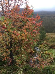
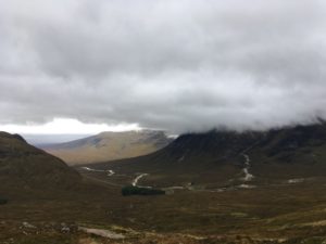
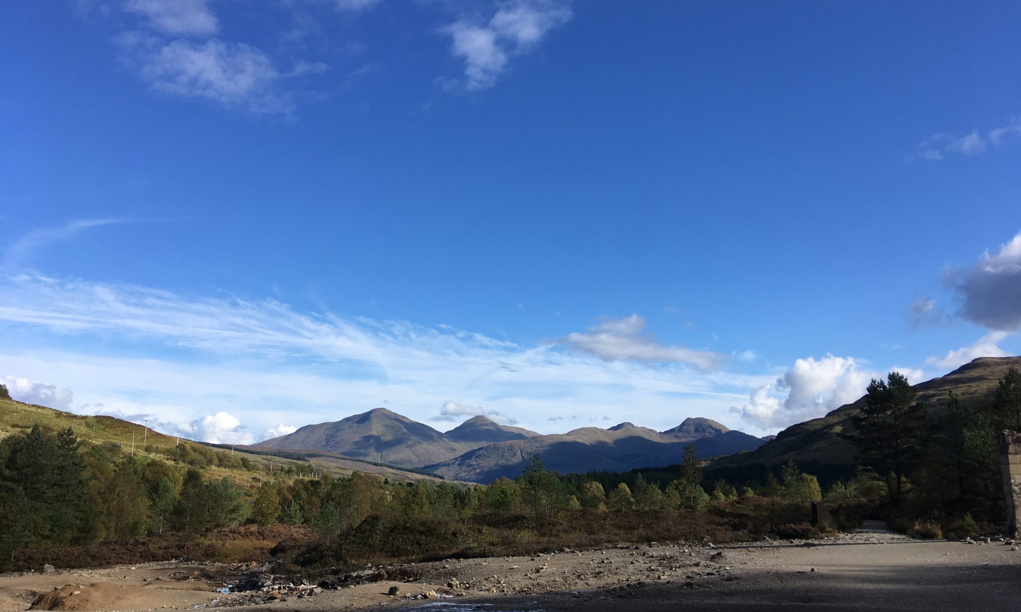
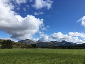
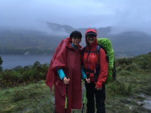
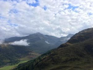
The weather started to improve and the sun even tried to come out, the air was still and it started to get warm. It was very pretty, particularly the view back down to Lundavra and its little loch (apparently Macbeth stayed on the island there) with the sun shining on it. An information board told of the history of the area, from the pursuit of the Argyll forces after the battle of Inverlochy to the communities who farmed the limestone-rich soil. If hills could speak what stories they would tell! The path was up and down through the cleared forest and eventually the mass that is Ben Nevis came into view, partially covered in cloud. Gosh, it’s big! And impressive. Suddenly I’m a bit daunted that I’m planning to climb it tomorrow! And excited.

Looking back to the tiny community of Lundavra and it’s stunning loch

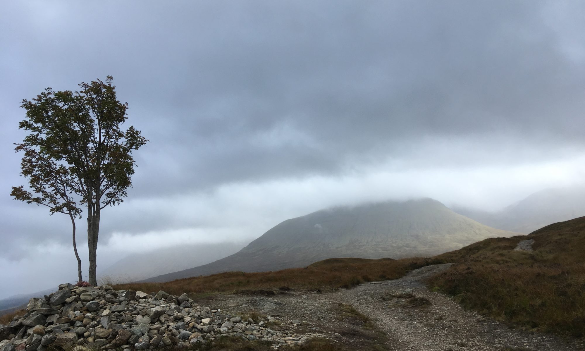
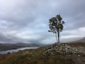
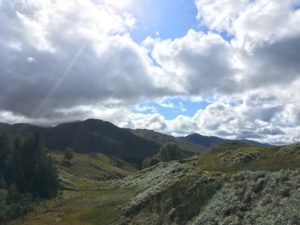
A bit further on, just before the descent into Glen Nevis, there is a turn off to the ancient fort of Dun Deardail. I’d read in a guidebook that the fort was vitrified (stone turned to glass by fire) and that the views into Glen Nevis were superb, so although I was tired and the fort was an uphill detour I decided to take a look. Well, I was a little disappointed not to see any vitrified rock but boy oh boy the views were worth it. Knocked socks off anything I’d seen today and turned a day I wasn’t enjoying all that much (it just felt slow and my legs and feet were struggling) into a splendid day. The view across to Ben Nevis was awe-inspiring and I could clearly see the mountain track, my route for tomorrow, heading up the edge. Glen Nevis itself was beautiful and wound up to the east into more tantalising peaks. To the west, at sea level (or more or less, I think) was Fort William, looking rather a long way away but at least closer than it had been all day!

Ben Nevis from the turn off to Dun Deardail
Glen Nevis

The descent into the Glen was along a wide forest track which wasn’t terribly inspiring. The woods were pretty enough, I was just keen to get to my hostel now! The final stretch of the Way follows the pavement along the main road into town which is a bit of a shame. I think there are some forest tracks which get you into town in a slightly nicer fashion so I’m not sure why the WHW doesn’t follow them, I can only imagine it’s because the Glen Nevis visitor centre is along the main road and they like you to visit! It was a bit of a slog, the last couple of miles, but thankfully my hostel was this side of town, albeit up a hill.

It was a rather anticlimactic end to the Way really, although I’d been forewarned of that so I made my hostel and a hot shower my goal! And ohh that hot shower felt good after a couple of days camping! I wandered down into town to pick up food from the supermarket and celebrated by cooking up a massive dinner of meatballs and pasta and heaps of veg. I was so full I didn’t have room for dessert but at least I’m here tomorrow too! I have managed to get an osteopath appointment for tomorrow which is great, as my shoulder/rib have been really painful. The appointment is not until 11am unfortunately which means my Ben Nevis climb gets pushed back a bit, but I think I should still be able to do it if I go straight from the appointment…provided I’m feeling ok. If not, I’ll take an executive decision on whether to spend an extra night in Fort William and do the climb on Wednesday…so far the weather seems like it will hold so we will see!

Route day 83

Day 82: Ba Cottage to Kinlochleven

Total miles: 14.4
Elevation gain: 1,801 ft
Time walking: 10am – 5:30pm
Miles to date: 1,127.5

Ok so I think today wins in terms of my favourite West Highland Way day so far! Whilst I’m in severe danger of overusing descriptors such as ‘stunning’, ‘incredible’, ‘beautiful’, ‘magnificent’ and ‘amazing’, today’s scenery really does deserve them! I think it was also the toughest day so far on the Way, other than the loch scrambling day, what with the Devil’s Staircase and the long descent the other side, but to be honest, it felt good (in a rather masochistic way?!) to feel a bit more challenged again!

The night was wild up on the moor, very wet and windy and at times I wasn’t sure my tent would stay put. It did, thankfully, and when I woke at 6am it was dark and still but raining heavily. I lay for a bit listening to the rain, all cosy in my sleeping bag, then decided that as it wasn’t an overly long day today and I was in no rush to get to my campsite this evening I might as well enjoy being cosy for a bit longer. I promptly went back to sleep and woke again 2 hours later! It was still raining but then it was supposed to be raining all day so I ate my wet weather breakfast of granola in my tent and packed everything up. Waterproofs on and out into the rain I went, which amazingly had eased to a light drizzle for me to put the tent down. The stream was very loud this morning and I went to have a quick look, finding it much higher than yesterday, with the rocks I had stood on to collect water now fully submerged in a gushing torrent. I was glad I had collected more water last night, the stream was distinctly fiercer today! Looking up at the mountain above I could see why – where one or two small waterfalls had been last night, now there were countless cascades, each white and frothy coming down off the top and converging into the stream I stood beside. It was incredibly beautiful and mesmerising and I felt sad to go!

The stream looking fierce this morning!

Rejoining the trail I soon met a few other hikers, presumably they had either also wild camped or left early from Inveroran. At one point I stopped by a bridge to put my gloves on and jumped out of my wits when a small dog suddenly appeared from nowhere and barked loudly to announce his presence! I think the owner must have been camped just below the bridge as they overtook me a bit further on. It was a wet morning – not so much on the forecasted rain front, although it was drizzling on and off – but wet underfoot, the ground was sodden and there was water everywhere, countless tiny streams gushing off the moor to join larger streams on their way to the loch below. I wonder if this place ever dries out. I doubt it!

A short climb led to a ridge which marked the end of Rannoch moor and the beginning of the stunning descent into Glen Coe, with the massive Buachaille Etive Mor dominating the valley. The mountains were huge and beautiful, and not as cloud-covered as I’d feared they’d be. It had even stopped raining! I had planned to see if I could get a cup of tea at a Kingshouse further on but when I saw the sign to Glencoe Mountain (where there is skiing in the winter) advertising the cafe, I decided to stop there instead. Three miles in and time for a cup of tea and maybe a second breakfast! The cafe didn’t disappoint, though it was expensive – £6 for a cup of tea and bacon & egg roll! – and full of non-hikers. The chair lift runs all year around so I guess it is a popular place to visit, and of course I’d forgotten that it was Sunday! It was a nice spot to drink my tea and update my blog though, and it was a good bacon & egg roll which put my dry granola to shame. The view was pretty awesome too, down the glen, watching the clouds come and go.

The stretch to Kingshouse was gorgeous, gradually making my way down towards Buchaille Etive Mor, and slow, as I kept stopping to take photos and just gawp at the scenery. I was fascinated to see wisps of cloud forming over one of the lesser peaks, I could virtually see the wind blowing up over the top and cooling into cloud. The Kings House Hotel appeared closed but there was a new-looking lodge which looked like it offered hostel type accommodation, and a cafe which I was tempted to visit. Given I’d only come another mile or two though I figured I probably ought to keep going otherwise I’d never make it to my campsite this evening! Just behind the hotel and lodge there were some flatter bits by the river that looked liked reasonable camping spots and would have been where I would have camped if I’d pushed on. They had a pretty view and a couple of people were still camped there, but I was pleased I’d stayed where I was. I guess it would be a nice spot to mix with other wild campers, but it was definitely less private and quite close to the busy road.

The view walking through Glen Coe with Buachaille Etive Mor looming just to the right

Between Kingshouse and the turn off for the Devil’s Staircase, a stretch of just under 3 miles, the scenery was breathtaking. As I neared Buchaille Etive Mor it changed shape from narrow and pointy to wide and craggy. Massive chasms split the summit and the clouds occasionally cleared for a better view. The light made all the nooks and crannies of the hills stand out clearly and it was impossible to photograph well because it was just all so big! The only downside was the busy road running right along the glen but at points the path was far enough away that I could ignore the traffic. I certainly can’t begrudge people driving this way, it would be a spectacular drive! At the turn off to head up to the Devil’s Staircase, just opposite Buachaille Etive Mor, there is a small parking area and I took a break on the bench there (sadly dedicated to a man, his 18 year old son and another 18 year old who were killed in an avalanche). I ate a light lunch of peanut butter and jam oatcakes while trying to take in the view. One of the many times I wished I had a proper camera and knew how to use it!

The craggy northernmost summit of Buachaille Etive Mor
Glen Etive

Feeling re-nourished, it was time for the climb up to the Devil’s Staircase, one of only three major ascents along the way (day two’s Conic Hill and tomorrow’s climb out of Kinlochleven being the other two) and the highest point of the way. The climb wasn’t actually all that bad but it was still a bit of a shock to the system after a relatively flat few weeks! It was also quite rocky in places, requiring focus, but it was quite doable and it even felt nice to feel a little bit challenged again. I did stop lots on the way up though, partly to catch my breath but partly to look back at the view, never less stunning.

The view back down into the valley from the Devil’s Staircase

Just as I was beginning to wish the climb would end it suddenly did, reaching the saddle between the two high points on the ridge. And I stopped looking back at the view behind me because the view ahead was breathtaking. There weren’t any iconic peaks like in the famous Glen Coe but it was beautiful. A wide, wild valley, with more mountains beyond, streams gushing down the slopes, wide open skies and not a soul to be seen, let alone a car! As I dropped down into this remote landscape it felt like I could have been the first person there, save for the well defined but rough and rocky path. Besides the sounds of bubbling streams which were never far away the air was silent. Peaceful. If it wasn’t for the midges which suddenly appeared every time I stopped I could have sat there for ages! Sadly midges have a habit of ruining beautiful spots! Still, I admired as I walked, the view changing subtly as the path gradually dropped and wound around the side of the hills. The distant Blackwater Reservoir came into view over to the east, and a lush, tree-lined glen below. There was water everywhere and the path was more often than not practically a stream bed, water flowing down amongst the rocks and pebbles until it found an alternative escape route over the edge. Across the valley a huge waterfall cascaded down the hillside from up high. I wondered if it had a name. Scotland seems to have so many waterfalls that many which would be popular tourist spots in England don’t even get names up here!

The descent was beautiful but felt long. I suppose that’s because it was a few miles, the longest descent of the WHW so far, which is strange after flatter days. My knees certainly felt it! You can see Kinlochleven nestled in the valley a couple of miles before you reach it, and added to that there is a wide loop in the path in order to follow the shape of the hill, so it feels like it takes a long time to get there. The path improves into a gravelly track and drops into pretty birch woodland, with the odd potential camping spot here and there beside the track. Lots more beautiful waterfalls as the streams make their way down the hillside, including one set of powerful falls through deep chasms in the rock just below a small reservoir. Soon the track follows along massive pipelines which were integral to the village’s smelting works. Water leaks from some of them, spraying up into the air under the pressure. The path crosses the River Leven and passes residential housing before cutting into woods beside the river. Apparently it has salmon but to my disappointment I am still yet to see any salmon leaping! Kinlochleven doesn’t seem to have the best reputation due in part to the massive buildings that were once part of the smelting works but I think it’s quite a pretty little place. It is certainly in an incredibly picturesque glen!

I avoided the main part of the village and instead continued on the path to the far end where there is a campsite at the Macdonald Hotel. They just manage to squeeze me in as they are already fully booked and I head out to find a spot. The hotel is by the end of Loch Leven and the view is stunning, although it’s hidden by trees at the campsite itself. As soon as I put my bag down and fish my tent out the midges start to swarm. It’s my first real run in with midges in Scotland and although annoying, they aren’t quite as bad as some of the midges I had along the Pennine Way. I guess that’s because I’m at the end of the season, thank goodness! The outer tent is soaking wet following the heavy rain overnight but the inner isn’t too bad so I should be fairly dry tonight. I can’t believe my luck with the weather today! It has rained on and off this evening but it stayed dry pretty much all afternoon. Once the tent was up and everything inside I quickly boiled some water for dinner then dove into my tent to eat to escape the midges. Unfortunately I realised as I was getting in that I still had my boots and gaiters on which slowed me down and meant I ended up with a cloud of midges in my tent and spent the next half an hour exterminating them one by one (aka squashing them as they land on the walls!). Not an easy or quick task, but perseverance paid off and I got them all. No midges are going to be having me for their dinner tonight! I ate my dinner (rehydrated dehydrated chicken curry, yum!) in the safety of my now midge-free tent and listened to the rain. It was still early, only 7pm! Once it had got dark I decided that perhaps the midges were asleep now and I’d venture to the bar for a bit to have a break from the tent and to make use of their wifi (no 3G here…gee, anyone would think I’m in the middle of nowhere…!). The wifi turned out to be rubbish, sadly, the glass of wine was nice though!

Chicken curry in the tent!

Now back in the tent listening to the campsite sounds and the stream running past, wondering if I have pitched in a soggy bit as I got very wet feet getting back to my tent. Fingers crossed I won’t wake up in a puddle! Tomorrow is the final day of the West Highland Way and I’m heading to Fort William. I can’t believe this section is nearly over! I’m hoping to climb Ben Nevis on Tuesday so fingers crossed for good weather. Then it’s time for the penultimate, and shortest, leg, the Great Glen Way to Inverness. I have a feeling these last three weeks are going to fly by…!

Day 81: Tyndrum to Ba Cottage, Rannoch Moor

Total miles: 15.5
Elevation gain: 1,689 ft
Time walking: 9:10am – 3:30pm
Miles to date: 1,113.1

They say the West Highland Way gets better and better and they aren’t wrong! Today’s scenery was just stunning, even though half of it was covered in cloud! The path was fairly easy going with only a couple of climbs which meant lots of opportunities to look around me on the way and I made good time, making it to my planned camping spot much earlier than I thought I might.

I woke up feeling well rested and looking forward to hitting the road again. The sun was trying to peek out from behind the clouds and it was forecast to stay dry until the evening. I said farewell to Lisa at the railway station and headed off at the very respectable time of just after 9am. The view was immediately glorious. Hills up ahead, a beautiful burn winding its way down the glen, glistening in the half-sun. The path skimmed the top of Tyndrum and I popped into the shop to replace my ham which had frozen in the fridge overnight! Then it was on the path for good, heading uphill flanked by steep slopes dotted with sheep and hundreds of gorgeous little streams cascading down the sides. For the most part it was an easy track, with just one rocky section going downhill where I had to pay a little more attention. Dominating the glen ahead was the massive peak of Beinn Dorain, which from this angle looked like a knife-edge ridge. Clouds were just hugging the top but its flanks were sunny and it was a spectacular sight to head towards. As I drew closer other big peaks revealed themselves further around the glen, with craggy tops and cavernous gullies, dwarfing the path I was following.

Beinn Dorain

The path follows the railway and skirts the flanks of Beinn Dorain crossing the countless streams that run down its slopes. The area is very open and it makes finding a good loo spot tricky! I spy a large block of trees and am disappointed but not surprised to find that many other people have had the same idea. Unfortunately they have not been considerate or responsible and have left toilet paper all over the place! People – if you need to use toilet paper, take it away with you! Pack a little plastic bag (nappy bags or freezer bags are ideal) and carry your used paper out! Yes, theoretically it biodegrades, but when a hundred people use the same spot it is not cool to leave your dirty paper flying about!! Ughh! (Sorry, rant over!)

A little way further on I got chatting to a couple of Scottish ladies who are just out for a short day hike. They are both keen hikers and one has climbed 180 munros (Scottish mountains over 3000 feet high) but has osteoarthritis in her hip and is now waiting for a hip replacement so she can climb a few more! I walked with them for the couple of miles to Bridge of Orchy where their walk was finishing and I was surprised to find I’d covered 7 miles in a little over 2 hours. Bridge of Orchy is a little village with a pub/hotel and the bridge itself is a lovely stone thing over a very picturesque river. The mountains behind – Beinn Dorain and fellow peaks – were starting to hide their heads more fully in the clouds now but I still had sunny spells which made for a pleasant walk.

The path headed up again from the bridge, through some muddy patches among young trees and heather before heading into a short section of denser forest. As I gained height I passed, or was passed by, a couple of solo hikers both of whom I saw a couple of times as we took turns stopping for photos and breaks and overtaking each other. As we cleared the forest I suddenly had the feeling of entering somewhere remote, a feeling I haven’t had since occasions in the Borders. Lonely hills covered in heather and vibrant orange/green grass and reeds, moody clouds rolling in further down the glen, rocky outcrops and the path gradually climbing higher towards the sky. Ahhh, a beautiful place! So far the West Highland Way has been nice, with some beautiful scenery, but now it is getting much more up my street. As I pass the summit of the little hill crested by the path I get a gorgeous view down to Loch Tulla and Inveroran down below, surrounded by wild-looking mountains and glens. I pause on a well-placed rock to eat my lunch, glad that I’d replaced my ham! It was only about 1pm and I was glad I hadn’t planned to stop at Inveroran (nothing there but a hotel and a couple of houses). Until yesterday I’d been planning to walk the 19 miles to Kingshouse which I’d thought was going to be a long day, but after a bit of research online I’d decided to stop a little earlier and wild camp on Rannoch Moor to make a shorter day (and to make tomorrow, which originally was only going to be 9 miles, a little longer). It now looked like I would have been able to make Kingshouse easily but I had grown quite attached to the idea of wild camping on the moor!

Moody clouds rolling in further down the glen
A lonely tree above Loch Tulla

There were several people camping down near the river just the other side of Inveroran. A few looked like they’d arrived in cars, one looked like a West Highland Way walker and then there were a group of younger people, I’m not sure if they were DofE students or local yobs, but either way I was glad I was heading further on! The route follows an old drovers’ road from Inveroran which sounded like it would be easy walking but I quickly discovered a lot of it is paved with something akin to cobbles – really irregular, uneven cobbles – which were actually quite tricky to walk on. Tiring for the feet and ankles, but I suppose at least it gave my muscles more variety than a flat gravel road would have! The road climbed up steadily passing through pretty meadow-like fields of young and old trees, multiple streams and views out to the mountains, although the mountains were becoming increasingly shrouded in cloud. The big bulk of the Black Mount to my left was particularly shrouded, dark grey clouds smothered it protectively. I had no idea of its height but judging by the bulk of its slopes it felt like it must be a big one. It and the peaks around it, also smothered in dark cloud, seemed to repel the brighter sky, instead hunkering down moodily on the skyline, looking both intriguing and unapproachable at the same time.

The drovers’ road leads up onto and across Rannoch Moor, a lonely, desolate and heart-achingly beautiful place. The colours are surprisingly varied; black and grey rock, brown and purple heather, the surreal but striking orange of the grass that grows ubiquitously up here, splashes of green of normal grass, lime green and red moss, white foaming waterfalls and silvery lochs, all contrasting dramatically with the moody grey sky above. The path winds gently around hummocks and dips, wide but ever dwarfed by the expansive moor and the massive hills surrounding it. A few miles in I reach the first major landmark, Ba Bridge, over the gushing Ba River which heads out across the moor, settling into lazy bends before filling a small loch to the east. My research had told me that there were some potential camping spots near the bridge, and a few more by Ba Cottage, a ruin, half a mile further on. I easily found the spots just before the bridge, there is a small hill with several small grassy patches, perfect for a small tent or two. Sadly I was once again disappointed at the human race. This idyllic spot, with lovely views out over the river, loch and hills, was utterly spoiled – not only was there toilet paper lying around, left to flutter in the breeze, and blow away across the moor, but actually piles of human excrement too! Right by the camping spots! Yuck, yuck, yuck! People hadn’t even had the decency (not to mention a basic sense of hygiene!) to walk the few metres over to the other side of the hill away from the flat pitches. I couldn’t believe it, and apologies for mentioning such unpleasantries in my otherwise happy blog today, but it makes me so cross when people don’t show even a basic level of respect for the environment or fellow enjoyers of the countryside. Ok, rant number two over! Last one, promise!

Disappointed by the state of that spot I headed on over the bridge, stopping briefly to admire the pretty rock formations over which the river flows. A solo hiker was resting by another, smaller but cleaner, flat spot just by the river and I debated asking whether they were planning to camp there but decided to head onto the cottage to see whether it had escaped the attention of unruly campers. Everywhere else was damp and/or deep with heather and moss so I was hoping the ground around the ruined cottage would prove suitable, otherwise it would be on to Kingshouse as originally planned.

Beautiful colours
Part of Rannoch Moor

I spotted the ruins up on the hillside with some promising greeny yellow patches of grass surrounding the walls and a stream running a few metres away. A rough track led up to it and happily the ground was perfect and clean, save a few bits of tissue around the back. No poo here though, phew! There were in fact several potential spots, I think you could probably fit 6-8 small tents here, a few next to each wall. I chose a side which was slightly sheltered by the walls, where someone had fashioned a low bench out of a long thin slab of stone and quickly set up my tent while it was still dry. I’d had a light shower earlier and more rain was forecasted this evening but it was currently dry. I was here much earlier than planned, and earlier than I’d really wanted to be – I had a lot of time to fill before bedtime!

Camping by the ruins of Ba Cottage on Rannoch Moor
Looking out over Rannoch Moor

With the tent up I went to collect and filter water, always a therapeutic task (unless it’s raining!), then relaxed with a big cup of tea and some biscuits, just enjoying the view. It’s amazing how it changes as you look at it, as the clouds move over and the light changes. Wisps of cloud would drift over the big peak behind me, often obscuring it completely for a while, while the peaks back the way I had come still remained more or less permanently shrouded. Even arriving so early the time gradually passed, mostly with me lost in my thoughts and gazing at the stunning view. I can’t quite believe I am here, amongst this scenery. I feel so lucky, although also a tiny bit lonely. Wild camping is more fun with two people. There is no phone signal up here let alone internet which is both very satisfying and very isolating. It has also been the first time in a while that I have had lots of time to myself to think, and thinking is a bit scary, especially getting so close to the end now! Walking is the easy part!

To break up the thinking and view-gazing I decide I might as well make dinner before it starts to get chilly. Where I am sitting I am sheltered from the wind that comes and goes but I can tell the temperature will drop rapidly later. My tent is flapping in the wind. I know that it is sturdy enough to withstand it but it is still quite unnerving to see it quiver and bend when the wind catches it. It looks like a flimsy piece of silk held down with a handful of pegs! I know it will be cosy inside though, despite the wind, even when the rain comes. With dinner (vegetable hotpot) eaten I filter another couple of litres of water so I don’t have to do it in the rain tomorrow. I feel the chill coming so make another cup of tea and decide to retreat to my tent to get warm, even though it is not yet 7pm and still light.

The rain comes and I’m glad I’m cosy in my tent, but just before dark it stops for a bit and I decide it would be sensible to have one last wee, given the multiple cups of tea! I venture out – gosh it has gotten chilly! I’m glad I ventured out though, the clouds have cleared and I can finally see all of the mountains! Wow! I can’t describe, or capture in a photograph, how impressive this place is, you need to see it for yourself! I would have loved to stay and take it all in for a while longer but the wind was rapidly trying to strip away my heat so I did my business and headed back to the warmth of my tent and sleeping bag. It is now dark and it is windy but the rain still hasn’t returned. Maybe it will stay away…that would be wonderful! Whilst I don’t really mind the rain, tomorrow of all days I would like it to be clear as I pass through the most scenic section of all, Glen Coe and the Devil’s Staircase. If it is raining it is likely I won’t see a thing!! But it will be what it will be…and I have a feeling I’ll be back here one day anyway. For now though, looks like it will be an early night!

One last venture out of the tent just before dark to find the clouds have cleared from the mountains!

Day 80: Rest Day

Day 80: Rest Day

Oh the delight of a lie in, waking up not knowing what time it is but not needing to, cosy in my sleeping bag in our little hobbit hut, listening to the rain pattering on the roof. Cup of tea in bed, a first breakfast of oat cakes with vanilla almond butter, a little bit of Facebook scrolling (a rare occurrence the last few months!) and a little bit of stretching.

We decided to wander the short distance into town for proper breakfast, in flip flops and waterproofs, feeling sorry for all the wet-looking hikers and making it to the cafe and ordering just before they switched to serving lunch. A wee bit of planning over breakfast and coffee, then tea and cake, then a wander up to the couple of shops to get my form stamped and to pick up some supplies for the next few days.

Back to the hobbit hut and the rest of the afternoon is spent trying to plan the last two legs of my journey, the Great Glen Way and the final leg from Inverness to John O’Groats. It’s a bit of a headache! Finding it hard to pin down timings as I have no idea really how long the last leg will take me, it mostly depends on what route I actually take – stick to the road (dull and potentially dangerous) or try the fledgling John O’Groats Trail (mostly unmarked and potentially horribly overgrown in places). I’ll probably end up trying a combination of the two. It also depends how my body is doing by then and how quickly I want to finish. Part of me doesn’t want this journey to end, part of me just wants to get it done. But it was a headache to try and plan, so I’ve decided to leave it flexible, at least until I get to Inverness. Unfortunately it looks like I won’t complete in 100 days which was my original aim. I could do it if I pushed it but I’m not sure that would be the wise thing to do so I’m just going to go with the flow a bit and see how it all turns out. I’ll figure it out!

For now I just need to focus on the next few days and the end of the West Highland Way. I have three days left and I’m planning to wild camp along the way, then, weather dependent, I’m hoping to climb Ben Nevis. Might squeeze in another rest day even it seems a bit soon, to try to see an osteopath about my shoulder and to replace a few items of gear that are on their last legs – excitingly there is a Cotswold Outdoor store in Fort William!

It’s going to be strange heading out on my own again after having company for the last three weeks, part of me is excited and part of me is nervous. It’s strange to think I’m so close to the end now, only about three weeks to go!

Day 79: Inverarnan to Tyndrum

Total miles: 12.7
Elevation gain: 1,375 ft
Time walking: 10am – 4:45pm
Miles to date: 1,097.6

Compared to yesterday, today was a dream! Beautiful scenery (that we could actually see), easy path, dry (once the morning drizzle had cleared) and even ending in beautiful sunshine and blue sky! The only issue was that my feet weren’t terribly happy today. They were not pleased to go into my boots this morning, the first time it has felt genuinely unpleasant to be putting my boots back on, and although they warmed up and came back to life after a mile or so they quickly tired and were aching like crazy with several miles still to go. I’m hoping it’s just a temporary blip and it isn’t downhill from here! Perhaps (hopefully) it is just my feet getting used to the ‘new’ boots…

We both found it a bit hard to get up this morning after yesterday but at least we had a good breakfast to get us going. There were lots of hikers around, some left fairly early and some left after us, but there were a fair few on the trail today and we crossed paths with a few of them several times. It was drizzling lightly as we set off but not enough for the waterproofs thankfully. Benglas Falls, a stunning cascade of white water spreading out across the rocky hillside across the glen was looking and sounding spectacular – one good thing about all the rain! The path followed a decent, probably almost driveable, track up through the beginnings of Glen Falloch, where the scenery opened out to craggy hills partially shrouded in mist, with the River Falloch coursing through at the bottom. Numerous streams headed down to the river from the hillside – definitely no shortage of water today – and the sound of cascading waterfalls, from small and dainty to big and thunderous, filled the still morning air. We had glimpses of the Falls of Falloch from above but I think the best viewpoint would be from the other side of the river where the path is closer. It would have been a bit of a detour though and I wasn’t sure it would live up to the Falls of Clyde!

Stunning scenery today

Just over three miles and a few small climbs in we stopped for a quick break having made good time on the easy terrain. At this rate today was going to be a short day! Our legs were reminding us that they were a little tired though, and my shoulder is complaining a little louder each day, so we took care to rest from time to time. The handy thing about lots of streams to cross is that there are a fair few bag-height bridges to rest on! We are also hungry. I think I am more or less on top of the calorie intake now, although some days I’m far hungrier than others. I just make sure I have lots of snacks to hand, with spare snacks for the hungrier days!

Shortly after our break we crossed under the railway line through a tunnel that we had to crouch down to get through. One of the (many) times I’m glad I’m not a 6ft plus guy! The path climbed up again the other side and tracked along the opposite hillside of the glen. The views were stunning! The sun wasn’t out yet but it was brighter and the light made interesting patterns on the hillside. It was a shame that the road that threads through the glen was quite busy and loud but the rest of the glen was peaceful. We could see several groups or couples dotted along the path as it followed the hillside, all in bright colours with their waterproof rucksack covers or high vis gear or just bright clothes. We also came across several cows, thankfully of the very friendly, docile variety, with fluffy calves, looking rather bedraggled after yesterday’s rain. There were also lots of very muddy patches needing to be skirted around, and big puddles, which I just sploshed through. Love my boots and waterproof socks! We stopped for lunch just before the halfway point before we headed into the forest so we could make the most of the view. It was a good lunch, we’d picked it up from the Drovers Inn, although I think the most expensive packed lunch I will ever eat – £7.95 for a tuna sandwich, a juice carton, an apple, a packet of crisps and a cereal bar!! Still, it was sustenance and meant we didn’t need to detour into Crianlarich for lunch. It amused me however that the cereal bar was an “Alpen Light” which proudly stated that it contained only 70 calories. Perfect hiker food…??!! Hmmm, I think not…! We’d sat on the side of the path on a sloping gravel bank, not the best choice of seating as we kept sliding off the tarpaulin and had to wedge ourselves in slightly, but the view was nice! Typically, about 100m further on we spotted a couple of perfectly situated benches just before the trees. Ah well!

Looking back down Glen Falloch

The detour to Crianlarich leaves the main path just before the forest, at Crianlarich Crossroads where another path leads down a different glen. More paths to explore another day! There was a large group of Americans gathered around, presumably out for a day hike and they were very jovial, although apparently not too keen on the hills! We crossed paths a few times as we headed up into the forest but beyond that the only person we saw for several miles was a lone trail runner. Stunning place to run, even if I do think they are a bit bonkers! (Yes, I know, I’m sure they’d say the same about me…). The forest was pretty; coniferous but not overly dense, with bright green spongey moss covering the forest floor and bluey green lichen frosting the gnarled bark. A place where fairies live, no doubt! The sun had come out and dappled on the forest floor, making the bubbling streams sparkle on their way down the hillside. At the bottom we passed under a beautiful railway bridge and paused on the wall by the river in the sun to rest my bag and our feet for a bit. We didn’t dare stop too long though – every time we stopped our feet hurt even more!

A mile or so further on we passed the ruins of St. Fillan’s Priory, all covered in moss, and a burial ground with ancient looking gravestones. Just past that the path goes through a campsite with a little shop. As we were still making good time we decided to stop for an ice cream to make the most of the sun (it is supposed to rain for the next few days) and the civilisation! The little shop was great, selling lots of useful snacks and bits of food. I think they even did tea and coffee and bacon rolls!

Highly tempted to stop right there (they had wigwams!) we shouldered our packs for the last couple of miles, thankfully with stunning views of the Crianlarich Hills (all pointy mountains) behind us and the wide glen we were walking along. The path followed a pretty river through light woodland, past the lochan into which – legend has it – Robert the Bruce threw his sword, and then a winding path through Tyndrum Community Forest, a forest regeneration project where the trees are all still quite small. Our feet were complaining quite loudly by this point but it was a pretty walk. We were thrilled when a sign indicated we only had 500m to go to our campsite, a little closer than expected, and we picked up the pace excitedly.

The Crianlarich Hills

We reached “By the Way” footsore but happy, thrilled to have arrived at a sensible hour with time to rest, eat and enjoy the evening. We checked in and got chatting to the owner who it turned out had himself walked LEJOG 12 years ago! Except he did it January-March, climbing mountains along the way. Nutter! Great guy though, really interesting to hear about his version! Tonight (and tomorrow (an early rest day)) we are staying in a hobbit hut! It’s really cute, a little wooden hut with mattresses and electricity – glamping I guess! We cooked dinner (pasta and sauce) on my stove and somehow the evening has disappeared. Still, for once I’m finished writing this blog before 10pm which makes a change! Definitely need to do some stretching and massaging tonight though, I have not been good at that lately and it’s showing. Need to last another 300 miles! And tomorrow I need to plan those 300 miles…!!

Our hobbit hut!

Day 78: Rowardennan to Inverarnan

Total miles: 16.3
Elevation gain: 2,112 ft
Time walking: 9:30am – 7:30pm
Miles to date: 1,084.9

Wow, today was way harder than the mileage suggests! Or maybe I have just gone soft after a week or two of fairly easy walking and lots of rest days! Either way, despite an early-ish start we arrived tired, wet and footsore just as it was getting dark, very pleased that we have a bed for the night.

We are starting to see familiar faces along this section of the route and many of them were at breakfast at the hostel, hardly surprising as it’s pretty much the only place to stay around here unless you’re camping. The place was buzzing with hikers getting ready to take on the various bits of their walks, with a handful of non-walkers looking on slightly bemusedly. It was forecasted to be rainy all day but although the clouds were down around the hills it was dry as we set off.

The first bit of the day was along an unsealed road and I started to wonder if the whole way was going to be that straightforward (and a little dull) to walk. I began to doubt the stories I’d heard about the Loch Lomond section being tricky! My (admittedly slightly out of date) guidebook had warned against taking the lower of two options early on in the day but when we reached the fork the signpost pointed down so down we went. There were a few slightly scrambly bits down along the loch but nothing like I had imagined given the guidebook’s warning, and I wondered whether it had been written by someone walking in flip flops. At least it was an interesting path, and pretty, making its way between the twisted trees and fallen rocks, finally feeling like a proper hike. It started raining properly after about an hour so it was time to test out whether my re-waterproofing spray had worked! After a few miles we passed Rowchoish bothy and popped in to have a look. It was much bigger than the two I’d stayed in on the Pennine Way, and not as cosy or as well stocked with wood, but it was a nice break out of the rain. Shortly after the bothy we rejoined the “easy” track (not signposted on this side either) and the walk was a little more straightforward for a while. Not having to look at our feet quite so much we could look around a bit more. There wasn’t much to see over the loch – the mist had rolled right down so the far side was barely visible, let alone the mountains beyond! The woods we were walking through were pretty though and we climbed and dropped continuously from hillside to lochside, one moment walking through trees of all types the next scrambling over rocks with the water of the loch lapping just below.

Not such a great view today!

Although pretty, it was fairly samey, and with the clouds obscuring the views it felt like a long way to our lunch stop at Inversnaid! We arrived feeling damp and tired from all the ups and downs and rough terrain and looking forward to our packed lunch that we had bought at the hostel. Crossing the beautiful Inversnaid Falls (not stopping to admire them as much as they deserve because of the rain and our rumbling tummies) we reached the hotel and sat out in the rain on the benches in front. A couple of hikers came out of the hotel and told us that there was a room that the hotel let hikers use to dry off and eat their lunch in. They probably thought we were crazy, sitting out in the rain! We went inside and there was indeed a good sized room full of steaming hikers eating their lunch, drying their gear and drinking cups of tea. It seemed we’d arrived towards the end of lunch as most of them left not long after we arrived (do I smell that bad already?!), although a few more came in as we were there. It was amazing to sit down and strip the wet waterproofs off – they really aren’t doing a very good job of keeping me dry, despite the rewaterproofing! A few cups of tea and some chocolate later we realised that we had been stopped over an hour and really needed to get going, we were only halfway! It was a bit of a struggle, putting my wet clothes back on and persuading my stiffening joints (the knees are particularly bad at the moment) that they could go back out in the rain and walk another 7-8 miles. How tempting were the advertised vacancies at the hotel!!

Nevertheless we set off feeling reenergised by our break, ready (more or less) for whatever the rest of the day would bring. It wasn’t long before we realised that this stretch was even harder than the previous stretch (I have no idea why the guidebook suggested that the earlier route we took should be avoided when it was far easier than this section!). Lots of scrambling over rocks, big boulders, tree roots and wide muddy patches, all made more challenging by the constant rain and the heavy pack. It certainly felt like I was earning my dinner! The tricky terrain was incessant, with only brief stretches of narrow gravelled path breaking it up slightly, making for burning thighs, aching feet and thumping heart. Every hundred metres or so there would be beautiful streams cascading down little gullies and there would be smooth stepping stones, some a small hop, others a large step, others a careful tiptoe across the stream bed itself. After a while I gave up trying to keep my feet dry and just splashed through the wider ones!

Rough ground
But pretty waterfalls!

While resting my bag for a bit on a conveniently placed rock (my shoulder is pretty painful today – need to find an osteopath!) a girl caught up with us and told us that the guy she had been walking with had left her behind as she was walking more slowly. She was angry at him and also nervous and fed up of walking on her own because of the tricky terrain so we invited her to walk with us. Emily is from Israel and she was amazed by the rain – not something she gets much of back at home! It was slower going with three but good to walk together and keep each others’ spirits high, and she was so grateful to us!

From time to time the mists would part slightly and we would get a glimpse of what the day might look like if it were clear. Up above us the hills rose steep and craggy, mists drifting over the ridges and forests, looking almost like the rainforest or like we could be in Jurassic Park! No dinosaurs, thankfully, although we did see several of the feral goats that roam the banks, with their shaggy fur and tall curved horns. Lunch started to feel like a long time ago, but eventually the path flattened out slightly on a patch of open ground near the northern end of the loch, with a great view back down the loch and the steep wooded slopes we had walked along. One clever/mad/brave soul had opted to wild camp there tonight and although I envied the spot, for once I didn’t completely envy the camping!

All looking rather mystical

The second bothy of the trail, Doune Bothy, was just up ahead so we squelched through some more grass and mud terrain and came over a rise before seeing the little stone shelter down below. It was a relief to get inside and sit down, stripping off the wet waterproofs once more and eating some much needed food in the dry. There were several other hikers there, a few just stopping for a break and a few stopping for the night. I was slightly envious of those staying for the night as it meant they were done for the day, although nobody had lit a fire so it wasn’t as cosy as the bothies I’d stayed in. It was big though – easily four times the size of Spithope!

We only had three miles to go now, and we felt refreshed again. We’re also getting used to feeling soaked through (although I’m a bit miffed that Lisa’s £10 Peter Storm poncho appears to be keeping her far drier than my £300 Mountain Equipment jacket!!). It is starting to get a bit late though and it looks like we might be pushing dusk when we reach our accommodation so we hope that the path might be a little easier since we’re leaving the loch edge.

Well, it is a little easier, but only marginally! It does seem wetter though, but given we are already so wet we just squelch through it all. The hills that reveal themselves as the mist drifts around hint at a spectacular view in fine weather and it is stunning even today. Scotland really is a very beautiful place and I think I’m going to enjoy the rest of the West Highland Way! We stop to take it all in atop the small but cheeky hill that has suddenly presented itself, puffing to catch our breaths. Our feet are starting to throb so we try to not pause for too long. We see a baby frog. (A froglet?). Cute! Shortly afterwards a second tiny frog hops somewhat pathetically across the path. Then a third, which is met with much less interest. The fourth, I nearly squash accidentally, and then I lose count. There were a LOT of kamikaze baby frogs up there! We saw lots of big ones too, and toads! All enjoying the rain no doubt!

Tired and wet but still smiling!

The last two miles seem to go on forever. The path drops down from the open hill back into the trees, gradually making its slippery way down towards the river (we’ve finally lost the loch). And then we see the lights, happy happy lights, which can only be from the Drovers’ Inn, our stop for the night just off the path on the other side of the river. It still seems to take forever to get there, through Beinglas Farm campsite, past the soggy looking tents and onto the road into Inverarnan. My feet are wet and throbbing, my knees hurt, Lisa has just walked the hardest hike of her life and we are both ready to crash out!

It was such a relief to get to our room and find it warm and cosy, with a radiator and coat hangers to dry out our damp clothes. My hat, top and the upper half of my trousers are soaking wet. Ah well, they’ll dry and the weather is supposed to clear up by mid morning…fingers crossed! It is supposed to be a slightly shorter, easier day tomorrow but I’m not going to hold my breath!

Day 74: Rest Day

Perhaps surprisingly, today was a difficult day! I know everyone likes to see happy smiley pictures and posts about how much I’m enjoying the walk but when I started on this journey I made the decision to share “warts and all” (maybe saving you the blister photos though… ? ).

Today has been tough. Rest days always are, which might seem surprising! When I’m walking, I just need to walk. I’m getting pretty good at that now! Rest days are a bit misnamed though…yes I’m physically resting (mostly) but mentally and emotionally they are often the toughest. I use them to sort through my kit, dry and air stuff out, assess what I need to replenish and find supplies to get me through to the next potential supply stop, balancing necessity, comfort and adequate nutrition with weight to carry and convenience of having to divert or stop for supplies. I catch up on blogs, stretch, give myself some sometimes painful self-massages, cut my toenails, plan the route and accommodation for the next week or so and repack my restocked bag. Every time I find working through those logistics quite stressful! On top of my body crashing just a bit every time it stops for more than 12 hours and seeing friends with their loved ones when I’m heading out on my own. Altogether, the day rarely feels all that restful!

Today felt more tough than usual though. The elation of reaching Glasgow had to have its comedown and the sensory overload of being back in a city surrounded by people leading ‘normal’ lives, meeting up with friends, having to decide what to wear, feeling strange in jeans and sandals and the excitement and energy of the conference build up, all has taken its toll and I feel physically sick. My body is aching perhaps the most it has the entire trip, my tummy is cramping and I literally just want to curl up in a ball under the duvet and hibernate! I’m struggling to regulate my body temperature – I think due to the combination of feeling incredibly tired and having come from four weeks being pretty much outdoors day and night (no rapid changes in temperature to contend with) – and I’m feeling an emotional mix of overwhelm at the thought of having another 300+ miles to walk and overwhelm at the thought of NOT walking…!

I guess today, and the next couple of days, will give me a taste of what getting back to reality in a month’s time will be like. Thankfully I do know that I will get through it, and I just have to listen to and embrace how I’m feeling and let my body have what it needs. But right now it feels a bit rubbish! So, happy face will definitely be back – it is still there, it’s just buried under the duvet with King Jennifer for now!

And to ease worriers’ minds, I AM ok. Yes I could do with a few hugs, and I know I’ll get those. But something I’ve learned about resilience – being resilient doesn’t mean being happy all the time, it means being able to ride the lows knowing that the next wave will come. And so I will sit and wait patiently for that next wave and maybe take a couple of paracetamol…!

Thank you so much for all your amazing messages of support and your donations. I read every message and even if I don’t manage to reply to them all they really help cheer me along, so please keep them coming! Xx

It’s a tough decision…dry the tent out or have a bath…!
Well, this feels odd!!
Strange footwear…