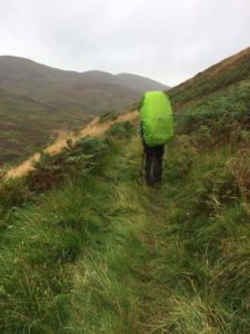
Total miles: 16.5
Elevation gain: 2,120 ft
Time walking: 10:30am – 7:30pm
Miles to date: 1,068.6
Full blog to come

My journey from Land's End to John O'Groats on foot

Total miles: 16.5
Elevation gain: 2,120 ft
Time walking: 10:30am – 7:30pm
Miles to date: 1,068.6
Full blog to come
Total miles: 12.9
Elevation gain: 735 ft
Time walking: 11:30am – 5:30pm
Miles to date: 1,052.1
Full blog to come!
Total miles: 12.5
Elevation gain: 731 ft
Time walking: 11am – 5:15pm
Full blog to come!
Perhaps surprisingly, today was a difficult day! I know everyone likes to see happy smiley pictures and posts about how much I’m enjoying the walk but when I started on this journey I made the decision to share “warts and all” (maybe saving you the blister photos though… ? ).
Today has been tough. Rest days always are, which might seem surprising! When I’m walking, I just need to walk. I’m getting pretty good at that now! Rest days are a bit misnamed though…yes I’m physically resting (mostly) but mentally and emotionally they are often the toughest. I use them to sort through my kit, dry and air stuff out, assess what I need to replenish and find supplies to get me through to the next potential supply stop, balancing necessity, comfort and adequate nutrition with weight to carry and convenience of having to divert or stop for supplies. I catch up on blogs, stretch, give myself some sometimes painful self-massages, cut my toenails, plan the route and accommodation for the next week or so and repack my restocked bag. Every time I find working through those logistics quite stressful! On top of my body crashing just a bit every time it stops for more than 12 hours and seeing friends with their loved ones when I’m heading out on my own. Altogether, the day rarely feels all that restful!
Today felt more tough than usual though. The elation of reaching Glasgow had to have its comedown and the sensory overload of being back in a city surrounded by people leading ‘normal’ lives, meeting up with friends, having to decide what to wear, feeling strange in jeans and sandals and the excitement and energy of the conference build up, all has taken its toll and I feel physically sick. My body is aching perhaps the most it has the entire trip, my tummy is cramping and I literally just want to curl up in a ball under the duvet and hibernate! I’m struggling to regulate my body temperature – I think due to the combination of feeling incredibly tired and having come from four weeks being pretty much outdoors day and night (no rapid changes in temperature to contend with) – and I’m feeling an emotional mix of overwhelm at the thought of having another 300+ miles to walk and overwhelm at the thought of NOT walking…!
I guess today, and the next couple of days, will give me a taste of what getting back to reality in a month’s time will be like. Thankfully I do know that I will get through it, and I just have to listen to and embrace how I’m feeling and let my body have what it needs. But right now it feels a bit rubbish! So, happy face will definitely be back – it is still there, it’s just buried under the duvet with King Jennifer for now!
And to ease worriers’ minds, I AM ok. Yes I could do with a few hugs, and I know I’ll get those. But something I’ve learned about resilience – being resilient doesn’t mean being happy all the time, it means being able to ride the lows knowing that the next wave will come. And so I will sit and wait patiently for that next wave and maybe take a couple of paracetamol…!
Thank you so much for all your amazing messages of support and your donations. I read every message and even if I don’t manage to reply to them all they really help cheer me along, so please keep them coming! Xx
Total miles: 20
Elevation gain: 786 ft
Time walking: 9:30am – 7pm
Miles to date: 1026.7
Today was one of those days that you think is going to be easy (ish) but ends up being quite tough! Randomly closed and/or unsignposted paths made for a few unanticipated extra miles and long flat walking on tarmac paths made for achey feet and tight calf muscles! On the plus side, the weather stayed mostly dry despite rain being forecasted all day and I reached Glasgow, a massive milestone on my journey.
After heavy rain last night (although thankfully not the stormy winds which had been predicted) and a few raindrops still pattering on the tent this morning I thought we were going to be in for a wet one. Amazingly, and unpredictedly (and yes, I know that’s not actually a word but I like it!), the rain somehow stopped sometime between me waking up and me finishing packing up inside the tent so when I emerged blinking into the new day my waterproof was only required for warmth, not dryness! We got the stove going for tea while we took the tents down, wet after the rain but quickly and temporarily wrapped up in plastic bags ready to be aired out at the hotel. For breakfast we ate our remaining dehydrated meals as we knew we had a longish day and didn’t know if we’d stop for a proper lunch. Anneliese had chicken curry and I had mushroom pasta…those well known breakfast dishes!! Rounded off with an avocado and some chocolate. I tell you, you eat some random things when you’re walking!

We headed out of the campsite feeling optimistic about the day ahead, the wardens’ best wishes ringing out behind us (they said if they’d known we were walking for charity they’d have waived our fee (there’s a lesson for me there!) but instead gave us a donation for our charities). Our first challenge was to pick up the path again, which looked easy enough on the map. Haha. Something about lessons… The ‘path’ (not signposted) apparently went pretty much straight over a busy slip road coming off the motorway, under a bridge on the edge of a massive roundabout and along another slip road that led onto a dual carriageway. Hmmm…something not right about that! We spotted a bridge that looked like it spanned part of the roundabout and tried to figure out how to get to it. For some reason we thought clambering up and following a pathless overgrown bank, between a new-looking wire fence and the campsite fence, was a potential route to the bridge. Obviously it wasn’t, as we realised when the wire fence went on forever into the distance, between us and the footpath we wanted! So back we headed, wondering what passing car drivers would be thinking of the two hikers walking along a busy roadside bank, spotting along the way that the path actually came up to the bridge from the other side, having passed under the bridge first. Well, that made much more sense, and after doing a loop the loop we made it onto the bridge. Another loop the loop at the other side, a brief stop to remove waterproofs, and we’d finally made it to the other side of the busy intersection, about half an hour after setting off. The campsite was all of about 200m away!
Heading up one of the smaller roads towards Bothwell Bridge we found where the actual path should have come out, where a sign apologised that “this section of the Clyde Walkway is closed”. No indication of why, or of an alternative route! But at least that explained why we’d found it hard to pick the path up from the other end. Never mind, our onward route followed a cycle path for a way, sheltered from the busy road by a hedge before leaving the busy road for a smaller road past an industrial estate. About a quarter of a mile past the industrial estate I looked at the map, confused, realising we had walked past the point the path turned off the road onto a footpath down through the woods. We walked back and found the right spot. Tall, spiky, padlocked metal gates stood across the overgrown path, big concrete bollards in front. Litter had collected at the feet of the gates and it looked like they hadn’t been open in a long time. There was no other way through, but no sign indicated that the path was closed, in fact there were no signs at all. I checked the map…the gps…and yes, we were definitely in the right place. Hmmm. Confused, I did a bit of googling and found an information leaflet I’d not seen before which mentioned something about maybe finding it difficult to walk through this section. Helpful! It did suggest an alternative if you “didn’t want to try” the Craighead section…well, I wanted to, just couldn’t! Bizarre. Anyway, reassured that at least I wasn’t going crazy but disappointed that we would miss what looked like a nice wooded section in favour of roads and housing estates, we headed back down the road for the second time, following the suggested alternative route. As we came out along a busy road we suddenly spotted a Lidl, looked at each other and almost simultaneously asked “shall we stop for a pastry?!” We felt we needed a break after the rather haphazard start to the day! Lidl does amazing pastries and we ended up buying two each (too much choice!) along with a big bar of crispy chocolate and some bananas. We then visited the snack van where the kind man gave us our coffees for free when he heard what we were doing, and took our goodies to a step in the sun (not the one with the bottle of wee on it…!). We promptly wolfed down both pastries, the coffee and the entire bar of chocolate, concluding that we’d clearly needed it, especially when we realised we had walked 3.5 miles but only ticked off 1.5 miles of our total day. Argh!
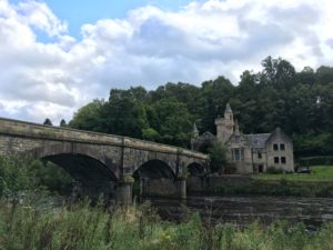
Thankfully after we’d had our break and made a fresh start things got better. We found our way back to the path fairly easily at Blantyre and it was a pleasant walk through woods along the river, crossing at a tall bridge by a weir where a nice old man stopped to chat and gave us a generous donation. We were sheltered from a rain shower by the trees, and the smell and the colours of the autumn leaves took me back to university days, walking along the banks of the river in Durham to lectures. We had a short climb up to red-stoned Bothwell Castle – ruined but imposing on the hill above the river – before dropping right back down again.
Just before Kylepark the path crossed over then left the river to enter into a brief spell of what felt like proper countryside. We had a heavy rain shower and paused to don waterproofs, although in the end it only lasted a few minutes. A slight misturn (according to the map, but the way markers disagreed!) and retracing steps along the road took us along a further road section, the first bit quite busy, the second bit much quieter and down over Rotten Calder (love that name) then up the other side. It was quite a long stretch of road walking which is never fun but it was a nice countryside break before the city. We hit the first signs of city life at Newton where there were big new housing estates, then joined a cycle path which although pretty was the start of the next tarmac stretch which lasted all the way into Glasgow. Gradually the sense of coming into a city started to grow – bigger buildings, more people, trees giving way to industrial parks – but I was impressed at how green it stayed. The cycle path hugged the river so there was always a bit of nature around.
The first few miles from Newton went fairly quickly with the good path and our eagerness to get to Glasgow, but the constant pounding on tarmac was tough on our feet and the miles gradually seemed to get longer! It didn’t help that the helpful cycle path signs gave the distance to Glasgow centre but we had an extra mile and a half to go after that! We also grew increasingly conscious of how conspicuous we looked…I don’t think many long-distance hikers venture into the centre of Glasgow! We saw more and more dog walkers, then runners, then people who were clearly on their way home from work, all in lovely clean clothes! The path comes into central Glasgow through a pretty park by the river and we stopped for a final rest to people-watch for a bit, already feeling slightly overwhelmed by all the activity, the busy-ness. What fascinated me were the pedestrian crossings. It felt so strange to have to stop at a road and wait for the green man to be able to cross! I wasn’t used to my speed being so determined by something beyond my control!
The last mile was tough, our feet were aching and my hips were feeling it, going down steps felt particularly challenging! But Glasgow was pretty by the river, lots of striking bridges and a mixture of old and new. Remarkably, the rain had held off since the brief heavy shower and it was a pleasant evening. Finally we saw our destination – the Premier Inn across the river from the Scottish Exhibition and Conference Centre – and we learned that our friend Eunice was there outside waiting for us. We hit 20 miles just as we drew up outside the hotel, really pleased as Anneliese had been determined to break 20 miles at some point!
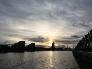
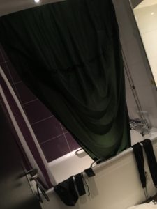
And there we are. We reached Glasgow! I can’t quite believe it! Tomorrow I have a rest day and then I am pausing for a couple of days to attend the U.K. Annual Arbonne conference which I have been aiming for. It will be amazing to catch up with friends and have some inspiring training but it is going to be strange to be in the same place for 4 nights when the longest I’ve stopped before is 2! And all these people…! A bit of a shock to the system! It’s also where I say goodbye to Anneliese which will feel really weird, and rather sad. The good news is I have another friend, Lisa, joining me for the next 5 days walking, so I’ll have some more company. But for now, lots of food to be eaten and rest to be had…not to mention drying out my tent in the bathroom…!
Total miles: 9.6
Elevation gain: 355 ft
Time walking: 12pm – 5pm
Miles to date: 1,006.7
Wow, I cracked 1000 miles! Such an incredible milestone and yet it feels rather surreal! I’ve actually walked 1000 miles?! It’s amazing what the human body can do, if you treat it well and put your mind to it! The walk itself today wasn’t the most exciting or enjoyable of walks, and I think it was the second shortest day of the whole trip so far (mainly down to being driven by the location of the only campsite between Maudslie Bridge and Glasgow), but it was a nice day all in all.
It was a dry morning and although we didn’t have the sun on our little spot the sky was blue and the air was fresh and we very much enjoyed our breakfast and tea on the river bank! With such a short walk ahead of us we didn’t need to rush off so we decided to make the most of our beautiful spot, just relaxing and enjoying the peace. It’s amazing how easy it is to pass the time just by being. By enjoying nature and all the sounds, the way the light reflects off the rippling water, the wildlife you can hear if not see. We saw a heron going about his business, and the orange and blue streak of a kingfisher – the first Anneliese has ever seen! Neither of us particularly wanted to move! We knew that soon we’d be heading into more urban areas and we weren’t looking forward to that after our days of hills, rivers and wild camping!
Happily our tents went away completely dry, a rare luxury these days, and we packed up leisurely, eventually being ready to head off at midday. The first mile was through pretty woodland along the river but then the path left the river and joined a short stretch of fairly busy road up a hill, crossing a busier road at the top. Main roads feel quite daunting after days of footpaths and small country roads! After that the path followed a gravelled farm track for a while and we spotted the first signs of the city in the form of a tower block on the horizon and the distant hum of a busy road. It was weird, knowing we were heading into a big city, a rather bizarre thing to do really on a long distance walk! We were both feeling tired today and our packs felt heavy. My left shoulder is not feeling great when I have the pack on – I think I could do with an osteopath to crack a few joints – and it was particularly bad today for some reason, to the extent it felt like it was harder to breathe!
Coming back to the river the path ran through gentle pastures and the walking was easy and enjoyable, the river wide and pretty to our left, a beautiful old priory in the trees on the slopes across to our right, tower blocks growing on the skyline. I had cause to celebrate as I passed the 1000 mile mark, resulting in much singing of the Proclaimers! And yes, we may have looked it up on YouTube to remind ourselves of the actual words…! What was nice was that Anneliese hit her 100 mile mark at a similar point to me passing 1000 miles, so we could have double celebrations!

There was a short but very pretty section through Dalzell Park which had been landscaped two to three hundred years ago – grand avenues of huge chestnuts and lime trees. Some of the trees were huge but half dead – massive hollowed trunks but then new growth sprouting out of one section at the top. One tree had fallen and half of the trunk had rotted away (or something) but new growth had grown straight upwards all along the trunk and formed mature tree trunks themselves. How amazing it is that a tree can be damaged to the extent of nearly dying and yet it manages to hold on and fight back. Quite inspiring!

The path then entered the Baron’s Haugh nature reserve which, surprisingly, wasn’t a terribly pretty section – the nature reserve itself was surrounded by a tall hedge of trees and the track was a narrow gravel path on the wrong side (so, better for nature, obviously, but not so interesting for walkers) – and the noise from the motorway was getting louder and louder. Happily there were some bird hides along the way which not only provided a nice view of the reserve but also a convenient rest stop sheltered from the one heavy rain shower we had.
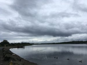
A mile or so later we crossed under a busy dual carriageway which intersected with the motorway and suddenly we felt like we were somewhere much more urban. We came into the Strathclyde Country Park, with its own loch, and I was a little underwhelmed. I guess if you come from the city then this is a beautiful breath of fresh air but to me it seemed rather dull and grey – tarmac paths, neat grass and beige-bricked buildings, with the constant roar of traffic. Still, there were lots of birds on the water which was nice and I’m sure on a sunny day it would look far more attractive! The best thing for us though, tired despite a ridiculously short day, was that it meant we were close to our campsite!
We found the campsite without too much trouble and the kind lady only charged us for one pitch as we could squeeze our tiny tents onto one fairly easily. We managed to get the tents pitched just before it started to rain, thankfully, as it’s set in for the night. Then, straight to the pub! We’d found out earlier that there was a Toby Carvery just around the corner and after two nights of wild camping we were ready for tables, chairs, warmth and lots of hearty food! It didn’t disappoint! I went king-sized, loaded my plate and managed to eat pretty much all of it. Plus dessert! I’m trying to ignore the fact that I’m now struggling to breathe, let alone move, because I ate so much! It has been raining all evening and it sounds like it’s going to rain all night. I’m so glad we managed to have dry tents to put up, it makes such a difference!
We are both a bit sad that this is our last night camping (for now, at least), and tomorrow is Anneliese’s last day. It is a long-ish one, 17 miles, but mostly flat so it shouldn’t be too challenging. Mind you, I feel like I’m going a bit soft what with the past two short days so it will be good to have a bit of a longer distance before my break in Glasgow! And then, a hotel! For four nights! It will be the longest I’ve stopped anywhere and it will feel quite strange I think!

Total miles: 11.1
Elevation gain: 825 ft
Time walking: 11am – 5:30pm
Miles to date: 997.1
An unusually short and flat day!! Day one of the Clyde Walkway which follows the River Clyde from the New Lanark World Heritage Site to the centre of Glasgow over 40 miles. A leisurely start, a leisurely walk, a leisurely evening…a pretty good day really, although it feels strange to not cover more miles!
We woke up to the sound of the river but no rain and after packing up inside my tent I peeked out to see damp grass but pale blue sky and the fresh autumnal hint of a beautiful morning coming up over the trees. While I tried to dry out the outer tent a little (never really going to happen on a cool damp morning!) I made us some tea and myself some porridge (Anneliese doesn’t eat porridge, crazy woman). Considering the rain last night I had thankfully managed to stay fairly dry and I couldn’t believe our luck with the dry morning! It was lovely to be able to drink tea and eat breakfast outside! A couple of dog walkers came past while we were packing up and they both stopped to say hello. I keep expecting people to tut disapprovingly at us camping but of course it is allowed up here, and besides, everyone is so friendly up here I don’t think they’d tut even if it wasn’t allowed!
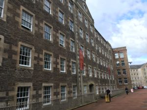
We finished packing up at about 9am, not in any hurry as we were planning to head to the visitor centre cafe just down the hill for (second) breakfast. I think we were the first people in the cafe and the manager stopped to chat with us, fascinated about where we had come from. We ordered our breakfast (scrambled eggs for me, pancakes with maple syrup and bacon for Anneliese) and the obligatory cups of tea and settled into the nice comfy chairs. We hadn’t even walked half a mile and it felt good to sit down! Checking the map we only had 10-11 miles to go today so we were in no rush to head off. We are wild camping again tonight so we figured we’d make the most of a bit of comfort while we had it! Another cup of tea and a shared slice of a weird but delicious coconut and marshmallow cake (who says you can’t eat cake for breakfast?) and we finally made a move. We wandered around the site for a little in the sun, admiring the huge but beautiful former cotton mills, water wheel and the river just in front. It all looked exceptionally tidy and well-ordered, it was strange to think that some of the buildings dated back to the 18th century. It was a fascinating place, both a museum and a living working village. I couldn’t imagine living there, it would almost feel like living on a period drama film set, were it not for the modern cars and bus loads of tourists!
It took us a few wrong turns to find the path that would lead to the river (for once, the map really didn’t quite depict reality as far as the path was concerned!). After a steep uphill climb back to the road we finally picked up the path and headed down into the woods, first gentle and quiet conifer woods, then brighter and livelier deciduous woodland, the river flowing just below. It was strange to think that the quick but quiet water had just come down through all those incredible waterfalls. How quickly it can go from peaceful to torrential to peaceful again!
The path undulated up and down along the river with one steep zigzagging climb up to the pretty Castlebank Park, before dropping back down to cross the river on the old (possibly mediaeval) Clydesholm Bridge. The path then followed a busy main road through the village of Kirkfieldbank before dropping back to the river and crossing it at another powerful weir. Shortly after the weir the river tumbles over another set of spectacular waterfalls – Stonebyres Falls – doubtless less famous than the Falls of Clyde and sadly less visible but still incredibly beautiful and powerful. Masses of water literally just pours off sudden edges to crash into boiling pools below, mist being caught in the updraft and creating a hazy veil. One of the falls tumbles over a v-shaped cleft in the river bed and the result is spectacular. Sadly there was no suitable place to get a decent photo but I can still picture the amazing sight and hear the noise!
The path kept close to the river all day, passing by a mixture of fields and woodland and a weird deserted holiday park. Those places still give me the creeps! We stopped in Crossford (with another pretty bridge) to see if the pub was open (perhaps a long shot for a Monday lunchtime…) but not only was it not open it had shut down! Never mind, we continued on our way knowing there was a pub/hotel near Maudslie Bridge (our planned stop), if we felt like it. This pub was still out of our way though, a kilometre back along the other side of the river from the bridge, at the small village of Rosebank, and as we got closer we decided we’d actually rather just find a camping spot, get our tents up to dry and make the most of actually arriving not only in the daylight but in the sun, before 6pm!
When we first arrived at Maudslie Bridge we were a bit dismayed as all of the flat unenclosed land along the river was knee high with grass and thistles…not exactly prime camping spots! The map said that about half a mile further on the path returned to steep woodland so we knew we had to find somewhere in the vicinity of the bridge to camp or walk several miles further on. We kept going past the ridge, passing a few fishermen on the banks of the river, then came across a flat-ish spot beneath a beech tree, right next to the path and a few feet from the river. It wasn’t ideal, but it was by far the best we had seen! At least it was easy access to the water! We weren’t convinced it was the right spot so we decided to try walking along just a little further. It was all long and thistly, or young woods with clear but very lumpy ground and we very nearly gave up, until, right at the edge of the woods, we spotted a wee patch of grass tucked away on the bend of the river. Popping down to check it out we found a tiny but more or less flat patch of soft grass (long but flatten-able), hidden from the path behind some bushes and trees with a beautiful unobscured view of, and access to, the river! Whoop!
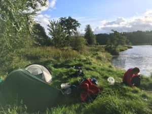
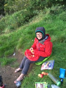
The sun was shining and it was perfect. We got the tents up (it was a squeeze to get them both in but they fitted!) and dried them out while fetching some water and making a celebratory cup of tea. We even had a little grassy bank/ledge to sit comfortably on! It was so nice to be able to have plenty of time to relax, drink tea, cook dinner etc without the rush of getting to bed or getting out of the rain, a welcome treat after our last few nights’ camping! We even finally got around to stewing the apples that Bracken had given us (the newest trial of my stove!) along with some blackberries picked from around our camp. Now that’s what I call dessert! The colours as the sun started to go down were beautiful – oranges and silvers and blues – and reflected on the water, silhouetting the trees on the other side. Incredibly peaceful. It grew cold quickly once the sun started to drop, as it always does, so it was fairly quickly into tents and sleeping bags. It’s amazing, camping out here. There is something about wild camping which for me is what camping is all about – getting out in nature. None of this camping in a field surrounded by lots of other people and tents with no view!

It’s another shorter day tomorrow as we are aiming for the only campsite between here and Glasgow, and then it will be a longer day for the final stretch. But that means we can enjoy our lovely camping spot for a bit in the morning before we go!
Total miles: 17.4
Elevation gain: 1,305 ft
Time walking: 10:45am – 7:45pm
Miles to date: 986
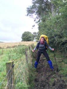
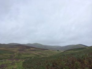
Wet, wet, wet! Scottish people keep apologising for the Scottish weather and I suppose I can understand why but they really shouldn’t worry, I love the rain! Ok so I wouldn’t want it to rain ALL the time, but there is something incredibly liberating and exhilarating about walking in the rain, when you’re out in the middle of the hills.
Today was rainy from the start but we had a lovely send off from Jan and Allan and set off feeling refreshed from our rest day. I took us on a slight detour as I wanted to start from exactly where we were picked up the other day (no missing stretches on this end-to-end adventure!) but soon we were heading down through lovely Biggar and up onto a little road which would turn into a track which would turn into a footpath. I was keeping my fingers crossed today as there were no obvious off-road routes to follow so I was piecing together sections of road and sections of footpaths in the hope they’d all fit together nicely and there’d be no impassable hedges or walls or anything! The first section to Cormiston worked well and was even signposted as a footpath. It was a bit muddy in sections – cue picking our way along looking ridiculous straddling the wide muddy bit in the middle as there wasn’t enough dry land either side – but it was easy to follow and there was a helpful gate either end of the one field that wasn’t marked as having a footpath. The weather even dried out a bit and we chanced a few miles without our waterproofs!
The second section was a long walk along roads, first into Thankerton where we crossed the River Clyde for the first time (much smaller here than when we see it later in the day as it does a massive loop to the north), then out the other side and up towards the Tinto Tearooms on the main road, battling a strong, bitter headwind and with the rain starting to make a reappearance. Tinto Hill, the tearoom’s namesake and one of the highest peaks in the area at 711m, had its head in the clouds today, but it still looked impressive. The quarter mile detour up to the tearoom felt like a long way but it was worth it when we got there, to step into the warmth and to get out of that incessant wind! We’d already decided this would be our lunch stop, even though at just under 7 miles it was a little earlier than usual in the walk. We probably spent a bit too long in there too, but the warmth, the soup (pea and ham for me), the toasted sandwich (bacon, Brie and cranberry, yuuum), the coffee and the cake made us feel rather sleepy and not really like going back outside into the weather! Eventually we goaded ourselves back into action only to see it absolutely pouring down outside, the wind blowing the rain almost horizontal. Maybe we would wait just a little bit longer…
Five minutes later the rain had eased slightly but not stopped completely and we decided we might as well make a move. So we splashed back down the road, narrowly missing being showered in muddy puddle by a passing lorry, turning off onto our next stretch of road, another 2 miles or so. Happily, only a short way along we found an old footpath signpost pointing across a field to Carmichael, with a very precise distance of 2.84 miles. The footpath wasn’t marked on the map but judging by the way it was headed it would cut a corner off so we decided to give it a go. A couple of twine-tied gates and electric fences later it crossed the main road and headed onto a nice mossy forest track, much better than tarmac, if a little more damp! The track passed by woods and farmland, including some super pink hay bales that at first glance I mistook for pink sheep…(of course, that well known variety of farm animal…?!). The rain had abated again so we stripped off our waterproof jackets so we could breath and have slightly less slippery packs (heavy packs + shiny waterproofs = even heavier-feeling packs) for a while.
All too soon it was time to rejoin the road again, this time for the long steady climb up the narrow Crossridge Hill. Tinto Hill across the valley had lost its cloudy veil and was now standing proudly out above the surrounding lower ground. It looked like a satisfying but straightforward climb, a bit Pen-y-Fan like in the apparent simplicity and clear path running up the side. One to do one day! Looking back the way we had come, to the hills in the distance, it looked like the weather was improving. Looking down the other side of the hill, the way we were headed…well…slightly different story. You know when you can see layer upon layer of thick black cloud hanging low in the sky, sheets of rain pouring down from them, the type that looks like there may well be thunder and lightning waiting to erupt too…? Yes, that! Headed our way! Well, it WAS forecasted I suppose! With the advanced warning we stopped to waterproof up, inviting the weather to bring it on and do its worst. It took another 10 minutes or so, by which time we were off the hill and through the little village of Carmichael, but when it came, it really came! The rain lashed down, so heavy it was bouncing off the road and we could do little but march on, face down, the occasional exhilarated (and possibly rather delirious) whoop at the excitement of being out in the weather! (Yes, we are both mad!)

A man drove past in his jeep and stopped to say hello and check we knew where we were going. He offered us a lift! So many people in Scotland have offered us lifts, I feel almost bad to have to say no! Another kind man at a lovely looking b&b (Station House) filled our water bottles for us and confirmed directions to the Falls of Clyde (whoop, another of my crossed fingers at footpath existence worked out!). In the rain it was sorely tempting to take one of the vacant rooms they had there, but we had a waterfall waiting for us!
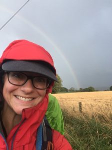
It was another mile or so to get to the bridge across the River Clyde at Bonnington Weir, a mile full of rain showers, golden sun and rainbows! I don’t think I have ever seen so many rainbows in one day before! When we reached the river (satisfied whoop from me), it was big, dark and lazy and the sun had come out. It shone through the trees of a small conifer wood and onto the sodden grass of the fields. A beautiful evening!
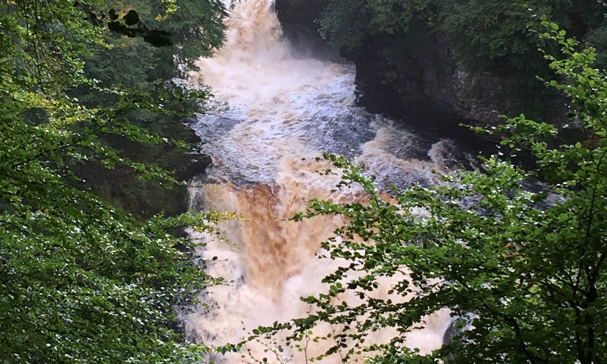
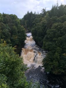
We could hear a roar in the background and guessed it must be the weir, but as we drew closer we started to sense the power of something much bigger… The weir was indeed impressive, one section of the man made barrier was open and the water poured through it, suddenly loud and powerful, but just beyond was the first of the many waterfalls we were about to see as we walked through the Falls of Clyde Nature Reserve. We couldn’t even see these properly but we could see the water just disappearing over the edge and hear the roar of it pounding rocks on its way below. As the path wound its way through the woods we’d get occasional glimpses of the river through the trees and at purpose built viewing platforms but even when we couldn’t see it we could always hear it. It’s incredible how water that is so calm and peaceful one moment can so quickly become a torrential force, crashing its way down the rocky gorge, churning shining dark water into frenzied white froth. It was stunning. The falls just got more powerful and magnificent the further we walked, with the falls at Corra Linn being the most spectacular of all. Even though we were fairly high above the water we could feel the power and the sound was constant and thrilling. We later learned that on the other side of the river the path goes much closer to the falls themselves and the power is almost overwhelming – another one to add to the list! It was mesmerising even from up high and I had to drag myself away. I’m sorry High Force, you have nothing on the Falls of Clyde!
It was starting to get late and we still needed to find somewhere to camp for the night. We knew if all else failed there was the possibility of camping on the grass by the visitor centre car park on top of the hill (research told us other people had done it before) but we hoped to find something a little nicer. A few waterlogged patches later and the light was starting to fade, then we spotted it. A perfect, level, not too waterlogged grassy area, among the trees but near the track, just above the village but not overlooked by any buildings. Bingo! As we gratefully plonked our bags down and pulled our tents out the dry window ended and the rain began to fall. Waterproofs on and tents going up in the rain. I was so grateful we’d been able to dry them at Jan and Allan’s – putting wet tents up in the rain is really not fun – and I’d reattached my inner to my outer which meant mine went up super quickly and I could help Anneliese with hers (not so quick or easy to put up in the rain as it pitches inner first…). With tents up and all essentials inside and relatively dry I stayed out to cook our dinner. I used my last match to boil the water for the first meal, then retrieved the spare box of matches from Anneliese to start the second one going. Bit of an issue though….damp matches! After several attempts, in the dark with the rain coming down, it was clear the matches weren’t going to work despite our best efforts. I chided myself for not replacing the lighter when it stopped working. And then I remembered…I had my fire steel… I hadn’t yet used it on this trip, and prayed, please please please let this work! After a few practice strikes I managed to get a couple of sparks but in the rain with slippery hands it was hard and I couldn’t get the gas to catch. Quick breather and another go, several sparks and then finally, a whoosh – oh happy sound – as one of the sparks ignited the gas. Oh I have never been so happy to see fire! Second meal gets made. The rain suddenly decides to stop as we begin to eat, out of the packets, standing up, in our soggy waterproofs, glad of the hot food. As the rain has stopped we decide to make a cup of tea and make the most of the dry spell. I manage to light the stove more quickly this time, ah-hah (proud face), only for the fuel to run out 30 seconds later and the rain to start coming down again. Clearly tea is not meant to be so we quickly retreat to our tents, strip the waterproofs off and huddle up inside eating our rehydrated dehydrated chicken curry dinner, which tastes remarkably good when you are tired, cold and hungry!
The rain is still coming down and I think we are in for a wet night but I am grateful to be in warm, dry clothes, tent and sleeping bag and I love hearing the rain on the tent and the roar of the waterfalls in the distance. I also have a hip flask of raspberry gin courtesy of Anneliese which is helping to keep the cold at bay, and at least the rain means we get an early night!
Lots of tea, coffee, cake. More fluffy dressing gowns, tent-drying-out, eating, supply restocking, planning and a fish and white pudding supper!
Total miles: 17.1
Elevation gain: 1,584ft
Time walking: 8:30am – 6:30pm
Miles to date: 968.6
What a delightful day! Wet, windy, chilly, but delightful!
We got ourselves up early as we had a long day ahead, packing the majority of our things away whilst still in the tent as it was on and off drizzle and also blustery and chilly up on the hill. There is something amazing though about emerging from your tent in the early morning, to a beautiful view, with no one else around, and making a cup of tea which you clasp close to keep warm. The tents went away pretty wet but we didn’t worry too much as we knew we had a bed for the night tonight, a real luxury after 5 nights camping!

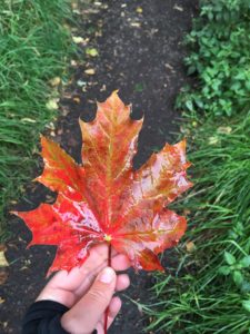
Wrapped up warm in long sleeved tops and waterproofs, buffs around our ears to keep the wind out, we shouldered our packs and headed up to the path, meeting a couple of trail runners on the way who looked very wet and muddy. The path wandered through an old settlement – nothing but big grassy lumps and bumps on the hill now – then down the other side of the saddle along a muddy path to a small road which wound around the bottom of the hill. The trees at the bottom were showing their autumn colours, beautiful but also strange as part of me feels like it should still be summer, despite the growing chill in the air, heavy dews and darker evenings.
The path followed the road for a couple of miles, past a fast flowing stream, pretty hillside and free-roaming sheep before heading back into field-come-moorland. It was a squelchy, uphill trudge and one very large field had both sheep and cows. At one point a cow started running down the hill in our direction, which made my heart quicken; I didn’t much fancy chasing off cows but I was more worried for Anneliese as she is terrified of them! Thankfully it turned out the cow was just running to her friends at a salt lick and wasn’t headed to us at all. Phew! Eventually the path reached the highest point of that particular section and started to track downhill towards the tiny village of Stobo. Stobo Castle, just down the way and visible on the hillside from where we were, is apparently a nice hotel and spa. How tempting! The John Buchan Way took us in the opposite direction though, heading up past cute little cottages and along a pretty stream running through light woodland, back towards the hills. We found a nice spot for a break to crack open Anneliese’s peanut butter and munch on our oat cakes. We had planned to get some water from the stream to filter but couldn’t find a suitable spot to actually get to the water without getting either very wet or very muddy, or both! Whilst falling in the river would have made for a good story, neither of us fancied doing the honours… Thankfully a bit further on the path actually crossed the stream at a little bridge by an old ruined cottage, and was much more accessible!
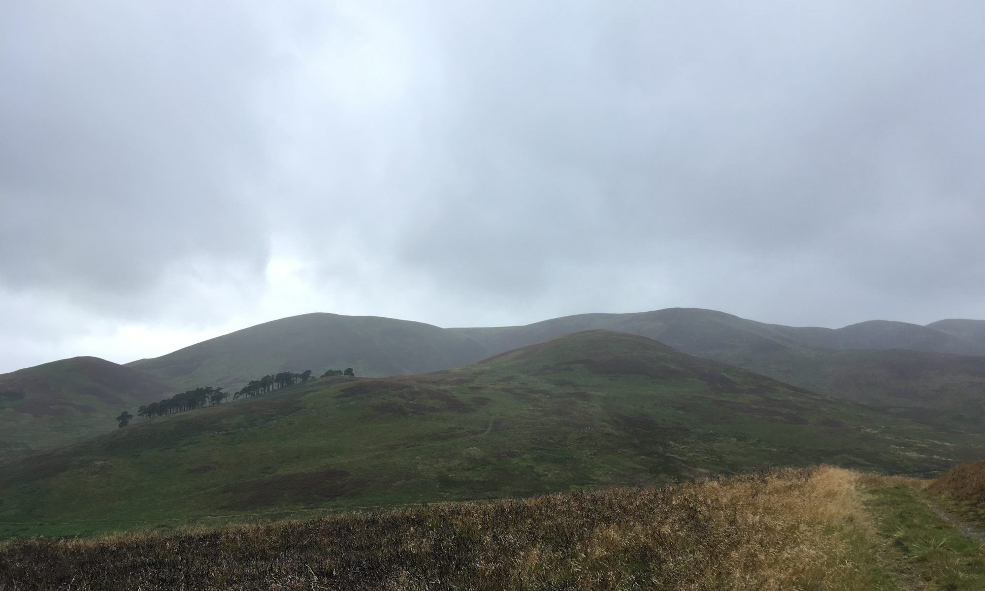
From here the path got more remote and beautiful, climbing up higher between the hills and then walking along the edge of a stunning valley. It was on and off drizzle all the way but always just a bit too light and short lived to really warrant the waterproofs so we just got a little bit wet each time! It was blustery too, and often we had to work hard to keep our balance. Thankfully the path didn’t actually go over the hills, at first glance on the map it looked like a potentially very hilly day so it was quite a pleasant surprise to not have too many climbs, even if the couple we did have still felt tough enough! It was a beautiful section of the path, it really felt like we were walking on the edge of the world. In places it was almost reminiscent of parts of the Pennine Way, muddy paths and all, just not quite as high up!
As we dropped down into the quiet valley we spotted a remote cottage, Stobo Hopehead, right in the middle of the flat open space between the hills with only a rough track leading up to it. Sadly it didn’t look occupied, but it was amazing to think that someone might (have) live(d) all the way out there! It would make an awesome bothy! The wind really picked up as we climbed up a narrow, boggy track up to the head of the next valley over and we couldn’t talk because it flew away with our voices and made our eyes and noses stream! We had a quick rest on a bench at the top with a great view down the winding valley into which we were about to descend, purple and orange heather on the hillside and green grass at the bottom, the occasional white dots of distant sheep scattered over the slopes.
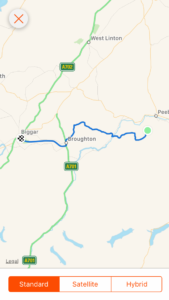
Descending was a slippery business but incredibly pretty with the hills towering each side of us and countless streams gushing off the hillsides. A mile or so later we came across hints of civilisation – a field, a barn, and then a man and his dog, followed by a proper track and then the turrets of a (modern-ish) castle! It was another mile down to the village of Broughton, past some nice farm buildings, a water wheel and a grand tree-lined road. And when we reached the village – the happy sight of a tearoom! We walked in gratefully, suddenly really hungry, as well as muddy and a bit wet around the edges! I had a baked potato with chilli con carne and Anneliese had a macaroni cheese, plus a lovely hot cup of tea (or three…). Then we shared an almond slice. The food didn’t last long, it was so good! We got chatting to several of the other customers who were curious about where we were walking, and picked up some more donations! It’s lovely to be back in civilisation occasionally even just to meet new people who donate to the causes I’m supporting, as that was something that didn’t happen a lot along the Pennine Way!
While we were having our tea I double checked the rest of the route, expecting it to be another 10 miles as that was what I had written in my plan. I was surprised, pleasantly so, to realise it was only in fact 6 miles! Confused, I measured it again, wondering how on earth I’d got that wrong. On reflection, I think I must have read somewhere that it was 10 something from Broughton to Biggar along the old railway line, and taken it to be miles when actually it was kilometres! Glad it was that way around…!
Having prepared ourselves for 10 miles suddenly 6 seemed like a walk in the park, especially along the easy, flat, grassy track. Halfway along we were glad it was only 6 though, as we were starting to tire and 10 miles of straight and flat would have become a little tiresome! The surrounding hills were pretty though and the early evening light made pretty patterns in the sky. A couple of miles from Biggar we saw a massive black cloud over the town – it was definitely raining there… We watched the cloud start to head our way and realised we were going to get wet! We didn’t bother with our waterproof jackets as we’d managed without them all day (I had kept my waterproof trousers on all day though), but after a while we realised we probably should have put them on – it was a much heavier and longer shower than the others! But soon we spotted the caravans that marked the campsite on the edge of town, near to where we were meeting Jan and Allan, our hosts for the night. We arrived looking rather wet but still smiling, of course, excited at the prospect of a hot shower, home cooked meal and a bed!
Now all our wet gear is hanging up in the garage, we’ve washed our dirty clothes, washed ourselves (ohh that shower was sooo good!), wrapped ourselves up in fluffy dressing gowns, been fed delicious food and wine and are now falling asleep at a ridiculously early time of day! Tomorrow is a rest day, which almost feels cheeky after having had a rest day only four days ago, but we are now back on track and a rest day is always useful for catching up on anything that needs catching up on, restocking our food supplies and just giving our bodies a bit of a break. And no doubt there’ll be lots of nice hot cups of tea!