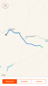
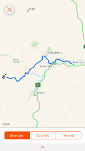
Day 67: A hill in the middle of nowhere to a hill just outside of Peebles

Total miles: 16.4
Elevation gain: 1,717 ft
Time walking: 9:15am – 8:15pm
Miles to date: 951.5

Today was one of those days that would have been easy to not enjoy. It was cold and windy, wet, we changed our route which took us along roads and cycle paths and pitched in the rain. But it was a great day, for multiple reasons.

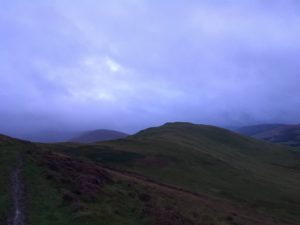
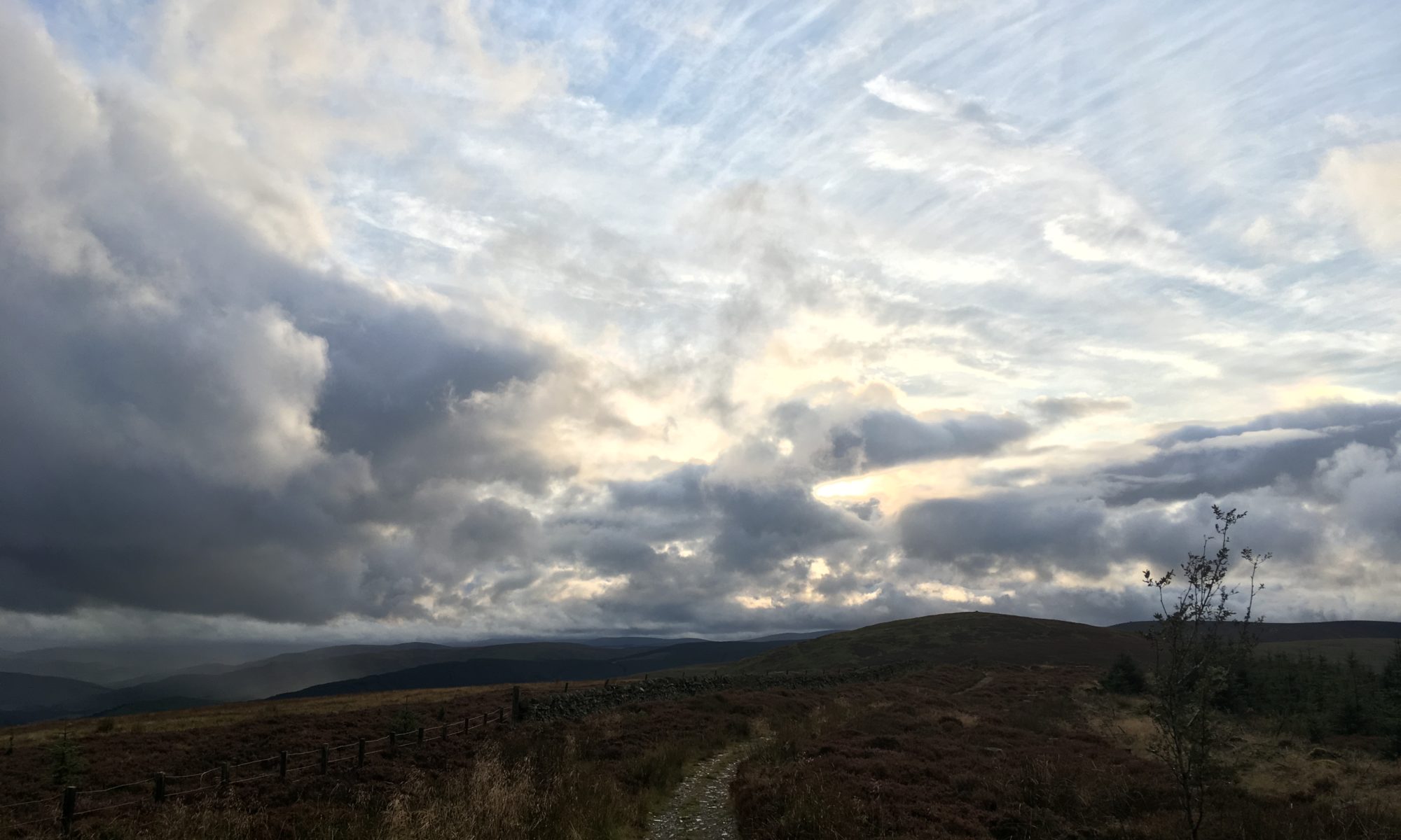
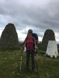
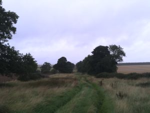
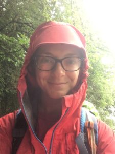
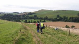
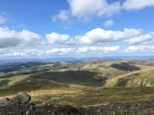
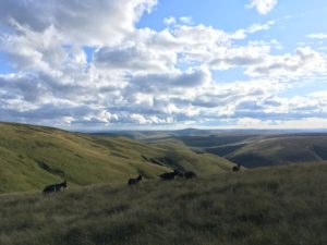
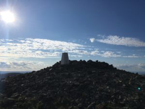
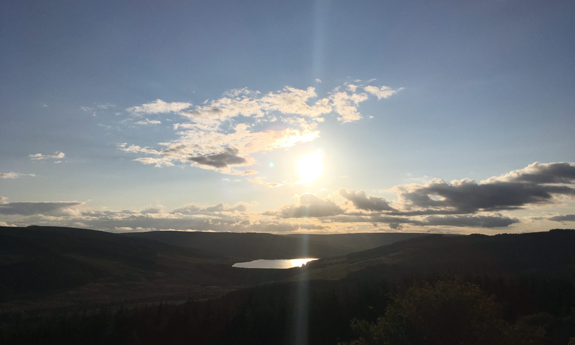
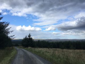
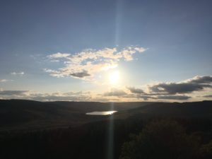
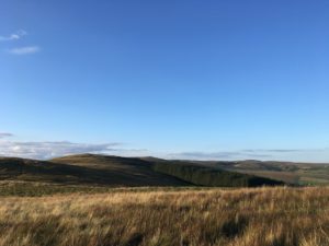
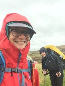
We woke to a misty start after a cold and windy night. I had been perfectly snuggly and warm in my sleeping bag but I was worried Anneliese would have been cold as she was chilly the night before, thankfully she appears to have perfected her sleeping layers and was warm too. We layered up this morning though – warm layers, waterproofs and all – as although it was currently dry the wind was bitter. A cup of tea and packing everything up warmed us up nicely and the inner sections of our tents went away dry even if the outers didn’t – even the wind wasn’t enough to dry off the heavy dew. We waved goodbye to our lovely camping spot at just after 9 o’clock, ready for an 18 mile day. There was mist on the hills and occasional fine drizzle so we kept the waterproofs on even though the packs always feel heavier against the slippery material. The path skirted around one hill before heading straight up another, a good climb for first thing in the day peaking at 523m, the highest point on this leg of the journey. The view in good weather is probably spectacular, it was great even with the mist hugging the surrounding hilltops.

Not a bad spot to camp!
Smiling through the rain!

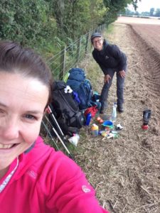
Part way along the path we crossed paths with two hikers walking the whole Southern Upland Way, they seemed very confused to see us coming from the opposite direction and wondered if we were going the wrong way! We explained what we were doing and that we had wild camped last night, but they still seemed perplexed! Well, we are a bit bonkers and probably looked a bit rough around the edges…

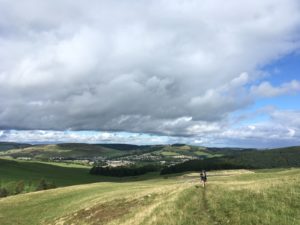
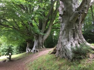
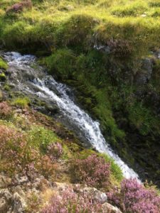
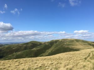
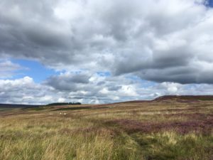
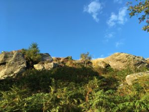
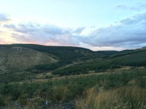
The path moved into Minch Moor, which is more forested and has some good downhill mountain biking trails. We saw a couple of bikers, it looks a bit hard and muddy for me! We didn’t take the diversion up to Minch Moor itself, the highest point in the area with supposedly stunning views – neither of us really felt like the extra climb or distance, especially given the weather! We passed the Cheese Well, a good source of spring water which we probably would have used last night if we’d made it to this area to camp. It turned out there wasn’t really any immediately obvious places to camp near the spring though, so we were glad we had stayed where we did. Apparently you are supposed to leave an offering of cheese at the Cheese Well, sadly we had forgotten to buy any, and it looked liked lots of other people hadn’t had cheese on them either as there were lots of offerings of coins and gems but no cheese!

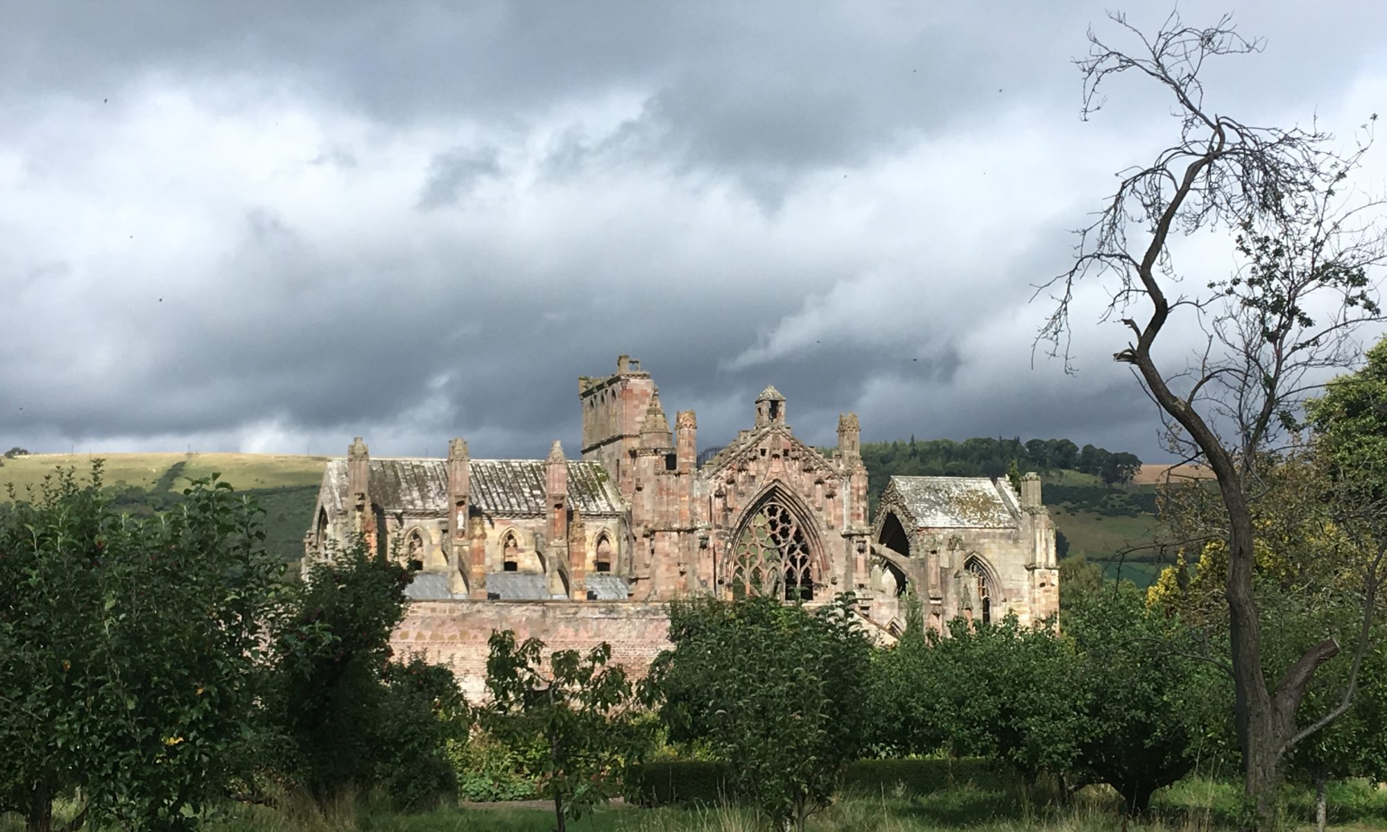
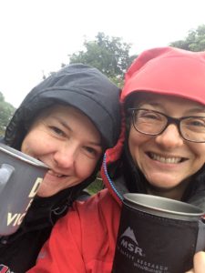
Dropping down gradually off the moor we bumped into four friendly people out for a walk who said they were from Traquair just below. We asked if there was a cafe there as we quite fancied a cup of tea and something warm to eat, and they told us there was a cafe in the grounds of Traquair House and if were visiting the jewellery studio (which it turned out Debby and Terry, two of the walkers, worked at) we should be able to get in without paying to see the house etc. We thanked them and continued on our way, looking forward to a nice hot cup of tea! On the way down we looked out for the bothy but didn’t see it – it must have been just off of the path somewhere – and were glad we hadn’t tried to find it in the dark! It felt like quite a long walk down to Traquair (a tiny tiny village) and we felt like we had walked further than the five miles my tracker told me we had covered. The house was a half mile detour to and from the path but we judged it worth it for a proper break on a day like today so we headed along the road to find it. As we reached the gates a friendly head popped out of the gatehouse and called out to us. It was Terry, who we’d met on the hill! He offered us some porridge, which we gladly accepted, as it saved us the walk all the way down to the house. It turned out he and Debby live in the gatehouse! They have a beautiful home, and Terry makes beautiful porridge! He made us feel incredibly welcome even though he was busy and had to get to work – he is the resident silversmith at Traquair House! As he was about to leave, Bracken, Debby’s sister, came in and after initial surprise at finding the two travel-stained hikers from the hill sitting on the sofa, took over on the hospitality front. Oh these are such lovely people! Bracken was fascinating, as was Debby when she returned and we ended up staying and chatting to them for over two hours! We had a lot of connections and loved hearing about their travels, spirituality and healing journeys. Debby played her Tibetan sound bowls for us (I can still feel the goosebumps) and smudged us with smouldering Palo Santo. I felt at home, and was so touched to have met them and to have been welcomed into their home. I really could have stayed there forever!

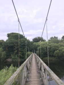
Unfortunately we couldn’t stay there forever but we left with big hugs and warmth in our hearts and our bellies, out once more into the rain. I’d looked at the map and decided to change routes to avoid the hills and cut some distance, given the time and the weather, and Debby and Bracken had helped out by suggesting an alternative route along the road and then a cycle track. It wasn’t the hills but it was still pretty, between the river and the woods, and we were both glowing from our lovely time in the gatehouse and enjoying the rain and being outside. We reflected on how cleansing the rain felt, and how glorious it was to be outside, whatever the weather!

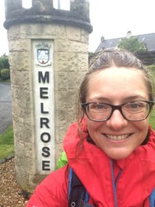
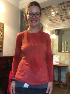
We followed the road a couple of miles to Cardrona, declining a friendly offer of a lift from a passing car (they are so friendly up here!) and then joined the cycle track for the last four or so miles. It was flat and tarmac, but it was quick(er) and straightforward in the rain, which was steadily set in for the evening. I could feel the rain gradually seeking through my waterproofs – rather annoying given that I invested in supposedly very good ones – and we didn’t dare stop for too long in case we caught a chill. By the time we made it to Peebles it was really coming down. We were still smiling, but were definitely in need of another break to dry off and refuel! Bracken had recommended the Court Inn as a good place to get some cheap and cheerful pub grub so we headed straight there, dripping everywhere was we walked in and getting a few surprised looks from the locals. As I stripped off my waterproofs I realised the full extent of their failure – I was soaking wet all over my shoulders, upper arms, chest and down my back. Oh dear! I removed myself to the bathroom to change into a drier top and see if I could dry out the wet one under the hand dryers!

Not terribly impressed! (But still smiling…of course!)

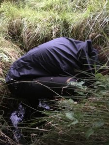
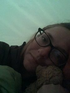
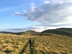
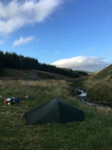
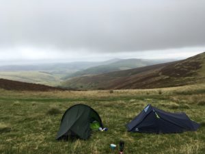
The dinner tasted amazing, just what we needed to set us up for the last couple of miles into the hills to find a spot to camp. We filled up on water so we didn’t need to worry about finding a stream (definitely not so fun in the rain!), donned wet clothes and waterproofs once more and headed out into the evening. We had a reprieve from the rain which was a relief and set a good pace (as good as we could with a belly full of food!) to give ourselves the best opportunity for finding a camping spot before it got dark. We were now following the John Buchan Way which heads up into the hills again and a couple of miles out of Peebles, not quite at the old settlement we were trying to reach but nearly, we found a semi-decent looking spot in a small clearing of heather where it was grassy and the flattest bit around. We were worried that if we headed further on we wouldn’t find a better spot and once again the light was fading fast. It was a pleasant spot though, again in a saddle between two hills, about 10m below the path with a pretty view out across the valley to the surrounding hills. It was raining on and off so we pitched quickly and retreated inside our respective tents, stripping off waterproofs and trying to keep the tents as dry as possible. Once in, we realised the slope was a bit more pronounced than we first thought – it’s amazing how slippery an inflatable sleeping mat and sleeping bag can be on the most gradual of slopes…! Still, we are warm, more or less dry and in bed at 9pm, listening to the rain on the tent and the wind around us, reflecting on our beautiful day. It’s not a bad life, really!

Our camping spot was somewhere just below the saddle between the hills

Day 66: Melrose to a hill in the middle of nowhere

Total miles: 14
Elevation gain: 2,795 ft
Time walking: 11am – 7:30pm
Miles to date: 935.1

And we’re back! It’s funny how you don’t realise how ill you felt until you feel better again! We woke up this morning feeling back on it and packed up quickly (relatively speaking…when camping it usually takes around two hours from waking up to starting walking, this used to frustrate me slightly but I’ve learned it’s all part of the journey and now embrace it as a big part of the day). We then lost a bit of time sitting and having a more leisurely breakfast and cups of tea before getting going properly, but never mind, it’s all part of the fun!

It felt great to be walking again, back to more-or-less full strength. Our route today was to follow the Southern Upland Way, Scotland’s coast to coast path (and yes, I have just added another trail to my list…), to near Traquair. Apparently there is a bothy up in the woods not far from the trail and as Anneliese had not stayed in a bothy before that was where we were aiming for. The first few miles of the path were flat and easy, following the River Tweed out of Melrose and we met lots of people out walking, despite it being a week day. It was a nice gentle introduction back into the walk before we reached the first set of hills which would take us down to the edge of Galashiels. As we were dropping down the hill we met a couple of women out walking their dogs and we got chatting to them. Their local knowledge was very handy as they saved us a trek into town to find a loo and some refreshments – just off the path was a swimming pool which had loos and vending machines, which was all we really needed for a quick break. I’m not quite sure what the swimming pool staff thought of us, coming in in full hiking gear, but they did find it amusing when Anneliese got stuck coming out of the door because her roll mat was too wide to fit through!

After Galashiels it was back into the hills, a gentle climb through farm fields and then a very steep climb up a grassy field to some woods. The path actually climbed up to the ridge slightly more steadily, but we chose to make a small detour to avoid the cows guarding the top of the ridge! We kept a close eye on them and at one point it looked like they might venture down the hill to have a closer look at us, thankfully they decided either that we were no threat or that the hill was too steep to bother walking down. Either way, we were both glad they stayed put. We didn’t fancy running from cows uphill…

Walking up from Galashiels

Once clear of the little wood we could see a cairn on top of the hill we were aiming for and the wind picked up as we got higher. The sun was out too though and it was a pretty climb with views back down to Galashiels and across to the three Eildon Hills above Melrose. The path went up over the hill and down the other side, dropping down once more to the River Tweed, crossed by a lovely old stone bridge where we stopped for a quick bag rest. We are both getting good at spotting suitable bag rest spots – a fence, wall or gate at just the right height to rest the weight of the bag without taking it off – it saves a lot of energy stopping to take it off and put it back on!

From the river it was into the woods of Yair Hill Forest, following a pretty little stream and once again up a hill, this time a much steadier, but longer, climb. Every now and then the view would open out through the trees and we could see the pretty valley we were tracking up, or back the way we had come across the hills from Galashiels. It was pretty and peaceful and after a couple of fairly flat days it was great to be back in the hills again! We’d neglected to pick up water from the stream so we were on the lookout for some water so we could top up and stop for our (late) lunch – we were planning on cup-a-soup, mug shot pasta and ham sandwiches (the random things you eat when you’re on the trail…!). There were a couple of tiny streams marked on the map and it was so satisfying to approach the place I expected to see a stream and hear the beautiful sound of flowing water! We stopped there, on the track by the stream coming off of the hill, filled our water and made our lunch. Although the sun was out it was chilly and it was really lovely to have something hot to eat. I don’t usually bother to make something hot when I’m on my own so it felt like something of an occasion!

Another steep climb along a mushroom and toadstool-rich track (wish I knew more about mushrooms!) brought us out onto open moorland, with misty hilltops and heather-clad slopes. The heather is just going over so it is more of a dusky orange than a purply pink now, but it is still beautiful. I appreciated the nice firm, clear path we were walking on – it’s a delight after the rough terrain of the Pennine Way! It certainly made climbing up the hills easier, despite the strengthening wind. This climb took us up to the Three Brethren, the highest point of the day at 464m topped with three big cairns. The views were incredible and we could see the weather all around us. Lots of mist on the surrounding hills and coming up the valley, sunshine on some of the hills in the distance, rain on others. Far away we could see the three Eildon hills, even further away was the Cheviot, standing out distinctively along the ridge of the rest of the Cheviots. Wow, I’d walked all the way from there?!

The Three Brethren

It was getting a bit chillier now and we could see some rain heading our way. We stayed optimistic and headed down along the ridge we were following, our warm layers on back to front to keep our fronts and arms warm without taking our bags off or overheating too much, but soon enough the rain came and we had to give in and don the waterproofs. The shower didn’t last too long thankfully but the wind was chilly so we were grateful for the extra layer. When it got to 7pm we stopped to assess where we were and decided we wouldn’t make the bothy before 8pm (our designated cut off time for camping) so looked at where we might be able to camp in the next couple of miles. There wasn’t much water for the next four miles as the path went up over hills so we decided to stop on a saddle between two hills where there was a stream marked on the map just below, about a mile further on. It wasn’t as far as we had wanted to get but water is pretty essential. Especially if we wanted something hot for dinner!

When we reached the planned spot we found a nice flat-ish bit by a wall for shelter, with slightly shorter grass and not too many hummocks. We dropped the bags and went on a hunt for some water. When we dropped down towards where the stream should be we found it was dry…so we went a bit further down…still no water but slightly boggier ground. Hmm…we needed water so we kept going, following sheep paths through the heather and bracken until, very excitingly, we heard the precious sound of a trickle of water. Finally we saw the tiniest ribbon of water trickling its way through the grass and ferns. It wasn’t enough to collect, but it was a promising start! We headed further down, to where trees started to crowd around the route of the stream and found a larger trickle. Annie was determined to get water and got down to it, practically disappearing underground! It still wasn’t enough though, but then we saw a pool of water between the trees so headed there. As we were making our way to where we could see the pool we suddenly heard an amazing sound – running water. Not just a trickle this time, a good flow of water cascading down to join the infant stream. It looked like it must have been a spring, and it was a wonderful sight (and sound!). Anneliese still had to practically climb into a hole to get to the good flow (she was determined to do it – I didn’t make her!) but we filtered just over 3 litres, gratefully! We then had the long trek back up the hill to our bags, hoping that nobody had found them deserted and panicked, or that it didn’t rain before we got there! All in all it took us about 45 minutes, and a mile, to find and collect the water and get back to our camping spot, just as the light was fading. I tell you, I’m not going to take turning a tap on for granted again!

Anneliese fetching water

We set up our tents quickly, the temperature dropping and the light disappearing quickly. It’s amazing how your eyes adjust though, when there are no lights around! The fading light isn’t really too much of an issue, the temperature is the one to watch! Tents pitched, it was time to make our dinner – dehydrated minced beef hotpot. Yum! Warming and filling! We sat and ate it in Anneliese’s tent – my old tent! I still love it so much, it’s a bit roomier than my current tent, and easier to get in and out of, but it weighs a ton, comparatively! As night truly set in around us, the lights of a village across the valley looking very pretty and comforting. It’s interesting to see how the nights are drawing in on this trip, it’s definitely getting darker earlier. Still, I have been going for over two months now…! One good thing though, darker nights mean I’m getting to bed earlier – when you’re camping your body just tunes in to the natural day and night cycles and I struggle to stay awake once it gets dark!

Tomorrow I’ll need to look over the route as we are about four miles short today so I think we will need a different camping spot than the one I had planned, but I’m sure we will figure it out!

Day 65: Rest day – Melrose

Miles: 0!

We both woke up feeling so much better today, thank goodness, but still weak after not much food yesterday and me walking 17 miles when feeling rubbish! While still cosy in my sleeping bag I checked the weather and it was forecast to be a wet day so I took the executive decision to take an impromptu rest day so we could both regain our strength. Definitely the right decision. We might have been able to walk but it would not have been fun.

Our fellow campers (I say ‘campers’…they were in campervans), thought we were mad as we were sat out on our picnic bench (what luxury!) in our waterproofs, drinking tea in the rain. We were very happy but I think they took pity on us, as they left they brought us some apples and bananas!

Drinking tea in the rain

After a couple of cups of tea we wandered into Melrose with our maps and found a gorgeous little cafe at the back of a wine shop. We installed ourselves there for a couple of hours, making our way through coffee, tea cakes, jacket potatoes and cakes. Clearly our appetites are getting back to normal! We looked at the route for the next few days to see if we could make up time somehow. Thankfully there were some shorter days ahead and as we are happy wild camping we have managed to re-split the route into fewer days so we can get back on track. Phew!

In the afternoon, by which time we felt we had probably taken as much advantage as we could of the cafe and their wifi, we went for a gentle wander through the town and the Priory gardens and orchard, past the beautiful abbey and back to our tents via the Co-op for a bit of food restocking. We had a quiet relax in our tents, hot showers and prepped to head off in the morning. An early and delicious dinner (rib eye steak for me, yum!) in Burt’s Hotel (it looked like a safe option…) and we are back for an early night, ready to get going again tomorrow! It’s such a relief to be feeling a bit better!

Day 64: Jedburgh to Melrose

Total miles: 17.4
Elevation gain: 1,699 ft
Time walking: 1pm – 7:30pm
Miles to date: 921.1

Oh dear, today was not a fun day! Poor Anneliese was up sick all night with what we think must have been food poisoning and was really not looking well this morning. Tough cookie that she is she was determined to try to walk and so we packed up gradually to give her a bit of time to recover. I managed to shorten the route slightly and we set off just after midday. She was so faint and lightheaded though that we quickly realised there was no way she could continue so we made the decision to return to the campsite after a mile, the plan being for Anneliese to get a taxi to our next stop. That meant that she could rest up for the afternoon but also she could take some of my heavier stuff so I could walk with a lighter bag for the afternoon. It felt pretty rubbish for both of us, illness aside, Anneliese felt bad for slowing me down and I felt bad for leaving her!

I was very grateful for the lighter bag as it meant I could cover ground much more quickly. It was heavenly! After walking with weight for so long I felt like I was practically floating along! A friendly farmer who had seen me earlier with Anneliese stopped to ask if everything was ok and when I explained what had happened he pointed me in the direction of a shortcut to cut back onto the St. Cuthbert’s Way without walking along the main road. The thing is in Scotland they don’t have public rights of way like we do in England – you have the “right to roam”, which is great but makes it a bit harder to know where suitable paths might be from looking at the map!

I managed to pick up St. Cuthbert’s Way fairly easily by cutting across down through some fields to the river and then crossed the gorgeous (and bouncy!) Monteviot chain suspension bridge and walked up through the wooded grounds. I had made good progress for the first four miles but felt like I was tiring quickly which was odd. I put it down to feeling worried about Anneliese and knowing I had lots more miles to go before I reached the campsite. It didn’t help that I missed a turning at one point and added half a mile to my trip. After a few miles of walking through rather brown woods the path joined Dere Street, the Roman road from York which I had first come across in the Cheviots at Chew Green. It looked on the map like it could be quite dull – dead straight for several miles and close to a main road, but it was actually quite pleasant. The path wound a little through a 10m wide strip of land between fields and was a mixture of grass, trees and woodland. Unfortunately early on the rain started to come down, the first rain I’ve had for a while and not long after that I started to realise I wasn’t feeling great. The cereal bar I had eaten wasn’t sitting very well and my tiredness turned into weariness, a very different thing! Dere Street suddenly started to feel very long…

The Monteviot Suspension Bridge
Beautiful old beech trees in the woods
Dere street

I tried to keep the pace up though, just focusing on getting to the campsite. After Dere Street the path joins a road for a while and I checked the map to see if I could cut any more distance out. It looked like I could cut through on a couple of small roads to cut out a big loop of the river. It was a bit sad as I’m sure that is one of the best bits but I still had about 8 miles to go and was starting to flag. I still got to do a bit of riverside walking, some of which was a bit damp and slippery with ups and downs on rickety steps, some of which was pleasant and pretty right by the river, the Tweed. Dryburgh Abbey was on the other side but I didn’t get much of a view of it sadly. One for another day! My feet were soaking by this point and I made myself stop for a quick break on a bench to change my socks. I have new waterproof socks which are a tad on the small side bit at least they are dry. I hadn’t worn them today as my boots have dried out for the first time since the Pennine Way and it was rather novel to not be wearing waterproof socks for once! Still, this was definitely a time for them to go on, my feet were all white and wrinkly, uh oh! The dry socks felt amazing and I was so glad I’d stopped. I was feeling gradually worse and worse, feeling sick and my stomach was cramping. It was beginning to look like I had food poisoning as well, which made sense as we had shared food.

Tired, wet and sick…

The last four miles were really tough. All I wanted to do was to get to the campsite and curl up in my tent. There were some pretty views of the surrounding countryside including one of the distinctive three peaks of the Eildon Hills. St. Cuthbert’s Way actually goes up over the saddle between the hills but to cut time I had switched to the Borders Abbey Way which took a flatter route! I finally arrived into Melrose feeling tired, sick, cold and wet and although it looked like a pretty town I made a beeline for the campsite. I found Anneliese and bless her she had put my tent up and sorted my sleeping mat and sleeping bag out. I literally just crawled in my tent, put dry clothes on, managed to drink a cup of herbal tea that Anneliese made for me, crawled into my sleeping bag and fell asleep, exhausted!

Made it, somehow!
An early night for me…


Day 63: Morebattle to Jedburgh

Total miles: 12.3
Elevation gain: 1,331 ft
Time walking: 12pm – 7:30pm
Miles to date: 903.7

I was tired today! Grateful for a shorter, less hilly day! We were a bit slow to get going this morning after our late finish the night before, Nicky and Neil’s amazing hospitality (full English with eggs from their own hens and multiple cups of tea!), and exploring their beautiful garden, saying hello to the hens and raiding the apple tree! We also spent a bit of time repacking our bags with new supplies and Neil, a Sergeant Major, kept threatening to come and remove unnecessary items from our packs to reduce the weight. And yes, we teased Anneliese incessantly about her hairspray and mascara, but at least we both got gently teased for our cuddly toys!

And we’re off

Nicky kindly dropped us back where we left off last night and we rejoined St. Cuthbert’s Way. After a mile or so along a field track and over a bridge we rejoined the road which led us into Morebattle. It was warm and Anneliese decided it would be a good idea to change out of her waterproof trousers so we decided to stop for a cheeky half pint in the pub at the same time! Well, it was the last opportunity until we reached Jedburgh that evening…! Back on the road, readjusted and feeling refreshed again (yes, we had only walked 2 miles, but still…) it was quite a long old trudge on the road. The area was pretty and we made good time on the even surface but it wasn’t the most interesting part of the walk. It was improved by passing the ruined Cessford Castle, a former home of one of the Border Reiver families and shortly after that the route left the road to follow a track up into fields and then woods. About 7 miles in we passed a promising stream where we could collect some water, so we stopped for a proper break, making up some super noodles! Ah it is lovely to have something warm inside when you’re walking!

Late lunch stop

The path returned briefly to a road where there were lots of delicious blackberries and then followed a little track through a beautiful narrow wood on top of a ridge from where we could see a monument on a hill across the valley. Tomorrow’s route takes us much nearer to it. Fields, tracks, woods, bridges across pretty streams, that was pretty much the rest of the walk. Nothing of particular interest but pleasant overall!

Eventually we came to the point where we left St. Cuthbert’s Way to detour into Jedburgh where our campsite was. Anneliese was starting to flag and I was feeling it too, but when we checked the map and it was only a mile to go we upped our pace and marched determinedly on. It ended up being fractionally further as the entrance to the campsite was on the main road not the little road we were on, but we made it, well before nightfall, and managed to pitch up on a nice flat spot. We had heard that Jedburgh was a pretty town with a beautiful abbey and so we decided to walk into town for a pub dinner. It turned out to be about a mile’s walk! Still, it was much easier without the bag! We made it to the abbey (which was indeed beautiful and all lit up) and found a gorgeous pub with tasty looking food, only to find they’d just stopped serving. Nooo! The only other option we’d seen, other than a pizza/chippy place next door which didn’t look too promising, was an Indian, so we headed back that way and got ourselves a table. It was ok, nothing special but it filled a hole, and we headed back to our tents to curl up for a good night’s sleep, feeling pretty tired!

Tomorrow we return to St. Cuthbert’s Way for a slightly longer but more scenic day to Melrose. Earlier start tomorrow hopefully!

Day 62: Davidson’s Linn to Kirk Yetholm to Morebattle

Total miles: 18.1
Elevation gain: 3,691 ft
Time walking: 10:30am – 8:30pm
Miles to date: 891.4

Another truly splendid day! I think I must hold the record for the driest Pennine Way journey ever! I can’t believe how lucky I have been with the weather, I really have seen all the best bits at their very best and made it through with not *too* wet feet! Today also marked the end of the Pennine Way, the beginning of Leg 5 of my journey and finally fully crossing into Scotland.

The day started slightly later than intended (no change there really…!) as last night was so cold! I was nice and cosy in my sleeping bag but I could feel the cold air on my face and I was in no hurry to get out of my snug bed! I even pulled my clothes into my sleeping bag for a bit to warm them up! The plus side of the chilly morning was that there were no midges first thing! The sun was out but hadn’t made it to the bottom of the valley yet and it looked like it would be another stunning day. A breakfast of porridge, banana, avocado and tea eaten by the river, enjoying the peace and then I spot something moving by the tree line. I think it must be a deer at first, and then I see a pair of large slightly curved horns. Then the rest of the goat appeared – a magnificent male, black and grey with a long shaggy coat, leisurely enjoying a munch on the grass before gradually making his way up the track on the opposite slope. He had clearly seen me but seemed completely nonplussed by my presence, continuing on his journey wherever he was off to, nibble by nibble.

The upper section of the waterfall

I started to pack up just as the midges, roused by the gradually warming morning, started to gather around. First one, then another, then lots! No fire today to keep them at bay, I quickly packed up the rest of my camp while covering up as best I could. I quickly popped over to look at the waterfall from above (it was a long climb around to get to the bottom) and saw several butterflies warming their wings and a mouse that ran into my boot, shook itself in surprise then turned and scuttled back the way it had come! I was sad to leave my little valley but if I was going to make Kirk Yetholm at a decent time to meet Anneliese and Michael I had to make a move!

Trying to keep the midges at bay…!

As I emerged from the forest (spotting lots of good dead wood on the way!) I saw lots of hikers heading up the trail towards the Pennine Way. More people, crazy! I supposed it was at least Saturday today… As I joined a few of the hikers I asked what the event was and they told me it was the Cheviots Challenge, a 23 mile hike (or run) around the Cheviots. What a gorgeous day for it! At the top I stopped and chatted with the marshals, they seemed quite impressed that I was walking all this way on my own. People keep telling me I’m brave, but I don’t really think much about it! I guess when the Way is less clear and the weather is bad it does get a bit scarier, but there is something quite liberating about walking alone.

Turning away from the stream of challenge hikers, whose route took them up Windy Gyle, part of me was glad to have the route back to myself, part of me was sad – it might have been a good opportunity to pick up some more spontaneous sponsorship, which has slowed down in recent weeks due to the remoteness of my walk! Still, I had a big hill to climb. Several, actually! The first was the gradual climb up towards the Cheviot, the highest point in the Cheviots. In front of me I spotted four hikers and gradually caught them up. They were the four I’d met briefly at the hut yesterday, they had dropped down to a B&B last night. They have been meeting one weekend a year for the last 10 years to complete the Pennine Way – this was their last day! We passed each other a couple of times during the day, joking about who would finish first. I decided not to do the detour up to the summit of the Cheviot, although it is technically part of the Pennine Way it is supposedly not that worth it, a very flat summit with no views and it was 2.5 miles of ascent/descent I didn’t really fancy given my already long day! Instead I followed the path down to a slightly lower summit further down the ridge which for some reason doesn’t seem to have a name, despite having some fantastic cairns and a view to die for! My four fellow hikers paused there for lunch, savouring the view. It was the last chance to really look back at the rest of the Cheviots and I could see all along the ridge back to Windy Gyle, which looked small from up here! In front of me was Scotland, with just a few rounded hills standing between me and the end of the Pennine Way. To my right was a sudden steep valley with a tiny stream and cascading waterfalls at the bottom. The descent was steep, not as steep as the valley beside me thank goodness (a viewpoint to the right of the path looked back at a natural chasm halfway up the valley from which the water tumbled fervently, I could hear the sound of it even from way up above), and it made my knees ache! I could spy my next target though, the second mountain hut, and when I reached it stopped for another quick break. I could see why lots of people camped here, although very basic the hut was in a beautiful spot, high enough for a view out either side but still nestled down beneath the larger hills.

Another day of stunning scenery

The next big climb, The Schill, was there in front of me, unabashedly jutting its rocky summit into the sky above its steep grassy slopes. This one was definitely not as subtle as the Cheviot! A deep breath and several jelly babies and up I go, passing a fair few day hikers on the way up (seriously, where have all these people come from?!!). Ah the view from the top. Worth the huffing and puffing climb! Behind me my route stretched out impressively and to the north west…the sea! I did a double take and exclaimed in surprise to the sky “my god I can see the sea!!” before realising there was a couple sat on the rocks enjoying their lunch and smiling at me, amused. I haven’t seen the sea since north Wales four weeks ago, and wasn’t expecting to see it again til I got past Inverness!

Another steep descent (I really think going down is much harder than going up!) and I pass a man with a big rucksack coming up. He looks quite fresh and smiley despite the hills he must have come up already but his boots look suspiciously clean, shiny and un-broken-in. I pray they don’t give him blisters! Soon after The Schill the path finally crosses over into Scotland for the last time. No border checks, welcome sign or bells and whistles, just a simple gate in the fence, but I give myself an imaginary high five, not quite believing I’m now in my final country, albeit a very big one! There’s a decision here – high route or low route. The main route is the high one so of course that’s the one I have to go for given the weather is good and these are my last hills of the Pennine Way. I do question my sanity slightly when over the next small rise I see those last few hills. A majestic final ridge with White Law, the highest point, looking like it was going to provide one last challenge to tired legs. I can’t believe some people do this last section (from Byrness) in one day. It would be an absolute killer! Not to mention that the need to rush would be such a shame with such stunning scenery! I was a little sad that I wasn’t staying in Kirk Yetholm which would have meant I could have taken a little longer! Still, only a few miles to go, mostly downhill, and Annie and Mike were waiting for me at the pub, with a sandwich they’d ordered for me just before the kitchen closed.

The last hills standing between me and the end of the Pennine Way!

It was hot and sticky in the sun and the last couple of miles, although technically easy, felt tough – the last couple of any walk always feel the hardest! The last mile is on a small but tarmac road, a killer on tired feet, but as I came down the hill into the village and saw the pub across the green Annie spotted me and came running up to give me a big hug. I’d done it, I’d finished the Pennine Way! I know I’ve said this a lot, but I couldn’t believe it! The Pennine Way is a trail I’ve always wanted to walk, and I’d just done it, all 268 miles (and some!) of it! I immediately started to wonder when I could do it again…

Another major milestone!

The sandwich, coke and bench were all very welcome and I enjoyed finally getting to give my feet some air – they’d started to feel a bit sticky in my not-so-waterproof-any-more socks and the warm sun. Anneliese is super excited to be joining me for the next 12 days, as am I to have her company, and it was wonderful to discuss plans with her and Mike in the sunshine. We also enjoyed teasing her about some of the arguably unnecessary items she had brought with her and even managed to persuade her to leave a few with Mike, a move she was soon grateful for a few miles in…

I had arrived a bit later than planned – the day was hillier and a bit longer than I had expected – and we still had 7 miles to go, including, I discovered and revealed to a willing but unsuspecting Anneliese, a few big-ish hills… It was 5pm by the time we were all set up and ready to go but it was a beautiful evening and the Scottish Borders are just beautiful, so it looked like we were in for a gorgeous walk. As we headed out across the fields, now following St. Cuthbert’s Way, I hear a voice calling me. I turn around and see Sean, following us up the field! He’d seen us walk past him at the hostel and had come to say hello and goodbye – he was off to Glasgow tomorrow to do the West Highland Way so I really wouldn’t see him again. So nice of him to come and catch me up, he was definitely a massive part of my Pennine Way journey!

St. Cuthbert’s Way followed the road for a fair distance before finally cutting back up on a track next to a field of goats (hilariously, Annie had been told she would see goats on her journey, she wasn’t expecting to find them so quickly though!) which would take us to the foot of the ridge we had to climb. The road was tough on my feet but at least it was easy walking and we made good progress, stopping occasionally to readjust Anneliese’s rucksack until we got the right fit for her. Then came the hill…! It was Anneliese’s first time climbing a big hill with so much weight and I was tired after my big day so we slowed down somewhat! Thankfully Anneliese lives in a hilly area and is pretty fit anyway, and her enthusiasm got her up the hill. I had to keep up with her at points! As we got higher and higher the view grew more spectacular. To the left towards the Cheviots and the way I had come, to the right across the fields further into Scotland, right out to the distinctive three peaks of the Eildon hills in front of Melrose where we will finish in a couple of days’ time.

Heading up the hill

The sun was getting lower in the sky and bathing everything in a warm golden glow, and we felt fantastic! The ridge was a deceptively tough climb and had several summits along the way. At one point I took us the wrong side of a wall and we had to climb over a rickety gate and another wall to get back on track. And then Anneliese had her first taste of a big ladder stile over a stone wall – this one had a very tall first step and it took a big heave to get up onto it! Followed by another big climb, thankfully the last of the day, up onto Wideopen Hill. A sign at the top told us this was the highest point along St. Cuthbert’s Way and also the halfway point of the route between Melrose and Lindisfarne, which means that by the time we reach Melrose we will have walked over half of it! I had told Nicky (who we were staying with tonight) we were a bit later than planned and she told us of a slightly quicker route down off the hill. This was welcome news as the light was just starting to go and the moon was coming out! It was pretty though, and as we walked along the last bit of the ridge we spotted two beautiful horses walking over to see us in the adjacent field. They were friendly but gentle and we spent a few minutes just enjoying their presence, soft noses and warm breath. It’s magical moments like that that really make this walk special.

Beautiful creatures
Another stunning evening

We dropped down off the hill on the track Nicky had mentioned and she messaged to say she could see us through her binoculars! She very kindly drove out to meet us part way up the track, just after we’d jumped out of our skins when a flock of pheasants flew out of the bushes in a dark section of wood! We were very grateful, she saved us another mile and a half (although we’ll have to do it tomorrow instead) and meant we didn’t finish completely in the dark! We were incredibly glad to get in and eat a delicious and plentiful home cooked meal with veggies from the garden, and a bath!! So tired now. Looking at the elevation gain it has been the biggest day of my trip, and pretty hefty mileage too. Given how I pushed the first section, I guess it’s not surprising I’m tired! For now, making the most of my bed as we have several nights camping ahead of us as we head further into the Scottish Borders and beyond!

Day 61: Spithope Bothy to Davidson’s Linn

Total miles: 13.1
Elevation gain: 1,908 ft
Time walking: 11:15am – 6:30pm
Miles to date: 873.3

Oh. My. Goodness. Wow! The Cheviots! Today has been an AWESOME day! Absolutely stunning. Definitely a contender for one of the best days yet.

The first few hours of the morning were taken up with the usual bothy tasks…finding a loo spot, hunting for firewood, fetching water, making tea and breakfast and getting everything packed up and tidied. It always takes longer than I expect but it is an enjoyable part of the day, provided I’m not in too much of a rush to get going. The valley was peaceful, a morning hush lay over it, not a soul to be seen. I wondered whether I was going to go three days with barely seeing any other people – this was one of the most remote stretches of the country after all. My tea, granola and banana tasted amazing, they always do eaten outside in nature!

The bothy in daylight

All too soon I had to leave the cosy little bothy and find my way back to the Pennine Way. Someone had mentioned in the visitor book that they had come down to the Hearts Toe lookout from the Pennine Way and along the bridleway to the hut so I thought I’d try that. The bridleway wasn’t at all clear despite being waymarked so I took the track to begin with, and when I got to the bridleway a bit further on, still not terribly obvious, I headed off into the undergrowth. I was quickly beaten back by head height bracken and no sign of a path at all. Frustrated, I double checked the map, and my GPS. There was definitely meant to be a bridleway here! After yesterday’s escapades I really didn’t fancy fighting through more undergrowth though so I looked for an alternative option. Following the track a bit further on looked like it would take me within about 50m of the permissive path that led from Hearts Toe to the Pennine Way. Thankfully those 50 metres weren’t too tricky to cross and although the path was barely visible there were signs of people having passed that way and it ran along the line of a fence which turned out to be the fence which marks the border! It wasn’t the easiest path but at least it was a path and I was back on track!

It was strange, knowing I was at the Scottish border. It felt like such a major milestone, I still can’t quite believe I’ve made it this far! I spent a lot of the day walking along the border fence, crossing it a couple of times but always ending up back on the English side.

The Cheviots were beautiful and showing themselves off at their finest. A gorgeous sunny day, nobody to be seen, a few sheep here and there, just miles of rolling golden hills and endless sky. This was what it was all about! Across the way I could see clearly the lines of former walls and banks of the old roman fort of Chew Green. The path goes right past it but up close you could almost not realise it was there. It was amazing, knowing that roman legionaries had lived here thousands of years ago. The roman road, Dere Street, crossed here and I’d pick it up again in a couple of days. It must have been a remote spot even then, but what else did they need other than space, a stream and a route to and from wherever the next town was?! I had a quick break sat on one of the grassy banks, eating my peanut butter and jam sandwich that I’d made back in Bellingham, feeling rather content. Suddenly up on the hill, silhouetted against the sky, I saw the unmistakable shape of three hikers. People! I assumed they must be coming towards me so excitedly got up and got ready to move again.

Heading slowly but steadily up the hill I kept an eye out for the hikers but they were nowhere to be seen. I started to wonder whether I’d imagined them, or mistaken sheep for people, and it wasn’t until I was well along the ridge that I finally saw them again, up ahead. It turned out they were in front of me, heading in the same direction. I’m not sure how I hadn’t seen them earlier but there they were. It was quite nice to know there were other people out there, even if they were ahead of me.

Wild goats!

After a little more walking, some great views over into Scotland, a couple of hills, a few boggy bits and a lot more sky, I spotted the first mountain refuge hut (there are two on this final section of the Pennine Way). And…people! The three hikers I’d seen earlier were just disappearing over the top of the next hill as I crested the hill coming down to the hut but there were five other hikers down there eating their lunch. Suddenly I wasn’t quite sure I did want to see people, I was getting used to having the hills to myself! As I reached the hut a group of four of the hikers were just setting off again, and the other wasn’t far behind but he was there long enough to have a quick chat and to compare notes. I then sat in the sun and enjoyed my lunch – cheese, ham and crisp sandwich – glad of my food prep in Bellingham! The refuge huts are much more basic than bothies, basically just small wooden huts with narrow benches, but people often sleep in them on this stretch if the weather is too wild for full on camping. I imagine they are incredibly welcome on wet and wild days!

As I was getting ready to head on, fuelled for the next few hills, two more hikers came down the hill towards me. I couldn’t believe this – the wildest stretch of the Pennine Way and I’d nearly seen more people than I’d seen on the entire route! The two hikers, a man and his son, arrived at the hut and exhaustedly dumped their bags on the ground. They looked tired and hot, and, by their own admission, rather unfit. The size of their bags (very large!) suggested they weren’t seasoned hikers and campers and they told me they were new to this, and that they were walking the Pennine Way to get fit. I’m seriously impressed. The PW is tough, and walking it north to south is a tough way to start! They had taken two days to get to this point, having stayed at the other mountain hut last night. It turned out they’d stayed there with Sean, who had told them to pass on his best wishes if they saw me! I love how that happens when you’re out on these trails. A real sense of camaraderie. The father and son were taking it steady and were wild camping so they could be flexible with how far they went in a day. I told them of a few potential wild camping spots I’d seen along the way this morning, including the option of camping at Chew Green where there was the stream. I really hope they enjoy their trip and they make it, it will be an incredible experience for them.

There were a few more tough hills and lots more stunning views, until eventually I make it up to Windy Gyle which is one of the bigger hills in the area and has a massive pile of stones atop which sits the trig point – it’s distinctive and can be seen for miles around. It also was not as windy as the name suggests! Often it is gale force winds up on top but this evening it was still and sunny. At the top I see the guy I’d been chatting to at the hut, chatting to another man who had walked up just to camp. What a spot! There is a perfect flat grassy spot on top of the hill, I can see why they say it is popular with wild campers, and he had pitched his tent there ready for a glorious sunset, clear skies and sunrise in the morning. I asked him whether there was any water close by, he said there wasn’t and he had carried his water in, but he told me of a pretty waterfall down in the woods not far from where I had been planning to camp. He also said it was possible to camp next to the waterfall too. I was a bit dubious about midges and water but figured I would go and check it out and at least get topped up with water, even if I came back up on top to camp.

The cairn and trig point on top of Windy Gyle

The guy I’d chatted to at the hut headed off in front (he was aiming for the second hut for the night) and I followed in his footsteps, we both went the wrong (Scottish!) side of the fence and struggled through some boggier sections before realising there was a flagstone path on the English side, doh! Clearly we weren’t the only ones – the fence looked like it had been hopped over many a time! At the point where I was leaving the path (to walk down Chennel Street, another Roman road) I caught up with the hut guy again (still didn’t manage to get his name..!) as he’d stopped to chat to another wild camper in another gorgeous spot. Everyone was out today! We admired his tent etc etc and then we went our separate ways. As I dropped down the hill on a nice clear path I sussed out some potential camping spots in case the waterfall wasn’t suitable. It was a beautiful evening and it seemed a shame to drop into the trees, and as I joined the forest track that led down through the conifers I was pretty sure I would come back up to camp. That was until the track emerged into a beautiful shallow valley, sun shining on the heather on the opposite side, a little bridge crossing over the stream bubbling along at the bottom and a gorgeous waterfall. As the wild camper had said, there was a perfect flat grassy spot right by the stream just above the waterfall and there was even the remains of a fire, in a rustic but robust fire pit made out of large stones. Ok, I am so camping here, I don’t care if there are midges!! I dropped down to the stream and quickly put the tent up. The midges did appear (although thankfully not quite as badly as at the horrible midge-infested spot at Garrigill) so I layered up and decided I would get a little fire going in the hope the smoke would keep the worst of the midges at bay. Thankfully the last people had left a fair bit of wood as there wasn’t much in the immediate vicinity, despite the surrounding trees (the woods have clearly been well-plundered previously!). So I lit the fire but kept it small and smoky, and it did seem to help with the midges. Water collected from the stream, dinner ‘cooked’ and I sat on the log by the fire feeling incredibly happy. The moon was even out and beautiful above the trees. What a perfect spot! At one point I heard a helicopter approaching and suddenly it appeared low above the trees, flying a bit further down the little valley across to the other side. It soon came back, this time flying up the valley, right over my head, really low. I half feared that it had come to check out my fire but I think it was just a military helicopter practising its manoeuvres. Probably using me as target practice! It was loud and quite scary though, but it has only come back once, when I was in my tent.

Gorgeous little camping spot at Davidson’s Linn

It is cold tonight. I guess I am camping at an altitude of about 400m so much higher than previous nights, and I think being by the water cools it down too. For the first time this trip I have pulled the hood of my sleeping bag tight around my face and I think I will need to dig out my woolly hat too! It has been a glorious day, one of the best, and I am looking forward to my last day of the Pennine Way tomorrow. I have a feeling I will be sad to finish it though!

Day 60: Bellingham to Spithope Bothy

Total miles: 18
Elevation gain: 2,966 ft
Time walking: 11:15am – 8:15pm
Miles to date: 860.2

Another great day, not without its challenges (admittedly mostly of my own making!) but incredibly satisfying.

I set off from Bellingham far later than I intended but I did manage to have two breakfasts (partly because I need to eat as much as I can and partly because I needed to use up some food!) and somehow fit all of my food into my rucksack, including five rounds of sandwiches, half a loaf of bread, two packets of crisps, half a bag of granola, half a packet of pasta, the leftovers from last night’s bolognaise, two bananas, an avocado and an apple. On top of the usual cereal bars, protein powder, chocolate bars, oat cakes and jelly babies of course! Rucksack bulging at the seams and me gasping at the weight (not ideal but there’s no food between here and Kirk Yetholm in three days’ time (unless I ate at the hotel in Byrness like most sensible people…)), I set off in gorgeous sunshine, not looking forward to the hill climb out of Bellingham.

Yup, that was a tough climb! Well, not really that tough considering some of the other climbs I’ve done, but the first bit was along the road, it was hot, my pack was heavy and the path just kept going up and up and up! The elevation gain made for pretty views though and I was back in the heather again, so I just took it steady and kept breathing in the gorgeous heathery smell in the air. It was great to be back on the moors again, with that feeling of space and oodles of sky. The path was reasonably well marked here, or where it wasn’t waymarked the tread of countless footprints gave it away. Past the crossing of the road a little after Hareshaw House the path started to become fainter as it turned up the hill and eventually I lost it completely. I’m not sure if I missed a bit heading off to the side or something but when the bit I was on peetered out I couldn’t see another path anywhere! I knew where I was aiming for though – the summit of the hill, so I forged my own path through the heather. I felt bad, tramping over the heather, but I didn’t have any option. I tried to keep to the grassiest/mossiest bits I could find, and slowly (the heather was knee high in places) I made my way towards the top. As I got closer I spotted a signpost, phew, always a good sign! (Literally, haha). And out of nowhere I came across a very well defined, albeit narrow, path. It amazes me how a path can fizzle out at one point but be so clear at others!

Back in moorland and heather

Glad I’d found the path and the top of the hill I stopped for a quick lunch break. I was only about 5 miles in but was already peckish, despite my two breakfasts, and figured I could lighten my pack just a little. Also, the sun was lovely and warm and the view was fab. Refreshed, I tackled the next section, a short and occasionally boggy descent followed by a gentle climb up to another summit. Here I crossed paths with a guy coming the other way. He was just doing a couple of days but he mentioned he had stayed in Spithope Bothy just outside of Byrness and he said it was really worth a visit. I also gathered he had met Sean – who had stayed in the bothy with him – who had told him about me! Whilst I was pleased that Sean had made it to the bothy I was also sad as I knew that meant he wouldn’t be there tonight and he was now a day ahead of me, so we’d be unlikely to cross paths again. There was something nice though, about knowing he was out there on the path somewhere, ahead of me.

The next couple of miles were pretty, more moorland (and a few annoying midges), a bit of drizzle and then a steep climb up along the edge of a forest. I say ‘a’ forest…I probably should say ‘the’ forest – I’d reached the edge of Kielder Forest, the largest forest in Great Britain! Also one of the largest man-made forests in Europe! (Another “biggest” for the list!). The climb up was a bit of a killer and involved having to duck under a fallen pine tree (not so easy with a big pack on your back) but once again the views back were lovely and with the drizzle gone it was quite pleasant. I even found bilberries! The first actual berries since Offa’s Dyke. I’ve seen lots of the bushes but none of the berries til now, so I ate as many as I could find!

At the top I had a great view of some massive clouds over the valley, brought to my attention by a loud clap and then a long rumble of thunder. There were sheets of rain coming down from them. Cool, but I couldn’t tell which way the clouds were moving. I hoped they were continuing south, not east, as although they were impressive to look at I didn’t fancy giving them a closer inspection, especially being on top of a big hill! I kept an eye on the clouds as I bog-hopped along the top of the hill, still on the edge of the forest. They seemed to be behaving and not getting any closer. Good! I turned my full concentration towards trying not to go knee-deep in bog. Even though I think the moors are far drier than usual right now (I don’t know what sort of deal I have with the weather gods at the moment but it’s a good one!) it was still pretty boggy. I only had a couple of calf-deep moments but there was a lot of ankle-deep squelching!

Sadly the forest wasn’t entirely peaceful as there were forestry works near the path and the quiet was broken by the constant sound of machinery. It was fascinating to walk past a very recently felled section of forest, with the air smelling a little like a hamster’s cage – fresh sawdust and the slight ammonia type smell of the bogs. I could see trees on the other side of the felled area moving as they too were being cut down. This section of the path was very boggy, presumably because until recently it was completely shadowed by tall pine trees.

It wasn’t long before the path joined a gravel forest road, which it followed pretty much all the way to the edge of the forest, save a couple of sections where the path ventured away from the track for a short distance (a welcome break for the feet!). I (along with most hikers I expect) have mixed feelings about gravel tracks. At first they can be welcome respite from heavy boggy trudging, and the pace certainly picks up. But they are hard on the feet and often not all that interesting. I was pleasantly surprised that, although indeed hard on the feet, these tracks had good views – the forest didn’t encroach right onto the path and a lot of it was younger forest. I was still relatively high at this point too and could see out to moorland and distant hills, including a big one I presumed to be The Cheviot.

Pretty views to break up the monotony of forest tracks

Several miles of forest tracks later I emerged at a small picnic area on the edge of the forest with some handy toilets. A winding path through more natural feeling woods and along a little river brought me out to the campsite on the edge of Byrness where I had originally planned to stay. It was still early(ish) though, and a beautiful evening, so I decided I would continue walking and aim to get to the bothy. The path continues for another mile before coming out at the surprisingly busy main road next to a gorgeous tiny church. An information board showed a map of the whole Pennine Way and it was amazing to look at it and see how far I’d come even just on this particular leg of my journey.

Across the road the path heads up into more woodland. Straight up! Byrness Hill is a tall steep hill at one end of a ridge which the Pennine Way follows to join the Border Ridge (which follows the English/Scottish border). In the evening sun it looked stunning, standing proudly above the village and the trees, craggy edges catching the sun in a mixture of light and shadow. It was quite a big ask, to climb it at the end of the day and I did wonder if I was slightly mad. Still, fuelled by a handful of jelly babies up I went, through the fir trees, crossing a few forest tracks and out into the sun. The last bit up to the top was steep and scrambly but once up, ohhhh. Happy place! The view was delightfulness bathed in gold! To the south and southwest stretched Kielder Forest, with Catcleugh Reservoir glinting in the sun. To the south east stretched miles of moorland. And to the north, the Cheviots! Rolling hills and valleys at their very best. What a perfect evening for a ridge walk! Part of me wanted to pitch my tent right there and just watch the sun go down!

A bit of scramble to get to the top
Evening sun glinting on Catcleugh Reservoir
Glowing after a sticky final climb!
Looking out to the Cheviots

I was keen to get to my bothy though, and conscious that once the sun went down it would get dark pretty quickly – I still had to find my way down to it through the forest! My plan was to walk along the ridge for a while then cut down into the forest along one of the clearings marked on the map, to reach a forest track, then another clearing which should take me to the bridleway leading to the bothy. Note to self: what looks ‘easy’ on a map is very often not so easy in reality!!! After a beautiful day and lovely evening I had one of the worst hours of the entire trip trying to get down off the hill! It started well, a sheep track led down to a fence by the clearing and it looked like people had crossed the fence before as it was easy to hop across. The reeds were deep and covering squelchy ground in places but again, there was almost a rough trail. The clearing was another matter. Rows and rows of old tree stumps and piles of old wood, divided by often deep boggy channels running down hill. Walking by the stumps and over the wood was slow and slippery, walking down the gullies was wet and unnerving. Several times I had to jump across the gullies as I couldn’t tell how deep they were. This was slow, sweaty, frustrating progress! I began to wish I’d taken the more straightforward option of following the bridleway right up from Byrness…but at least the gorgeous evening up on top had made it worth it! Eventually I spotted the track below. Oh never have I been so happy to see a forest track before! I reached the track and followed it along, looking out for the bothy which would be somewhere below. I spotted it, oh happy sight, and squinted to see if I could make out any smoke coming from the chimney. I was still a bit too far away to see properly. Target in sight I began to look for the best course to take to get down to it. The forest around it had been cleared but I wasn’t such a fan of cleared forest as a route option now! This previously cleared section had been replanted though, and as a result the ground looked slightly better. As I drew level with the bothy I took a deep breath and headed down into the new growth, watching my step very carefully. It was easier than the previous section but I still had to choose my route carefully, detouring around deep or boggy sections or where there was a lot of old wood. The bothy grew closer. As I neared I realised there was another problem. I was coming to a steep confluence of two streams, and the bothy lay on the other side. No way. I wanted to cry! But I’m not getting this close and being thwarted at the final hurdle! I headed down to the banks of the stream and eyed the other side. It was steep and looked a little too far to jump comfortably. I looked around, but couldn’t find any options that looked more promising. Testing the depth of the stream with my poles it didn’t seem too deep so I took a deep breath, counted down from 5 and jumped. I say ‘jumped’, it was more a ‘hurl myself over and hope for the best with eyes squeezed shut’ type manoeuvre! I just made it and clung to some heather to stop me falling backwards with the weight of my pack. Scrambling up the other side I triumphantly whooped, through the tired adrenaline rush. I wasn’t there yet though. I had to cross another stream (thankfully a much easier crossing), then fight my way up through dense, head-height bracken, up onto and along a dry stone wall and jump down into the yard of the bothy. I’d made it! And it was still daylight, just.

The bothy is down there somewhere

Pushing open the door of the bothy I was slightly sad to see nobody else was there (it would have been nice to arrive to a fire, a cup of tea and a sympathetic listener to whom I could relay my “you’ll never believe the journey I’ve had” tale of my trip down the hill) but also relieved as I wasn’t sure I was in the mood for conversation! Thankfully there was plenty of wood for the fire (nice one Sean) so after heading down to the stream to filter plenty of water for tea and dinner I got a fire going in the stove just as the light was fading. I was quite pleased with my fire (although I was very grateful I still had some newspaper with me…haven’t quite mastered starting a fire without paper!) and it soon heated the little room up nicely. I had some challenges finding the right balance between not smoking the room out and having enough light/not letting the fire go out but I compensated for the former by opening the top hatch of the door and praying I didn’t get carbon monoxide poisoning in the night…

By the time water was collected and the fire was going well it was getting late and I still hadn’t had my dinner! I had been planning to try to cook pasta and reheat my bolognaise using my little stove but I found a pan in the bothy so used that on top of the bothy stove. Slower, but it worked perfectly! There was a whistling kettle too which I used to boil water for tea. I do love a whistling kettle! I was pleased to find two candles in the bothy box (another note to self: always bring candles when planning to stay in a bothy!) which I lit to give me some light. My head torch is ok but nothing beats candlelight. I also think I probably need to change the batteries in my headtorch but I’m eeking them out for now. Whilst I ate my dinner and drank my tea, feeling decidedly better about my decision to make it to the bothy, I read through the visitor’s book. It looks like a popular bothy, but not so much for Pennine Way-ers (I now know why!) and people often come out just for the night or after a short walk, some bring their children which I think is brilliant! A few mentions of people arriving in the afternoon, getting the fire going then cooking a stew or something on the stove, enjoyed with wine or beers later in the evening. Sounds amazing, I’m going to have to try it one day! I think it’s fair to say I have caught the bothy bug…!

I’m sad that it has got late so quickly, I would have loved more time to enjoy the bothy, but I’m glad I got here at all. I have stuck my head out of the door a few times as the moon is very bright tonight and I can see the forest and the hills clearly. The stars are bright too, as you’d expect in Kielder, although dampened slightly by the moonlight. I can hear the stream gently bubbling and some owls calling, along with the fire crackling. It’s pretty awesome!

Beautiful moon…if you look closely you’ll see the silhouette of a tree