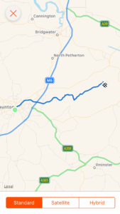
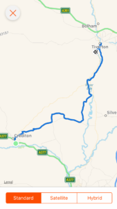
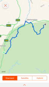
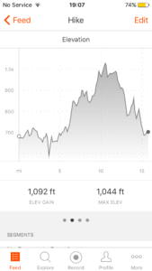
Day 20: Chew Stoke to Bristol (and beyond)

Total miles: 19.3

Elevation gain: 2,436 ft

Time walking: 11am – 9pm

Miles to date: 295.9

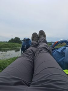
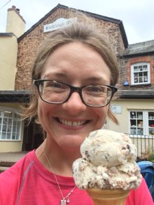
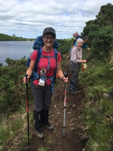
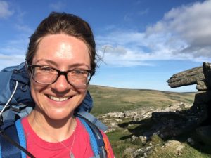
Another long day today and my feet are feeling it now! I’m getting used to the longer days now and whilst I know I can’t keep doing days this long, I’m finding that my body is adjusting and I can cover 14-15 miles fairly comfortably before my feet and legs start to complain. Having said that, the first 5 miles today seemed to be painfully slow. I wasn’t walking particularly slowly, but early on I dropped below a 2mph average which was pretty frustrating! It turned out that it was going to be one of those days where lots of little things kept happening to slow me down and test me, and there were tears at a few points! I knew that I’d probably find today hard having stayed with good friends last night and seeing Eunice for the first time in three weeks, and I missed them after just a couple of miles. I love meeting new people but it hit home how much I miss the friends I usually see very often, and I miss their hugs!

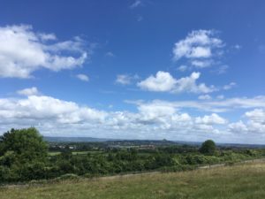
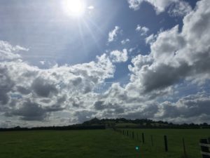
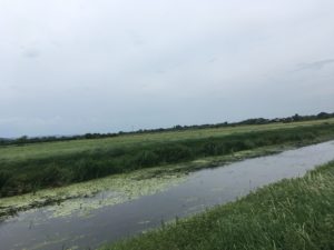
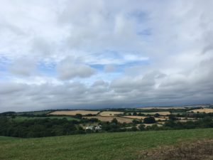
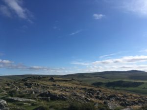
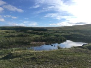
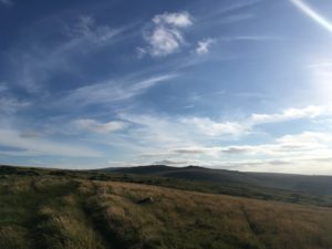
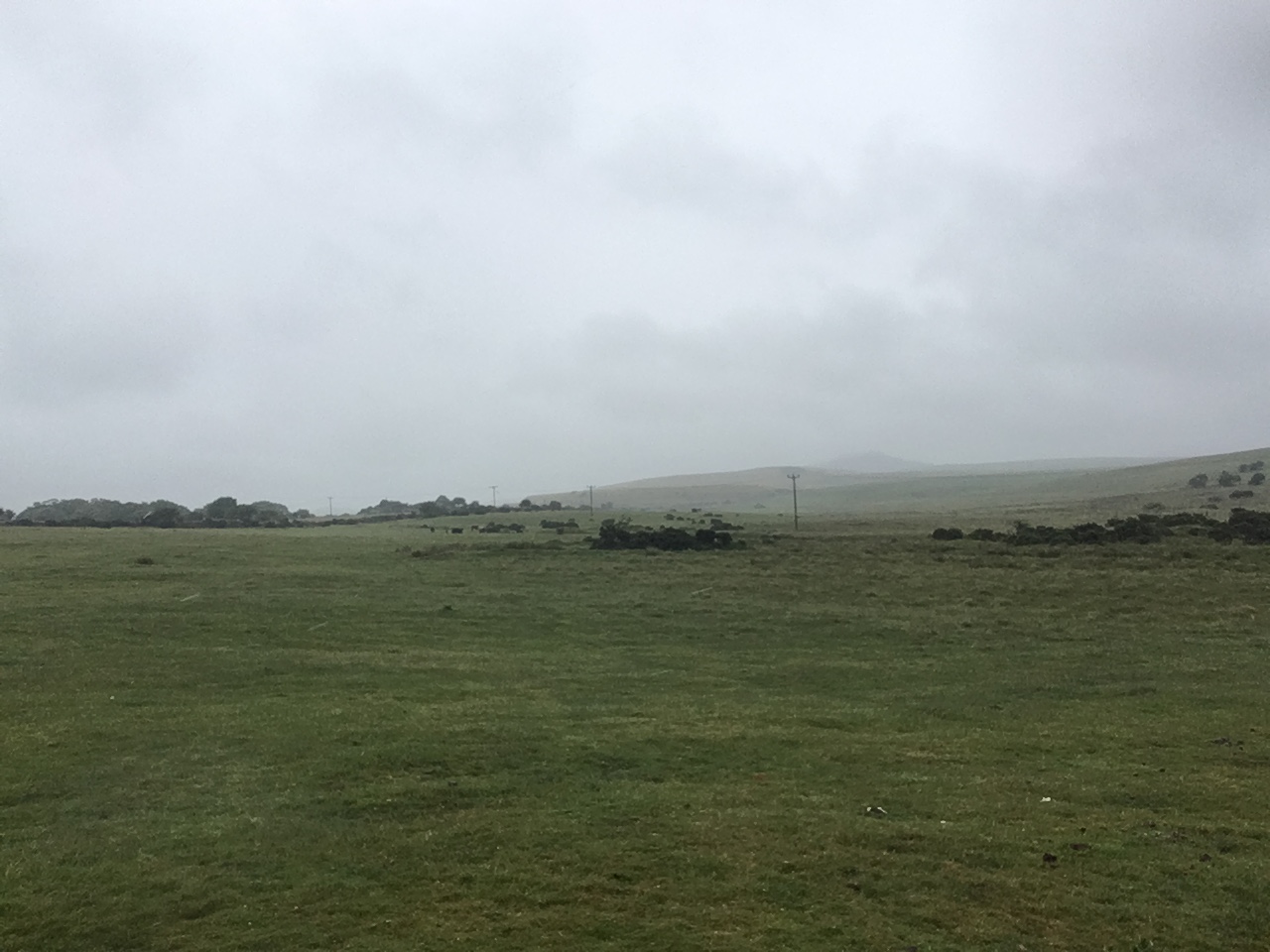
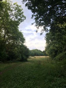
Still, I set off in the beautiful sunshine trying to focus on enjoying the walk, which was quite lovely to begin with. I was following the Monarch’s Way for the first part of the day and my route initially took me through meadows of beautiful flowers and butterflies gradually climbing out of the Chew Valley. There was one section of path that was fairly overgrown and I picked up my first nettle stings of the day early on, on both the legs and the hands. Ouch! I always feel that nettle stings should hurt less as you get older, but they really don’t!

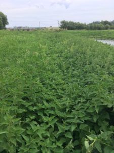
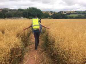
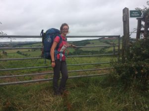
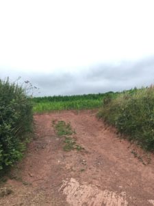
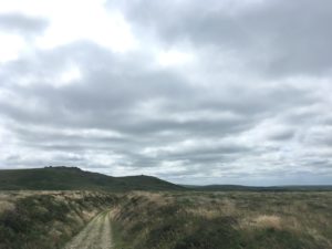
With a couple of my fingers tingling angrily I soon realised today was going to be the day for scratches and struggles, in particular wading through waist-high grass and trying to squeeze through small prickly gaps without getting stuck or snagging my bag. Sometimes it was gates or stiles that were overgrown with brambles or blackthorn, another time it was climbing through a barbed wire fence to avoid a particularly overgrown section of path, another was along a tiny winding path between gorse, wild roses and hawthorn, and once it was squeezing through a gap in the fence to avoid a long diversion where the footbridge I needed was closed for repair. Oh and there was the continuation of yesterday’s theme of kissing gates that are too narrow. Picture a fairly snug kissing gate. Picture trying to get through it with a pack on your back that at least doubles your ‘depth’. Now imagine brambles and nettles growing close around it…. sometimes I can just about make it through by hitting the right angle and breathing in just enough to squeeze the gate past, wedging my pack into the fence. Often, I have to climb up on the lower rungs of the fence and kind of straddle/hover over the gate as it opens, semi mission-impossible-style. It involves a lot of effort! And my speed is inversely proportional to the number of such obstacles encountered….

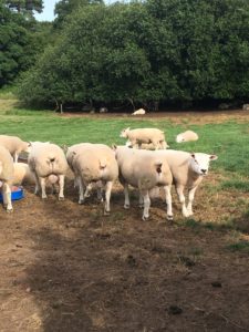
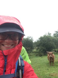
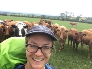
Cows, particularly young bulls, seem to be the order of the week. I passed through a couple of fields where they barely looked at me, then one field where the whole herd clocked me the moment I walked into the field and I had to make my way slowly across the field, turning every couple of steps to shoo the curious/indignant creatures away. I’m getting better at it, and more confident, but it’s slow and tedious – every time you turn your back they start to gain confidence and if you go more than a few paces they start to try to run at you! I wasn’t even wearing my red coat at this point..!

Once again being escorted none-too-politely out of a field!
A slightly friendlier welcome!

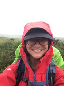
Talking of the red coat, the weather was supposed to be awful today so I kept my waterproofs handy. The moment it started to rain they were out of the bag and on. And then the rain would stop. A while after I’d stop, remove the jacket and carry it for a while. Then I’d stop and attach it to my bag as carrying it is a pain. Then it would threaten rain again, and I’d repeat the process. after all of that it didn’t rain properly the whole day! I know I should be glad about that, but the waterproof dance is tiresome when you are trying to cover some distance!

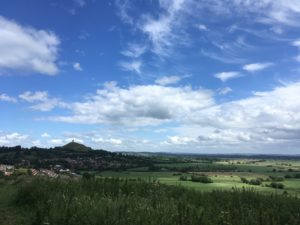
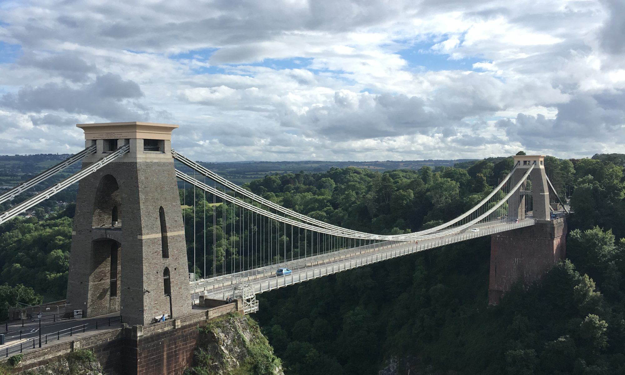
A very short while after the field of young bulls I was faced with a long field, up a steep hill, with, of course, more bulls. These ones looked older though, and bigger. There were only five or so in this field but I just couldn’t face it! I checked the map. If I followed the road up I could take a slightly different route which wasn’t much longer. Excellent! Up the road I trudge and initially I take the wrong footpath. Thankfully I realise before I’ve gone too far, but every wrong turn adds to my already long day and I really want to get to Bristol, yet I’ve somehow only managed to cover 5 miles and I’ve been walking for 3 hours already! I find my footpath, through another field of cows, and promptly slip on a massive cow pat and go flying. It’s the first time I’ve fallen on this trip and although I’m not remotely hurt I now have cow pat all over my boots, gaiters and waterproofs and that finished me off for the morning! The tears came, and part of me just wanted to sit down in the middle of the field and cry! It was probably a good thing that it was a field of cows (other than the fact their presence led to the existence of the offending cow pat in the first place) as it encouraged me to keep moving, and then, as I came over the crest of the hill, in front of me was a view that should have lifted my spirits – the whole of Bristol spread out before me, with the Clifton suspension bridge in clear view, both Severn bridges and the Black Mountains beyond. I took the obligatory photo but sadly was too grumpy at that particular moment to fully appreciate the fact that days of walking lay out in front of me. Whilst trying to wipe as much cow pat off as possible (jeez that stuff really smells!) I consoled myself with the fact I’d probably laugh at the incident later (which I did), but also half laughed, half cried about the fact that of all the days I could cover myself in cow poo it would be the day that I was meeting a friend for coffee in fancy Clifton a few hours later…!

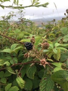
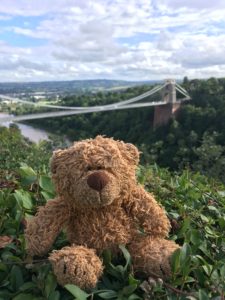
A few ripe blackberries cheered me up a little and I stopped for some food under an overpass just in case the rain came (it still didn’t) and that freshened me up a bit. I came up through the village of Long Ashton and cut through the beautiful Ashton Court Estate (although sadly had to skirt around the red deer park as they’d temporarily closed the footpaths), on my way to finally reach Clifton Suspension Bridge, one of the highlights of the day. It is such an iconic bridge and one I’m certainly not a stranger to, so walking over it as part of this journey felt pretty special. Also, I was meeting a friend of a friend, Jonny, and his wife and baby, on the other side for previously mentioned coffee break. They very kindly treated me to a coffee and a bacon roll and didn’t seem to mind too much that I had gotten a little closer to the countryside than even I would have liked. It did feel quite weird, walking through Clifton in my full hiking gear! But at least at this point I deemed it probably safe to finally remove my waterproof trousers, and gosh what a relief!

King Jennifer enjoying the sun in front of Clifton Suspension Bridge

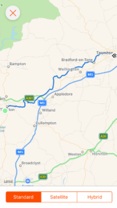
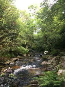
Despite making it to Bristol I was still barely only halfway to my stop for the night which is up near Cribbs Causeway. I could have cut straight up through the city (although even that would have been about 7 miles!) but as usual my route took me the scenic route, now following the Community Forest Path, which cuts across Clifton Down, Snead Park (very nice looking area!), Sea Mills and then the Blaise Castle Estate. It’s hard to imagine, as you’re walking along the wooded paths and meadows and then along a semi-landscaped river valley, that you are just a stone’s throw away from the bustle of the city! If you haven’t been, I thoroughly recommend you go and explore it! Whilst beautiful, it was getting late and suddenly my body decided to remind me it needed some more calories. I demolished the remainder of the jelly babies, Kendal mint cake and an entire bag of trail mix, which seemed to do the job, at least to tide me over til I arrived for the night. I also had a lovely call from my brother which lifted my spirits. He was telling me about how everyone he knew had been asking about me and wondering how I was getting on, and apparently they are planning some fundraising events in support of my charities! I love how people are all pulling together, so many people are going to benefit from that!

The peaceful footpaths of the Blaise Castle Estate

All but the final mile from there was along urban roads and it felt strange again to be walking through the outskirts of the city on a Saturday night in my hiking gear. I certainly stood out from the people who were just headed out for the night!

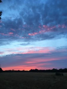
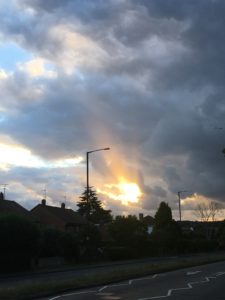
The last mile was along footpaths through fields, with one remaining cow-infested field to navigate, the aforementioned barbed wire fence and, as a reward, another beautiful sunset!

A stunning sunset

After 19 miles I was very glad to arrive at Lizzie’s and very happy with the prospect of takeout pizza for dinner. It’s now stupidly late and my eyes are drooping but wanted to get this written before I forget anything!

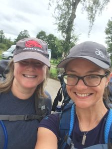
Tomorrow I’ll pass 300 miles and enter country number 2, whoop! It’s another long day but I’m looking forward to it as I have some company for the bridge crossing and hopefully some friends for the picnic! Now just need to speak very nicely to the weather gods…!

Night night! Xx

Day 18: Langport to Wells

Total miles: 22.7

Elevation gain: 1,619 ft

Time walking: 9:15am – 7:15pm

Miles to date: 261.1

Days walking: 16

Today was a really lovely day. It was long but beautiful and my feet and legs held out well!

I wasn’t sure how today was going to pan out at first. After a fairly good night’s sleep (I woke up a few times thinking I’d fallen asleep mid-walk and had to get up and keep walking…!) and an amazing full English breakfast thanks to Rich, I set off feeling refreshed and renewed however my pack felt seriously heavy. I couldn’t work out why. I knew I was carrying the new nutrition supplies but I wasn’t carrying excessive amounts of water or anything else, so I put it down to just having softened up on my rest day! I was a bit apprehensive though, knowing how far I had to walk today (and at that point I was expecting it to be 19 miles). Thankfully after a few miles the pack started to feel a bit more normal, so I must have just taken a while to get used to it again!

Heading out of Langport my first footpath was blocked off thanks to the Somerset Steam and Country Show so I had a bit of a diversion along the road, but at least I didn’t have to retrace my steps this time. My route took me along the Woodbirds Hill track which skirts a pretty hill to one side and an orchard to the other and although the vegetation was long (and wet, after the rain!) it was a nice track to follow, the air was all fresh and clear after more rain overnight and the day was looking promising.

Dropping down to a long, straight road then tracking due north along the levels I was expecting the next hour or so to be a bit monotonous, but actually it wasn’t at all. There were hills to aim for, the light was beautiful, there was a nice breeze, lots of pretty willow trees, ripe blackberries, puddles to dodge and the ground was nice and soft after the rain. So I made really good progress towards the Polden  Hills and even the climb up wasn’t too shocking. The view from the top however was stunning! The Polden Hiils form a ridge separating the levels around Langport from the levels around Glastonbury and I could look back from where I came and, for the first time since Dartmoor, I could see my onwards route as far as tomorrow morning! Glastonbury Tor stood high and proud out of the levels and it was exciting to know I’d be up there later this afternoon.

A beautiful fresh day, from the Polden Hills looking onwards to Glastonbury Tor

Even though my feet were feeling pretty good I stopped for a rest with my boots off and enjoyed sitting in the sun admiring the view. I was satisfied with the time I had made, which made a bit of a change! The next bit of the route took me down through fields of horses, where I made friends with a foal who I am convinced was a mule (horse crossed with a donkey). Whatever he was, he was very friendly, or at least very curious, and wanted to nibble everything! When I got to the first few houses a smell suddenly stopped me in my tracks. I looked around and then saw it – a eucalyptus tree! You don’t often see them in this country (although there was one in our garden growing up) but what amazed me was how striking the smell was, even from over 100m away! It suddenly felt like I was walking in Australia!

It took about a mile of walking through the quieter bits of Street to reach the high street. Street used to still be classed as a village (the largest in England apparently) despite its size, I’m not sure if it has now made it to town status but it really should have. I wandered along the high street and then up through Clarks Village where I decided to stop for a coffee and doughnut. It felt slightly bizarre being there as I went to college in Street and we also used to come here as children and spend the day at the outdoor pool, which is still there but looking distinctly less busy than how I remember it.

Coffee and doughnut break!

Leaving the bustling Clarks Village I took the main road out of towntowards Glastonbury then cut up onto Wearyall Hill, a small ridgeway which has some great views and cuts out a section of busy road into the town. I had some more great views of the tor and as I got closer I could make out the winding path and the people on top of the hill. It was definitely a (planned) diversion but I couldn’t go to Glastonbury and not climb the tor, it was one of my favourite things to do as a girl. The way up had me out of breath but wasn’t nearly as tough as I remember…possibly just me getting fitter…but the views were just as good as I remembered! The Somerset Levels just stretch out for miles in every direction, at sea level, and I tried to imagine what it would have looked like when the levels were covered with water, or even mist. Even today you could see the weather varying in different directions, one moment the sun would be shining on Exmoor and rain would be threatening over the Mendips, and then it would shift and the sun would briefly highlight my destination, the tiny city of Wells.

Glastonbury Tor from Wearyall Hill
Glastonbury Tor

Far-reaching views

There were lots of people out on the hill and it was very windy, so I didn’t stay too long after eating my lunch but I dropped down the other side feeling very glad I’d taken the diversion! My route from the Tor took me east for a few miles before turning to head towards Wells. I couldn’t cross the five miles as the crow flies due to all the water channels (rhynes) crossing the moor, so it was a big loop around, slightly frustrating when you can see your destination right there tantalisingly close in front of you!

Still, it was a pleasant walk and there were fabulous views back to the tor. After a few miles I headed north again, and I realised that it was the first time this trip I had actually been walking north for any significant length of time! I initially twigged the change in direction when I realised that the sun for once was shining on my left arm, not my right arm (seriously, my tan lines aren’t just dodgy, they are lopsided!). It was quite gratifying to know I was now making some headway northwards, rather than just eastwards!

Looking back at the Tor from the east

I had a couple of footpath-not-being-obvious-or-easily-accessible moments but thankfully at one potentially sticky spot involving a stream a friendly farmer spotted my confusion and came to help me out. They’re not all bad! The main issue was that I was running very low on water (I’d forgotten to  refill in Street, oops!) and there was nowhere really to refill. It’s amazing how conscious you get of how much you drink, when you don’t have much left! As if in answer to my water troubles the sky suddenly darkened and it threatened rain. I spoke to the weather gods very nicely and asked if they could hold off until I reached Wells, and I am very grateful that other than a little drizzle (which gave Wells cathedral a very “huddled down” look about it), the threatening clouds remained nothing more than that!

Wells Cathedral
The Bishop’s Palace

And so, a little later than intended given that the day turned out to be over 22 miles, starting to feel it in my feet (but thankfully nowhere near as badly as I had in Taunton), I walked into Wells past the Bishop’s Palace and along its lovely streets to arrive at tonight’s bed for the night, with the lovely Vanessa who is a friend of a friend, with dinner ready on the table and a big glass of water, perfect!

I was very good and did a good stretching session tonight, and although my feet ache and my blister is just beginning to grumble again, I think they should be ok by tomorrow. “Only” 14 miles tomorrow…and I might stop off at Wookey Hole Caves on the way!

Night night x

Day 18 route

Day 17: (Mostly a) rest day!

Miles walked: 3.8

Miles to date: 238.4

Rest day, yippee! Really good night’s sleep (except for being woken up by the rain and thunder, but I enjoyed listening to it before I fell back to sleep again), and woken up with a cup of tea in the morning, then fed coffee and bacon sandwiches. Good one bro!

Treat of the day was a sports massage with the lovely Jo Dalton at the Langport Physiotherapy Practice. Oh my goodness that was amazing! Rather painful at points – my legs and butt are seriously tight – but definitely needed, and I think I will try to fit one in where I can on future rest days!

I had just under 4 miles to make up after yesterday so after meeting dad for a drink at lunch he dropped me back where I left off and I had a gentle stroll along the River Parrett back into Langport. It was great to walk without the pack and the weather was somewhat moody which I love, although it was still muggy despite the storms!

My feet were feeling good but even without the pack I felt tired, so the 19 miles to Wells tomorrow is going to be interesting, especially as I’ll have a bit extra weight from another supply of nutrition being dropped off!

Today I saw some herons, swans, buzzards, curious cows and a red-tailed bumblebee nest in a hole in the ground. No kingfishers today though, which was a shame, as I know there are some on the river. No stinging nettles either, but that was a definite plus!

In the evening I got to see my nephew which was great, and then mum took us out for steak, yum! I was falling asleep over dinner so after packing up my bag as much as I could in order to make an early-ish start in the morning, it’s off to bed!

Day 16: Taunton to Langport

Total miles: 13.1

Elevation gain: 384 ft

Time walking: 11am – 5pm

Miles to date: 234.6

And so, the aches and pains that I’ve been expecting to hit at some point have finally struck! I was expecting them earlier, so I suppose I should be thankful that I’ve managed to get a few miles more under my belt before they came, but even being prepared for them it’s still a bummer when they hit!

I woke up feeling surprisingly good after yesterday’s mammoth day, and walking around the house my feet and legs didn’t feel too bad. Even after getting the bus back to where I left off last night and starting the walk knowing I had a few extra miles to cover than originally planned, my spirits were high and it was a beautiful, if hot, morning.

Taunton looks like a nice town and it has the river running right through it. Even though I’m a Somerset lass I think I’ve only actually been to Taunton once, and the brief glimpse I had made me think I should come and check it out properly!

My route took me along the Taunton and Bridgwater Canal for the first few miles and once I’d negotiated a new housing estate which wasn’t on the map and found my way to the right side of the canal it was easy going. However, it only took a couple of miles until my legs started to tire, yesterday’s marathon making itself felt. I decided to use my poles, which I usually save for ups and downs, to take a bit of weight from my hips and tried to walk on the grassy verge where possible to save my feet. Oh but it was muggy! Sweat was dripping off me and I started to worry I wouldn’t have enough water. I tried not to stop too much as every time I stopped my feet really began to throb, so I tried to power on for a couple of miles then stop for a 5-10 minute rest, and this seemed to work fairly well, even though I hobbled like crazy every time I started again! I also had the prospect of seeing my nephew at my brother’s house if I got there by about 5, which kept me focused, otherwise I think it might have taken me a lot longer!

After a few miles on the canal I came off and joined the River Parrett, which winds its way imperceptibly slowly through the Somerset levels (it’s mostly indistinguishable from the hundreds of drainage channels, with the only obvious differences being that it is a bit wider, has bigger banks and winds about a bit!). The walking is a bit same-y as it is flat, and it’s just a series of banks and gates which become quite irritating when your feet hurt! But the wildflowers were pretty (I tried not to get too frustrated when the footpath was overgrown…kept telling myself it was better for the wildlife!) and I saw some more swans, a couple of herons with their slow honking flight and even disturbed a buzzard in the grass only a few feet in front of me. The path alternated between nice short grass and long and overgrown and it felt surprisingly tiring, so much so that I had to take a break and put my feet up for a bit. I lay on my back with my feet over my bag and it felt good!

The River Parrett
A short rest to put my feet up!

A little further on and I came to my least favourite part, where the footpath disappeared into a long patch of stinging nettles. I looked ahead, dismayed. The road I was aiming for was tantalisingly close but seemed like miles when blockaded by 100m of knee-high nettles. I’d already been stung a few times as I was too tired to avoid the odd nettle, but this was almost despair-inducing! I took a deep breath and got busy with my hiking poles-come-nettle-bashers and made slow but steady progress. I noticed a woman walking on the other side of the river on lovely short grass, looking at me a bit strangely, and as she got closer she told me, in a somewhat confused voice, that I couldn’t get through to the road that way. But the path goes to the road, I said. Yes, she replied, but it goes around the other side of the property! I didn’t know whether to laugh or cry. Relieved I didn’t have to fight my way through the rest of the nettles, but frustrated that I’d already wasted energy in return for plenty of stings.

A rather morale-sapping sight!

Still, I made it to the road and the footpath the other side was much better. I was headed towards my only hill of the day, up to Moredon which looked to be some sort of former stately estate and farm or something. The hill wasn’t a big one, relative to hills of earlier days, but it was a bit of a shock to the system! Thankfully as I walked along the ridge the climb rewarded me with super views of the Somerset Levels and it was nice to have some elevation and views after a day and a half of flat walking. I was aiming for a promising-looking “V” marked on my map near Stoke-St-Gregory which indicates a visitors’ centre – I was hoping they’d have cold drinks, toilets and an opportunity to refill my near-empty water bottle. I just hoped they were also open! It turned out I was headed for the Willows and Wetlands centre, which is a lovely little spot and ticked all of my boxes. I had a lovely pink lemonade and took my boots off, part of me wanting to put my head on the table and fall asleep! I looked at the map and estimated I had another 6 or so miles to go and judging by the current time and the state of my feet I wouldn’t make it to Langport before 6, which was a shame. But I chatted to my brother and we came up with a plan. I’d walk another 2-3 miles which would take me to 5pm and he’d come and pick me up, then drop me back tomorrow to finish off the last 3-4 miles without my pack. Part of me was tempted to finish it all today so I didn’t need to walk at all tomorrow but the prospect of getting in earlier and having a leisurely, packless walk tomorrow was very appealing, so that’s what we did. I’m really glad too, as just before I reached the designated pick up point my left buttock decided to cramp horribly and I wasn’t sure if I’d have been able to walk the last few miles. I was disappointed not to finish the day as planned but I know I need to look after my body as best I can, I have a fair few miles to go!

It was great to have a whole evening to rest up. I spent a while lying on the floor with my legs elevated up against the wall, then had a lovely soak in the bath and was stuffed full of homemade curry and rice (and wine!). I even watched some trashy TV! I am so pleased I have a rest day tomorrow, and am going to look very carefully at my dates to make sure I don’t leave it so long til the next one!

Route day 16

Day 15: Tiverton to Taunton

Total miles: 26.7

Elevation gain: 1,104 ft

Time walking: 10am – 9:30pm

Miles walked to date: 221.5

Tough day! It was always going to be one of the longest days mileage-wise but when your bag feels heavy and your feet hurt less than a mile after you start you know you’re in for a long one! I’m not exactly sure why I thought it would be a good idea to try to do 24+ miles with an 20kg pack in one day.  I think it was just the way the accommodation and dates worked out and I thought I’d just go with it. But I really wouldn’t recommend it!!

The day started off very well with a lovely breakfast with Maureen my host, who packed me off with sandwiches and homemade quiche to fuel me up for the day. (Maureen makes the most amazing quiches!). I was also super lucky to be there just as a duck who had been nesting for a few weeks finally hatched her ducklings! There were two cute and fuzzy duckling heads peeking out from underneath their mum, such an adorable start to my day!

A 1.5 mile walk along the edge of town brought me up to the start of the Grand Western Canal, which I was surprised to find is up above the town, i.e. at a higher elevation. It feels quite strange to be standing next to water looking down across a town! Sadly on Mondays the horse-drawn barge doesn’t run so I didn’t get to see that in action but the canal was a lovely route to walk. It was good to have some nice flat, even ground to walk along, and some nice shady bits as it was another warm day, and I made good progress for the first 6 miles. This was time for a mini celebration as I just hit the 200 mile mark, which feels pretty amazing!

200 mile happy face!

Along the way I saw a woman with a prosthetic leg (from just below her hip) walking her dog, and although she looked fit and strong it made me thankful for my two working legs. Throughout the day, whenever my feet hurt, I kept reminding myself to be grateful that I had feet to get blisters on!

At Halberton, after a quick stop off at the farm shop to use their loo, I met up with Susan and her 6 month old daughter Zoe – I think most probably my youngest guest walker of the trip! I hadn’t seen Susan since university so it was great to catch up over the few miles we walked together. Three days in a row now I’ve had company for some or all of the day which has been great!

At 10 miles I stopped for my first proper break and although it was fairly early in the day considering I was less than halfway I took my boots off while I ate the quiche (very grateful for that quiche!), as my feet were starting to throb already. I’d put my first blister plaster on and although the blister was getting bigger I think the plaster helped. I decided to put one on my little toe too, given that I still had so far to walk. It took a while to persuade myself to get going again after the rest, and for the first time on the journey I felt properly tired. My feet and hips hurt as I hobbled for a few hundred metres while I got back into my stride, but then they eased back into it again feeling better for the break and refuel.

The serene and pretty Great Western Canal

After a while walking alongside the canal did get a bit monotonous but it was pretty and I kept reminding myself to take it all in. I passed through fertile farmland growing all sorts of crops and it was fascinating to see what was growing – maize, potatoes, kale, cabbage, peas, wheat, oats. All sorts! I saw lots of moorhens and swans too. One moorhen had not long hatched her second brood of chicks and I could just see them, all black and fluffy and ungainly. Further on I came across a magnificent family of swans, with seven cygnets, swimming proudly along in a perfect line. The canal was buzzing with insect life too, particularly noticeable were all the dragonflies and damselflies, some of them in a striking blue, flitting here and there across the water. Did you know that our larger species of dragonfly can cruise at speeds of 10mph but can reach speeds of 30mph?! That’s crazy!

Swans in a row

The canal eventually came to a sad and rather abrupt end shortly after the old Waytown limekilns and very narrow tunnel, but my intended route (picking up the West Deane Way) followed the route that the rest of the canal formerly took. I was running short on water however and as my map indicated a campsite at Gamlins Farm not far up the road I headed up there to refill my bottles and from there decided to cut across country a bit to cut out a bit of mileage. It did add some elevation but it was actually quite nice to use my legs slightly differently! I also realised that I just crossed over into Somerset which was exciting as not only is it my third county on the walk but it’s also my home county so it felt a little like I was coming home. I had a little cheer then soldiered on, I was only just over halfway and it was already gone 4pm – it was going to be a late one! Thankfully it was a beautiful evening and I counted myself lucky that it wasn’t raining!

After finding some more ripe blackberries (yippee!) my path took me across a number of fields of pigs. I’ve never walked through pig fields before and I’m not sure the pigs see many walkers, judging by the astounded look they gave me. I’m not sure pigs can actually do ‘astounded’ or in fact pull specific facial expressions at all, but they were funny anyway. The groups of piglets ran away squeaking and their mums came and stood guard protectively. I wondered whether I was about to add a charged-by-an-angry-mama-pig story to my collection, but thankfully (at this time at least) that story remains un-materialised. (Yes, I know that’s not a real word. But after 26.7 miles I think I’m entitled to make up words 😉 ). Apart from inadvertently disturbing a group mud bath (seriously, I don’t know how many pigs managed to fit into that small muddy puddle but it was way more than you’d imagine was possible!), and thinking I had a mystery pig following me for a bit (turns out it was just my rucksack talking pig…) the pig field crossing passed without further ado. A little further on however it was time for a field of “thug sheep”. Ram thug sheep! I don’t know what breed these sheep are but they really look like thugs. Lisa and I came across some last year on our hike and we named them then. We had a funny incident where one tried to head-butt me. I put my hand out and he kept coming until he was close enough for his forehead to touch my palm and then he stopped. Now Lisa thinks I am a sheep whisperer! It was quite amusing and I wish we’d gotten a photo! Even so, I didn’t particularly fancy having to give my sheep-whispering skills another go, not with another 10 or so miles to walk!

Thug sheep!

A few more fields and I’m back on the West Deane Way which follows the old canal through some lovely old woodland. It passed Wellington and I longingly wished I was stopping there tonight. I knew of a couple who were staying there tonight who were walking John O’Groats to Land’s End, we’d hoped to meet up but we ended up just missing each other by just a few miles!

There was a beautiful bit of the old canal which was where there used to be boat lifts. The brickwork is still there and a little thin pond where the canal had been, but further on there was no real trace of the canal left at all. I think it is amazing, and quite sad, how something so important in its time can disappear without a trace!

As the sun started to think about getting low in the sky I walked through more lovely arable farmland alongside the river. I passed through a field of young pea plants which for some reason made me so happy! And then the biggest (or at least longest) fields of wheat I have ever seen. With wiggles (along the river) it must be about a mile long!! It was a pretty spot and at some points you could get down to the river. I was so tempted to break again and cool my feet in the water, but it was getting late and I was worried that if I stopped I wouldn’t get started again! So instead I just gave my feet a pep talk. I think if people had heard me they would have thought I was crazy. Out loud, talking to my feet, telling them how strong they are and how I was so grateful to them for their epic performance that day. What can I say, at 20+ miles I was having to dig deep..!

As I finally drew towards the outskirts of Taunton I looked behind me to see the most incredible sunset. Proper reds and blues and fiery clouds. I was torn between marching on and constantly stopping to turn and watch the colours change. Every time I stopped my feet hurt but I couldn’t resist! It may have been a long day but if it hadn’t, I probably would have missed the sunset. Still, at nearly 9:30pm, I was definitely ready for the end of the day’s walking.

Sunset

Thankfully, Gary (my host for the night) had kindly offered to pick me up from central Taunton which meant I didn’t have to hobble the last 2.5 miles in the dark. It meant a couple of extra miles to make up in the morning but right then I really didn’t care! When I got in, boots were straight off and feet in the air. I was so grateful for the cup of tea and the pasta bolognaise Gary cooked for me. I wolfed it all down, a massive bowl of it, had a bath to ease my cramping legs, and flopped into bed – for the first time ever being too tired to even contemplate trying to write my blog.

In summary, it was a beautiful day and I wish now I had split it in two to save my legs and feet and to appreciate it a bit more! But still, now my feet are feeling a little better it is quite satisfying to know I walked 26.7 miles with my pack and survived!

One day til my rest day…

Route day 15. Thanks Strava!

Day 14: Crediton to Tiverton

Total miles: 17.9

Elevation gain: 2,390 ft

Time walking: 10am – 6:30pm

Miles walked to date: 194.8

Today was another long, hilly and very pleasant day! Once again a lot of the route wasn’t incredibly interesting, but there were some definite highlights and I had some more company! My friend Antonia who I stayed with last night (and hadn’t seen since we left school about 16 years ago!) walked the first 6 miles with me today (and then ran back….she’s training for a marathon….crazy girl…if I can judge…).

More company!

Our route took us out of Crediton and through the small but lovely Shobrooke park, then through a field of golden oats which made for some great photos (Antonia played photographer for the morning so I have some more action shots whoop!), followed by the village of Shobrooke itself (where I nearly took us in completely the wrong direction, oops! I don’t seem to concentrate on my route as much when I have company…!) and then a few miles of road with occasional views over rolling farmland. We made fairly quick progress despite the gentle hills, and then I took us up a VERY big hill. It was something of a diversion as we could have carried along the road, but it was one of those hills on the map which just looks like it will have something special to offer…

It did! Not only did we meet a gorgeous family – a grandmother, mother and four beautiful children – who donated some money,  shared their sweets with us and told us about the Parrot Tree, but the views were sensational! Devon rolled out beneath us and to the west we could just see Dartmoor (misty today!). To the south we could see the Sidmouth Gap and even a small section of sea – the only glimpse I’ll see of the south coast other than my very first two days! Sadly at the top of the hill the 6 mile mark meant it was time for Antonia to head back, and it was onwards and temporarily downwards for me.

Classic field of golden oats photo opportunity!
That was a very big hill! And goodness my bag looks quite big relative to me!
The Parrot Tree
Beautiful family

The family had mentioned a good pub in the next village, Thorverton (the Thorverton Arms) so I decided to make a proper lunch stop there. The last few days I’ve not been terribly good at eating a proper lunch, so as it was a Sunday and the pub fell conveniently at the halfway point, I decided to have a Sunday roast. It was also a nice chance for an early boots-off-break – it was hot and sticky again today and my feet were getting very warm! There were two families together in the beer garden and we had a great chat while I was eating my lunch. They also donated some money! I just love people. Every day I am amazed and touched at how chatty people are and how many well-wishers I pick up along the way! It is a real morale booster and really makes me feel like I’m really not alone in this, even if I may be physically walking it on my own.

From Thorverton I picked up the Exe Valley Way which climbed up another big hill (seriously, Devon is HILLY!!) along a little country road, then dropped down into the valley for a few miles before finally joining the River Exe at Bickleigh (those last few miles got a little tedious!). On top of the hill I was amazed to find some ripe blackberries. I don’t think I’ve ever seen wild blackberries this early before, so I excitedly scoffed every one I found. Yum! I love the fact I’ll be walking through autumn as I love foraging and am excited to see what I find along my way. I just didn’t expect the harvest to start so soon!

Early blackberries

I had a little bit of mizzle along the top of the hill and a few spots of rain into Bickleigh but actually it was quite welcome given the mugginess. I still can’t   believe how lucky I have been with the weather. Long may it continue! For my sake and everybody else’s!

Bickleigh has a castle (I think privately owned) which is small but pretty, and a very old bridge over which the main road runs (single lane…plus a hiker blocking the way…), and a beautiful spot by the river. I stopped off at Bickleigh Mill for an ice cream and a second boots-off-break (hoping this isn’t going to become a daily necessity…!). The ice cream was amazing. Cappuccino crunch! I think the girl took pity on me with my big bag and gave me an extra big scoop – it was enormous!

Happy face!

There were lots of families around and it looked like there was some sort of treasure hunt going on, with kids were clutching bits of paper and hurrying to different areas excitedly. On closer inspection there were clues they had to answer like “what type of tree is this clue attached to?” which I got very excited about as I love it when children (and adults!) are engaging with nature, and I have a particular soft spot for tree identification!

Soon it was time for boots back on for the last 3.5 miles to Tiverton, along a very promising-looking path that ran along the River Exe and through some woods. On the way out I passed a peacock, as you do (haven’t seen one in years – so beautiful!), and a friendly woman who warned me it was quite a long way to Tiverton. I smiled wryly and couldn’t resist returning “it’s ok, it’s not as far as I’ve come!”. I allow myself a chuckle thinking of her expression of shock and amazement when she saw my sign and realised I had walked from Land’s End and was walking all the way to John O’Groats 🙂

As predicted the last section of the walk was lovely. As I walked along the river I suddenly heard a sound that was incredibly distinctive but one I hadn’t heard for a while – the piping call of a kingfisher! My eyes darted to the river and sure enough, there was the telltale streak of blue zooming past. Yes! Made my day! Kingfishers are great because they always give themselves away by their call as they fly. Once you know the sound it is very easy to recognise, and they are such pretty birds! They don’t stay still for very long so sometimes a flash of colour is all you see, but that’s still special. I was in for a treat today though; further along the river I heard the call again, stopped, looked and saw the kingfisher fly to a perch right in my line of sight. He was tiny, but I could clearly see his orange chest and blue back. I waited until he flew off again, then moved on, happy. A little further on and it was the buzzard’s turn to put on a show. I heard her calling, and then I realised I could hear what I think must have been her chicks, calling back. I couldn’t have been far from the nest, judging by the sound and the fact she was circling right over head (with a safe canopy of trees between us, thankfully!).

As is usual on a long day like this, a few miles from the end I was starting to feel my feet. My left foot is fine but my right foot has the beginning of a blister on the inner edge of the ball of my foot. It’s not big but it’s a tough one, and just down to the pressure of walking. I’ll need to check it tomorrow and decide whether a blister plaster will help or not. I also have a blister on the underside of my little toe, which is one I tend to get if my feet have been getting too hot, so I’ll need to keep an eye on that too! Otherwise doing ok. My brother is booking me a sports massage for my rest day, which I am looking forward to as my back has felt pretty tight the last two days. Pippa (my osteopath) would have a field day right now! In fact, if there happens to be any osteopaths reading this who are along my route, I’d be glad of a few cracks to my back!!

Tonight I am staying with the lovely mum of a friend of a friend (the power of networks eh?!) who has looked after me very well. Tea, nibbles, a bath, homemade quiche, dessert, a hug and an early night. How lucky am I?!

A very long day ahead of me tomorrow – around 24 miles – which puts it in the running for the longest day distance wise of the entire three months…eek! Best get some sleep then…!

Much love xx

Day 14 route

Day 13: Sticklepath to Crediton

Total miles: 15.1

Elevation gain: 1,217 ft

Time walking: 10am – 6pm

Miles to date: 176.9

Well, yesterday was always going to be a tough act to follow! Route wise I have to say that today was fairly uninteresting. Mostly country roads with a few miles on footpaths and bridleways which were pleasant enough but not a huge amount to write home about. We walked through a pretty village called Spreyton which had an nice-looking pub (but not open between 3-6ish) and at some point I did enjoy walking through a field of broad beans and eating a few straight from the pod. Sorry Mr Farmer, they were very much appreciated though!

What made today lovely however was the people. Ged and Janet, my lovely hosts from last night took me out for a delicious full cooked breakfast and coffee, a very good start to any hiker’s day! And then Viv arrived, my first guest walker! It was amazing to have some company for the day, as whilst I love walking on my own, it makes a very pleasant change to have someone to natter away the miles with. Sadly it wasn’t the most exciting day for Viv to be walking with me, and it was actually a more hilly day that I thought (whilst I’m perfectly capable of figuring out how hilly a day is going to be by looking at the map, I’ve gotten a bit lazy…the odd hill here and there is all part and parcel of the day for me now! Unless it’s a big one I don’t take huge amounts of notice (until I’m halfway up it, panting!)) but she was a great sport and despite her feet giving her some grief we had a lovely day whiling away the hours and miles catching up on all sorts of interesting stuff! Viv knows a fair bit about plants and it was fascinating to learn from her a little more about the plants we saw. At one point we came across a super mushroom – it looked like a fairy’s dining table!

Viv and her family are thinking of walking Hadrian’s Wall path later in the year so this was a kickstart to her training. I hope I haven’t put her off!  Especially as she brought me some exciting snacks!

View over farmland – a rather typical view of the day (when we found gaps in the hedges!)

The other nice thing about having someone else along is that it made me stop and take breaks more often, which was good for me today as my feet were aching a bit today. I also was wearing thicker socks (my favourite pair really need washing now…I need to buy another pair of those!) so my feet were getting a bit hot and sticky – not good as hot and sticky breeds blisters… thankfully blister-wise my feet are doing fantastically. I have two blister-like patches on my inner heel where previously hardened-over blisters have softened, but I don’t think they will cause me any real trouble. As long as they keep hardening up again! I am incredibly grateful that my feet seem to be ok other than aching, I have to admit I am terrified at the thought of bad blisters!

Today apart from the aching feet I can really feel my calves. I should have done a bit more stretching when I first finished! I have done a bit this evening but they are really feeling it today. I think a combination of lots of steep ascent yesterday and a fairly hilly day today. My back is also starting to tighten up, I did a few twist stretches and was amazed at how tight I felt. Think I need to start doing some yoga daily! I just seem to run out of time though. My daily routine is pretty much wake up, get dressed, eat breakfast, pack up, walk, shower, eat, chat, next day map check, blog, sleep. There have only been a handful of days, the shorter ones, where I actually would have time for much more! But the stretching definitely needs to go in there somewhere!

Walking buddy!

But anyway, having dropped off Viv in Yeoford having walked 11.1 miles, I completed the final 4 alone, firstly along roads, then along a bridle path running along a maize field (glad I wasn’t actually riding a horse!) and noticed that the soil is incredibly red around here. It’s bizarre! The final bit of the day’s walk was a nice clear and flat footpath through fields near the River Yeo to meet my friend at Crediton train station. It felt a bit strange, being driven away from my route for the night, but Antonia reassured me she will drop me off at exactly the place she picked me up from! And I have a lovely four poster bed tonight in a beautiful old house, so I am definitely not complaining! Antonia and her family kindly treated me to a delicious dinner at a nice pub nearby – I’m feeling very spoilt on this trip!

Really red soil!

Am now very sleepy again but in bed way before midnight which is progress! I have a long day tomorrow – about 20 miles – but Antonia is going to join me for the first 6 so I get another part-day of company, yay! And thankfully tomorrow should be reasonably flat after the first few miles as I’ll be following the River Exe all the way into Tiverton. At least navigating should be easy!

Oh, and I just worked out I’ve completed just under 20,000 ft of ascent so far. That’s 2/3rds the height of Everest!!

And there’s still plenty to come…!

Night night lovely people xx

Day 13 route

Day 12: Nodden Gate to Sticklepath

Total miles: 16.7

Elevation gain: 2,532 ft

Time walking: 12pm – 8pm

Miles walked to date: 161.8

Oh, oh, oh, today was a FANTASTIC day! I think it was my favourite so far. Dartmoor. DARTMOOR!!

You know when you’re in a place and it just feels right, you feel like you belong? That’s Dartmoor for me. There’s something about the moors that just does it for me, and having felt cheated out of Bodmin Moor I was especially excited to get out on to Dartmoor, and what a beautiful day! Sunshine and a light breeze, the perfect weather. As I stepped through the gate onto the edge of the moor proper I felt the tiredness and aches lift and my heart soar. Today was going to be a great day!

Hello Dartmoor!

Dartmoor doesn’t really ease you in gently and right away it was uphill on a pleasant track from Nodden Gate up towards Great Nodden. The track curves around the hill, avoiding the summit, but you can’t come to Dartmoor and not bag as many tors as possible….ok so Great Nodden isn’t actually classed as a tor, but it’s still a big hill with stunning views. Climbing big hills always seems like a good idea when you start, a silly idea when you’re halfway up, and a brilliant idea when you reach the top. This one was no exception. After huffing and puffing up its slope the resultant view made me want to whoop for joy. In front of me was a high ridge crowned with ‘proper’ tors and behind me Devon stretched out way below, with Cornwall making an appearance with Bodmin Moor still on the horizon.

The next tor to be bagged was Sourton Tor, with some satisfyingly chunky granite slabs and further fine 180 degree views of Devon in one direction and the highest bits of Dartmoor in the other, dropping down into the pretty Meldon Reservoir.

The trig point at Sourton Tor
Panoramic view from Sourton Tor
Meldon reservoir and the high moor from Sourton Tor

Briefly picking up the West Devon Way I quickly left it again and dropped down to the southern end of the reservoir, crossed the West Okemont River which feeds it (pausing to watch a statue-like heron doing his thing), then traced a good path along the eastern edge of the reservoir towards the dam to the north. Partway along I meet a group of volunteers working with the park rangers to improve the path. It looks like hard work, and they had to carry all the tools in by foot! I stop and chat with them for a while and they are such a friendly and interesting bunch! I love outdoorsy people! I was glad to bump into them as Ged, who I am staying with tonight (a last minute offer of a bed whoop!), had said he’d be working with them today, but sadly I’d just missed him. That’ll be down to starting a couple of hours later than planned…combination of feeling very tired today and the big breakfast at the pub…!

Meldon Reservoir
Bumping into some volunteers and thinking to ask them to take a non-selfie photo of me!

After passing the dam, a very impressive structure, I followed a bridleway under the Meldon viaduct (also very impressive), picking up the Two Castles Trail again for my least favourite bit of the day, a long uninteresting stretch along a gravel track near the A30 and over a golf course, then down through a pretty wood with glimpses of Okehampton Castle through the trees – in a far worse state of repair than a Launceston at the other end of the trail!

Meldon Viaduct

I decided to head into Okehampton to break for a bite to eat and to rest my feet but sadly the cafe I found had stopped serving food 5 minutes earlier. Typical! Still, I had a coffee and a flapjack type thing and rested my feet for a bit and used the loos etc, but completely forgot to refill my water bottle which was one of the main reasons for stopping!

Heading out of Okehampton I picked up the Tarka Trail which follows the East Okemont River back up onto the moors and oh, what a pretty trail! The river is small but beautiful, and due to the elevation change it is constantly babbling as it works its way down the hill. With the sun shining down through the trees creating a perfect dappled shade, it was one of my favourite spots of the day. It was mostly an easy trail, with the exception of a couple of short scrambles which I imagine wouldn’t be so much fun in the rain. I thanked the weather gods again for my good fortune!

The Tarka Trail follows the pretty East Okemont River uphill to the moor

Eventually the trees thin out and the trail crosses the river and heads up onto the moor again, before dropping down to Belstone. At this point I decide to leave the trail and keep going up the hill, to add Belstone Tor to my trophies for the day. It was such a beautiful evening and I couldn’t resist the prospect of more good views and a stretch of wilder walking. There are no obvious paths heading up to Belstone Tor, at least not from my direction, so I followed sheep paths which worked out pretty well, if a little wiggly. I came across some ridiculously cute fluffy lambs too! As I got nearer the top the sheep tracks became increasingly sporadic, presumably because sheep have neither the need nor the desire to actually climb to the top of a tor…! And the rocks that looked like scree from below were actually rather large rocks and slabs, so it was a bit of a scramble to get to the top, but once I was there I knew exactly why I had made the effort. Dartmoor, stretching out in all directions in the golden early evening sun. I could have cried with happiness! To the west were the highest points in Dartmoor, High Willhays and Yes Tor, a wild and rugged section of the moor, and to the east was Cosdon Hill, the third highest point of the moor.

Belstone Tor. They are so big they always look closer than they are…!
Made it!
Totally worth it. Pure Dartmoor!

I could have sat up there for a very long time! Conscious of the time however (6:30pm already!) I made my descent into the shallow valley between Belstone Tor and Cosdon, picking my way down very carefully. The bottom was very peaceful. No sound other than skylarks warbling and sheep calling their lambs. No people, no buildings, just moor. I had to walk in the wrong direction for a little way to reach a ford over the river, and it was a beautiful spot which I imagine would be perfect for wild camping. I made a mental note to come back next year!

A peaceful spot by the ford in the river
A last look back…

I could start to feel the tiredness creep in during the climb up to the bridleway which hugs Cosdon about halfway up its slopes, and whilst I was sad at the prospect of leaving the moor I could feel that it had been another long day and I was getting hungry! I was still ridiculously happy though, and I reflected on the fact that I felt a lot stronger walking over the moors than I did walking the same distance through ‘regular’ countryside, even with increased ascents, and I put it down to the joy I feel when I’m walking in moorland. It gives me an energy like no other place! It was the second hardest day in terms of ascent and yet my bag felt light, my legs felt strong and my feet felt sure. It was only when I dropped down into the woods to the River Taw to walk the last half a mile into Sticklepath when my feet and legs really started to ache, and suddenly I was somewhat nervous about tomorrow which is 15 miles, a lot of which is back on country roads. Oh it was so nice to be walking on peaty ground and springy grass today!

I had a beautiful welcome into Sticklepath with my hosts for the night, Ged and Janet who are friends of a friend, making me a cup of tea and showing me around their beautiful garden which backs onto the river, then feeding me a delicious three course meal and tea and cake. Beats a boil in the bag meal any day!!

It’s rather late now (oops!) and my legs and feet are aching the most they have so far. I have four days before my next rest day and two of them are the longest mileage of the entire trip, so I’m a little nervous about how my legs and feet will hold up over the coming days… I’m hoping that a good night’s sleep will sort them out! The most exciting thing about tomorrow is that I have someone joining me for the day! My first guest walker! Whilst I love walking on my own it will make a lovely change to have someone along with me 🙂 I just hope she doesn’t think I’m too strange when I thank inanimate objects like signposts, perfect bag-resting-height fences and gates that open and close without a fight… Such things become very important!

Watch this space!

Much love xx

Day 12: Strava route map

Day 9: South Penquite Farm to Altarnun

Miles walked: 15.7

Elevation gain: 1,092 ft

Time walking: 9:30am – 4:30pm

Miles walked to date: 115.3

Wet! That is the word of the day! Thankfully I managed to get the tent down and get packed up before the rain started, right on time at 9am. It was time to put my waterproofs to the test…

Sadly because the rain was set to be here all day I decided to change my route to avoid the high moor. I was disappointed as I had been really looking forward to crossing Bodmin, but safety comes first. It wasn’t long before I knew I had made the right decision, the rain progressed from a heavy drizzle to a steady downpour and visibility was low. After about an hour I was very glad to come across the lovely little church in St. Breward which had one of those porches which are an absolute sanctuary for wet hikers! It was the perfect spot to de-bag and take a quick break. The church itself was open so I had a look around and it was lovely. It also had a loo! Yay! Something about the constant sound of the rain adds to the need for a loo, hehe.

Seeking shelter in St. Breward’s church porch

Despite taking a safer, less remote route, it was still fairly isolated and there were no real villages for the rest of the day. A lot of the roads I followed were little more than surfaced tracks across the lower levels of the moor, which suited me just fine! I wasn’t up high in the moor, but I still got to experience a taste of the wilderness. I followed the Moorland Walk for a while which is a reasonably well marked trail and took me through lovely fields overlooking the northern edge of the moor. I came across a few more herds of cows but thankfully although curious they only played at getting close, turning and dancing away before they got anywhere near me. Their calves were cute to watch – a mixture of curiousity and fear as they tried to be brave enough to come and check me out. I don’t blame their mums for being wary – I was a strange, bright red, green and black creature walking through the mist. I’d avoid me too! 😉 It seemed to be the day for meeting lots of animals. I saw lots of cows, including two herds of highland cows (sooo cute!), lots of sheep and a fair few ponies with fluffy, leggy foals.

I’d managed to find a route which cut off a long annoying loop on road (including a potentially busy stretch on a B-road) by cutting across a section of the northern edge of the moor just below Rough Tor. Cutting down to the car park below Rough Tor (which was intermittently visible behind great clouds of misty rain) I was surprised to find a few cars there. Clearly there are a few people nearly as mad as me out there today! Walking through a fir plantation, with either side of the path flanked by firs growing so close it was incredibly dark beneath (there’ll be fairies in there, I’m sure of it!), and the rain incessantly driving down, I met a couple walking towards me. I think I might have scared them slightly by waving my arms in the air and exclaiming “yay, someone as mad as me!” at them. I don’t think they spoke English, at least they smiled nervously and walked on… 😀

Coming out of the plantation and on to open moor it was time to get my compass out. Proper hiking! Due east should take me right to a bridleway which would lead me off the moor again. No funny stories here I’m afraid, my navigation was perfect for once, and I’m very glad as even though it was in the lower reaches of the moor it was still very exposed and made me doubly glad of my decision to avoid the high moor! It was breathtaking though, and only served to strengthen my love of moors and all places wild. Definitely my happy place! I must be one of the world’s craziest people – I was there in the wind and the rain, soaking wet (well, dry underneath my waterproofs if a little sticky), with the biggest grin on my face!

Wet but happy

After finding the bridleway without a problem, I followed it up the track with the wind at my back to an old abandoned farm. I think it must have been a house at some point but now it looks to be nothing more than a shelter for the animals out on the moor. It was a welcome break from the weather, and a chance to take the pack off and have some food in the dry. The glass-less windows looked back out to the moor and I dreamed of what the house might have looked like in its prime. I was in what looked like it must have been a large living room with two big fireplaces. I’d love that, to be curled up by a roaring fire while gazing out at the wild moorland beyond. My phone needed some charge so I sat there for a while, just listening to the wind and the rain, and then to my surprise in flies a beautiful falcon. I think it’s either a kestrel or a merlin (big dark eyes, dark wings, white chest and brown back), it perches on a wall and suddenly sees me. It peers at me, bobbing its head up and down, looking quite bewildered and not knowing what to make of me. We watch each other, and he seems to think me safe enough, but keeps a watchful eye on me. I assume he is taking a break from the rain, like me, and it felt quite peaceful, two creatures seeking shelter from the weather, accepting each other’s presence. Not long after that a second bird flies in, the female, I think, as she is all brown. She clings to the wall for a while – I can’t tell whether it is from exhaustion or from wariness of my presence – and soon flies out again. The male joins her, returning to the hunt, but after a while he returns. I wonder if they have a nest there, but I didn’t hear any babies chirping and they weren’t bringing in food, so I think they were just taking a break from the rain. Either way, I was judged safe as he turned his back on me this time, with the occasional curious glance back over his shoulder.

When he left a second time I supposed it was probably time for me to head on too. After the peaceful break from the rain I wasn’t thrilled to put the waterproofs and bag back on and head back out into the weather, but it didn’t take too long to settle back into my pace. It was all country roads from here, albeit pretty moorland roads to start with. There were some bits, with fords and old clapper bridges, that I imagine would be glorious in the sun. They were pretty in the rain, but not so appealing for a picnic or a paddle!

Who doesn’t want a selfie with a highland cow?!

After a few more miles I arrived at my destination, the Rising Sun Inn near Altarnun. Sadly the pub was closed, so I went and pitched my tent quickly and retreated inside. Thankfully there is just enough space in the porch of my tent for my rucksack and wet waterproofs, so there was a bit of room to assess the state of the damp. I had stayed remarkably dry but my rucksack was very wet, even with the waterproof cover. Thankfully all of my stuff is in waterproof bags so pretty much everything was fairly dry. Unfortunately the waterproof bag my sleeping bag came in doesn’t appear to be all that waterproof so it was a bit damp in places, not great for a down sleeping bag but it could be worse. At least tomorrow I’m in a b&b so can dry out properly! And when I get the chance I’ll get another waterproof bag. And some waterproof gloves! Wet hands aren’t fun.

After a relax in the tent, listening to the pitter patter of the rain, I contemplated what I’d do if the pub didn’t open. It could be a long night. And signal was intermittent. Found myself wishing I’d brought a book again!

Thankfully the pub opened at 5:30pm and it had wifi and food! Score! Good food too, so I filled up on bangers and mash and sticky toffee pudding, exactly what I needed after today. And a friendly man at the bar overheard what I was doing and gave me some money for my charities. I’m amazed how generous people are to someone they don’t know! It certainly boosts my faith in the human race 🙂

The rain appears to have finally stopped now, so hopefully I won’t get wet again now I’ve dried off in the pub! Tomorrow is supposed to be dry and possibly sunny which is very kind. I have a shorter day again tomorrow so can take my time in the morning to get dried out!

I have to say, despite the rain I have had a thoroughly enjoyable day. I thought that the constant rain might get me down a bit, I daresay it would if I had it days on end, but so far I am still smiling!

Tomorrow I head to Launceston which is my last stop in Cornwall – the next day I’ll cross over into Devon!

Keep your fingers crossed for more nice weather for me 🙂 xx

Day 9 route

Day 1: Land’s End to Penzance

Day 1: Land’s End to Penzance.

Total distance: 16.5 miles

Elevation gain: 2,925 ft

Time walking: 10am to 7:30pm (inc breaks)

Today was a beautiful day! It started out a little dubious with heavy mist at Land’s End, but after donning the waterproofs and taking the obligatory signpost photos we set off for the first leg of my journey. Mum and Spence were joining me for the first five miles to Porthcurno, and it was easy walking high up on the cliff tops. The weather wasn’t ideal but it could have been a whole lot worse, and the mist most definitely gave it a mystical feel! (Groan, no pun intended!). We met a lovely Swiss couple walking in the same direction and I ended up bumping into them again at several points during the day – just two of the great people I got chatting to on the path!

Starting out in true British weather…!
The Land’s End cat!

After the steep steps down past the Minnack theatre to Porthcurno beach I decided it was time for a paddle – the sun had come out and it was turning into a lovely day, and the water just looked so inviting! I don’t know what it is about Cornwall but the sea is a stunning azure blue (when the sun shines at least) and there were many points in the day when I was seriously hot and sticky that I was very tempted to have a swim! Mind you, the water was pretty cold when I paddled, so maybe just as well I didn’t go the whole hog…!

I said goodbye to Mum and Spence at Porthcurno to do the next leg to Mousehole where I’d meet them again. They were very clever, after Porthcurno the path was a true coastal path – up and down for several miles, then a bit of scrambling coming in and out of the gorgeous little port of Lamorna, where I was able to top up my water and get chatting to some more lovely people – including my new Swiss friends! We seemed to be having a bit of a race, they ended up getting to Mousehole before me (and bumped into Mum and Spence, letting them know I was only a little way behind them), but they decided to get the bus back from Mousehole to Penzance so I won on distance 😉

Despite the ups and downs being tiring, and the day turning out rather hot (I’m already developing some interesting tan lines!) the views were stunning. I loved dropping down to the secluded coves which were only accessible by foot or by boat, and apart from a few friendly hikers I barely saw anybody! Lots of birds and bumblebees, I watched a kestrel hovering into the wind and tried to out-stare an owl. Just as well I gave in first, as I have a feeling it might actually have been made out of wood…!

Mousehole was a welcome, and pretty, sight as my feet and hips were starting to feel the distance, and I very much enjoyed my glass of coke! We got chatting to a lovely couple at the next table, Sally and Kev, who gave me some sponsorship which really touched me. I think it’s wonderful that it’s only day one and I’ve already met so many beautiful people!

Mum and Spence joined me for the last three miles back to Penzance as it was supposed to be a straightforward stroll. Clearly we missed a signpost at some point because we ended up scrambling over rocks and up an overgrown embankment at one point (yes, in hindsight we probably should just have turned and retraced our steps, but hey, then we wouldn’t have a rock-scrambling story to tell and no walk with me is ever completely mishap free…!) but we made it back to Penzance in time for a delicious dinner at the Luggan Inn – I cooked steak on a volcanic stone. Yum!

An unexpected scramble!

All in all a really good start to my adventure! I’m tired now, but have a shorter day tomorrow, albeit a heavier one as I’m back to a full pack tomorrow! Think I’ll sleep well tonight…! St. Ives here I come!

Gotta love Strava!