First rest day! It felt quite strange to be having a rest day already as I’m just getting into the rhythm of walking and my body appears to be holding up remarkably well, but a) I know it’s sensible and b) it means I get to spend a day with my dad 🙂
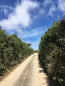
After a delicious full English (thanks dad!), the first of this trip, and another leisurely start to the day, we went for a drive about around the gorgeous country lanes around here. I really wouldn’t want to be driving anything big down here, there’s barely room for one car between the hedge-bank-walls let alone for two to pass! They are very pretty though. It didn’t take me long to fall asleep in the car (sorry dad!), my body is clearly making the most of the rest day!
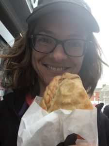
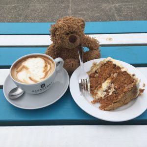
We headed to Padstow for a lovely afternoon of coffee, Cornish pasties (my first this trip!) a ferry trip across the estuary and an ice cream (also Cornish, of course!). A brass band was playing by the harbour so we stopped to listen for a while. The sun even came out for a bit!
Yuuuuum!
Having eaten dad out of nearly all his food we went to the nearest pub for dinner (a 20 minute drive, I’d really managed to find a spot in the middle of nowhere!) and I figured it would be criminal not to have fish given how close we were to the coast!
Challenged dad to a game of pool and lost twice, although not embarrassingly, I’m pleased to report! Then back to the caravan for an early night, ready for the next week for walking tomorrow!
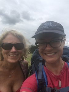
Ahhh, a delightfully short and gentle stroll today! The mileage I walk each day is usually dependent on where my accommodation is and whilst yesterday was a longer day it meant today was blissfully short. In turn that meant I had a nice leisurely morning chatting with Sharon my Airbnb host and the other guests over breakfast without needing to rush off.
Sharon joined me for the first couple of miles of my walk which was really lovely and I was impressed by her nettle-bashing skills!
Sharon, my lovely Airbnb host, joined me for a few miles!
The last few miles were along pleasant country lanes and although the sun was out it wasn’t quite as hot as previous days which was a welcome relief!
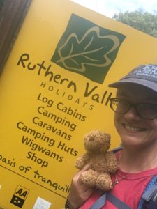
It wasn’t long before I reached the beautiful little campsite where dad is staying with his caravan and where I’ll be joining him for the next two nights. A rest afternoon and a rest day tomorrow, what a treat!
We’ve arrived!
The site is lovely, very peaceful and surrounded by trees, with a little stream nearby providing lulling background music. It is also a chance to wash and dry some of my clothes before my stint of camping next week! In the laundry area, not the stream. I haven’t quite gone wild just yet…! 😉
It feels quite strange to be writing this blog before 11pm at night. I’m looking forward to an early night tonight! But first, dinner time. Tonight it’s a BBQ, very exciting! I’m starving!
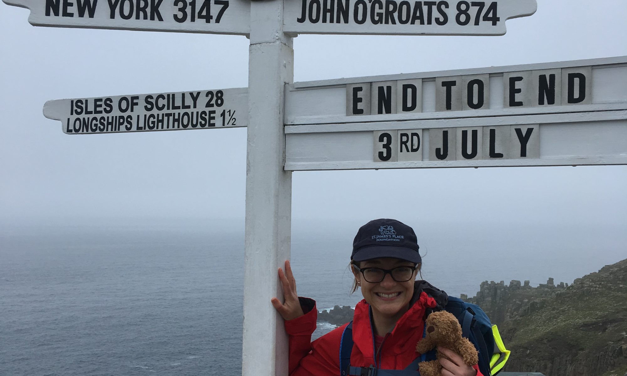
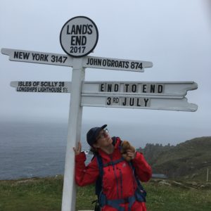
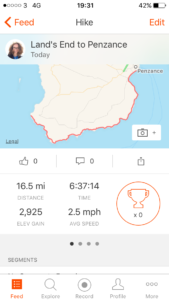
Today was a beautiful day! It started out a little dubious with heavy mist at Land’s End, but after donning the waterproofs and taking the obligatory signpost photos we set off for the first leg of my journey. Mum and Spence were joining me for the first five miles to Porthcurno, and it was easy walking high up on the cliff tops. The weather wasn’t ideal but it could have been a whole lot worse, and the mist most definitely gave it a mystical feel! (Groan, no pun intended!). We met a lovely Swiss couple walking in the same direction and I ended up bumping into them again at several points during the day – just two of the great people I got chatting to on the path!
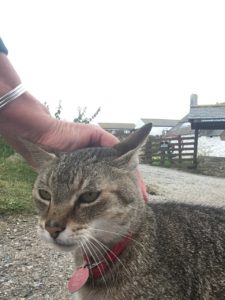
Starting out in true British weather…!The Land’s End cat!
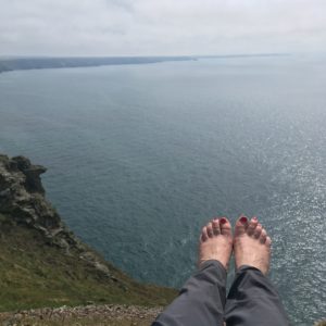
After the steep steps down past the Minnack theatre to Porthcurno beach I decided it was time for a paddle – the sun had come out and it was turning into a lovely day, and the water just looked so inviting! I don’t know what it is about Cornwall but the sea is a stunning azure blue (when the sun shines at least) and there were many points in the day when I was seriously hot and sticky that I was very tempted to have a swim! Mind you, the water was pretty cold when I paddled, so maybe just as well I didn’t go the whole hog…!
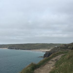
I said goodbye to Mum and Spence at Porthcurno to do the next leg to Mousehole where I’d meet them again. They were very clever, after Porthcurno the path was a true coastal path – up and down for several miles, then a bit of scrambling coming in and out of the gorgeous little port of Lamorna, where I was able to top up my water and get chatting to some more lovely people – including my new Swiss friends! We seemed to be having a bit of a race, they ended up getting to Mousehole before me (and bumped into Mum and Spence, letting them know I was only a little way behind them), but they decided to get the bus back from Mousehole to Penzance so I won on distance 😉
Despite the ups and downs being tiring, and the day turning out rather hot (I’m already developing some interesting tan lines!) the views were stunning. I loved dropping down to the secluded coves which were only accessible by foot or by boat, and apart from a few friendly hikers I barely saw anybody! Lots of birds and bumblebees, I watched a kestrel hovering into the wind and tried to out-stare an owl. Just as well I gave in first, as I have a feeling it might actually have been made out of wood…!
Mousehole was a welcome, and pretty, sight as my feet and hips were starting to feel the distance, and I very much enjoyed my glass of coke! We got chatting to a lovely couple at the next table, Sally and Kev, who gave me some sponsorship which really touched me. I think it’s wonderful that it’s only day one and I’ve already met so many beautiful people!
Mum and Spence joined me for the last three miles back to Penzance as it was supposed to be a straightforward stroll. Clearly we missed a signpost at some point because we ended up scrambling over rocks and up an overgrown embankment at one point (yes, in hindsight we probably should just have turned and retraced our steps, but hey, then we wouldn’t have a rock-scrambling story to tell and no walk with me is ever completely mishap free…!) but we made it back to Penzance in time for a delicious dinner at the Luggan Inn – I cooked steak on a volcanic stone. Yum!
An unexpected scramble!
All in all a really good start to my adventure! I’m tired now, but have a shorter day tomorrow, albeit a heavier one as I’m back to a full pack tomorrow! Think I’ll sleep well tonight…! St. Ives here I come!
Today was a long, hot slog! It was one of the days I was least looking forward to, and I have to say I’m glad it’s over!
Today was the day of cursing inconsiderate farmers, retracing my steps, scrambles up overgrown banks, bramble scratches, nettle stings and long long long stretches of road walking, without much of interest other than the stories which will probably make me laugh tomorrow but were frustrating today!
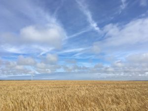
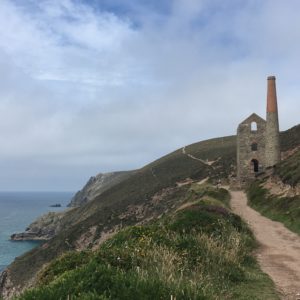
It wasn’t all bad, but 20 miles is a long way on any day, and in the heat it was tough. I made good progress for the first 4-5 miles and the paths I’d chosen were good – clear, well-marked and fairly flat. Then I seemed to slow down – I blame the four fields of barley I had to walk along (very grateful it has been dry recently otherwise I would have got soaked!) and the slow uphill walk to the only pub on my day’s route in order to refill my water bottle and use the loo.
Beautiful, but tiresome to walk through!A quick break in the pub. The high viz jacket is working well!
On leaving the pub I had about 6 miles of country lanes to tackle, so it was head down and march on, and I made good time. Road walking, especially fairly flat road walking, is much easier on the legs but harder on the feet and they soon began to feel the constant pounding. At one point two cyclists passed me and I saw from their t-shirts that they were cycling LEJOG – they called out “see you at the top!” to me and I replied “sure, race you!”. It was great to see some other people on the same route, albeit for a couple of seconds!
A common theme for the day
Not long after that a guy slows down in his car next to me and asks me about the charities I’m supporting – he gives me some coins to add to the pot! I love how open and generous people are. I am wondering whether I should get that sign made that says “notes only please, they’re much lighter” 😉
Having made up some time it’s time to get off the road and back to some footpaths and to start with all seemed well; a nice wide track through farmland, until, suddenly, the path disappears. Laiterally stops dead in the corner of a field, with an impenetrable hedge and a stream, with boggy ground in front. Confused, I check my map, check my gps. Yup, definitely where I think I am and there’s definitely supposed to be a path right there. But no. Nothing. Nadda. I wander along the fence a bit, maybe it’s a bit further along, or at least there might be another gap I can squeeze through. Nope! I reach the far corner of the field and spy a potential way through to the field beyond, only problem is it’s under an electric fence, down into an overgrown ditch, up a head-height wall/bank and along the a bit. Reluctant to retrace my steps (half a mile back to the road) I give it a go. Aside from a few scratches, I make it to the top of the bank. Whoop, go Jen! I triumphantly walk down to the corner only to be faced with a steep drop and more boggy ground the other side. Argh! It was a no go. Problem was, I wasn’t sure I could get back down the way I came up, safely. Hmm. Tip: always check you can get back down before you go up! Cue a scramble down the other side of the bank and across some slightly less boggy ground, into another field completely. And the long trudge back to the road to reassess my route. Oh look, more road walking! I was cursing farmers for not putting better signage up and keeping paths clear, which fuelled me on for a couple more miles until I realised I really needed to rest my feet and eat some food. I found a not particularly glamorous spot on the edge of the road and decided that although it was earlier than planned I’d air my feet for a bit and change my socks. Oh how lovely it is to have a fresh pair of socks on! It’s an amazing morale booster!
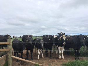
A few more miles and it was time to cross fields again. When I found the footpath I eyed it dubiously – the inconspicuous opening in the hedge was at the top of an overgrown bank. Not again! I took a deep breath and up I went. I surveyed the fields ahead. This one was clear, but there were cows in the one beyond. That’s ok, I can cope with cows. As I get closer though, the cows start taking a LOT more interest in me. And I’m not talking like 10, I’m talking more like 50 cows, young male cows in fact, and they are all jostling to get a closer look at me. They follow me up and down the fence and stick their heads through the gate at me while I look forlornly at the stile in the hedge no more than 100 metres away. I look at the young bullocks, I look at the stile. I look back at the bullocks jostling against the gate, sigh, say a few choice words, hike my bag up and turn back for the road. Again!
Overly curious bullocks
On the plus side, only another 4-5 miles to go now, and at least along the road it will be straightforward.
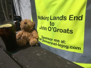
Turns out the B-road I now have to walk along is a pretty fast road and I’m constantly having to jump up on the verge as cars whizz past. Not fun walking! It was even worse when the verge disappeared from time to time! I had to walk about a mile and a half along that road and it was a bit hairy at points. I was grateful for my high viz jacket!
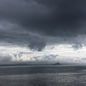
Eventually I reach the turn off for the one bit of the walk I was looking forward to – the walk up and over Castle-an-Dinas, an Iron Age hill fort with amazing views in all directions. It was beautiful, and refreshingly cool. I could see all the way to St. Agnes Beacon where I had been yesterday afternoon, and out to the sea at Newquay, then looking east I got my first view of Bodmin moor which I’ll be tackling in 4 days’ time. It looked moody! After a quick Facebook live to show everyone the view and to give myself a lift from seeing everyone say hello, it was time for the last easy-looking mile and a half into Tregonetha. I should know by now that easy-looking on the map does not translate into easy in reality. The first bit downhill was great, a clear obvious path, but then I had a missed turn (third time retracing steps) , more fighting through brambles and nettles, horse flies and lots of prickly gorse.
My oh my was I glad to make it to my accommodation for the night! And Sharon, my host, was cooking a massive roast dinner for all of her guests. Now that was worth walking for! Time for a quick shower, lots of amazing food, and a very pleasant evening swapping stories with the other guests. It had been a challenging day, so it was lovely to end it laughing and joking with some great people. Every day I am meeting amazing people, it’s fantastic!
So, a long day over, and one that resulted in a surprisingly high elevation gain (only 500ft less than yesterday!), and sore (but thankfully not blistered) feet. I’m satisfied as that is a good chunk of miles crossed off, and for the next week or so my days are mostly shorter, whoop!
Elevation gain: 2,475 ft (more than climbing Snowdon!)
Time walking: 10am – 7pm
Miles to date: 62.3
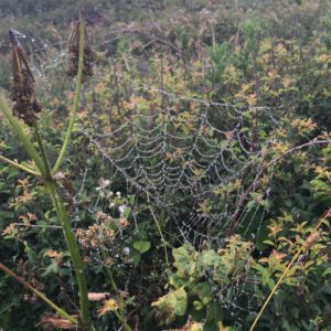
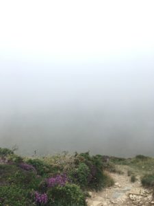
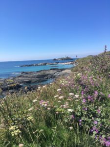
A misty start today! I was very glad after the heat of yesterday! It was quite surreal walking along the cliffs and hearing the sea but not being able to see it, with the mist rolling up over the edge and hiding the way ahead. It was very peaceful and although it is harder to get an idea of distance when you can’t see where you are, there is something quite relaxing about it – I could just settle into my pace and just ‘be’. The gorse and heather were scattered with dew-laden cobwebs, so pretty!
Dewy cobwebsIt’s a bit disconcerting when your path disappears off into the mist…!
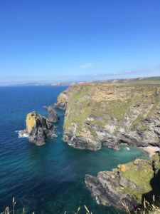
I was thankful for the cooler start to the day as the majority of the day was up and down, up and down, in true Cornish coast path style. 15 miles along the coast path is tough! But beautiful, as always! There were some stunning little coves, and lots of birds today – the falcons are around a lot (really must find out what they are!), I think they are nesting in the cliffs.
I had regular stops today throughout the day, thankfully there were lots of opportunities to fill up the water, have a loo break and enjoy the little coves along the way. Indulged in coffee and cake in Porthtowan, my halfway point, before heading on towards the lovely St. Agnes’ Head, which had been on the horizon since St. Ives. It was highly satisfying to finally get there! Lots of people stopped and asked me about my journey and wished me luck, which was a real morale boost after a morning of up and downs and helped me beat the mid-afternoon energy slump.
Yum!Lots of old tin mining buildings along this stretchNot a bad spot for my daily boots-off break
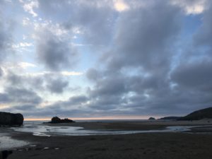
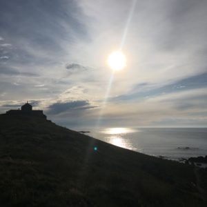
I took another long-ish break at St. Agnes Head as the sun came out and I found a lovely rock to lie on while I gave my feet some air. Could have stayed there all day! But alas I still had another 5 miles to go so it was soon time to press on. Two more down and ups, then thankfully the last 3 miles were fairly flat, even so it felt like a long 3 miles. Rounding the final headland and seeing the youth hostel perched on the cliff was a very exciting moment!
The Perranporth YHA perched on the cliff top. A very welcome sight!
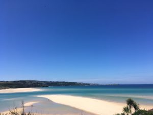
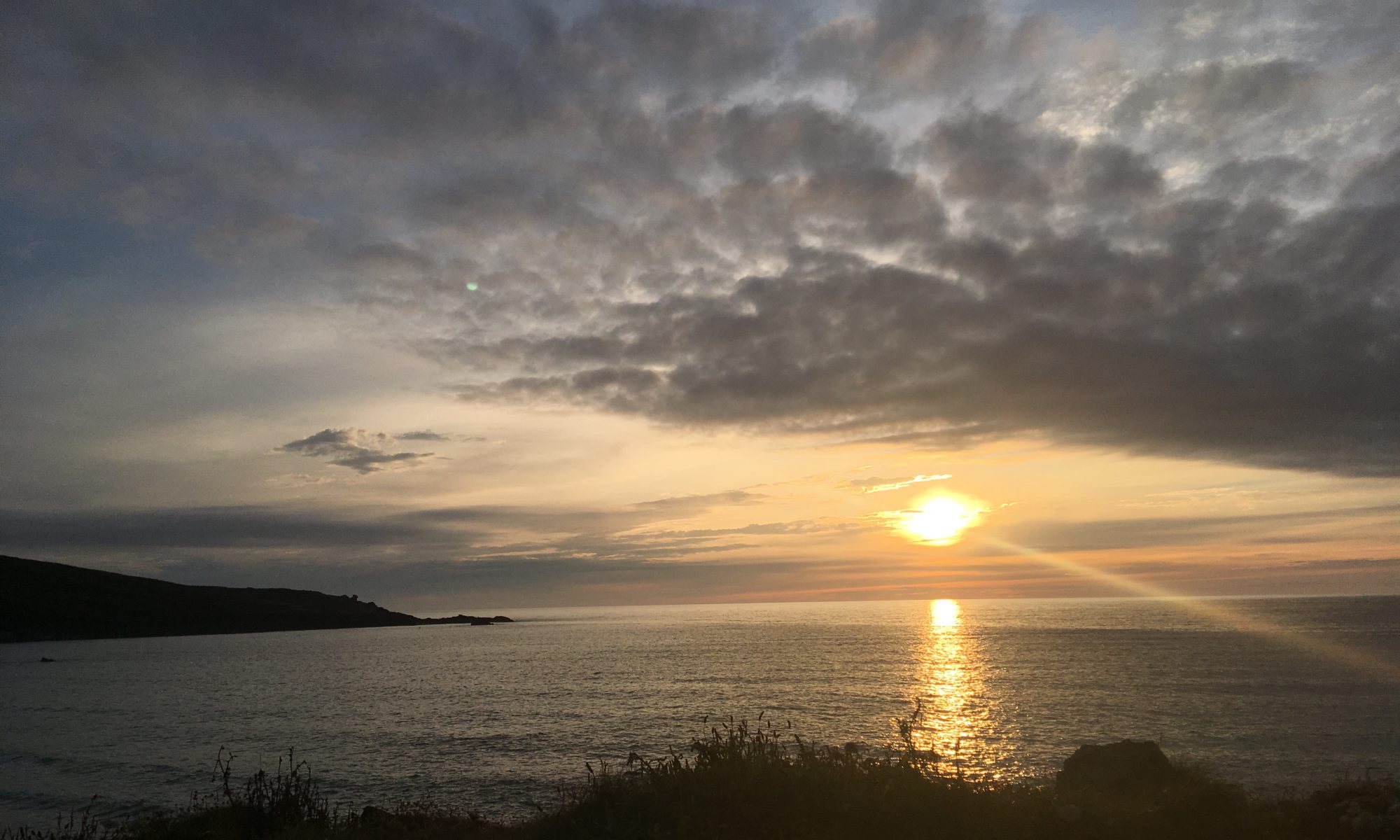
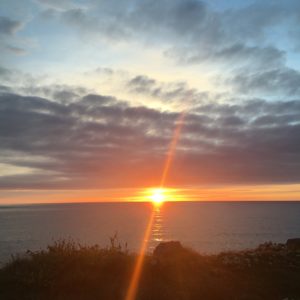
The hostel is small but cosy, and has the most incredible view over the beach (which is vast when the tide goes out!) and out across the sea, perfect for sunset! The sunset wasn’t nearly as spectacular as the one I saw in St. Ives, but it was still pretty cool.
After checking in and showering I had a quick (well, nearly another mile I think, but sans-pack it’s much easier) walk down into town to see the beach from ground level, and to pick up some food for dinner. I thoroughly enjoyed cooking my own meal!
They are friendly bunch in the hostel, lots of interesting stories. One of the reasons I love staying in hostels, you never know who you’re going to meet! Unfortunately it means another later-than-planned night, but I have some shorter days coming up so hopefully I can catch up on sleep then!
Evening on the beach
Tomorrow I leave the coast and head inland. I’m going to miss being by the sea! I don’t think I’ll miss all the ups and downs and ins and outs, but I’ll miss the fresh sea air and the sense of space you get on the cliff tops. I’ll also miss being able to see where I’ve come from and where I’m going, but I daresay being inland will have its own charms!
Wow, today was HOT! Great news for everybody on holiday on the beach, less great for this madwoman who is hiking the length of the country! Heat not only means harder walking, it also means a heavier bag! I carried 3 litres of water today at any one time, and if you don’t know, one litre of water weighs one kilogram!
Today was always going to be a long day because of the distance, and although it wasn’t too up and down (once I had climbed the long hill coming out of St. Ives), there were some tough sections. From Lelant to Hayle the coast path loops inland in order to cross the Hayle river estuary, and it’s a long 3 mile loop on tarmac which is not fun on the feet. I ended up taking an earlier than planned lunch break as I needed to take on some calories – I can’t eat them as quickly as I burn them! And there was also a big Asda right on my path which helped. I found a pretty spot over looking some boats (with yesterday’s hill fort in the distance!) and enjoyed taking the weight off my feet for a bit. I ended up taking a bit longer than I meant to as I got chatting to a lovely elderly lady and her carer, the lady was telling me all about her adventures when she was younger and was pleased that I was ‘doing it while I can’
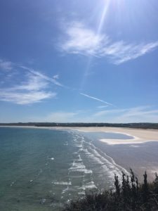
The afternoon brought with it the loooong stretch of sand dunes and beach. Sand dunes are a morale killer! They look pretty, but they are up and down and wiggly and hot and sandy. I decided to head to the beach for a bit for a break from the sand dunes and the beach was gorgeous! I could see right back across the bay to St. Ives and ahead to Godrevy point, my two-thirds point.
Back in the sand dunes briefly as the incoming tide meant I couldn’t make it around the small headland, and then I decided it really was time for a paddle. Two girls whooped as I walked down the beach with my high vis jacket and one called “You go girl!” which was a nice boost! After painstakingly brushing every last grain of sand from my feet (sand is enemy of hiking feet and best friends with blisters) it was back on the coast path for a fairly straightforward, but stunning, section.
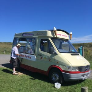
One of the happiest sights I saw at that point was an ice cream van! I treated myself to a 99 with a flake and promptly ended up with ice cream dribbling down my hand faster than I could eat it, but ohhh that ice cream tasted so good! The view from Godrevy point was incredible, and I bet it would be another amazing place to watch the sunset. I could see St. Ives across the bay and it looked a long way away!
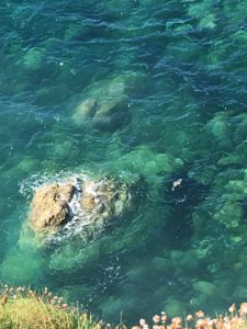
The next bit of the coast path is high up on the cliffs, which are incredibly beautiful, with views down to rocky coves, bright turquoise sea and…..seals!!! They were very small from above, but cute, bobbing around in the sea or sunbathing on the rocks. I also saw a few birds of prey, I think kestrels or some other falcon. I think one was nesting in the cliff!
My feet were starting to tire at this point and I could feel that I was catching the sun despite repeated applications of suncream, but I kept soaking my buff in water and wearing it around my neck which at least helped keep me a little bit cooler. And it was only a few miles to go, along good ground, so I picked up the pace a little. The last 2 miles took me inland to just outside of Camborne, where my hosts, friends of friends, live. I think they probably thought I was quite mad, wanting to walk to the house when they’d offered to pick me up, but there’s something incredibly satisfying about arriving somewhere on foot!
I was incredibly grateful for a delicious home cooked meal tonight, and I’m struck again how lovely people are! I’m really enjoying meeting new people too! Jo has published a book on caring for ex-battery hens and having had a flick through it looks really interesting and informative. I’ll definitely get my hands on one when I get my chickens!
It has been a really lovely day, and my body is holding up better than I had expected. My feet are aching tonight and I am very tired (trying not to nod off while writing this!) but I’m satisfied at having achieved what was a challenging day and knocked a few more miles off!
Now for a good night’s sleep and a 15 mile day tomorrow – my last day on the coast 🙁 it’s supposed to be cooler thankfully!
Ok so just figuring out the best way to do these posts…bear with me if they are all over the place for now!
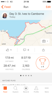
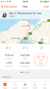
Total distance: 12.9 miles
Elevation gain: 1,311 feet
Time walking: 10am – 6:30pm
Miles to date: 29.4
Wow, what a glorious day! After a leisurely breakfast and the excitement at the first dots being put on the map we said farewell to our amazing hosts Lyn and John in Penzance and headed back to the coast path for the easy 2.5 mile stroll towards Marazion, with great views over to the moody-looking St. Michael’s Mount. Mum and Spence joined me for this bit but then it was time to say goodbye and head out on my own. It was amazing to have them join me for the first little bit of my adventure, and it felt strange to be saying goodbye – but one of the benefits of being a southwesterner is that for the first few weeks I’ll have a few visits from my family! I’m a few days’ time dad is coming down to meet me in his caravan, yay!
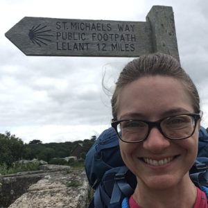
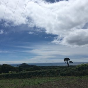
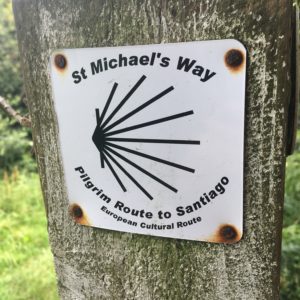
My route today followed St. Michael’s Way, a pilgrim route which would take me pretty much all the way to St. Ives. The joy of following a ‘way’ includes clear signposting, well maintained stiles and gates and usually some pretty views along the way, and today didn’t disappoint! The path took me around Marazion Marsh nature reserve where I saw a baby frog, a heron and lots of birds. The way then continued across easy farmland with stunning views back to St. Michael’s Mount and the bay, once I gained a bit of height. There was not nearly as much up and down as yesterday, thank goodness, as uphill is HARD with a heavy pack! I’m hoping I’ll get a bit stronger and fitter because the pack isn’t going to get any lighter…! At roughly the halfway point I could spy my target for lunch – an Iron Age hill fort which looked like it would have great views. It might seem a bit crazy, to add unnecessary unphills to my journey but oh my goodness was it worth it! At the top there were views back towards Penzance bay and in front of me the northern coastline spread out and I could see a large part of tomorrow’s route. There’s a reason I’m a sucker for a good hill fort! As I was in no rush I had a proper break, taking my boots and socks off and even lying down in the sun for a while. I was quite sad to have to get going again! Three women who I’d been chatting to at the bottom (they were waiting for a DofE group who were behind schedule) looked surprised to see me still there! They’d found their students and were now watching out for them from the top of the hill.
It wasn’t too long before I came across the students myself – they were looking very hot and tired, one lying flat out on the ground (rucksack still attached) and a couple sitting looking like they were on the verge of giving up. They were pleased to see me and wanted to check they were where they thought they were, which gladly they were. When I told them it was only about a mile, or 20-30 minutes to their campsite they perked up and made a last push for it. I remember DofE, I loved it! I think it was one of the things that gave me this hiking bug!
It was pretty much straightforward and downhill all the way into St. Ives after that – a very big downhill which I’m not particularly looking forward to walking back up first thing tomorrow! I was waiting for some smart Alec to point out I was going the wrong way (St. Ives is a slight detour for me), but no one did, maybe I looked too happy, despite being hot, tired and sticky, that they deemed me mad and best avoided… 😉
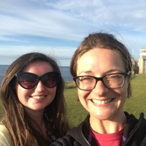
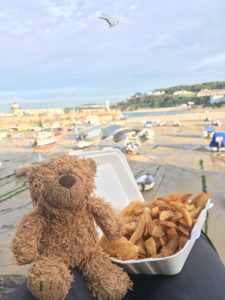
Well St. Ives lived up to my expectations. It looked so pretty walking in, and ohhh the sea looked so inviting! I had plans to go straight to the hostel, dump my bag and go and jump in the sea! As it turned out, I got chatting to a lovely girl called Beth at the hostel who is walking the coast path by herself during her summer break, and once I’d cooled down a bit the urge to jump in the sea had lessened. We did go and paddle though, and then wandered around St. Ives which is really beautiful and bustling. We ate fish and chips by the harbour and had to fight off seagulls (vicious creatures!), treated ourselves to an ice cream and then went and sat on the peninsula to watch the sunset. And wow, what a sunset! Straight into the sea. An incredible way to end a beautiful day!
I’m not aching as much as I thought I would thankfully, but I expect it will hit me in the next couple of days. Right now, I’m just enjoying the moment! I’m in my happy place 🙂
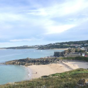
A moody view over St. Michael’s MountLunch stop on top of the hill fortOne of St. Ives’ four beachesWell, Tuesday is yoga day!St. Michael’s WayBeth, someone nearly as crazy as me!
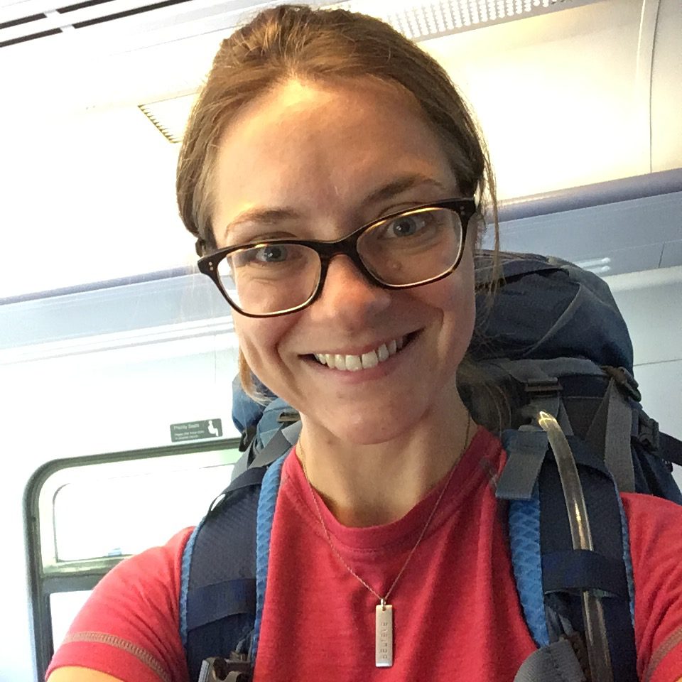
Oh my goodness, I’m off! Well, on the train down to Penzance at least, so it definitely feels like the adventure has truly begun. My bag is packed, my route is, well, not as finalised as I’d like but pretty much there, I’ve dealt with everything I needed to sort before I left and now all I have to do is walk!
I can’t believe the time has finally come. It feels like I have spent so long planning and dreaming about this trip that it feels quite surreal that it’s actually happening. I’ve had a few oh-my-god-what-am-I-doing moments over the last week but not once have I felt like it’s a bad idea, so I guess that’s a good sign?! It was all hands on deck to get everything done in time, but thankfully Eunice made me pack my bag yesterday morning which meant I wasn’t faffing with it all afternoon – if you don’t know what I’m like I’m usually to be found frantically packing at midnight the night before I leave, so this was a real first!
I’m currently on the train and the countryside is so beautiful. I was born in Somerset so I have a real soft spot for the South West and it feels really nice to be travelling through! We went through Taunton, and Tiverton earlier, where I’ll be in 2 weeks’ time. It’s quite amusing to be travelling backwards through my journey, although, 3 hours by train, two weeks to walk it….I really am bonkers aren’t I?! It took about 5-10 minutes to get from Taunton to Tiverton – that’s a day’s walk for me! In fact, it’s potentially my longest day of the whole trip at 24 miles!
We then reached the south coast just past Exeter, and the excitement really hit! The sea!! Oh my goodness, so beautiful! It helps that it is a beautiful day today and the sea is sparkling, but I forgot that the train runs right along the shoreline, and it reminded me how much I love the sea. My route takes me along the coast path for the first few days, first from Land’s End to Penzance, then up to St. Ives and following up for a couple of days so I’m so excited!
We’ve now headed back inland a little and I got a great view of Dartmoor. I will be skirting around the northern edge of Dartmoor, and I’m praying for good weather as Dartmoor in the sun is stunning. Dartmoor in the rain…not so much! I’m also doing a stint of camping at that point, so please all pray for dry days!!
So, tomorrow it begins properly. I’ll be posting some photos and videos on my Facebook page of the set off from Land’s End so if you haven’t found that yet it’s @jlemarinel.lejog
Of course I’ll be updating this blog too. The aim is to post a daily update of my progress and (hopefully) a Strava map of my route (find me on Strava and give me kudos please!), and then do a more general blog post once a week. For those of you who have subscribed to blog updates, there won’t be notifications of the daily blogs (I don’t want to inundate your inboxes) so do check back here if you want to see how I’m doing. I will continue to send out the notifications for the weekly blog posts though, so please do keep reading them and dropping me messages of support!
And I think that’s all to be said for now….let’s get this thing started! Thank you so much for your support in getting me to this point, and keep cheering me on from afar!
With love
Jen xx
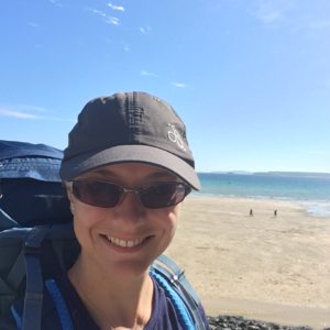
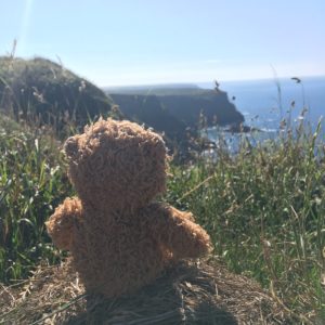
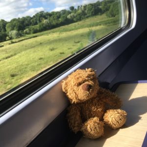
My friend King Jennifer (don’t ask me how he got his name, I can’t actually remember…!) is joining me for the adventure 🙂