Total miles: 10.0
Elevation gain: 2,688 ft
Time walking: 10:30am – 6pm
Miles to date: 1,344.7
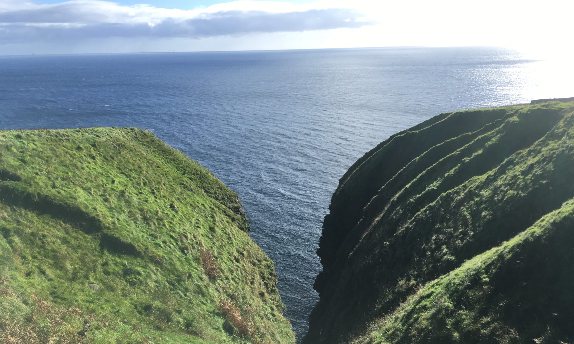
A “short” day that took a long time! Lots of bracken-bashing today, a rather addictive past-time, which was satisfying but made for slow progress. The reward: stunning clifftop walking, spectacular views of waterfalls cascading straight into the sea, precarious sea stacks and cavernous geos, all of which barely anybody else has seen. Not to mention the satisfaction of helping to create a new path that hopefully many people will go on to enjoy. The downside: aching a lot more than I should do after a ten mile hike!
It was another gorgeous sunny morning when I woke up, although much windier today than the previous couple of days and the sea was choppy and uninviting. Jay (who kindly let me crash on his floor) spent some time talking me through the rest of the route, pointing out potentially tricky sections, and then I headed out, looking forward to being able to take a slower day. I was anticipating, and looking forward to, a bit of scrub bashing on the way as Jay had warned me there were some very overgrown sections that were hard going, and I thought it would be nice if I could make a bit of a path for others to follow. The first section, from Jay’s house, was already well-bashed and easy to follow, although I kept cross referencing against the map and instructions so I could add comments if needed. There are some slightly fiddly sections cutting in and out of the clifftop fence but after a while I was able to stay outside of the fence for most of the way. This is much better where landowner relations are concerned, but currently much harder going!
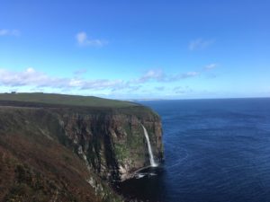
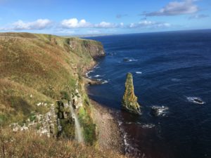
The views quickly made it worthwhile though, the first extra special sight being a tall waterfall tumbling off the cliff into the sea below, shimmering silver and white in the sunlight against the deep blue of the sea and the pale blue of the sky. It was quite a sight, and I was struck by how nobody would have seen this unless they’d walked this path (which given there isn’t actually a path, isn’t all that many people!) or seen it from a boat. I felt privileged to be up there at that beautiful vantage point.
The waterfall soon disappeared out of sight as the path cut in around a narrow cove and onto the very wet ground above the steep gully through which the stream that fed the waterfall ran. Getting down to the stream was probably the trickiest bit of the day – wet, steep and overgrown with damp-loving plants – but thankfully this is a stream where a bridge has been built so once down it was fine. The way back up was steep but it was also south-facing and grassy, rather than bracken covered or boggy so although tiring it was straightforward.
I took a rest at the top on a handy rock and checked my tracker, amazed to find I had only covered 1.5 miles! The terrain makes such a difference. I hadn’t even been doing that much deliberate scrub bashing yet, just picking my way along the faint path, but I think a fair bit of time was lost crossing stiles and a couple of barbed wire fences (after tearing my waterproof rucksack cover the other day I’m a bit more careful now, although I still managed to catch and enlarge the hole in my waterproof trousers where the seam had started to disintegrate. Ah well, another item to add to the “things I’ve destroyed on this trip” list!).
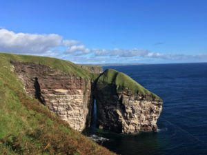
The next section was pleasantly grassy which made for slightly easier walking, although the grass was long and soft and hid the occasional hole. The wind was stronger too so I was taking it steady on the narrower bits! The next impressive sight was An-Dun, a hill-like outcrop of rock joined to the mainland by an incredibly thin ridge above a narrow sea arch. “Dun” usually indicates a hill fort of some kind…I wonder if people once lived on top of this one. It would be bleak up there on bad days! Pretty fine views though!
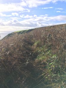
Soon after An-Dun there was a gate which marked the end of the grazed section of cliff and I had been warned that past this gate it was very overgrown. Jay wasn’t lying! Up this far north the summer growing season is short but fierce, and unless an area is regularly grazed (or otherwise managed/trampled), bracken (and gorse etc) quickly takes over. Here it was bracken, but thankfully it is the end of the season and it is now dying off which makes it easier to squash! For the next couple of miles I made my way along, trampling a path as best I could. Fun, and satisfying, but slow. And surprisingly tiring! I must be slightly bonkers as it’s not like this journey isn’t challenging enough, without adding in scrub bashing to the mix, but it certainly has added another dimension to my adventure, and one I’m rather pleased about! I have to admit though that I was rather glad when I reached the point where the path leaves the cliff tops before Dunbeath Castle and cuts in through a field (how civilised!) before joining a well-maintained grassy path through the estate, near to but separate from the road. This path eventually joins the old A9 which is now a quiet, pleasant dead-end road leading past the castle driveway into the southern part of Dunbeath.
Along this road I met Ken, the dad of a friend, who lives in Dunbeath, and his lovely terrier. It was so nice to see someone with links to back home, and we chatted about my trip as we walked back to his house (which is right on the sea front!) for a cup of tea and a rest for my feet. The weather was just starting to turn, the wind was picking up and the clouds were looking moody, so it was nice to get inside for a bit. After tea Ken walked me around the harbour to the picnic area where the next section of path started, with a steep climb back up to the cliff tops. The going was much less overgrown on this section, but it was still a tough walk, as you’d expect for any coast path, let alone an unfinished one!
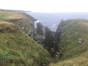
There were some spectacular features along the way – massive geos with sheer cliffs and rocky beaches, waves crashing at their feet, and sea stacks which looked as though they’d topple and fall with the next battering wave. Birds – buzzards, gulls, other birds I didn’t know – flew out of hiding places in the fragmented cliffs and soared over the sea spray and craggy headlands. There were views back towards Dunbeath Castle, its white walls standing out clearly against the dark slopes behind.
The walk continued along the cliff top before retreating a safe distance back from the edge into fields. There was a slightly tricky section that is yet to be properly marked or constructed (i.e. stiles etc built) because the landowner is not playing ball. With the detailed instructions I was fine, but for once my progress was slowed not by heavy undergrowth but by the need to carefully cross barbed wire fences. In order to cross a stream that cannot yet have a bridge built over it the path veers inland toward the road and then back again, and as I was heading towards another set of fences, figuring out the best place to cross, I hear a quad bike draw up behind me. Uh oh!
I had an instant guilty feeling, even though I was perfectly within my rights to be there, and I wondered what the farmer was going to say. He was actually really friendly, and although I think his ulterior motive was to dissuade me from crossing his land, he warned me that the next few fields had cows and a bull in them and the trying to follow the coast was “very difficult”. I didn’t quite have the energy or the desire to explain that I had come across more cows and “difficult paths” than he could imagine and was so far coping very well, thank him very much, so I played the wide eyed schoolgirl and thanked him for the warning. His suggestion (clearly not meant to be ignored, despite saying it was of course completely my choice) was that I head back to the road and follow it into Latheronwheel, which would be easier. I decided it would be easiest just to go along with his suggestion (and to be fair, although the cows were at the far end of the field and would almost certainly have been absolutely fine, I had been eyeing them slightly warily) so retraced my steps across the field to easily join the A9.
I was disappointed to be back on the road as I was so close to completing the day entirely on the path. Furthermore there was a deer farm coming up with an enormous deer-fence-surrounded field which would make it impossible to cross back to the path before Latheronwheel, meaning a couple of miles on the road instead. I felt myself being a bit annoyed with the farmer. It must be difficult though, as a landowner. I can understand their reluctance to open up their fields to a potentially very popular long distance trail, which could see hundreds of hikers passing through, with the challenges that brings in terms of fence maintenance and livestock considerations. It wouldn’t be so bad if all hikers were considerate, but sadly it is still so common to see litter and all such things along trails. I’d like to claim that long distance hikers are perhaps a little more considerate and aware of their impact, but judging by the state of parts of the West Highland Way I’m disappointed that that might not be the case. I do hope that a mutually agreeable solution can be reached though, as it really is so lovely to not be walking along the road!
As I headed down the road I spotted a lay-by on the right and decided to see if I could find a way back to the cliff tops now I was at the far end of the cow field (and out of sight of the farmer!). The deer fence had just begun so I followed it back to the edge of the cow field, which was enclosed by a fence-topped wall. And then, result! I spotted a promising-looking space between the deer fence and cow field wall that looked like it would head right down to the cliff tops. The only problem was that there was a 5-6ft drop down a wall to get to it, not an easy prospect with a heavy backpack. I inspected the wall more closely and was happy (like, seriously happy – fist pump in the air type happy) to find there was a tiny stone ledge halfway down, just big enough for me to carefully climb down if I hung onto the fence and the stones at the top of the wall. Successfully landing ninja-like in the precious gap, I triumphantly headed down the slope, bashing my way through bracken, to pick up the path again.
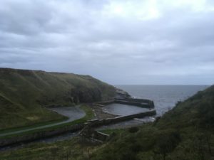
I was so pleased with myself that I didn’t even worry too much about the rain that started to fall, even though it was pretty miserable. Thankfully I did at least already have my waterproof on, I just forgot to put my waterproof rucksack cover on and my bag got soaked! The path, although slightly covered with bracken, was fairly clear from this point and it was a pretty walk towards Latheronwheel. There was a lovely view of the tiny harbour and the path dropped down towards it over an old stone bridge, before climbing up the other side into the village. The path branched off back to the cliff tops but I was staying in a B&B run by Ken’s nephew right at the top of the village, half a mile further up. It felt like a long half mile after a tiring day, in the rain, as the light was just beginning to fade, and I was pleased to finally arrive, somewhat later than I had expected!
I feel incredibly tired considering I’ve only walked ten miles today. The elevation gain is pretty impressive for that distance though which goes some way to explaining that, on top of the heavy undergrowth. It’s amazing what a cup of tea, a biscuit and a nice hot shower can do though! And I had a lovely dinner with Ken at the Bay Owl, the only restaurant in Dunbeath (felt strange, to be driven back to Dunbeath in a matter of minutes having spent two hours walking from there!), so I think I’m going to sleep pretty well tonight.
Tomorrow I’m merging two stages (the first of which actually started in Dunbeath) so it’s a slightly longer day at around 12.5 miles but hopefully slightly less scrub bashing on the way! It’s going to be a wet one underfoot, judging by the rain I can hear on my window right now…!
