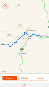
Total miles: 14
Elevation gain: 2,795 ft
Time walking: 11am – 7:30pm
Miles to date: 935.1
And we’re back! It’s funny how you don’t realise how ill you felt until you feel better again! We woke up this morning feeling back on it and packed up quickly (relatively speaking…when camping it usually takes around two hours from waking up to starting walking, this used to frustrate me slightly but I’ve learned it’s all part of the journey and now embrace it as a big part of the day). We then lost a bit of time sitting and having a more leisurely breakfast and cups of tea before getting going properly, but never mind, it’s all part of the fun!
It felt great to be walking again, back to more-or-less full strength. Our route today was to follow the Southern Upland Way, Scotland’s coast to coast path (and yes, I have just added another trail to my list…), to near Traquair. Apparently there is a bothy up in the woods not far from the trail and as Anneliese had not stayed in a bothy before that was where we were aiming for. The first few miles of the path were flat and easy, following the River Tweed out of Melrose and we met lots of people out walking, despite it being a week day. It was a nice gentle introduction back into the walk before we reached the first set of hills which would take us down to the edge of Galashiels. As we were dropping down the hill we met a couple of women out walking their dogs and we got chatting to them. Their local knowledge was very handy as they saved us a trek into town to find a loo and some refreshments – just off the path was a swimming pool which had loos and vending machines, which was all we really needed for a quick break. I’m not quite sure what the swimming pool staff thought of us, coming in in full hiking gear, but they did find it amusing when Anneliese got stuck coming out of the door because her roll mat was too wide to fit through!
After Galashiels it was back into the hills, a gentle climb through farm fields and then a very steep climb up a grassy field to some woods. The path actually climbed up to the ridge slightly more steadily, but we chose to make a small detour to avoid the cows guarding the top of the ridge! We kept a close eye on them and at one point it looked like they might venture down the hill to have a closer look at us, thankfully they decided either that we were no threat or that the hill was too steep to bother walking down. Either way, we were both glad they stayed put. We didn’t fancy running from cows uphill…
Once clear of the little wood we could see a cairn on top of the hill we were aiming for and the wind picked up as we got higher. The sun was out too though and it was a pretty climb with views back down to Galashiels and across to the three Eildon Hills above Melrose. The path went up over the hill and down the other side, dropping down once more to the River Tweed, crossed by a lovely old stone bridge where we stopped for a quick bag rest. We are both getting good at spotting suitable bag rest spots – a fence, wall or gate at just the right height to rest the weight of the bag without taking it off – it saves a lot of energy stopping to take it off and put it back on!
From the river it was into the woods of Yair Hill Forest, following a pretty little stream and once again up a hill, this time a much steadier, but longer, climb. Every now and then the view would open out through the trees and we could see the pretty valley we were tracking up, or back the way we had come across the hills from Galashiels. It was pretty and peaceful and after a couple of fairly flat days it was great to be back in the hills again! We’d neglected to pick up water from the stream so we were on the lookout for some water so we could top up and stop for our (late) lunch – we were planning on cup-a-soup, mug shot pasta and ham sandwiches (the random things you eat when you’re on the trail…!). There were a couple of tiny streams marked on the map and it was so satisfying to approach the place I expected to see a stream and hear the beautiful sound of flowing water! We stopped there, on the track by the stream coming off of the hill, filled our water and made our lunch. Although the sun was out it was chilly and it was really lovely to have something hot to eat. I don’t usually bother to make something hot when I’m on my own so it felt like something of an occasion!
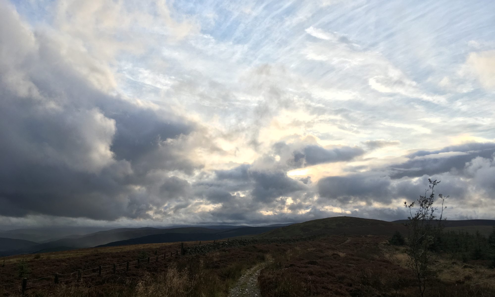
Another steep climb along a mushroom and toadstool-rich track (wish I knew more about mushrooms!) brought us out onto open moorland, with misty hilltops and heather-clad slopes. The heather is just going over so it is more of a dusky orange than a purply pink now, but it is still beautiful. I appreciated the nice firm, clear path we were walking on – it’s a delight after the rough terrain of the Pennine Way! It certainly made climbing up the hills easier, despite the strengthening wind. This climb took us up to the Three Brethren, the highest point of the day at 464m topped with three big cairns. The views were incredible and we could see the weather all around us. Lots of mist on the surrounding hills and coming up the valley, sunshine on some of the hills in the distance, rain on others. Far away we could see the three Eildon hills, even further away was the Cheviot, standing out distinctively along the ridge of the rest of the Cheviots. Wow, I’d walked all the way from there?!
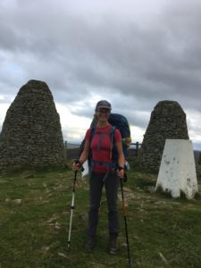
It was getting a bit chillier now and we could see some rain heading our way. We stayed optimistic and headed down along the ridge we were following, our warm layers on back to front to keep our fronts and arms warm without taking our bags off or overheating too much, but soon enough the rain came and we had to give in and don the waterproofs. The shower didn’t last too long thankfully but the wind was chilly so we were grateful for the extra layer. When it got to 7pm we stopped to assess where we were and decided we wouldn’t make the bothy before 8pm (our designated cut off time for camping) so looked at where we might be able to camp in the next couple of miles. There wasn’t much water for the next four miles as the path went up over hills so we decided to stop on a saddle between two hills where there was a stream marked on the map just below, about a mile further on. It wasn’t as far as we had wanted to get but water is pretty essential. Especially if we wanted something hot for dinner!
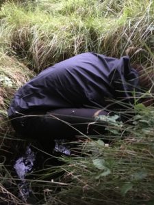
When we reached the planned spot we found a nice flat-ish bit by a wall for shelter, with slightly shorter grass and not too many hummocks. We dropped the bags and went on a hunt for some water. When we dropped down towards where the stream should be we found it was dry…so we went a bit further down…still no water but slightly boggier ground. Hmm…we needed water so we kept going, following sheep paths through the heather and bracken until, very excitingly, we heard the precious sound of a trickle of water. Finally we saw the tiniest ribbon of water trickling its way through the grass and ferns. It wasn’t enough to collect, but it was a promising start! We headed further down, to where trees started to crowd around the route of the stream and found a larger trickle. Annie was determined to get water and got down to it, practically disappearing underground! It still wasn’t enough though, but then we saw a pool of water between the trees so headed there. As we were making our way to where we could see the pool we suddenly heard an amazing sound – running water. Not just a trickle this time, a good flow of water cascading down to join the infant stream. It looked like it must have been a spring, and it was a wonderful sight (and sound!). Anneliese still had to practically climb into a hole to get to the good flow (she was determined to do it – I didn’t make her!) but we filtered just over 3 litres, gratefully! We then had the long trek back up the hill to our bags, hoping that nobody had found them deserted and panicked, or that it didn’t rain before we got there! All in all it took us about 45 minutes, and a mile, to find and collect the water and get back to our camping spot, just as the light was fading. I tell you, I’m not going to take turning a tap on for granted again!
We set up our tents quickly, the temperature dropping and the light disappearing quickly. It’s amazing how your eyes adjust though, when there are no lights around! The fading light isn’t really too much of an issue, the temperature is the one to watch! Tents pitched, it was time to make our dinner – dehydrated minced beef hotpot. Yum! Warming and filling! We sat and ate it in Anneliese’s tent – my old tent! I still love it so much, it’s a bit roomier than my current tent, and easier to get in and out of, but it weighs a ton, comparatively! As night truly set in around us, the lights of a village across the valley looking very pretty and comforting. It’s interesting to see how the nights are drawing in on this trip, it’s definitely getting darker earlier. Still, I have been going for over two months now…! One good thing though, darker nights mean I’m getting to bed earlier – when you’re camping your body just tunes in to the natural day and night cycles and I struggle to stay awake once it gets dark!
Tomorrow I’ll need to look over the route as we are about four miles short today so I think we will need a different camping spot than the one I had planned, but I’m sure we will figure it out!
