Total miles: 11.6 Elevation gain: 2,333ft Time walking: 9:45am – 6:30pm Miles to date: 1,334.7
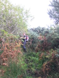
Today was a fun day! I walked the first couple of miles alone, with the first hill out of two for the day (hilliest day I’ve had since before Inverness!) to get my legs warmed up, to a spot where I had planned to meet Jay, the trail guy. Jay had parked further up along the path and walked back to meet me, armed with loppers and a sickle. It was trailblazing time!
Over the next three hours we travelled all of about one or two miles, clearing the overgrown path on our way. It was slow but satisfying work – it felt great to actually be helping to “build” the path as I went! It was also amazing to have Jay guiding me through the potentially tricky section. It would have been hard to follow here, with such thick undergrowth and, until now, no waymarkers.
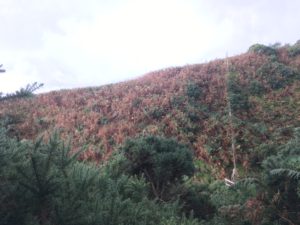
Jay leading the way through the gorse with the loppersBelieve it or not, that’s the trail AFTER we’d been through clearing it…!
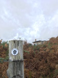
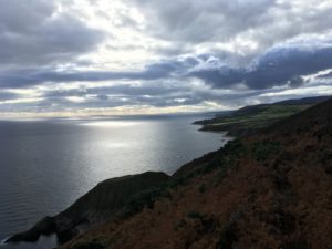
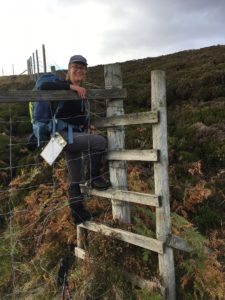
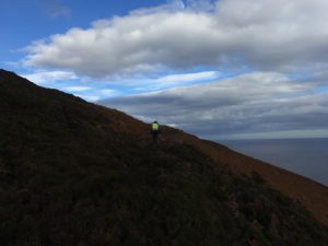
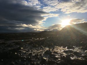
The weather was stunning today, still and sunny, and hot at points! Well ok…warm…! It was the first real time being up on the cliffs instead of down at the beach which led to some amazing views. After the morning’s trailblazing, with gorse-scratched hands and aching arms (makes a change from aching legs I suppose), we headed out into slightly more open country, traversing steep heather and bracken-covered slopes that rolled down to the sea far below (not a section for vertigo-sufferers!). A few way markers got added here to help guide future users of the trail and then, after scaling a 6-foot deer fence (which thankfully had been graced with a ladder stile) it was time to head off on my own again, with a few more pointers from Jay.
The countryside opened up into coastal moorland and I was reminded of the Pennine Way. Happy memories, and I can’t believe that was a month ago already. It felt good to feel on top of the world again. The highlight of the afternoon was seeing a beautiful red deer stag run out of the heather just in front of me. He was majestic and magnificent and magical and a dream come true! When I first saw him out of the corner of my eye I thought it was perhaps a pheasant or something, but as he jumped out onto the rough track, barely 10 metres in front of me I was faced with a fully grown stag, with elegant antlers and a look of proud surprise in his eyes. I’d heard the red deer calling several times in Scotland, but I had barely dared to hope I might actually get to see one, let alone one so up close and personal. He trotted off ahead of me, before leaving the track and bounding away over the heather and out of sight. As if that wasn’t enough, later I saw a female deer and her calf too. I can tell it’s wild up here!
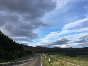
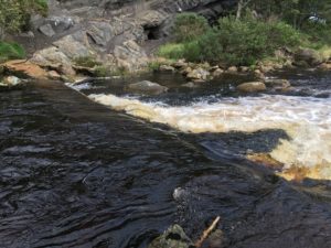
After this rather glorious section I had to detour from the trail to join the A9 – oh road of infamy on LEJOG! Sadly, the section of the trail that drops down into the deep Ousdale valley requires a burn crossing that is not safe for me to attempt on my own. It’s probably the only section of the trail I won’t be able to attempt, and I’m a little bit gutted, but safety comes first, and after my rather hairy crossing of Loth Burn two days ago I’m definitely playing it safe today! Still, I was quite intrigued to see what walking along the A9 might be like. I’ve heard that it’s awful and monotonous and comes with its own dangers (in the form of narrow verges and racing cars) – perhaps it is all part of the LEJOG adventure? [Edit: I believe this section of the trail has been much improved and there may even be a bridge across the burn now, hurrah!]
A tranquil shot of the A9
Well, the A9 wasn’t absolutely awful, but I’m glad I’ve not followed it for days on end! A mile or so was plenty! The scenery was still beautiful although of course you don’t get the stunning views of the sea, or the precipitous cliffs and crashing waves, and yes, the road was surprisingly busy.
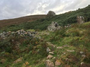
I rejoined the trail at the Badbea clearance village. There’s little more here now than the tumbled ruins of cottages, and a monument in memory of the families who settled here in the 18th and 19th centuries after being evicted from their homes during the Highland Clearances. It’s a beautiful but lonely and exposed place, and even on a warm day the breeze gives a chilling impression of how tough life must have been up here. The ground was poor and rumour has it that in strong winds the villagers would tie their children and animals down so they didn’t blow off the cliff into the sea!
Some of the ruins at Badbea
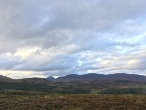
I continued my walk in the glorious sunshine, giving my thanks to the weather gods, barely believing this was October! I smiled each time I came across the distinctive black and white octagonal JoG Trail way markers. the trail was easy and pleasant here. At points I had clear views out to mountains inland, and oil rigs far out to sea.
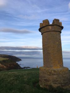
Approaching Berriedale I see two towers on the hillside. Known as “the Duke’s Candlesticks”, they look a little like chess pieces, and were used for navigational purposes. Fires would be lit in them and ships would find the safe approach into the harbour at Berriedale by ensuring the towers were in line.
The Duke’s Candlesticks
Dropping down into Berriedale itself I have a great view of the famous hairpin bends climbing up back out of the village on the other side. Articulated lorries have been known to get stuck there, and I’m glad to discover there’s a bridge over the river closer to the sea so I don’t need to take to the road again.
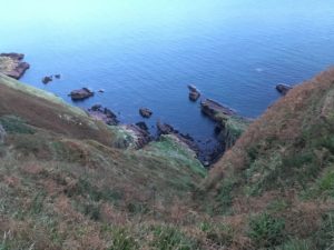
I’m staying just outside Berriedale, so I have to make the climb up the hillside, and the light is just starting to fade. The trail runs rather precariously close to the edge of steep cliffs here, and I have to hold both my nerve and my concentration. I skirt along the edge of a field of cows, unsure whether I more fearful of the cows to my left or the sharp drop to my right! Thankfully, they only half-looked at me before returning to chew the cud, and I breathe a sigh of relief, returning my focus to staying upright and on top of the cliff.
Don’t look down…!
Tonight the rain has come in and I’m listening to it drum on the roof. I’m in an attic room and the sound is glorious. Glad I’m not camping tonight though!
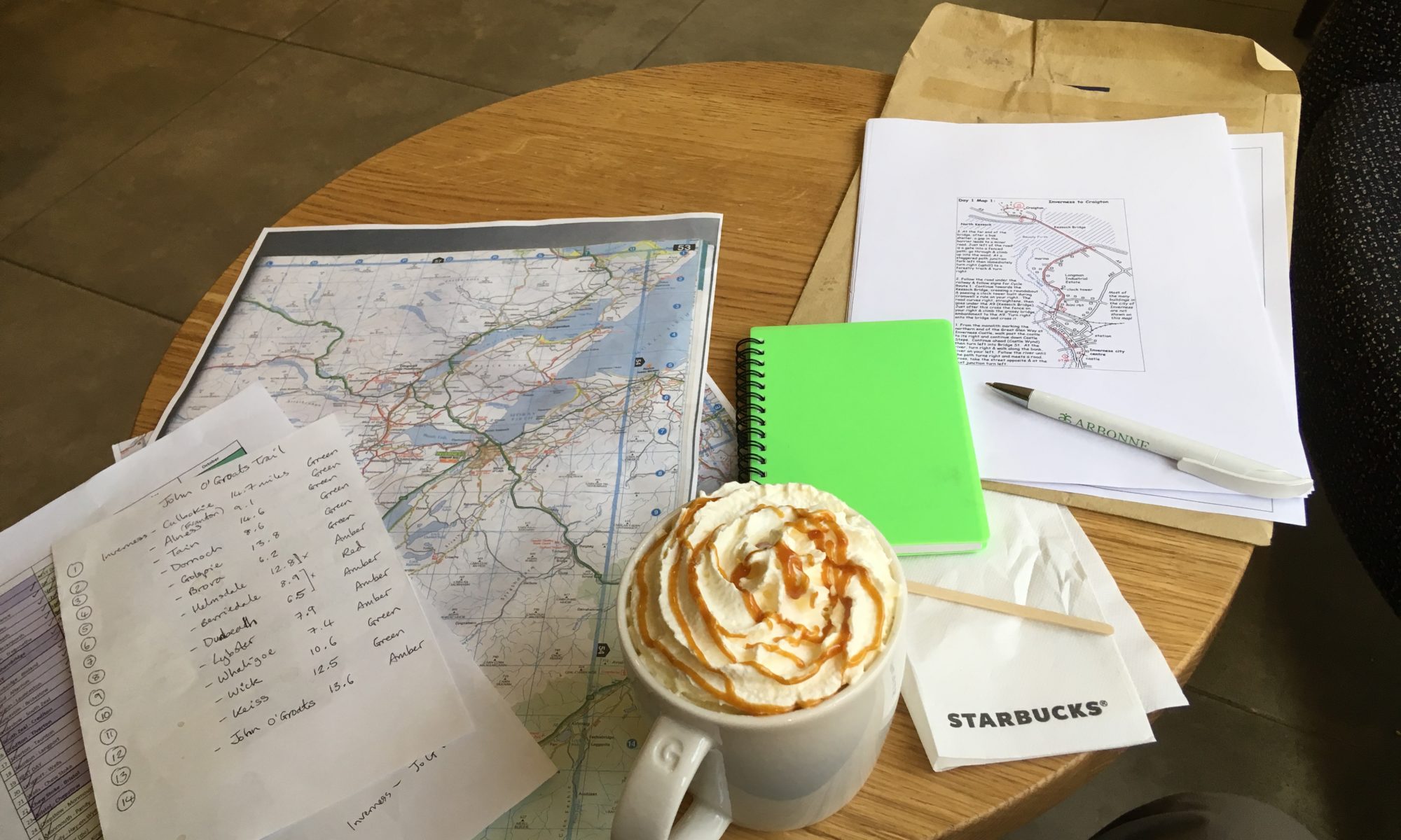
A very restful day! My last rest day and not too much more planning to do, just a few tweaks to the split of the route, some accommodation booking and a little bit of train travel booking to get me home again after Orkney.
Can’t believe in one week’s time (next Sunday morning) I’ll be done! Less than 70 miles left now, which doesn’t feel much, although before this trip that was pretty much the furthest I’d ever walked in one go!
I had a nice short stroll down to the harbour for some fresh air and to stretch the legs a little, feet and knee feeling a bit sore but otherwise not doing too badly. Jay (the JoG Trail guy) took me for dinner at La Mirage, a bit of a legend in these parts, where the fish and chips are amazing and a “small” portion is enormous! Lots of useful tips from Jay about the upcoming stages, and some feedback from me on the trail and guidebook so far. Tomorrow Jay is going to walk me through one of the trickier bits of the path and, time permitting, we will do a bit of trailblazing with the slashers and loppers along the way!
Total miles: 16.2
Elevation gain: 931 ft
Time walking: 10am – 7pm
Miles to date: 1,323.1
Wow. After 95 days you’d think I would be getting used to everything that comes with long distance walking; the emotions, the aches and pains, the scenery, the joy, the challenges, the pride, the humility, the wonder, the excitement, the routine….but no, every day still hits me in some way, some more than others. Today was a big buffeting wave that rolled over me and somehow embraced and knocked me all at the same time, and I’m almost at a loss for words to describe it! Today’s walk was one of the most beautiful days and also one of the more challenging days and came with a huge mixture of emotions. I know it is one of those days that will stay with me forever.
As all good walking days should start, I had a good breakfast and a really lovely chat with my Airbnb host Caroline (I highly recommend her gorgeous, peaceful little B&B, Sputieburn, in Doll!). Once again, it proved that one of the most incredible things about this journey is the people I meet along it. I left the house in my waterproofs as we were due heavy showers all day but it wasn’t long before I took my jacket off. The showers came, on and off, but they were mostly light and the wind had dropped today so it was mostly warmer. The wind still picked up every now and then and prompted donning of the jacket for warmth (it’s around 12-14 degrees max during the day here now, but the wind strips away several more degrees!).
It was a short walk back down to the beach where I’d left off yesterday, where the pretty Sputie Burn cascades off a mini cliff down to a pool on the beach. A waterfall is always nice, but first thing – it’s a good beginning to a walk! The beach was still and beautiful. Without the wind the sea was flat, and silvery under a sky that hadn’t quite made up its mind, with gentle waves rhythmically lapping the tiny pebbles at the water’s edge. I was immediately filled with a sense of calm. The sound of the waves, the light breeze carrying scents of salt, fresh air, space and possibility, the serene light, all added to a sense of contentment and peace that went deep to my core. It was so beautiful, even right there, that I could feel tears and emotion welling up and the desire to impart even a little bit of this feeling, this sense of being right here right now, to everyone who needed it – present-ness, peace, fulfilment, grounding, alignment, connection – whatever you might call it. It was a feeling that stayed with me most of the day and I know it has some part to play in my future.
A calm and silvery sea
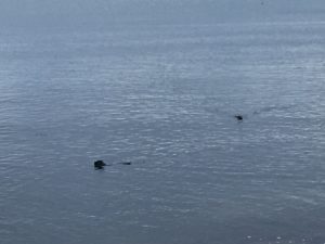
It was almost hard to keep walking at first. If it had been a shorter or easier day I might have sat on a rock there and then, and stayed all day! But I knew I had a challenging walk ahead and I did not want to be caught out by the light along a pathless coastline! I thanked myself for booking Orkney – where I’ll have time to sit on endless beaches – and carried on. A lot of the path merges into one in my memory, but the first two or so miles were reasonably straightforward as the path between Golspie and Brora, although not waymarked, is known and used. It was still quiet though, I didn’t see anybody else out, despite it being a Saturday! I wasn’t alone though – at one point I looked more carefully at some of the small rocks just poking out of the sea, swearing that they’d moved, wondering if my mind was playing tricks with me, when one of them disappeared completely, only to reappear again a few metres to the left. Seals! My first up close seals! There they were, just bobbing along in the sea, watching me curiously. Once I’d worked out what they were they were easy to spot – they bob along with their noses pointed up at the sky, then look around, then sometimes take a quick swim. They always look so happy, just floating around! I was thrilled to have seen them, but when I was a bit further along it got more exciting – there were a whole group of seals on the beach! At this point the path ran inside a field so I wasn’t on the beach which I was glad of, it meant I didn’t disturb them too much but also I got closer before they realised I was there as the field dipped out of view for a bit. As I drew nearer they saw me and some eyed me warily, some grunted and “oomfed” their way into the safety of the waves. They move pretty fast, for creatures without arms or legs! They are amusing to watch when they are lolloping their way into the sea. Is that a word?! Lollop? I don’t know, but it suits seals very well!
All this in about two miles. Today was going to be a glorious – if slow – day! I reached the seaside village of Brora which seemed incredibly sleepy for a Saturday but there was a nice little cafe open so I decided to stop for a coffee and some lunch as there was nothing between there and Helmsdale. The ladies in the cafe were so friendly, and even though they see many End-to-Enders they still showed a lovely mixture of admiration, interest and encouragement. The panini and coffee were delicious too, and set me up well for the next section.
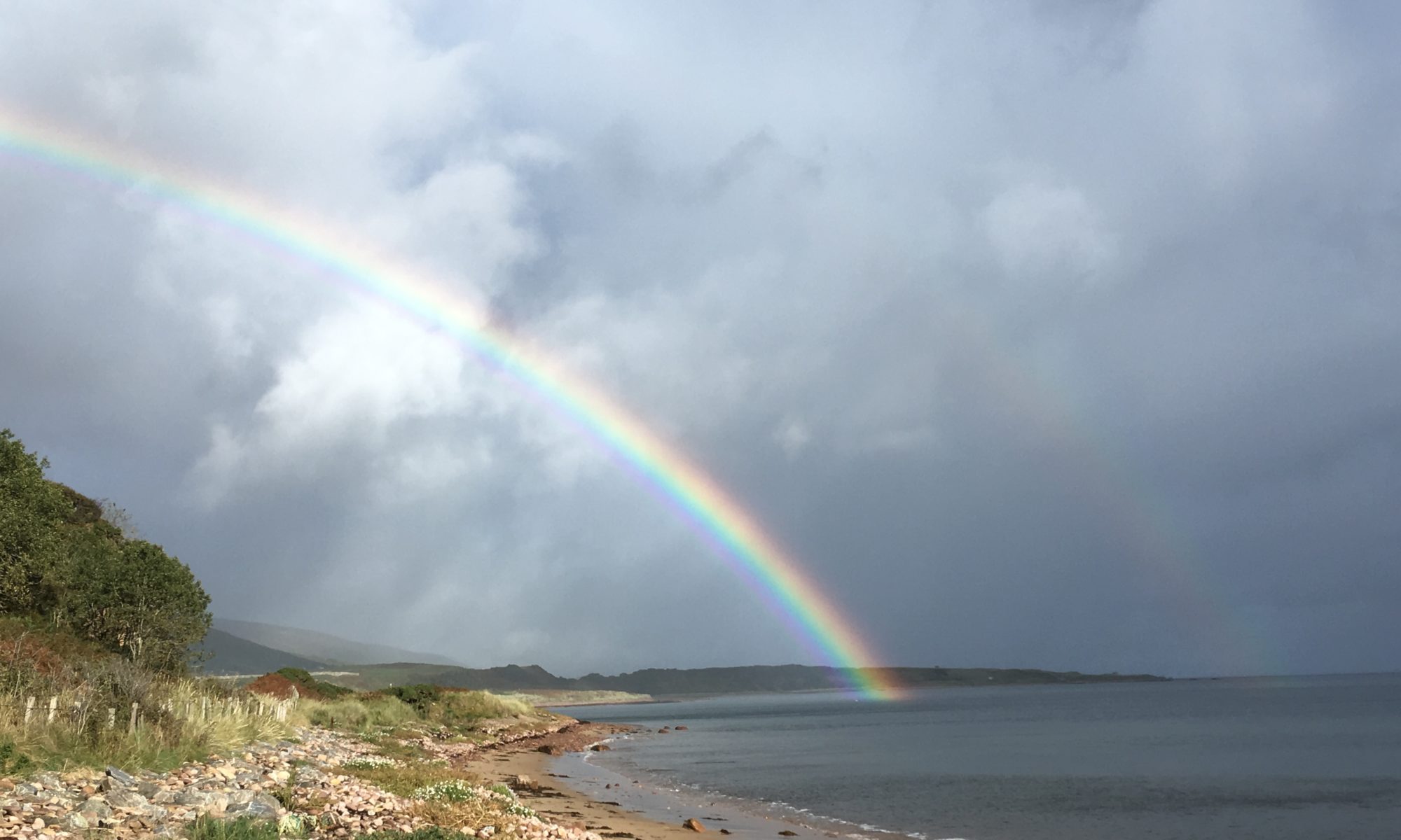
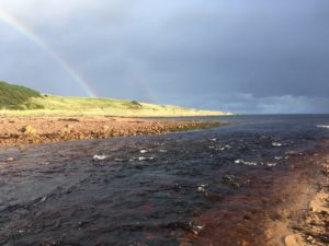
The next couple of miles were easy and beautiful, along the edge of a golf course on a path through the sand dunes. The sky was a mixture of colours from grey to white to blue and the colours reflected on the sea. It was incredible to clearly see half the sea blue, half grey. Along the northern coast ahead of me the hills rolled into the sea with the sun and clouds dappling their bracken covered slopes. A light shower passed over me and headed towards the hills, momentarily veiling them in grey, and then, the most beautiful rainbow I have ever seen. It poured out of the clouds and into the sea, colours shimmering vibrantly. It grew brighter over the next few minutes and I kept stopping to watch it and to try to capture its brilliance on photo, expecting it to disappear any moment. It shone there for well over five minutes though, a beacon signalling my onward path!
Possibly the most beautiful rainbow I have ever seen!
At the end of the golf course the railway line, a near-constant companion throughout the day (although only about four trains a day I think) drew near to the beach and I had my first burn crossing. It looked narrow and easy. Unfortunately it was just wide enough that it was un-jumpable and just deep enough that potential stepping stones were submerged or dangerously slippery. After a few minutes of trying to figure out how I could get across without taking my boots off, I resigned myself to having my first enforced paddle of the day. I wasn’t bothered about getting my feet wet, it was quite nice actually, but it’s a real palava, taking the gaiters and boots off, rolling up waterproofs and trousers, crossing (literally in two steps) and then drying feet off properly and ensuring no sand is left to irritate my toes then putting everything back on again. It’s a lot of effort to move forward less than a metre!! Boots back on and feet feeling a little refreshed after their chilly paddle, the path crossed into a field on a small rustic stile, with white paint splashes on fence posts marking the way – always reassuring to find waymarkers, even when it’s reasonably obvious where you need to head….keep the sea to your right….! Out of the field the other side and across another small burn – this one small enough to half tiptoe half jump across.
The path then gets incredibly squeezed between the railway and the beach, and with the tide being mostly in there wasn’t much of an option to walk on the sand so it was a bit of boulder hopping along a rocky embankment beside the railway (with a handy fence in between to cling on to where bits got a bit narrow). There were small sections of grass covered bank too and as I walked along these I instinctively stepped over something in my path. I turned around to see what it was and to my amazement saw an adder curled up in the grass, sunbathing. I’ve never seen a live adder before! I didn’t get too close, adders being venomous (not quite your Aussie killers but can still do some harm!), but it was beautiful with its olive and black zigzags. Hard to tell how big as it was folded up in a concertina, but probably no more than two thirds of a metre, and much more slender than I expected. I left it be and headed on, a warm fuzzy feeling at having seen a little bit more of nature’s magic. A little further on was burn crossing number three, this one wider than the other two, a couple of metres from bank to bank. I spent a few moments looking for the best place to cross. The beach end was relatively shallow if I could dodge the incoming waves, with just one slightly deeper section that looked like it would require boots to come off. In the middle it looked like there could be some stones to hop across but the burn was flowing just a little too quickly – I didn’t trust my balance enough and envisioned an unwanted bath. I opted in the end to cross just under the railway bridge, where there was a slight ledge over which the water fell. It looked just about shallow enough to cross with my boots on (yes, I was getting lazy already!), although there was a small scramble down to get to that section. I made it across no problem, but I can tell my boots aren’t as waterproof as they used to be – or the morning’s wet grass had soaked them enough that they were just letting in any old water now – as although no water went over the top of my boots I still ended up with one slightly wet foot. In hindsight I probably should have just climbed up into the small railway bridge as I don’t think there was another train for ages, but somehow I preferred to face the water than a train!
Kept my boots on for this one…got wet feet!
The next section of path went through (thankfully cow-free) fields and was fairly easy to follow, with another rainbow showing me the way, this time a full arch right over the path ahead! When the path dropped back more or less to the beach I noticed movement in the flat sea beside me. I watched for a while, and a head popped out of the water, looking at me curiously. The seal dove under again, emerging a little closer this time, and then I noticed two others a little further away. They swam closer, inquisitive, and I watched them for a while before heading on along just above the beach. They swam along with me for a while, following me along the coast, and it felt nice to feel like I had a little bit of company! The path ventured up some bracken covered rough ground for a short while but although overgrown there were definite signs of a path which was promising – the trail is obviously being used at points by someone! Along here I saw yet another incredible rainbow, the best one yet, full, bright and a double, pouring into the sea. They are magical things, rainbows!
Company!
The day had gone well so far and I was coping well with the “rough” path. Then I reached Loth Burn! Yikes. The developers of the trail stress heavily that the trail is mostly unfinished and challenging in many parts, with a rating given to each section (red/amber/green) giving an overview of just how challenging/unfinished it is. This section is currently marked amber, and I think it’s probably all down to Loth Burn! I followed the instructions in the guide through fairly well beaten down vegetation to the edge of the burn just beneath the tall bridge over which the railway runs. My heart sank. The burn was wide – about 4 metres – and was flowing fast and deep. The guide suggested wading using a weir as a handrail and I could see the paint splash markers on the other side, but that river did not look remotely safe to even try to cross. I looked back at the guidebook, confused. It did say that it was the second biggest river crossing on the whole trail, and it had an alternative crossing suggestion at the beach, so I decided to try there. It was wider at the beach which meant the current looked much less fierce, and it wasn’t so deep. At least the bottom was a bit more obvious! It was cross here or retrace my steps and find an alternative…which definitely wasn’t ideal as the road had veered away from the coast a mile or so back. I looked at the river again and decided that it would be cold, but safe, as long as I took it steady. So it was boots off again, rolling my trousers etc to above my knees, getting the walking poles out and into the water I went. Brrr! It was chilly and quickly went calf deep, and it was uncomfortable and slow going on the pebbly bottom, but the flow wasn’t too strong and as long as I went steadily it was ok. There was a deeper section two thirds of the way across where the water went over my knees up to mid thigh, soaking the bottom of my rolled up trousers. I had to take a deep breath and remind myself to go slow – wet trousers were better than a full dunking! My patience paid off and I made it safely to the other side, where I rested (and recovered my nerves!) on a rock while rewarding myself with chocolate and jelly babies while my feet dried off a little in the faint sunlight. I’d made it! The river crossing had certainly made this section a little more intrepid though, and it took me a while to get back into the happy place I’d been in earlier on in the day, not to mention a little while for my feet and ankles to warm back up again! Brrr that water was fresh! I’d changed into my waterproof socks though, which were nice and cosy after my somewhat damp other socks.
[Edit: I spoke to the trail developer about Loth Burn and showed him some pictures of that river and a couple of the others. He said he’s never seen them that high before! Which explains why it has usually been relatively safe to cross Loth Burn beneath the bridge. They are currently trying to get a contractor to look at the crossing and provide a quote for a bridge, so hopefully the crossing will be much easier for future walkers!].
Loth Burn…not looking very crossable!
Loth Burn by the beach…a slightly better crossing option but still mid-thigh deep at points!
Thankfully the path took an easier route again after the river crossing, up into a sprawling, peaceful (and slightly eerie!) caravan park at Crackaig. It looked like people either left their caravans there or you hire a permanently-placed caravan. They were dotted along on top of the cliffs, with stunning views! You can camp there too. It was practically deserted, which I think is why it felt a tad eerie. It made for pleasantly easy walking on grass tracks for a mile or so though, which was nice but not fully appreciated until I came to the next section – a couple of miles pushing through long grass in sand dunes with little more than intermittent sheep tracks to follow. At least I knew what general direction I had to head! It was hard work but not unpleasant walking, with more deserted beaches and more seals. I didn’t spot this bunch until they saw me and noisily made for the water, from the safety of which they turned to watch me warily. There were at least twenty, possibly thirty there, all shapes and sizes (I’m assuming a mix of common and grey seals), and some of this year’s pups.
The last kilometre or so was a mixture of scrambles along narrow rocky escarpments and walking along the beach or sections of grass above, picking my way through on an increasingly well defined path. The sun had turned into that gorgeous golden late afternoon colour and bathed the sand and the rocks in a warm glow, silhouetting the coastline behind me and creating colours in the clouds on the horizon that reflected onto the sea. Once again I could have sat on the beach for ages, watching the colours change, but I was conscious I had a couple of miles to go before I reached Helmsdale and I definitely didn’t want to be caught on the coast path as dusk fell! Thankfully the path leaves the coast for the final stretch of the day, cutting across the railway at a level crossing and heading up a good track into the little village of Portgower. From there it follows a track inland and uphill to cross a burn then takes a back lane through Gartymore to drop down much closer to Helmsdale, crossing the bridge over the Helmsdale River with the A9. Daylight was fading as I walked through Gartymore and the lights in the town and around the harbour down below looked incredibly inviting! It started to drizzle as I headed down the hill and I was definitely ready for a cup of tea and a good sit down!
Gorgeous late afternoon sun
I am staying in a beautiful old house which is an Airbnb but I have the house to myself which is a treat. After the obligatory cup of tea I headed back out into the tiny town to find the one food shop, a Spar. This shop was amazing, it sold everything! I passed a couple of pubs and restaurants on the way and part of me was sorely tempted to duck in for some food but I also was very keen on the idea of having a hot shower, cooking myself something simple and healthy and curling up for an early night! I just about had enough brain power left to buy some sensible food for the next few days while I was there, without buying toooo many cakes and other such sweet treats…!
Today has been epic. I’m so grateful the weather was good as it would have been a lot tougher in the rain. The photos, while amazing, don’t really do it justice! I’m loving this trail. I didn’t realise quite how spectacular it would be. And river crossing aside, it hasn’t been all that bad. It gets less easy from here though, with most days except the last couple marked as amber or red. Tomorrow (a rest day, yay, my final one!) I’m meeting Jay Wilson, the trail developer, to pick his brains about the onward route. Watch this space…!
[For more photos from today, visit my Facebook page: @jlemarinel.lejog]
Total miles: 11.8
Elevation gain: 327 ft
Time walking: 12pm – 5pm
Miles to date: 1,290.4
Oh what a delightfully short and easy day! It felt like a real treat, if a little strange, to be able to slow down today and not rush or feel overly tired. Definitely a good thing, after the last week. My hips and gluts were really tight and aching during the night which, combined with the cold and the rain, woke me up several times. I still seem to not feel too bad once I’m up and moving though, it just seems to take a little longer each day to ease my muscles and joints back into action!
The morning was dry and semi-sunny so I made the most of it by having a leisurely breakfast while the tent dried out a bit after the rain. Then I met Jay, who is the guy who is heading the development of the John O’Groats Trail and gave me the draft guidebook to trial. He lives further north but was driving south and had a few more pages of the maps to give me. It was great to actually meet him after exchanging several messages and emails and he gave me some more tips about various sections of the trail further north.
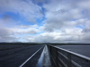
I finally headed off about midday, just as it started to rain, and was pretty much straight onto the long Dornoch Firth Bridge. The A9 wasn’t as busy as I’d expected but it was windy and there was lots of spray from the rain (which stopped when I got on the bridge thankfully), both worse when tall lorries barrelled by. I was glad of the very secure barrier/fence as occasionally the wind would nearly push me into it! Halfway across the bridge my rib started to hurt again and I sighed. Each day when I start out it is fine, and I have a brief glimmer of hope that it has magically got better overnight. Then a mile or two in the pain hits with a vengeance, and continues on and off for the rest of the day. The first few pangs always seem to be the worst, throughout the day the pain eases slightly (or maybe I get more used to it?). I try to breathe through the worst of it, which isn’t easy as it hurts more when I breathe…! Ah well, only a week and a bit left now…
Heading across the bridge, a rare moment of calm
Reaching the end of the bridge took my mind off the pain for a while as I had to step over the barrier, climb down a grassy embankment and then climb a fence, to join a track which ran at the water’s edge. Definitely worth the slight scramble, suddenly the road was a distant memory and the calm of the shining water, ruffled by occasional gusts of wind, breaking around the rocks and seaweed at the shore, had an instant calming effect. The sun came out and it was perfect! I suddenly had a huge sense of happiness and gratitude, and realised I was looking forward to the next week or so, walking along the coast. How lucky am I, to be out here, up here, doing this?!
Fees so good to be by the water again
The track wound inland slightly after a bit and then headed into fields. All fine, until I spy in the field ahead two very large looking black cows with massive horns. They were possibly bulls, I’m not sure (due to the fact they were right at the other end of the field…not a lack of basic bovine anatomy knowledge!) but they were not your average cow…they looked something like a cross between a Highland cow and a buffalo. Whatever they were, I wasn’t convinced they would let me through the field without showing some sort of unwanted interest in me so I scouted out another route. Thankfully there was a semi-decent path the other side of the fence (maybe lots of other people also didn’t fancy their chances against the horned buffalo cows) so I did a bit of fence scaling and took the slightly less daunting route.
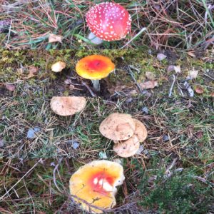
One more field, this one with good old sheep, and I was back to the safety of the road, this time a nice quiet back lane, and then into the pretty Camore Wood. Loads of funky mushrooms and toadstools in this wood! Big ones, small ones, bright ones, spotted ones. There were some flat-topped creamy brown mushrooms that looked just like creme brûlées! Sometimes I wish I knew more about mushrooms, but I’m not sure I’d actually ever dare to forage for them. Just too many deadly lookalikes! The wood was over far too quickly and it was back to the edge of a field and then a mile of pavement into the pretty little town of Dornoch.
A selection of funky mushrooms
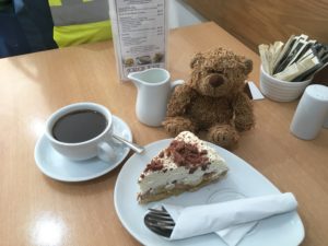
I stopped for a few cereal bars and snacks (and bananas, yay!) in a gorgeous little shop-come-deli that seemed to sell everything, then headed down past the old castle and beautiful 13th century cathedral to a little cafe in a shop-come-gallery. I had plenty of time so I had a nice rest there, enjoying lunch and one of the most delicious banoffee pies I have ever had! After two cups of coffee I figured I probably should make a move, especially when they started to prepare to close!
All King Jennifer seems to do on this trip is drink coffee and eat cake…!
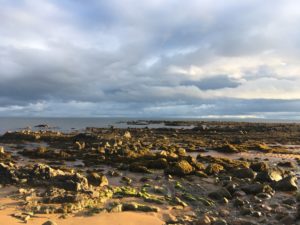
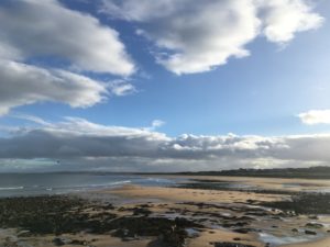
The sun was out again and I had a nice walk through the remainder of the town and out towards the golf course. This was on a slight hill so there were lovely views back across the Firth and out to Tain and beyond, and then as I rounded the corner the sea was there and I was properly on the coast! It was beautiful. Classic golden late afternoon sun bouncing off the sand, the sea, the rocks; patches of blue sky reflected in rock pools, dark rain clouds and black rocks contrasting with silvery water and the white froth of breaking waves. From time to time a rainbow would appear out to sea, and the light breeze brought the delightful taste of salty air. An instant feeling of contentment came over me. I love the sea. I always forget how much, until I’m by it again! I was suddenly really glad that I’d decided to head to Orkney when I finish, up until now I still wasn’t entirely sure if it was the right idea. But the instant I saw the coast I knew that a few days by the sea just relaxing, walking along the beach, watching the waves, would be just what I needed.
The coast
The last bit of the day followed the path between the golf course and the sea for a couple of miles, the weather constantly changing from sun to cloud to rain, which made for beautiful, ever-changing scenery. Soon I could see my destination ahead, the holiday resort/camping and touring ground at Embo, right on the coast. As I neared, and passed, all the static caravans I wondered whether I’d chosen the right place, it was very “resort-y”, but when I had checked in and went down to the non-electric tent pitches I was definitely happy. I’m on a little section just in front of the sea (far enough away that there’s no chance of getting wet!), away from all the cars and caravans. I think I have the best view of the whole site! And I’m the only tent here. It’s my own little patch of heaven, I can see the sea from my tent and I can hear the waves rolling up onto the beach and crashing on the rocks. Tonight, when I came back from the restaurant (where I had dessert again…talk about sugar overload today!), the full harvest moon was up and its reflection was shining like silver on the sea. I stood gazing at it for ages, watching the lighthouse far away steadily mark time with light, the silhouette of the rocks and the waves that broke on them. I could have stayed watching that beautiful scene all night, but even wrapped up in multiple layers it soon grew chilly and I retired to my tent. It’s very peaceful, listening the waves and the gentle breeze. It’s nice too, to feel both away from the crowds but not too far from civilisation. There is something comforting about knowing there are people nearby!
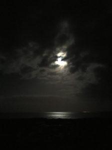
The full harvest moon shining on the sea
Tomorrow is a little longer but nothing like previous days. I’m looking forward to it, it’s pretty much all along the coast or around Loch Fleet, and I go through the little town of Golspie and past the huge Dunrobin Castle which I can see from here. Maybe I’ll even catch a sunrise in the morning…
Total miles: 21.2
Elevation gain: 1,524 ft
Time walking: 9:15am – 6:30pm
Miles to date: 1,278.6
Another long day! Five of the last six walking days have been 21 miles. No wonder my legs and feet ache! I’m actually amazed at how I’ve managed to do that, I guess it is a sign of my fitness – before this trip I had only ever walked more that 20 miles twice, and never carrying so much weight. Now I’ve had over ten days that were longer than 20 miles, five of which were this past week. Crazy!
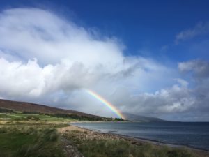
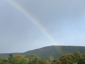
Today was a nice walk, far away from the busy A9 for which I am so grateful. It was a walk of two halves, the first half mostly on quiet roads or cycle tracks, the last half on forestry tracks and paths through beautiful forest. The weather was once again variable, ranging from lovely warm sunshine to bitter cold winds and squally rain. It was therefore a bit of an on/off with the waterproofs day, but it also meant I saw some beautiful rainbows!
A rainbow falls over the folly on top of the hill
The day started on the cycle track out of Evanton, which although tarmac was mostly set back from the road and ran through pretty trees. There was a rather long and dull stretch into Alness along a fairly busy road but there was a pavement at least and some views out to Cromarty Firth. I popped into the leisure centre/library on the edge of town to use the loo and then had a quick break on a bench by a children’s playground, wondering whether people might mistake my for a homeless person! Alness has a few shops but I resisted the urge to buy more food and weigh my bag down more, knowing that tomorrow I’d go through Dornoch and there were a few other small towns over the next few days. Every time I pass a shop though I feel like I should stock up, as I really feel like I am starting to head into the middle of nowhere! But people still live up here, as way up north as it is. There are some beautiful, but incredibly remote, houses up here. I don’t think I could do it!
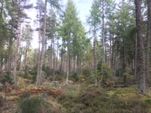
Out of Alness the route follows a quiet country road for several miles. It was pretty scenery but tough on the feet, pounding along all those miles. I gave a bit of a cheer when the route diverted into a pretty wood. Suddenly to be fully back in nature, on a winding narrow path, surrounded by trees, ferns and heather, was really lovely, and it was a pleasant mile or so. Even some squelchy bits! At one point along a wider track a large tree had fallen across the path and as it was currently sunny and I was about halfway I decided to stop for some lunch. I used the tree as a drying rack for my tent, which had been wrapped up soaking wet in my bag for the last three days. Sooo nice to get it dry! It’s unpleasant enough carrying a wet tent around – it’s heavy and starts to make everything else damp – but climbing into a wet smelly tent on a cold evening is even more horrible!
The pretty woods of Badachonacher Moss
Getting going again after the extended break was a bit of a challenge, it took a while to warm up my muscles and joints once more, but it was good to have had the break. As I rejoined the road it started to spit with rain again but I was fed up of putting waterproofs on only for the rain to stop 5 minutes later so I tried to cover my head and the top of bag with my bright green rucksack cover. I’m not sure the look will take off….I resembled something like a giant lime green walking shower cap! Still, I managed without the waterproofs for that shower at least!
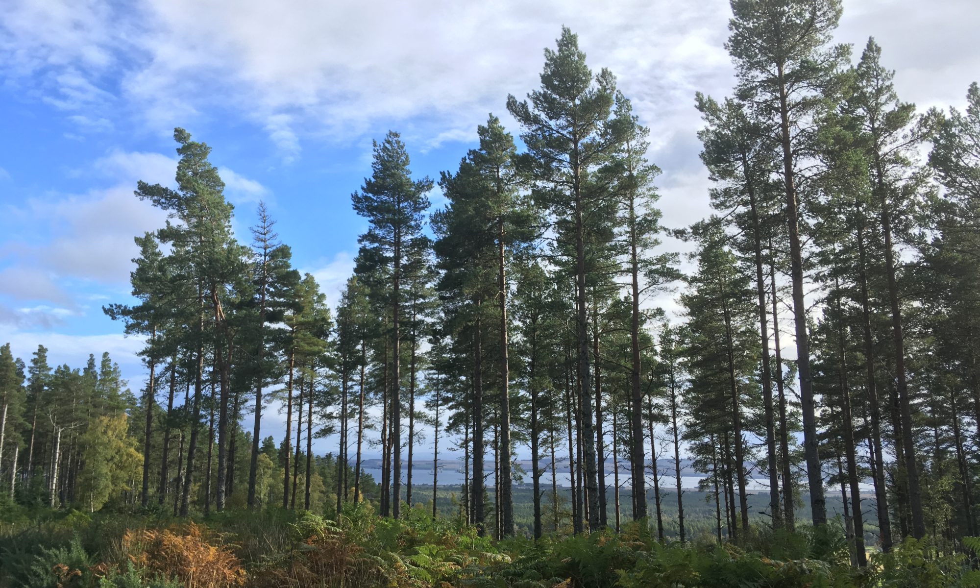
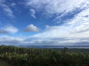
At Scotsburn the path finally left the road and headed up into woods, the first major uphill of the day (still not massive, but it got the heart pumping!) and some proper mud to negotiate. The forests around here are very pretty. They are still conifer forests but they are much lighter than those further south. There’s plenty of space between the trees for light to reach the forest floor which is a rich carpet of ferns, moss, heather and smaller trees. Once back on flatter ground the path gradually widened out into a gravelled forest track which somehow seemed more pleasant than some of the tracks I’d followed recently, I think just because the forests were more open. It helped that at this precise moment in time the sun was shining and it was a lovely autumnal afternoon. Occasionally the trees would open out and there were some super views back over the Cromarty Firth.
Stunning views back over Cromarty Firth
15 miles in and I was running low on water but I found a handy stream where there was a lovely wooden shelter so I stopped for a water refill and a quick break, pleased to shelter out of a brief patch of drizzle. It was uphill again from here but I saw a few other people which made a nice change, mainly runners and mountain bikers. I passed “A Dog’s Grave”, famous enough to be signposted, dating back to 1928! The grave read “Geordie, faithful friend and constant companion for 11 years of John Dewar. Killed by a road hog near Perth, 9th Aug 1928. Served with the 3rd Bat. The Cameronians 1917-1918”.
The path left the main track and led through more pretty woodland and felled forest, getting quite boggy in places (a nice change after days of firm forest tracks and roads), lonely but beautiful. This was Morangie Forest, it took me a while to figure out why that sounded familiar…think Glen Morangie whiskey! At a loch flanked by pine forest and tall breezy grass the scene was so Canadian I half expected to see a bear or moose lazily wander out of the trees to take a drink. Ahead the view opened out to the sea and as the path started to descend around a bend I had a glorious teaser of the coastline I’d be following in the days to come.
My feet and legs were really starting to feel it by this point and I was glad when the path finally dropped down to a track which would lead me pretty much to my campsite. It was 6pm already, later than I had expected given the good time I’d made earlier in the day. I guess there were a few more hills and it was a bit further than I’d thought, plus as I really should know by now, the second half is always slower as I get tired! Despite feeling rather pleased at my rapid progress over the last few days, I’m even more pleased to realise that today should mark the end of the long days. I slow down from here, with my longest day being in the region of 15 miles, with a couple of days as short as 8 miles. I won’t know what to do with myself!
I have to be more careful with evenings now though, the sun sets before 7pm these days and if it’s a rainy day the light goes really quickly! Still, I was at the campsite by 6:30pm which wasn’t too bad and I had the choice of pitches as I was the only tent there! The only downside was that the map had indicated there was a pub by the roundabout just by the campsite…sadly it turned out to be a Jehovas Witness Hall…not quite the same thing! Strange, for the OS maps to get that wrong?! Ah well, it was dehydrated chicken curry for dinner for me (actually really tasty!) huddled up in multiple layers as it is COLD tonight! I made the most of the benches and light though and stayed outside for quite a while…evenings are quite long and uncomfortable when they are spent sitting huddled in a small tent for the few hours before bedtime! I went through several cups of tea and a hot chocolate before eventually I got too cold to stay out, retiring to my sleeping bag wearing thermals, socks and warm hat, pulling every drawstring on my sleeping bag and its hood close. It’s a chilly one tonight!
After 5 pretty big days it was time to make the most of the last major bit of civilisation to rest, restock supplies, see an osteopath and do some major planning!
I now have the (draft) guidebook for this final leg, it’s a bit daunting though as it’s a new trail which is incredibly rough in places (think no path, overgrown undergrowth, fields with no stiles, burns with no bridges etc) so need to pick and choose a bit. And winging it a bit with accommodation…need to book some in advance otherwise at this rate I’ll be wild camping every night…!
In other exciting news, I’ve spent part of today planning my gradual return to civilisation…starting by getting even more remote and taking a trip to Orkney for a few days! Then I’ll be making my way back over a few days, by overnight ferry, multiple trains, probably a few buses and hopefully a visit to a friend or two on the way back down!
Back on the trail again tomorrow, mixed feelings about it – part of me just wants it done, part of me never wants it to end!
Total miles: 21.5
Elevation gain: 3,755 ft
Time walking: 9:30am – 6:30pm
Miles to date: 1,214.7
Ok so I have to say, I am impressed with today! The route was awesome, the weather was beautiful and I made pretty good time on a day that was not only one of my longest distance-wise but was the biggest in terms of elevation gain of the entire trip (save Ben Nevis)!! No wonder my feet and legs are aching so much!
I knew that today was going to be a long day – it’s either a really short day stopping at Invermoriston or a really long day as there’s nowhere else to stay in the middle. I hadn’t quite anticipated the amount of elevation gain though and now don’t feel so bad that I had to keep stopping to catch my breath on the hills, some of which were very steep! I tried to make an early-ish start as with the nights drawing in I have less daylight hours to walk and 20+ miles is starting to push it. The hostel (Morag’s Lodge) did a good breakfast so I filled up and headed out onto the trail which conveniently passed the hostel. I’d risked leaving my waterproofs off for now as the forecasted heavy rain hadn’t quite materialised yet and I knew I had some hills to climb from the off.
After a brief stint on a quiet road the path heads up into the woods, the short but steep climb a bit of a surprise after the flat going the last couple of days. It levels out a bit when it joins a forest track which leads to the first main lookout across the loch. Shortly after, the path forks and there is a decision to be made – high route or low route?! High route, always! As far as I know the low route follows forest tracks (it is suitable for bikes and horses) and is mostly in the trees. The high route is only suitable for walkers and is relatively new – it’s not even marked on my OS map, just on my new Harvey’s map – and as the name suggests, goes up high, above the tree line. This does of course mean a bit of a climb, and a steep one at that, but it is definitely worth it! At first the path zigzags steeply up through the forest, closely following a tumbling stream which falls over a series of beautiful waterfalls. It was a bit of a gruelling climb but it was so nice to have a bit of a change of scenery.